Mesa (/ˈmeɪsə/ MAY-sə) is a city in Maricopa County, in the U.S. state of Arizona. It is the most populous city in the East Valley section of the Phoenix Metropolitan Area. It is bordered by Tempe on the west, the Salt River Pima-Maricopa Indian Community on the north, Chandler and Gilbert on the south along with Queen Creek, and Apache Junction on the east.
Mesa is the third-largest city in Arizona after Phoenix and Tucson, the 36th-largest city in the US, and the largest city that is not a county seat. The city is home to 504,258 people as of 2020 according to the Census Bureau.
More than 40,000 students are enrolled in more than 10 colleges and universities located in Mesa, including the Polytechnic campus of Arizona State University, Benedictine University, A.T. Still University, Upper Iowa University, Mesa Community College and Chandler-Gilbert Community College. Private for-profit institutions include Arizona College, Carrington College, DeVry University, Pima Medical Institute, and CAE Phoenix Aviation Academy. Arizona State University opened ASU at Mesa City Center in 2022, offering programs from the Herberger Institute for Design and Arts including a film school with media production facilities and a theater.
Mesa is home to the largest relief airport in the Phoenix area, Phoenix-Mesa Gateway Airport, located in the southeastern corner of the city.
| Name: | Mesa city |
|---|---|
| LSAD Code: | 25 |
| LSAD Description: | city (suffix) |
| State: | Arizona |
| County: | Maricopa County |
| Founded: | 1878 |
| Elevation: | 1,326 ft (404 m) |
| Total Area: | 139.42 sq mi (361.09 km²) |
| Land Area: | 138.79 sq mi (359.48 km²) |
| Water Area: | 0.62 sq mi (1.62 km²) |
| Total Population: | 504,258 |
| Population Density: | 3,633.14/sq mi (1,402.76/km²) |
| ZIP code: | 85200-85299 |
| Area code: | 480 602 |
| FIPS code: | 0446000 |
| GNISfeature ID: | 2411087 |
| Website: | www.mesaaz.gov |
Online Interactive Map
Click on ![]() to view map in "full screen" mode.
to view map in "full screen" mode.
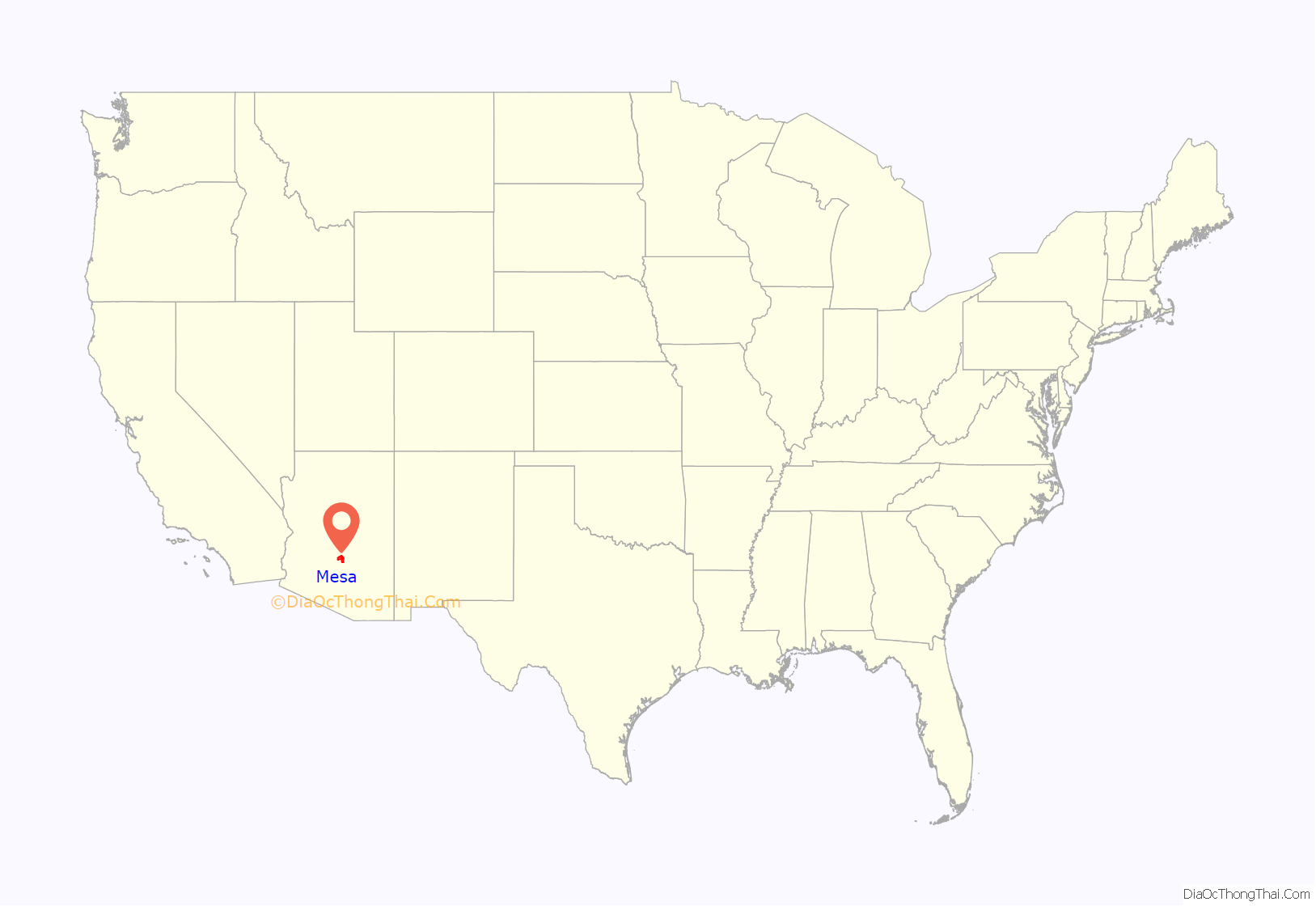
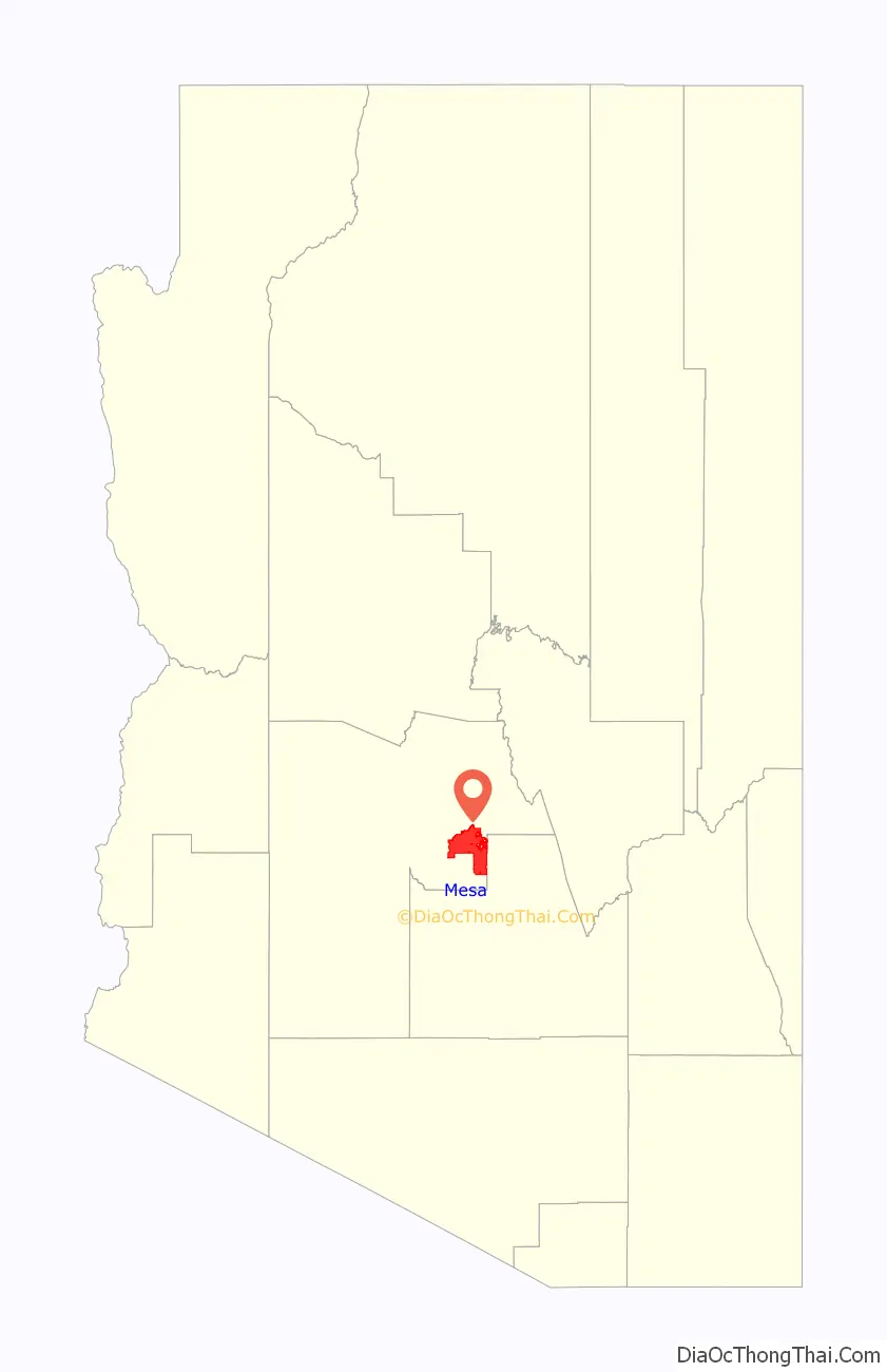
Mesa location map. Where is Mesa city?
History
The history of Mesa dates back at least 2,000 years to the arrival of the Hohokam people. The Hohokam, whose name means “All Used Up” or “The Departed Ones”, built the original canal system. The canals were the largest and most sophisticated in the prehistoric New World. Some were up to 90 feet (27 m) wide and 10 feet (3.0 m) deep at their head gates, extending for as far as 16 miles (26 km) across the desert. By A.D. 1100 water could be delivered to an area over 110,000 acres (450 km), transforming the Sonoran Desert into an agricultural oasis. By A.D. 1450, the Hohokam had constructed hundreds of miles of canals many of which are still in use.
After the disappearance of the Hohokam and before the arrival of the early settlers little is known, as explorers did not venture into this area. By the late 19th century near present-day Mesa, U.S. Army troops relocated the Apache, opening the way for settlement.
Mormon pioneer Daniel Webster Jones, with Henry Clay Rogers as his right-hand man, left St. George, Utah in March 1877. Jones had been asked by Mormon officials to direct a party of people in establishing a settlement in Arizona. They traveled south and settled on the north side of the present Mesa area. This settlement was initially known as Fort Utah and later as Jonesville. It was located near Lehi Road. In 1883 it was named Lehi at the suggestion of Brigham Young, Jr.
About this same time, another group dubbed the First Mesa Company arrived from Utah and Idaho. Their leaders were named Francis Martin Pomeroy, Charles Crismon, George Warren Sirrine and Charles I. Robson. Rather than accepting an invitation to settle at Jones’ Lehi settlement, they moved up onto the mesa that serves as the city’s namesake. They dug irrigation canals and used some of the original Hohokam canals. By April 1878, water was flowing through them. The Second Mesa Company arrived in 1879 and settled to the west of the First Mesa Company because of more available farmland. This settlement was originally called Alma and later Stringtown. It was located near where Alma School Road.
On July 17, 1878, Mesa City was registered as a 1-square-mile (2.6 km) townsite. The first school was built in 1879. In 1883, Mesa City was incorporated with a population of 300 people. Dr. A. J. Chandler, who would later go on to found the city of Chandler, worked on widening the Mesa Canal in 1895 to allow for enough flow to build a power plant. In 1917, the city of Mesa purchased this utility company. The revenues from the company provided enough for capital expenditures until the 1960s. During the Great Depression, WPA funds provided paved streets, a new hospital, a new town hall and a library.
After the founding of the city the elected official that most impacted the municipality was George Nicholas Goodman. He was mayor 5 different times in parts of 3 different decade (1938–1942, 1946–1948, 1952–1956) (see: List of mayors of Mesa, Arizona). As mayor he was directly involved in the process of acquiring land for both Falcon Field and Williams Field.
With the opening of Falcon Field and Williams Field in the early 1940s, more military personnel began to move into the Mesa area. With the advent of air conditioning and the rise of tourism, population growth exploded in Mesa as well as the rest of the Phoenix area. Industry—especially early aerospace companies—grew in the 1950s and 1960s. As late as 1960, half of the residents of Mesa made a living with agriculture, but this has declined substantially as Mesa’s suburban growth continued on track with the rest of the Phoenix metro area.
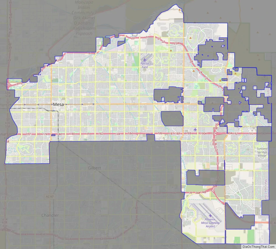
Mesa Road Map
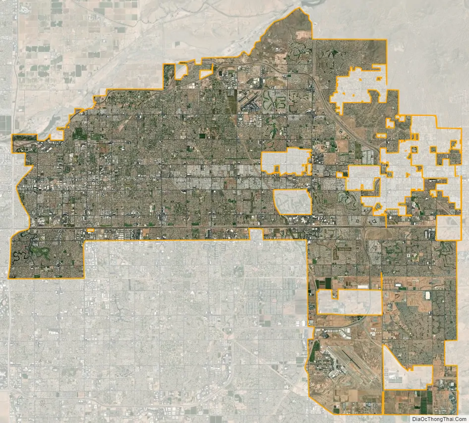
Mesa city Satellite Map
Geography
Defining east and west Mesa
Due to Mesa’s long east to west travel distance, in excess of 18 miles (29 km) and large land area 133.13 square miles (344.8 km), locations in Mesa are often referred to as residing within either West Mesa or East Mesa.
Mesa employs a grid system for street numbering that is different from that used in Phoenix and other portions of the metropolitan area. Center Street, running north to south, bisects Mesa into eastern and western halves and serves as the east and west numbering point of origin within Mesa. Streets west of Center St., such as W. University Drive or W. Main St. are considered to be in West Mesa, whereas streets east of Center St., such as E. University or E. Main St., are considered to be in East Mesa.
Mesa Drive, running north to south and bisecting Mesa into east and west sections, is located 0.5 miles (800 m) east of Center Street, and serves as the zip code boundary between the 85281, 85201, 85202, and 85210 zip codes of Western Mesa and the 85203, 85204, 85205, 85206, 85207, 85208, 85209, 85212, 85213, 85215, 85220, and 85242 zip codes of Eastern Mesa.
Climate
Located in the Sonoran Desert, Mesa has a hot desert climate (Köppen: BWh), with mild winters and very hot summers.
See also
Map of Arizona State and its subdivision: Map of other states:- Alabama
- Alaska
- Arizona
- Arkansas
- California
- Colorado
- Connecticut
- Delaware
- District of Columbia
- Florida
- Georgia
- Hawaii
- Idaho
- Illinois
- Indiana
- Iowa
- Kansas
- Kentucky
- Louisiana
- Maine
- Maryland
- Massachusetts
- Michigan
- Minnesota
- Mississippi
- Missouri
- Montana
- Nebraska
- Nevada
- New Hampshire
- New Jersey
- New Mexico
- New York
- North Carolina
- North Dakota
- Ohio
- Oklahoma
- Oregon
- Pennsylvania
- Rhode Island
- South Carolina
- South Dakota
- Tennessee
- Texas
- Utah
- Vermont
- Virginia
- Washington
- West Virginia
- Wisconsin
- Wyoming


