Fort Mohave is an unincorporated community and CDP in Mohave County, Arizona, United States. It is named for a nearby fort that was used during the Mohave War. As of the 2020 census, the population of Fort Mohave was 16,190, up from 14,364 in 2010 and 8,919 in 2000. It is a suburb of Bullhead City. Its recent growth has made it the most populous unincorporated community in Mohave County.
The largest single employer in Fort Mohave is Valley View Medical Center. In 2013, Fort Mohave became the home of a 200+ acre photovoltaic solar generating plant. The plant was built east of Vanderslice Road between Joy Lane and Lipan Boulevard.
| Name: | Fort Mohave CDP |
|---|---|
| LSAD Code: | 57 |
| LSAD Description: | CDP (suffix) |
| State: | Arizona |
| County: | Mohave County |
| Founded: | 1935 |
| Elevation: | 545 ft (166 m) |
| Total Area: | 16.70 sq mi (43.25 km²) |
| Land Area: | 16.70 sq mi (43.25 km²) |
| Water Area: | 0.00 sq mi (0.00 km²) |
| Total Population: | 16,190 |
| Population Density: | 969.52/sq mi (374.34/km²) |
| ZIP code: | 86426 |
| Area code: | 928 |
| FIPS code: | 0424895 |
| GNISfeature ID: | 2628855 |
Online Interactive Map
Click on ![]() to view map in "full screen" mode.
to view map in "full screen" mode.
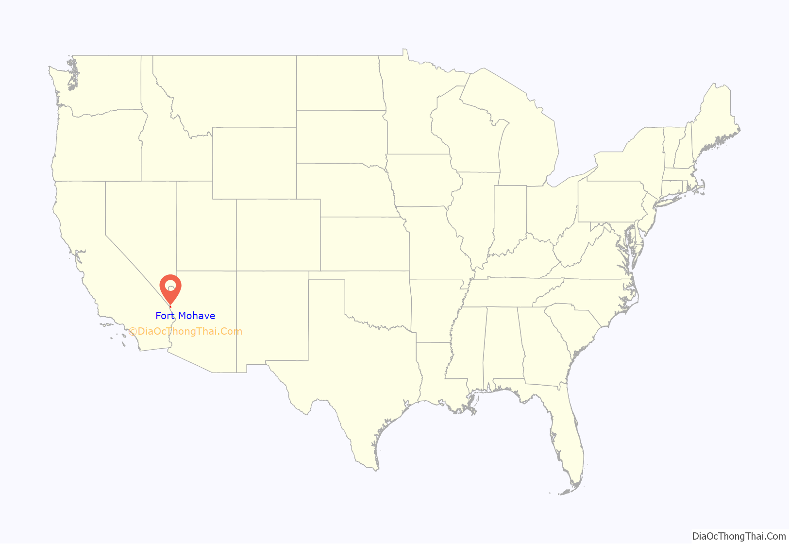
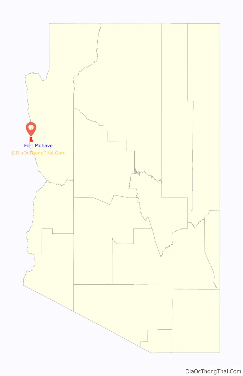
Fort Mohave location map. Where is Fort Mohave CDP?
History
The first known European to visit the area was Spanish explorer Melchor Díaz. He documented his travels in what is now northwestern Mohave County in 1540. He recounts meeting a large population of natives who referred to themselves as the Pipa Aha Macav, meaning “People by the River”. From “Aha Macav” came the Spanish name “Mojave”, which was later passed into English, where it is also spelled “Mohave”. When most people refer to Fort Mohave, they use the spelling “Mohave”, while the tribe retains the traditional Spanish spelling “Mojave”.
During the Mohave War the fort was established as a base of U. S. Army military operations against the native Mohave people, who had been living in the area for centuries prior. In April 1861, during the early part of the American Civil War, the fort was abandoned, its garrison sent to secure Southern California from possible secession, and then sent to the east. It was subsequently garrisoned by Company B and Company I, 4th California Infantry Regiment, in May 1863. Company B remained for six months, but Company I remained until March 1865, when it was relieved by Company C, 7th California Infantry Regiment, until 1866 when Camp Mohave was again garrisoned by regular U.S. Army troops. The U.S. Army remained until September 29, 1890, when the War Department turned it over to the Indian Service by order of President Benjamin Harrison. It was given up by the Indian Service in 1935 and is now part of the Fort Mojave Indian Reservation.
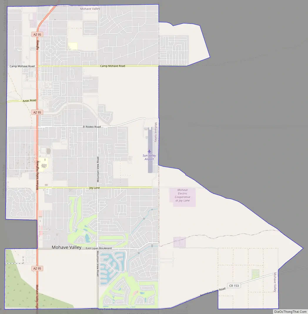
Fort Mohave Road Map
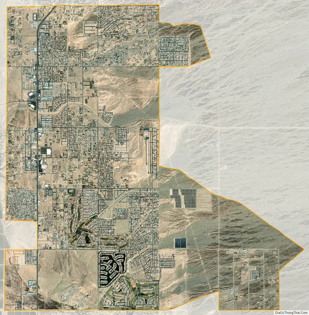
Fort Mohave city Satellite Map
Geography
Fort Mohave is in western Mohave County along Arizona State Route 95. It is bordered to the north by Bullhead City, to the west by the Fort Mojave Indian Reservation, and to the south by unincorporated Mesquite Creek. AZ 95 leads north 10 miles (16 km) to the center of Bullhead City and south 12 miles (19 km) to Needles, California, across the Colorado River. Aztec Road leads west from the center of Fort Mohave across the Colorado into the southernmost corner of Nevada, 16 miles (26 km) south of Laughlin.
According to the U.S. Census Bureau, the Fort Mohave CDP has an area of 16.7 square miles (43 km), all of it recorded as land.
Many neighborhoods in Fort Mohave are built on man-made lakes, golf courses, and mesas with majestic mountain views. The newest golf course, Los Lagos Golf Club, is a Ted Robinson, Sr. Signature Golf Course.
It is home to the Mojave Crossing Event Center, the largest stadium within 90 miles (140 km), serving all Mohave County for large indoor events. It has a seating capacity of 3,000 stadium style and 5,000 arena style.
See also
Map of Arizona State and its subdivision: Map of other states:- Alabama
- Alaska
- Arizona
- Arkansas
- California
- Colorado
- Connecticut
- Delaware
- District of Columbia
- Florida
- Georgia
- Hawaii
- Idaho
- Illinois
- Indiana
- Iowa
- Kansas
- Kentucky
- Louisiana
- Maine
- Maryland
- Massachusetts
- Michigan
- Minnesota
- Mississippi
- Missouri
- Montana
- Nebraska
- Nevada
- New Hampshire
- New Jersey
- New Mexico
- New York
- North Carolina
- North Dakota
- Ohio
- Oklahoma
- Oregon
- Pennsylvania
- Rhode Island
- South Carolina
- South Dakota
- Tennessee
- Texas
- Utah
- Vermont
- Virginia
- Washington
- West Virginia
- Wisconsin
- Wyoming


