Mohave Valley (‘Amat’ ‘Analy Uuhwely in Mojave) is an unincorporated community and census-designated place (CDP) in Mohave County, Arizona, United States. The population was 2,693 at the 2020 census. It is geographically connected to Needles, California, Fort Mohave and Bullhead City.
| Name: | Mohave Valley CDP |
|---|---|
| LSAD Code: | 57 |
| LSAD Description: | CDP (suffix) |
| State: | Arizona |
| County: | Mohave County |
| Elevation: | 523 ft (159 m) |
| Total Area: | 14.04 sq mi (36.36 km²) |
| Land Area: | 14.02 sq mi (36.32 km²) |
| Water Area: | 0.02 sq mi (0.04 km²) |
| Total Population: | 2,693 |
| Population Density: | 192.06/sq mi (74.15/km²) |
| ZIP code: | 86440, 86446 |
| Area code: | 928 |
| FIPS code: | 0447400 |
| GNISfeature ID: | 1866989 |
Online Interactive Map
Click on ![]() to view map in "full screen" mode.
to view map in "full screen" mode.
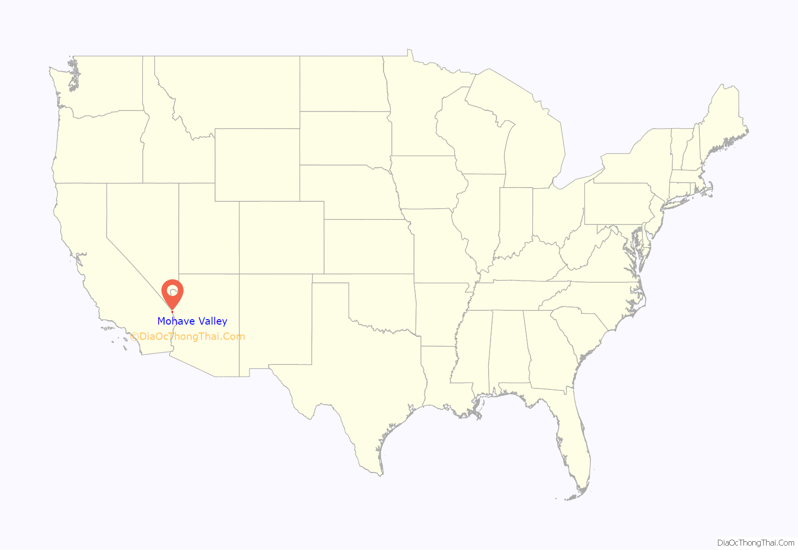
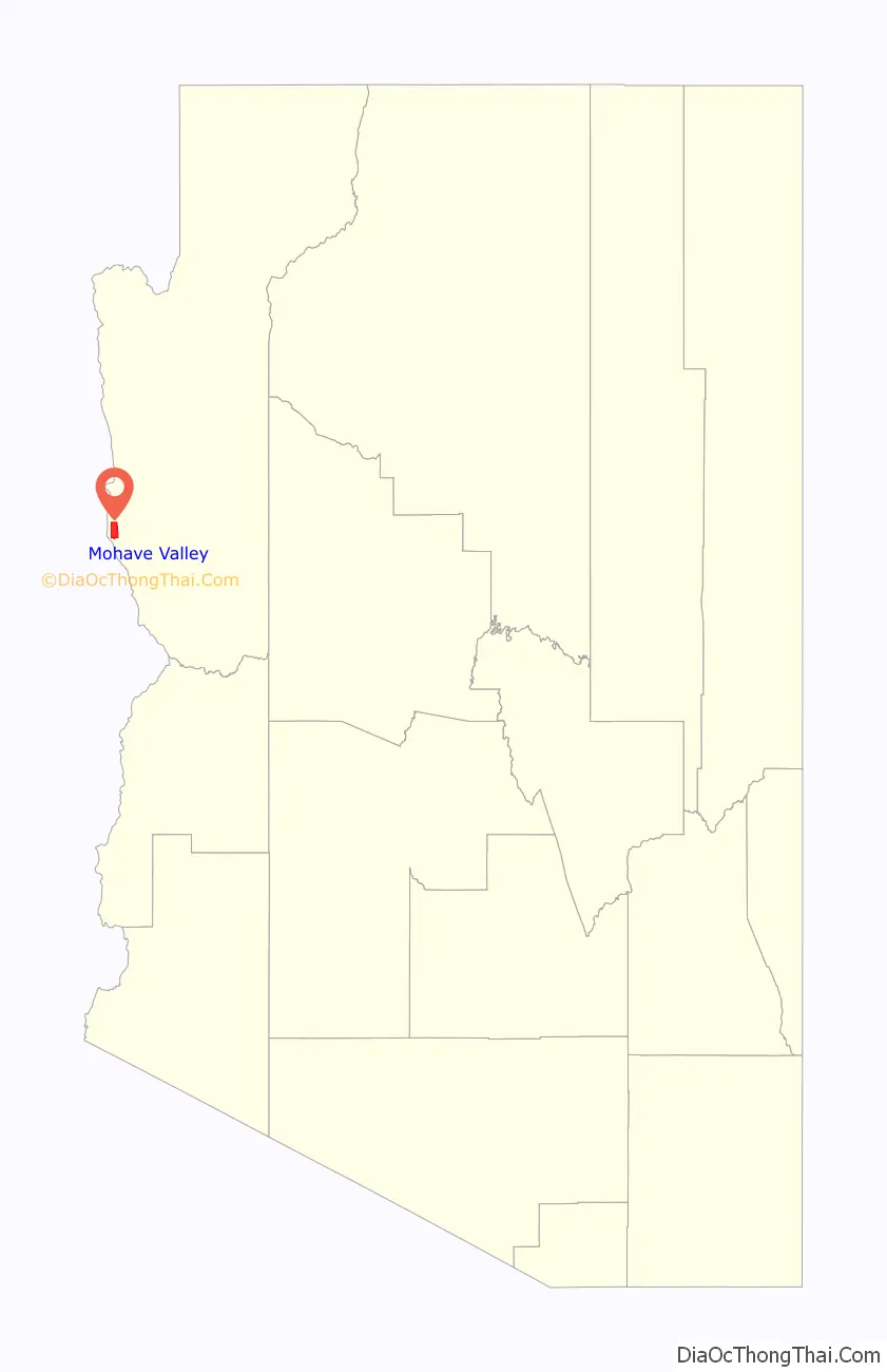
Mohave Valley location map. Where is Mohave Valley CDP?
History
The first recorded European to come through Mohave Valley was Melchor Díaz. He documented his travels in what is now northwestern Mohave County in 1540. He recounts meeting a large population of natives who referred to themselves as the Pipa Aha Macav, meaning “People by the River”. From “Aha Macav” came the shortened name “Mojave” (also spelled “Mohave”). While Mohave Valley and Mohave County use the modern English spelling, the tribe retains the traditional Spanish spelling “Mojave”. Both are correct, and both are pronounced “Moh-hah-vee”.
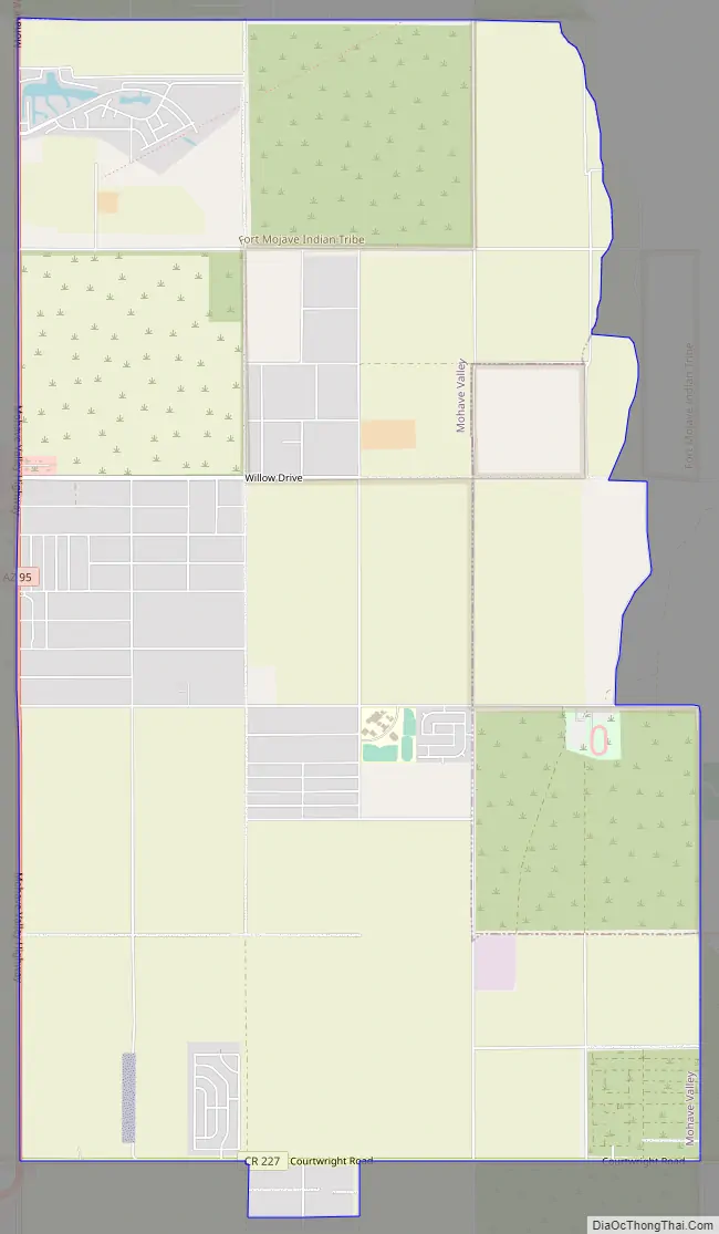
Mohave Valley Road Map
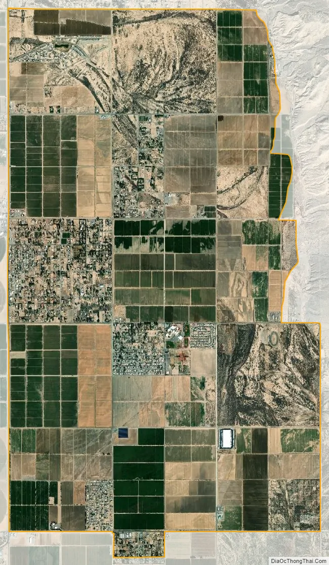
Mohave Valley city Satellite Map
Geography
Mohave Valley is located in western Mohave County at 34°57′25″N 114°35′5″W / 34.95694°N 114.58472°W / 34.95694; -114.58472 (34.956929, -114.584613), in the valley of the same name, drained by the Colorado River. The CDP is on the east side of Arizona State Route 95, which leads 3 miles (5 km) north to Fort Mohave, 16 miles (26 km) north to Bullhead City, and 6 miles (10 km) south to Needles, California, across the Colorado River. The Mohave Valley CDP is bordered to the south by Arizona Village, to the west by Willow Valley, and to the north by Mohave Ranch Estates, all CDPs.
According to the United States Census Bureau, the Mohave Valley CDP has a total area of 14.0 square miles (36 km), of which 0.02 square miles (0.05 km), or 0.11%, are water.
See also
Map of Arizona State and its subdivision: Map of other states:- Alabama
- Alaska
- Arizona
- Arkansas
- California
- Colorado
- Connecticut
- Delaware
- District of Columbia
- Florida
- Georgia
- Hawaii
- Idaho
- Illinois
- Indiana
- Iowa
- Kansas
- Kentucky
- Louisiana
- Maine
- Maryland
- Massachusetts
- Michigan
- Minnesota
- Mississippi
- Missouri
- Montana
- Nebraska
- Nevada
- New Hampshire
- New Jersey
- New Mexico
- New York
- North Carolina
- North Dakota
- Ohio
- Oklahoma
- Oregon
- Pennsylvania
- Rhode Island
- South Carolina
- South Dakota
- Tennessee
- Texas
- Utah
- Vermont
- Virginia
- Washington
- West Virginia
- Wisconsin
- Wyoming


