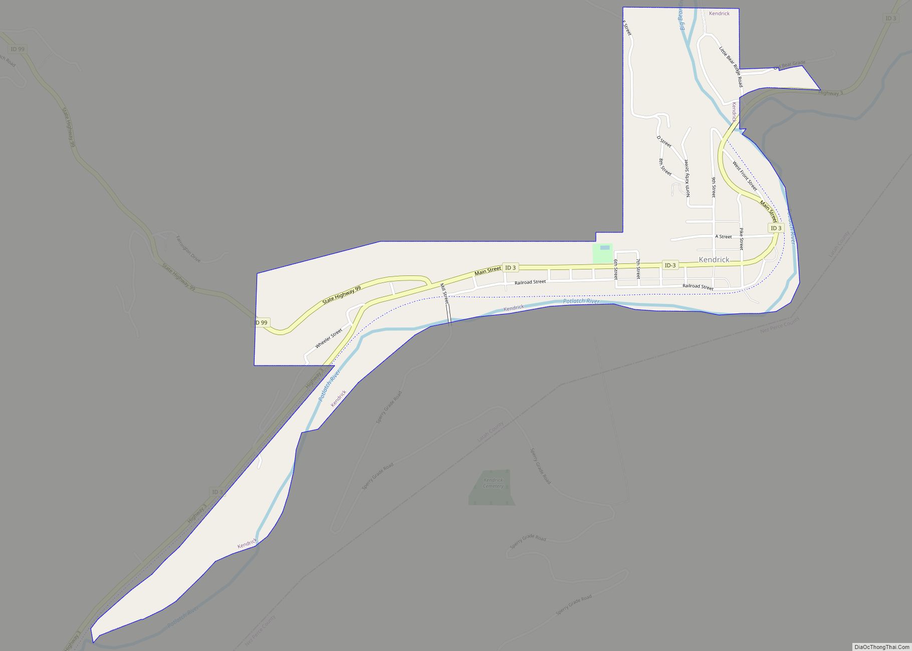
Kendrick is a city in Latah County, Idaho, United States. Its population was 303 at the 2010 census, a decrease from 369 in 2000.
| Name: | Kendrick city |
|---|---|
| LSAD Code: | 25 |
| LSAD Description: | city (suffix) |
| State: | Idaho |
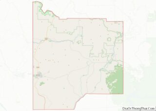
| County: | Latah County |
| Elevation: | 1,240 ft (378 m) |
| Total Area: | 0.38 sq mi (0.98 km²) |
| Land Area: | 0.36 sq mi (0.93 km²) |
| Water Area: | 0.02 sq mi (0.05 km²) |
| Total Population: | 303 |
| Population Density: | 847.22/sq mi (327.13/km²) |
| ZIP code: | 83537 |
| Area code: | 208 |
| FIPS code: | 1642760 |
| GNISfeature ID: | 0399944 |
| Website: | www.kendrick-juliaetta.org |
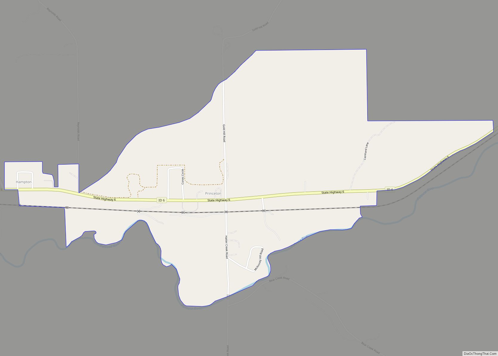
Online Interactive Map
Click on ![]() to view map in "full screen" mode.
to view map in "full screen" mode.
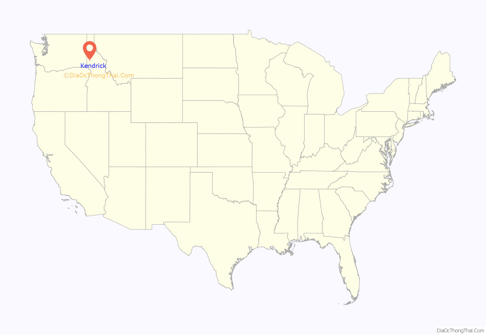
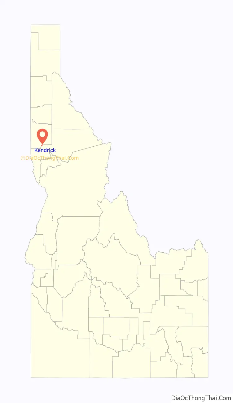
Kendrick location map. Where is Kendrick city?
History
Founded as Latah or Latah City in 1889 by Thomas Kirby, a post office was established on May 24 with Kirby as the postmaster.
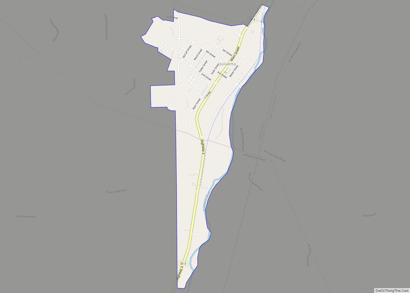
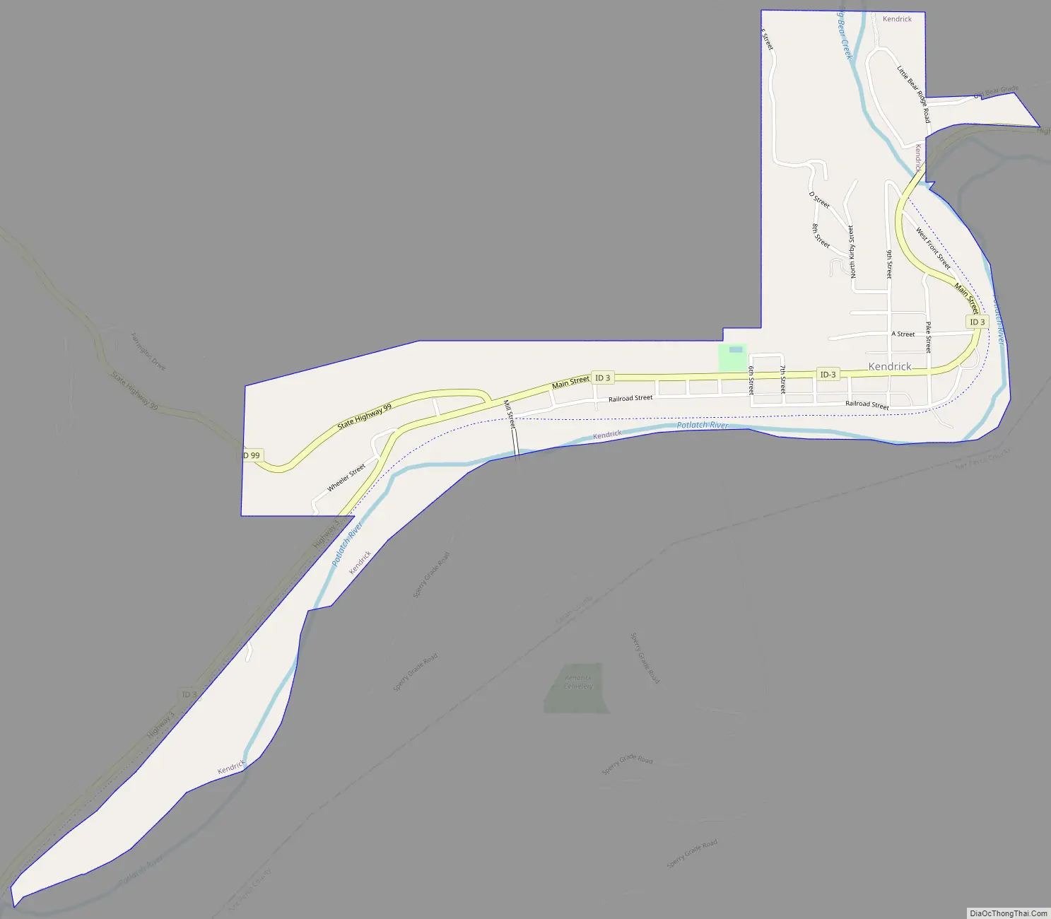
Kendrick Road Map
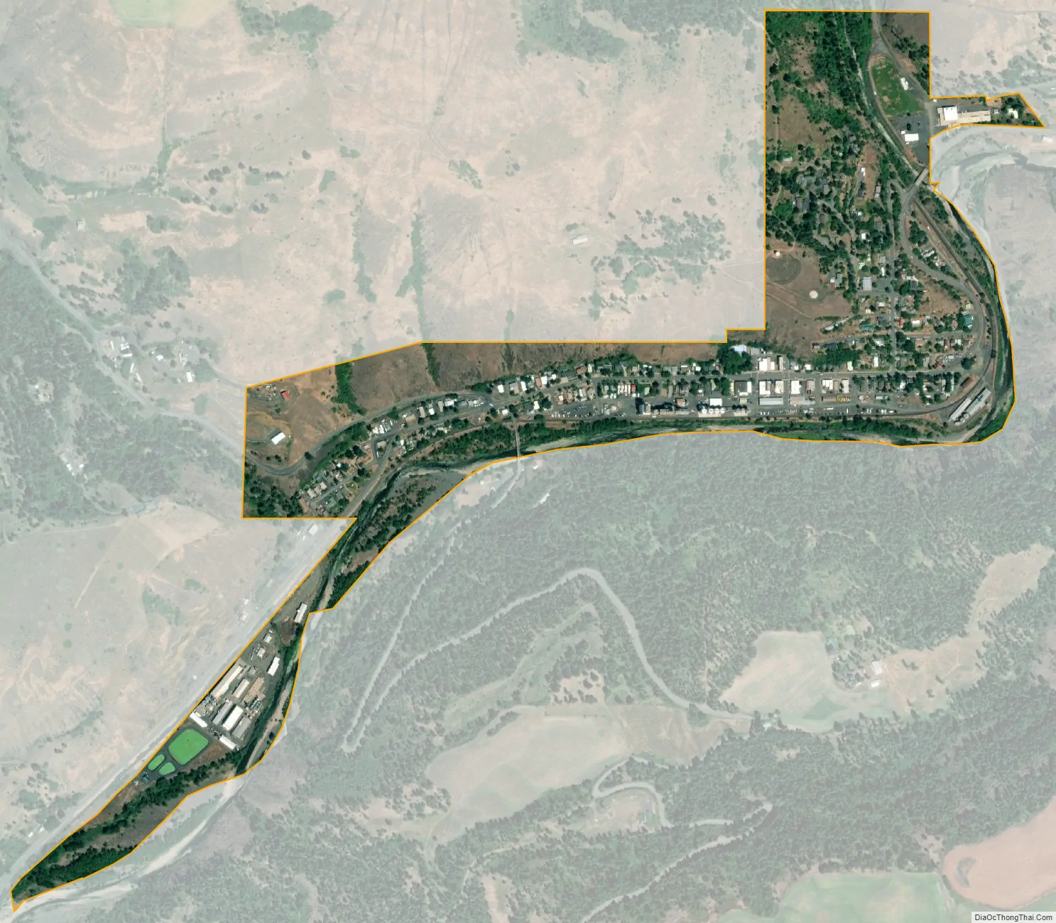
Kendrick city Satellite Map
Geography
According to the United States Census Bureau, the city has a total area of 0.40 square miles (1.04 km), of which, 0.39 square miles (1.01 km) is land and 0.01 square miles (0.03 km) is water.
See also
Map of Idaho State and its subdivision:- Ada
- Adams
- Bannock
- Bear Lake
- Benewah
- Bingham
- Blaine
- Boise
- Bonner
- Bonneville
- Boundary
- Butte
- Camas
- Canyon
- Caribou
- Cassia
- Clark
- Clearwater
- Custer
- Elmore
- Franklin
- Fremont
- Gem
- Gooding
- Idaho
- Jefferson
- Jerome
- Kootenai
- Latah
- Lemhi
- Lewis
- Lincoln
- Madison
- Minidoka
- Nez Perce
- Oneida
- Owyhee
- Payette
- Power
- Shoshone
- Teton
- Twin Falls
- Valley
- Washington
- Alabama
- Alaska
- Arizona
- Arkansas
- California
- Colorado
- Connecticut
- Delaware
- District of Columbia
- Florida
- Georgia
- Hawaii
- Idaho
- Illinois
- Indiana
- Iowa
- Kansas
- Kentucky
- Louisiana
- Maine
- Maryland
- Massachusetts
- Michigan
- Minnesota
- Mississippi
- Missouri
- Montana
- Nebraska
- Nevada
- New Hampshire
- New Jersey
- New Mexico
- New York
- North Carolina
- North Dakota
- Ohio
- Oklahoma
- Oregon
- Pennsylvania
- Rhode Island
- South Carolina
- South Dakota
- Tennessee
- Texas
- Utah
- Vermont
- Virginia
- Washington
- West Virginia
- Wisconsin
- Wyoming