Oakdale is a city in Allen Parish in south Louisiana, United States. The population was 7,780 at the 2010 census.
Oakdale was founded as “Dunnsville” by William T. Dunn. The history of Allen Parish is preserved at the Leatherwood Museum, which reopened on September 27, 2008, in a renovated facility at 202 E. 7th Ave. in Oakdale.
| Name: | Oakdale city |
|---|---|
| LSAD Code: | 25 |
| LSAD Description: | city (suffix) |
| State: | Louisiana |
| County: | Allen Parish |
| Total Area: | 5.25 sq mi (13.61 km²) |
| Land Area: | 5.19 sq mi (13.45 km²) |
| Water Area: | 0.06 sq mi (0.16 km²) |
| Total Population: | 6,692 |
| Population Density: | 1,288.91/sq mi (497.64/km²) |
| ZIP code: | 71463 |
| Area code: | 318 |
| FIPS code: | 2256540 |
| Website: | www.cityofoakdale.net |
Online Interactive Map
Click on ![]() to view map in "full screen" mode.
to view map in "full screen" mode.
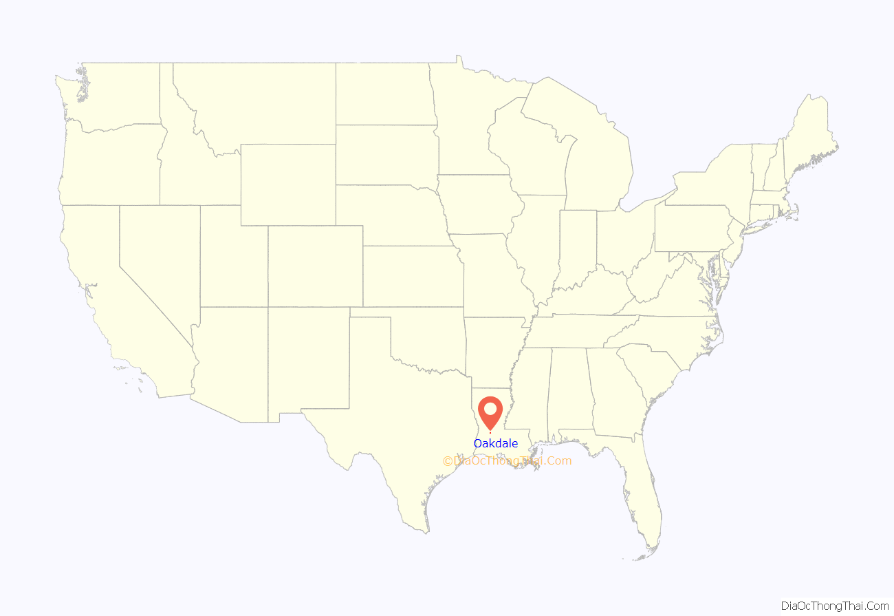
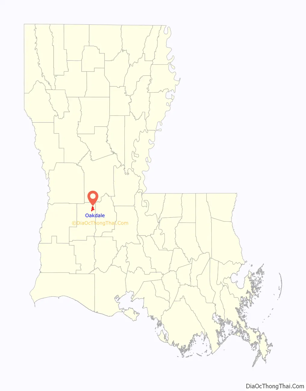
Oakdale location map. Where is Oakdale city?
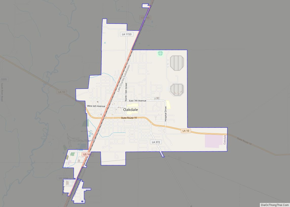
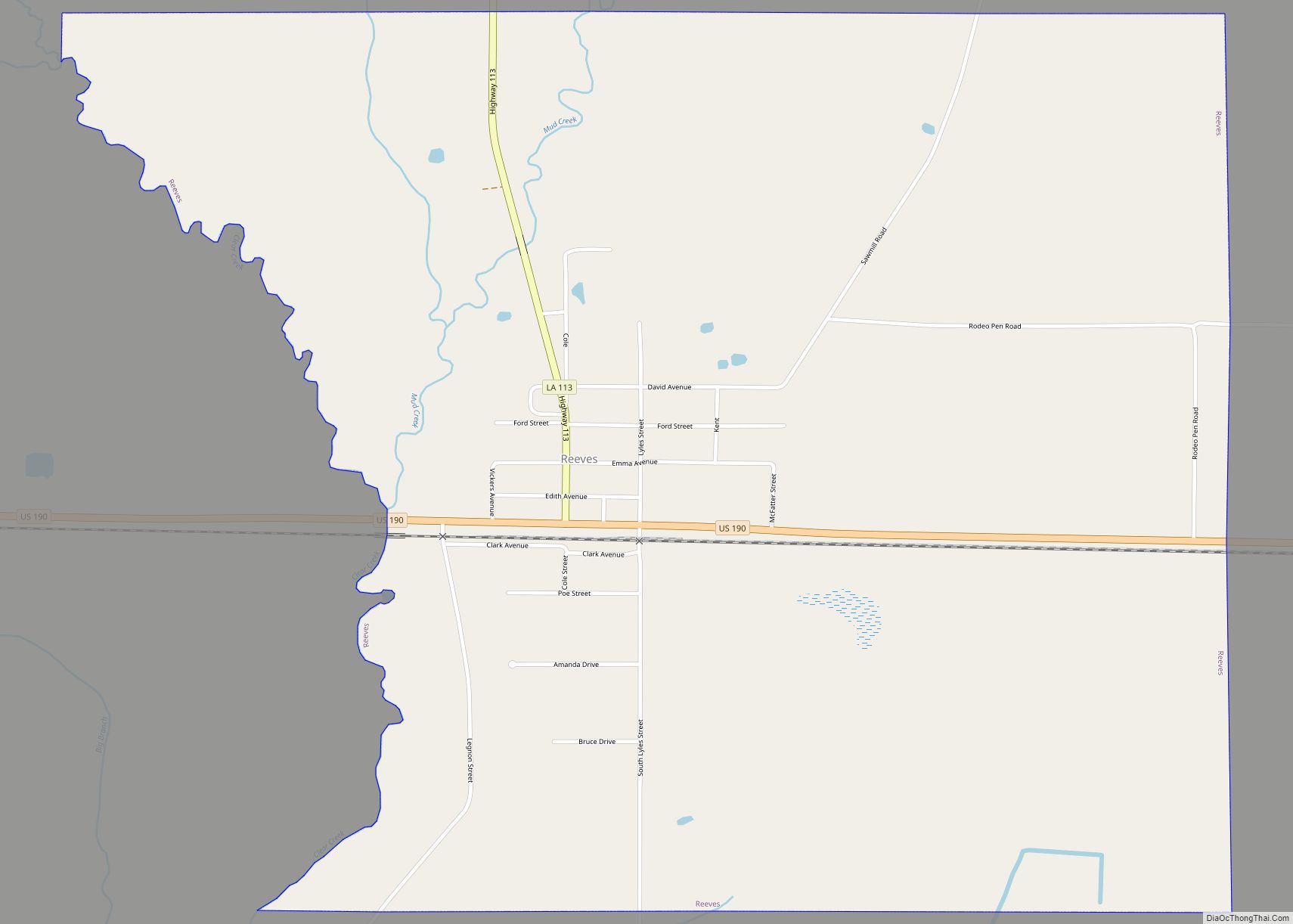
Oakdale Road Map
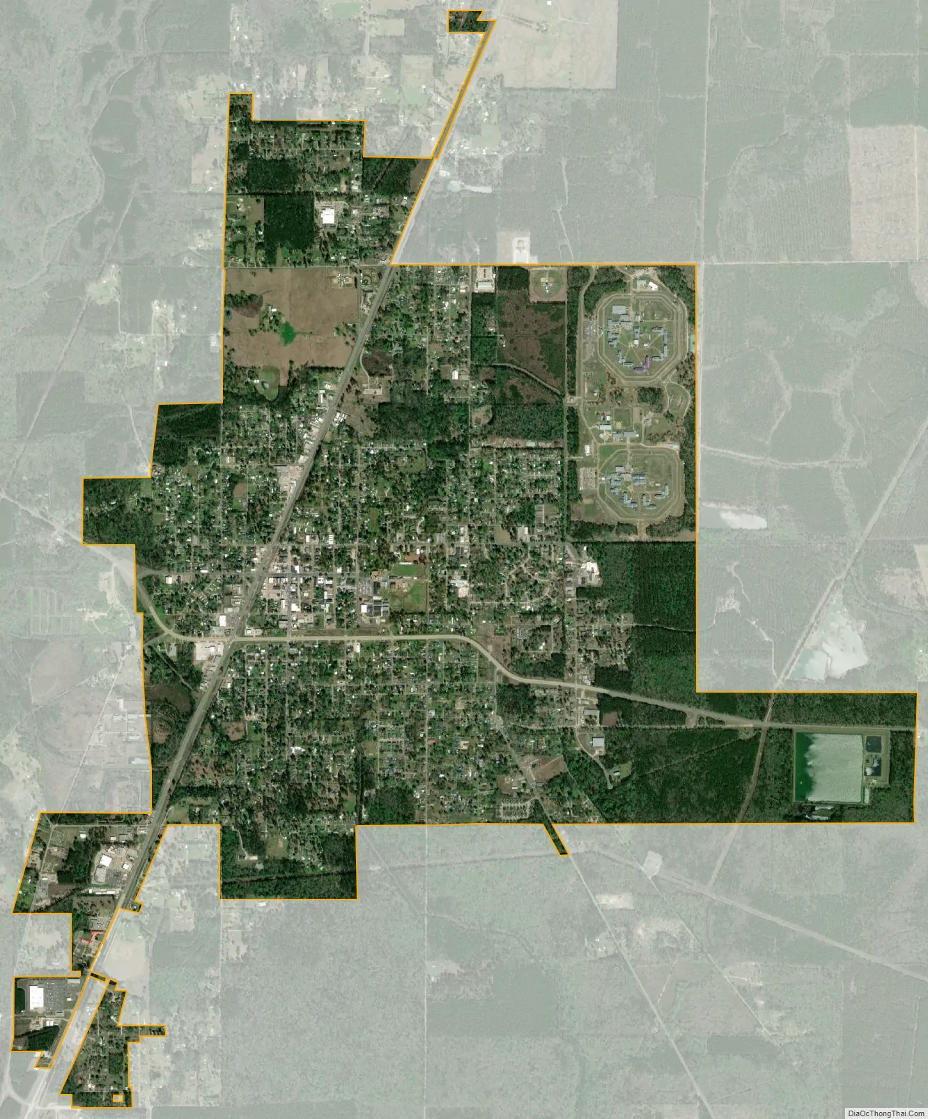
Oakdale city Satellite Map
Geography
According to the United States Census Bureau, the city has a total area of 5.3 square miles (13.6 km), of which 5.2 square miles (13.4 km) is land and 0.077 square miles (0.2 km), or 1.18%, is water. Oakdale’s closest neighbor in Allen Parish is Elizabeth, located just west of Oakdale.
See also
Map of Louisiana State and its subdivision:- Acadia
- Allen
- Ascension
- Assumption
- Avoyelles
- Beauregard
- Bienville
- Bossier
- Caddo
- Calcasieu
- Caldwell
- Cameron
- Catahoula
- Claiborne
- Concordia
- De Soto
- East Baton Rouge
- East Carroll
- East Feliciana
- Evangeline
- Franklin
- Grant
- Iberia
- Iberville
- Jackson
- Jefferson
- Jefferson Davis
- La Salle
- Lafayette
- Lafourche
- Lincoln
- Livingston
- Madison
- Morehouse
- Natchitoches
- Orleans
- Ouachita
- Plaquemines
- Pointe Coupee
- Rapides
- Red River
- Richland
- Sabine
- Saint Bernard
- Saint Charles
- Saint Helena
- Saint James
- Saint John the Baptist
- Saint Landry
- Saint Martin
- Saint Mary
- Saint Tammany
- Tangipahoa
- Tensas
- Terrebonne
- Union
- Vermilion
- Vernon
- Washington
- Webster
- West Baton Rouge
- West Carroll
- West Feliciana
- Winn
- Alabama
- Alaska
- Arizona
- Arkansas
- California
- Colorado
- Connecticut
- Delaware
- District of Columbia
- Florida
- Georgia
- Hawaii
- Idaho
- Illinois
- Indiana
- Iowa
- Kansas
- Kentucky
- Louisiana
- Maine
- Maryland
- Massachusetts
- Michigan
- Minnesota
- Mississippi
- Missouri
- Montana
- Nebraska
- Nevada
- New Hampshire
- New Jersey
- New Mexico
- New York
- North Carolina
- North Dakota
- Ohio
- Oklahoma
- Oregon
- Pennsylvania
- Rhode Island
- South Carolina
- South Dakota
- Tennessee
- Texas
- Utah
- Vermont
- Virginia
- Washington
- West Virginia
- Wisconsin
- Wyoming