Lynnfield is a town in Essex County, Massachusetts, in the United States. At the 2020 census, the town population was 13,000.
Lynnfield initially consisted of two distinct villages with a single governing body. Lynnfield Center comprises mostly an agricultural population, while South Lynnfield boasted a mixed culture. Together, the two towns evolved into one of the most prosperous suburbs in the North Shore region of Massachusetts.
| Name: | Lynnfield CDP |
|---|---|
| LSAD Code: | 57 |
| LSAD Description: | CDP (suffix) |
| State: | Massachusetts |
| County: | Essex County |
| Incorporated: | 1814 |
| Elevation: | 98 ft (30 m) |
| Total Area: | 10.5 sq mi (27.1 km²) |
| Land Area: | 9.9 sq mi (25.6 km²) |
| Water Area: | 0.6 sq mi (1.5 km²) |
| Total Population: | 13,000 |
| Population Density: | 1,200/sq mi (480/km²) |
| ZIP code: | 01940 |
| Area code: | 339 / 781 |
| FIPS code: | 2537595 |
| GNISfeature ID: | 0618299 |
| Website: | www.town.lynnfield.ma.us |
Online Interactive Map
Click on ![]() to view map in "full screen" mode.
to view map in "full screen" mode.
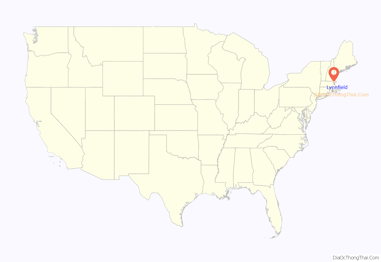
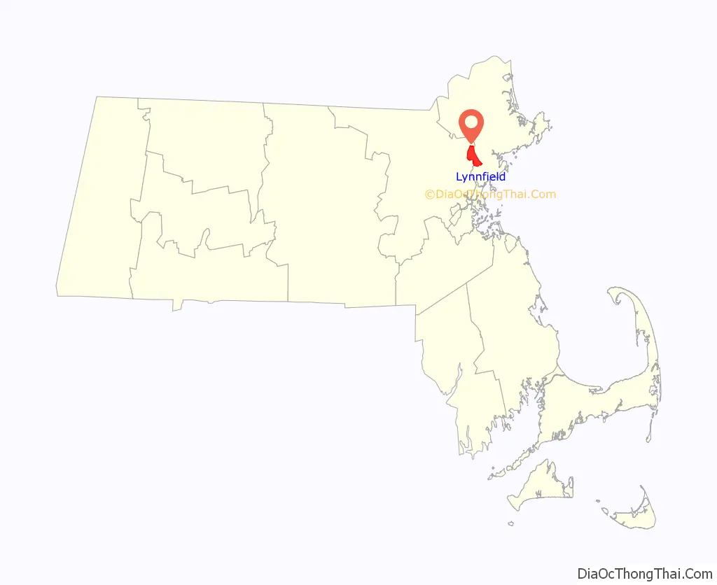
Lynnfield location map. Where is Lynnfield CDP?
History
The town of Lynnfield was first settled in 1638 and was made a district separate from Lynn in 1782. It was later officially incorporated in 1814. Historically, Lynnfield functioned as two separate villages connected by one governing body: in Lynnfield Center resided a mostly agricultural population, while South Lynnfield was a crossroad situated amongst neighboring larger towns. During this time, the town had two inns, a granite rock quarry, a small carbonated beverage bottler, and various eating institutions.
The stagecoach line north from Boston to Portsmouth, New Hampshire, known locally as the “Newburyport Turnpike”, ran through South Lynnfield. Later this roadway became U.S. Route 1, the route which brought many people north to the small town during the post-World War Two population surge. Lynnfield had attractions such as horse shows and ballroom dancing. Lynnfield has since become a modern, chiefly residential suburb of Boston.
Along with the communities of Chelsea, Lynn, Salem, Marblehead, Danvers, Middleton, Andover, Methuen, Haverhill, Amesbury and Salisbury, Lynnfield was a part of “The Gerry-mander” so described by the Boston Gazette on March 26, 1812.
Lynnfield Center retained limited commuter rail service, via the Boston & Maine Railroad, into the late 1950s/early 1960s with a small railroad boarding platform located not far from the current Town Hall offices.
When, in the 1960s, the United States Post Office implemented the Zone Improvement Program with 5-digit numerical codes, Lynnfield was assigned two ZIP codes, 01940 and 01944, for the Lynnfield Center and the South Lynnfield post offices, respectively. Later, 01944 was reassigned to Manchester (now Manchester-by-the-Sea); South Lynnfield currently shares Zip Code 01940 with Lynnfield Center.
Lynnfield Road Map
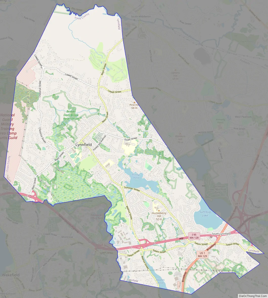
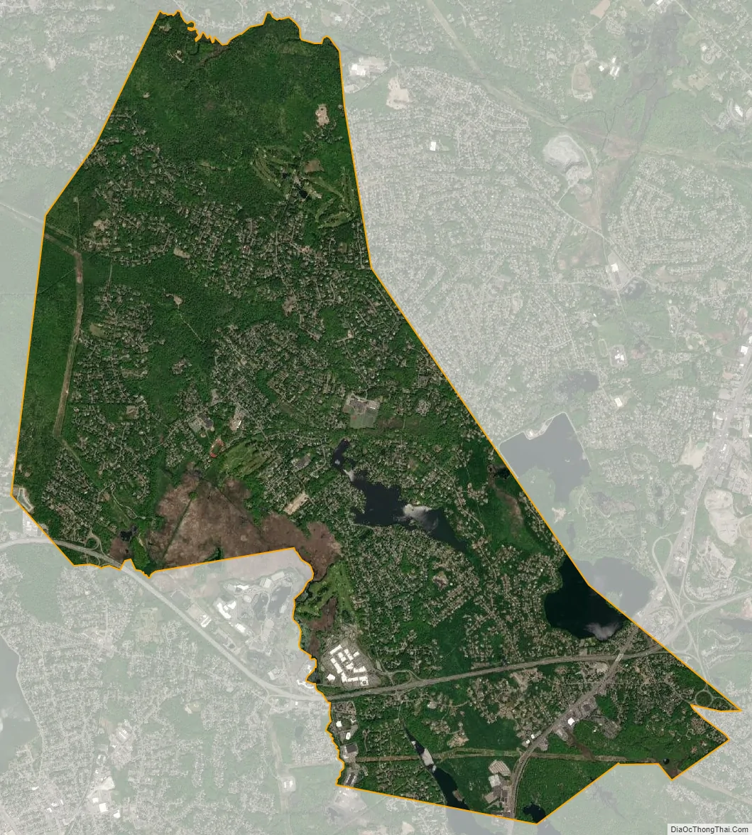
Lynnfield city Satellite Map
Geography
Lynnfield is located at 42°31′40″N 71°1′42″W / 42.52778°N 71.02833°W / 42.52778; -71.02833 (42.527895, −71.028348). According to the United States Census Bureau, the town has a total area of 10.5 square miles (27.1 km), of which 9.9 square miles (25.6 km) is land and 0.58 square miles (1.5 km), or 5.58%, is water. The Ipswich River forms the northern border of the town, and several brooks cross through town. Several lakes and ponds dot the town, including Suntaug Lake, Reedy Meadow, Pillings Pond, and Walden Pond (a less famous cousin of the one in Concord). A portion of the Lynn Woods Reservation is located in the southeast corner of town, and in the northwest part of town lies part of Camp Curtis Guild, a Massachusetts National Guard base which also contains lands in the neighboring towns. The highest part of town lies on Middleton Hill in the northern part of town.
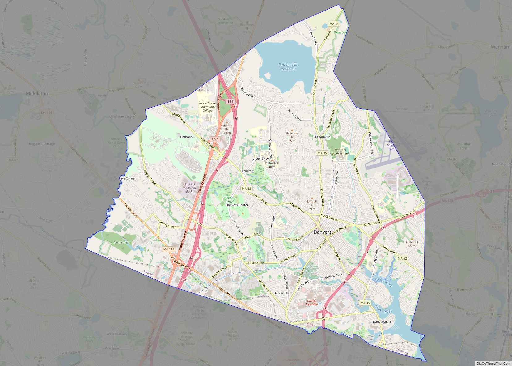
Lynnfield lies along the western border of Essex County, and is bordered by the Middlesex County towns of Wakefield to the southwest, Reading to the west, and North Reading to the north and northwest. Within Essex County, the town is bordered by Peabody to the northeast, Lynn to the southeast, and Saugus to the south. The town commons lies 9 miles (14 km) west of Salem, 14 miles (23 km) north of Boston, and 15 miles (24 km) south of Lawrence.
Interstate 95 and Massachusetts State Route 128 pass concurrently through town twice, becoming separate just over the Peabody line. U.S. Highway Route 1 and Massachusetts State Route 129 also enter the town concurrently, separating in the southeast corner of town at the Lynnfield Tunnel, a local traffic landmark. No other state routes pass through the town. The Springfield Terminal Railroad passes through town, but is no longer in service. There is no MBTA Commuter Rail service within Lynnfield; the nearest train station is off to the west in the neighboring town of Wakefield which serves the Haverhill Commuter Rail Line. MBTA Bus Route 436 clips the extreme southeastern corner of Lynnfield with a bus stop available at the intersection of Lynnfield Street and Lookout Terrace; the stop is located just two blocks southeast of Condon Circle (sometimes referred to as Goodwin Circle). Inbound service on MBTA Bus Route 436 travels to Central Square, Lynn to connect with the Newburyport/Rockport Commuter Rail Line; outbound buses provide service to the Northshore Mall in Peabody and the Liberty Tree Mall in Danvers. The nearest general aviation airport is Beverly Municipal Airport to the east; the nearest commercial airport for domestic and international service can be found at Boston’s Logan International Airport.
See also
Map of Massachusetts State and its subdivision: Map of other states:- Alabama
- Alaska
- Arizona
- Arkansas
- California
- Colorado
- Connecticut
- Delaware
- District of Columbia
- Florida
- Georgia
- Hawaii
- Idaho
- Illinois
- Indiana
- Iowa
- Kansas
- Kentucky
- Louisiana
- Maine
- Maryland
- Massachusetts
- Michigan
- Minnesota
- Mississippi
- Missouri
- Montana
- Nebraska
- Nevada
- New Hampshire
- New Jersey
- New Mexico
- New York
- North Carolina
- North Dakota
- Ohio
- Oklahoma
- Oregon
- Pennsylvania
- Rhode Island
- South Carolina
- South Dakota
- Tennessee
- Texas
- Utah
- Vermont
- Virginia
- Washington
- West Virginia
- Wisconsin
- Wyoming