Cheverly is a town in Prince George’s County, Maryland, United States, located very close to Washington, D.C., though not bordering it directly. The town was founded in 1918 and incorporated in 1931. Per the 2020 census, the population was 6,170. Cheverly borders the communities of Tuxedo, Chapel Oaks, Landover, Landover Hills, Villa Heights, and Bladensburg.
Cheverly is home to the Prince George’s County Health Department, Cheverly Professional Building, PepsiCo bottling plant, Judith P Hoyer Early Childhood Center, Cheverly American Legion, Magruder Spring Historic Landmark, ABC Supply Company Inc., Washington Woodworking Company, Cheverly Sport Fair Fishing Store, and Publick Playhouse Theater. The main ZIP code for Cheverly is 20785. Until 2021, Cheverly had been home to the University of Maryland (UM) Prince George’s Hospital Center, which was founded in 1944 and was known as a first-class trauma center. The facility closed on June 12, 2021, replaced by the all-new, $543 million UM Capital Region Medical Center, which opened the same day in nearby Largo, Md.
| Name: | Cheverly town |
|---|---|
| LSAD Code: | 43 |
| LSAD Description: | town (suffix) |
| State: | Maryland |
| County: | Prince George’s County |
| Incorporated: | April 18, 1931 |
| Elevation: | 955 ft (291 m) |
| Total Area: | 1.32 sq mi (3.41 km²) |
| Land Area: | 1.32 sq mi (3.41 km²) |
| Water Area: | 0.00 sq mi (0.00 km²) |
| Total Population: | 6,170 |
| Population Density: | 4,681.34/sq mi (1,808.15/km²) |
| ZIP code: | 20784 & 20785 |
| Area code: | 301, 240 |
| FIPS code: | 2416550 |
| GNISfeature ID: | 0597234 |
| Website: | https://www.cheverly-md.gov/ |
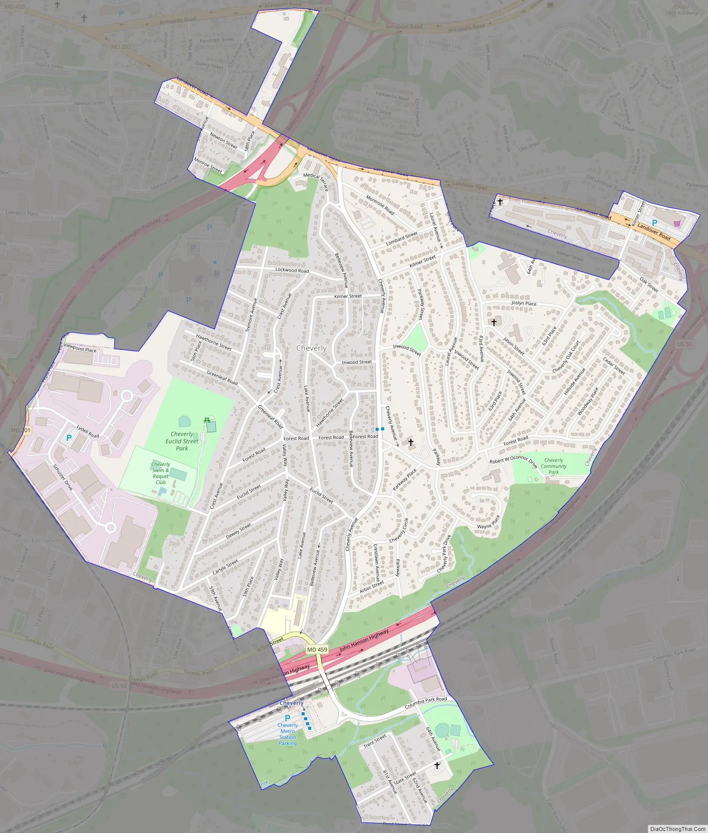
Online Interactive Map
Click on ![]() to view map in "full screen" mode.
to view map in "full screen" mode.
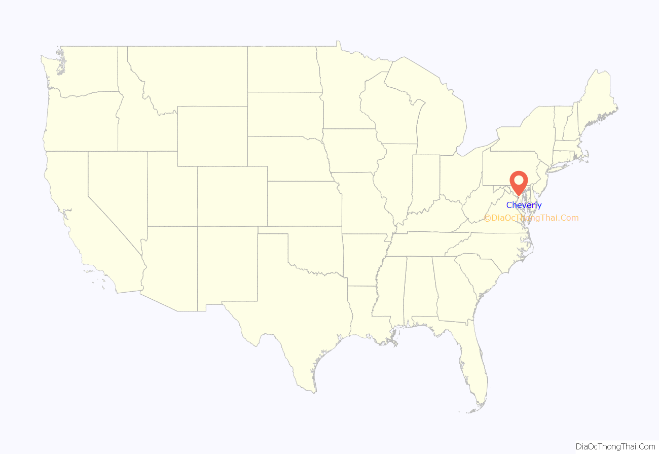
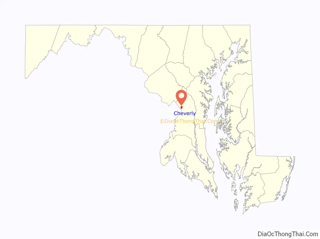
Cheverly location map. Where is Cheverly town?
History
Cheverly was begun as a planned suburb in the early 1900s. The Cheverly area was first platted in 1904 for a 93-acre (380,000 m) community called Cheverly Gardens. The land was subsequently purchased in 1918 by Robert Marshall, president of the Washington Suburban Realty Company. The Cheverly subdivision platted by Marshall was developed around the 1839 Magruder family homestead known as Mount Hope. Marshall became the first resident of Cheverly by taking up residence in the restored homestead in 1919. In 1923, the first road, now known as Cheverly Avenue, was completed and paved to connect the Pennsylvania Railroad line to Landover Road. Thirty-four developer-built houses were constructed between 1921 and 1925. Most of the early houses were mail-order homes from Sears & Roebuck and the McClure Homes Company. Marshall lost control of the Washington Suburban Realty Company in 1927. Harry Wardman assumed the position until the company’s bankruptcy in 1929 due to the stock market crash.
Incorporation was granted in 1931 to address concerns for better roads and services. During the 1930s and 1940s, the streets were improved and lighting enhanced, and the number of residences increased from 135 to 650. Residential construction continued through the 1960s, creating a varied housing stock of early Cape Cod houses, with later ranch and split-level types. Two garden-style apartment complexes (Cheverly Terrace and Hanson Arms) were constructed in the early 1960s along Landover Road near the U.S. Route 50 interchange. The community center, town hall, and park facility was built in 1978. Industrial property was established in 1958 on the west side of town and adjacent to Route 50.
On April 29, 2006, the community held a 75th anniversary celebration at the town community center. The historic home Mount Hope had been the town’s official symbol since 1931, however, on June 11, 2020 the Mayor and Council voted unanimous to remove the home from the Town Seal and redesign it.
Historic sites
The following is a list of historic sites in Cheverly identified by the Maryland-National Capital Park and Planning Commission:
Cheverly Road Map
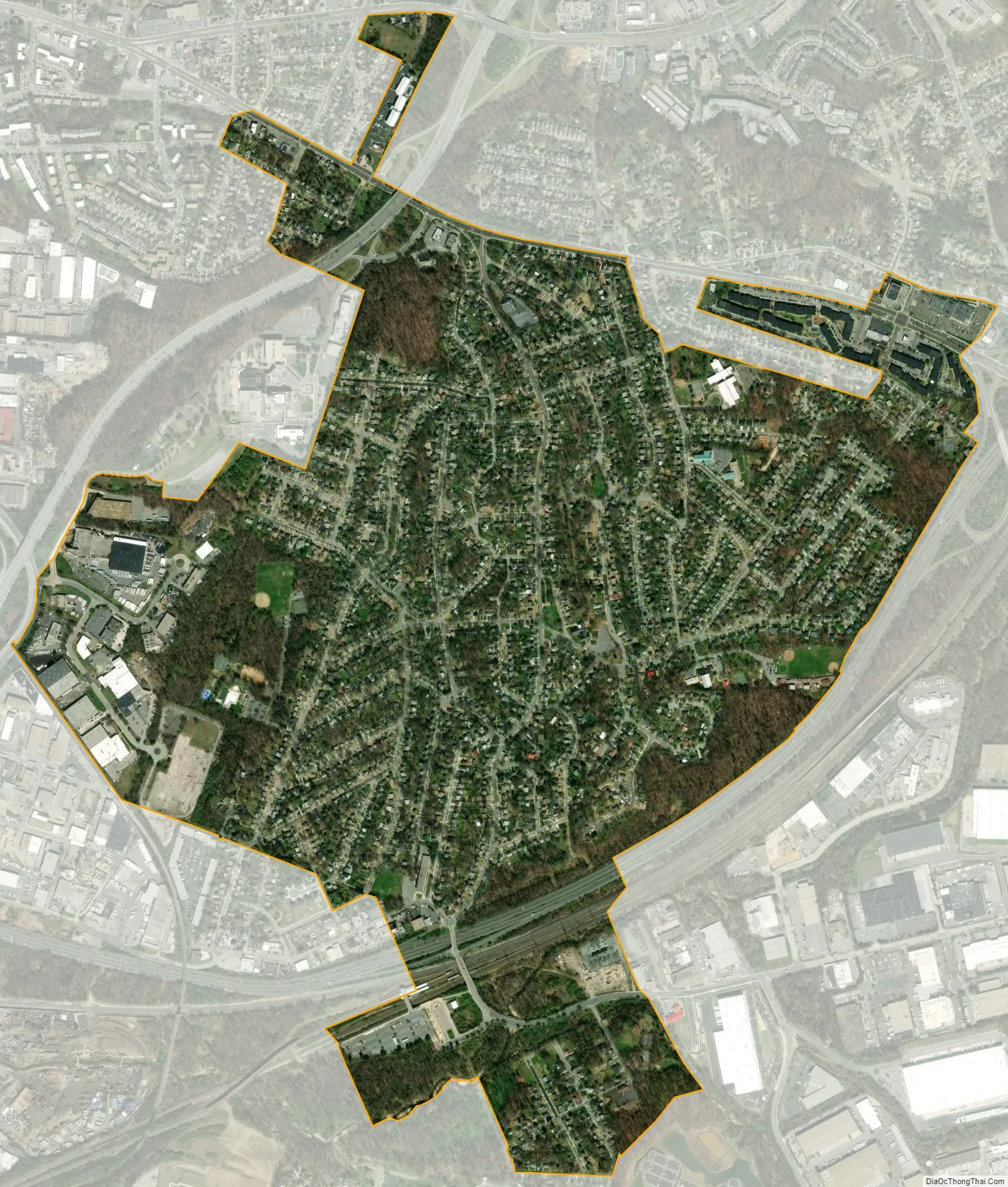
Cheverly city Satellite Map
Geography
Cheverly is located at 38°55′28″N 76°54′49″W / 38.92444°N 76.91361°W / 38.92444; -76.91361 (38.924478, -76.913488).
According to the United States Census Bureau, the town has a total area of 1.35 square miles (3.50 km), all land.
While a majority of the homes in Cheverly are small to mid-sized red brick homes, there are a few apartment complexes. The names of these apartment complexes notably are:
- Cheverly Gardens Apartments; located at the intersection of Newton Street, Madison Way, and 55th Avenue
- Parke Cheverly Apartments; located directly south of the Cheverly Gardens Apartments at the intersections of 54th Avenue, Macbeth Street, and 55th Avenue
- Cheverly Station Apartments (formerly Cheverly Terrace Apartments); located at the intersection of Landover Road (MD 202) and Kilmer Street, facing the John Hanson Highway (U.S. Highway 50) directly east
Bordering areas
- Tuxedo (south and west)
- Chapel Oaks (southwest)
- Landover (east, northeast, and southeast)
- Landover Hills (north)
- Villa Heights (northwest)
- Bladensburg (northwest)
See also
Map of Maryland State and its subdivision: Map of other states:- Alabama
- Alaska
- Arizona
- Arkansas
- California
- Colorado
- Connecticut
- Delaware
- District of Columbia
- Florida
- Georgia
- Hawaii
- Idaho
- Illinois
- Indiana
- Iowa
- Kansas
- Kentucky
- Louisiana
- Maine
- Maryland
- Massachusetts
- Michigan
- Minnesota
- Mississippi
- Missouri
- Montana
- Nebraska
- Nevada
- New Hampshire
- New Jersey
- New Mexico
- New York
- North Carolina
- North Dakota
- Ohio
- Oklahoma
- Oregon
- Pennsylvania
- Rhode Island
- South Carolina
- South Dakota
- Tennessee
- Texas
- Utah
- Vermont
- Virginia
- Washington
- West Virginia
- Wisconsin
- Wyoming


