Colmar Manor is a town located in Prince George’s County, Maryland, United States. As of the 2010 census, the town had a population of 1,404. As the town developed at the beginning of the 20th century, it assumed a name derived from its proximity to the District of Columbia—the first syllable of Columbia and that of Maryland were combined to form “Colmar”. Colmar Manor was incorporated in 1927.
| Name: | Colmar Manor town |
|---|---|
| LSAD Code: | 43 |
| LSAD Description: | town (suffix) |
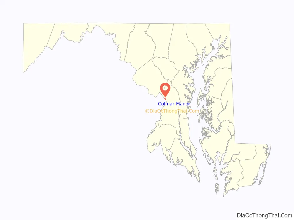
| State: | Maryland |
| County: | Prince George’s County |
| Incorporated: | 1927 |
| Elevation: | 30 ft (9 m) |
| Total Area: | 0.48 sq mi (1.24 km²) |
| Land Area: | 0.43 sq mi (1.11 km²) |
| Water Area: | 0.05 sq mi (0.13 km²) |
| Total Population: | 1,588 |
| Population Density: | 3,701.63/sq mi (1,430.87/km²) |
| ZIP code: | 20722 |
| Area code: | 301, 240 |
| FIPS code: | 2418850 |
| GNISfeature ID: | 0597270 |
| Website: | http://colmarmanor.org |
Online Interactive Map
Click on ![]() to view map in "full screen" mode.
to view map in "full screen" mode.
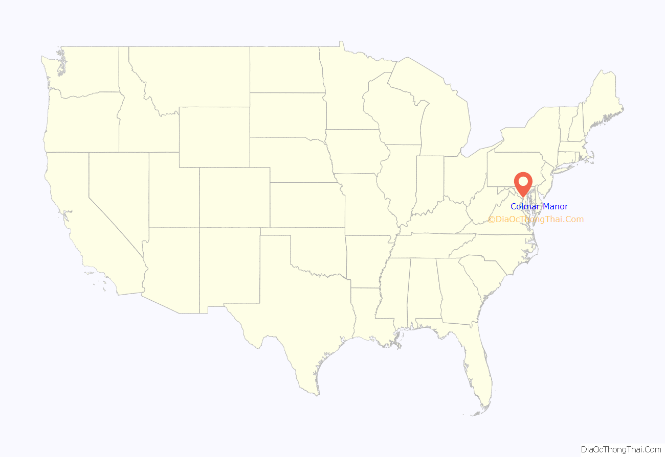
Colmar Manor location map. Where is Colmar Manor town?
History
19th century
The town is home to Dueling Creek, formerly in Bladensburg, Maryland, a small waterway that because of its secluded location was a popular site for dueling. Duels were banned in neighboring Washington, D.C., but legal in Maryland, and Dueling Creek was the site for more than 50 duels between 1808 and 1868. The most famous duel fought on the site was on March 22, 1820, between Stephen Decatur and James Barron. Decatur was mortally wounded in the exchange.
During the War of 1812, on August 24, 1814, the area was the scene of the Battle of Bladensburg. The place became a battlefield again in the early days of the Civil War when Confederate troops mounted an assault on Battery Jameson, Fort Lincoln, now northeast Washington, D.C., which was one of a number Union defensive forts built around the nation’s capital to protect it from capture. The remains of Fort Lincoln are located on the hillside that is now a part of Fort Lincoln Cemetery.
20th century
In 1912, the Capitol Cemetery of Prince George’s County was incorporated on the Washington, D.C., boundary line. Directly north of the cemetery was the Shreve estate. The Shreve house was destroyed in the 1890s. The 260-acre (1.1 km) farm site was used by the 6,000 jobless men from Ohio who descended on the Capitol in 1894 as “Coxey’s Army”. Bladensburg Road traversed the area, becoming more heavily traveled in the 1920s, and eventually became designated as U.S. Route 1. Part of the former Shreve estate was subdivided into building lots in 1918. The lots were 50 feet (15 m) wide by 100 feet (30 m) deep, arranged along a grid pattern of streets. The streets were originally named after President Woodrow Wilson (1913–21), members of his cabinet, and other prominent men of the era. Some time later, the streets were renamed to conform to the system in use in the District of Columbia. The location of the development within the first service area of the Washington Suburban Sanitary Commission offered homeowners modern water and sewer lines. The houses constructed were modest one- and two-story wood-frame buildings. In 1931, the town’s streets were paved and gutters were installed. A concrete block municipal building was constructed in 1934, followed by the construction of a brick schoolhouse in 1935. In 1959, a municipal building was constructed to house the town’s administrative offices and police department.
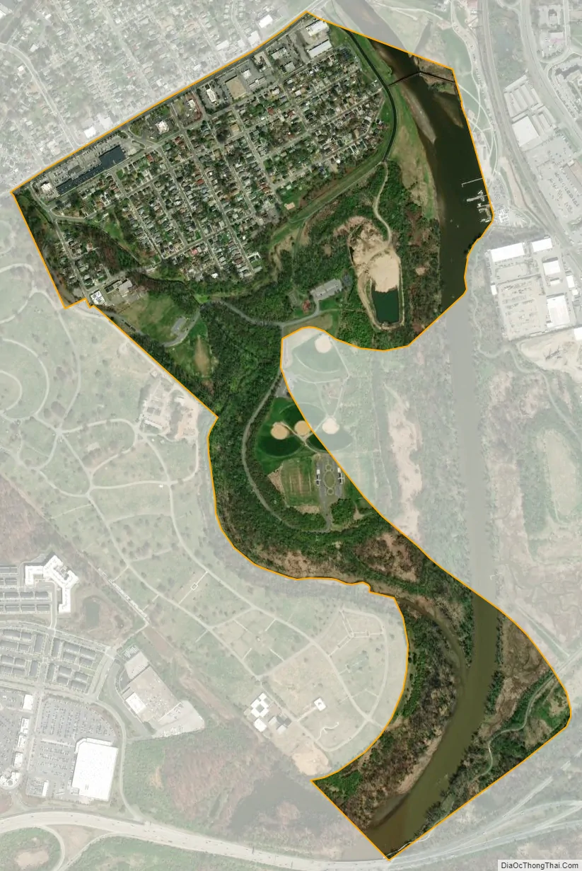
During the second half of the 20th century, the area along Bladensburg Road, now known as Alternate Route 1, became lined with commercial establishments, and much of the housing stock was used as rental units. A large urban renewal project in the 1970s and 1980s resulted in the demolition of many commercial properties along Bladenburg Road. The old businesses were replaced with new structures such as fast food restaurants and a shopping center. Streets and houses were also improved. The Colmar Manor Community Park was established along the west bank of the Anacostia River in the 1970s on the site of a sanitary landfill.
In 1999, Colmar Manor, Bladensburg, and Cottage City were lauded by the Joint Center for Sustainable Communities for their collaboration with Prince George’s County for the Port Towns Revitalization Initiative, which created a common Port Towns identity for the towns; encouraged businesses development through infrastructure and facade improvements; acquisition of historic properties and plans for their reuse; and reconstruction of the Bladensburg waterfront, marina and the Bladensburg Waterfront Park.
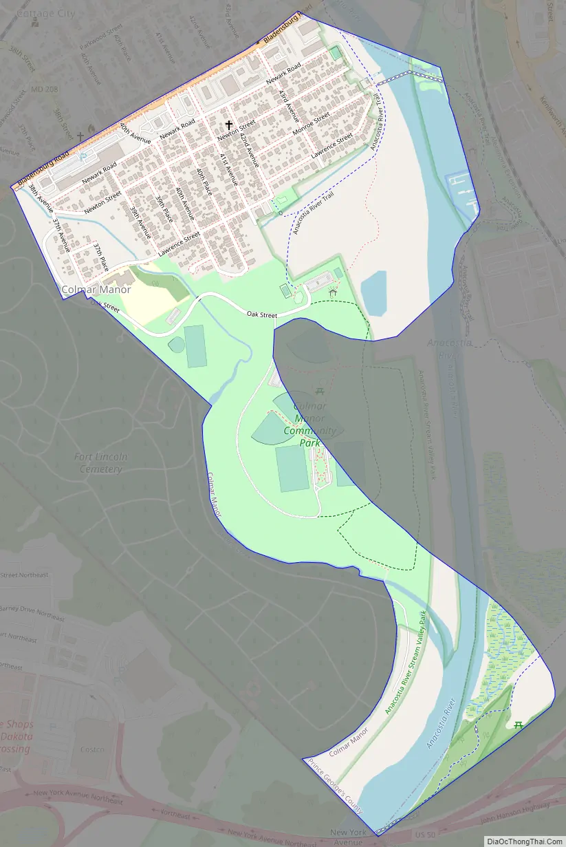
Colmar Manor Road Map
Colmar Manor city Satellite Map
Geography
Colmar Manor is located at 38°56’2″ North, 76°56’49” West (38.933811, -76.947077).
According to the United States Census Bureau, the town has a total area of 0.52 square miles (1.35 km), of which 0.47 square miles (1.22 km) is land and 0.05 square miles (0.13 km) is water.
See also
Map of Maryland State and its subdivision: Map of other states:- Alabama
- Alaska
- Arizona
- Arkansas
- California
- Colorado
- Connecticut
- Delaware
- District of Columbia
- Florida
- Georgia
- Hawaii
- Idaho
- Illinois
- Indiana
- Iowa
- Kansas
- Kentucky
- Louisiana
- Maine
- Maryland
- Massachusetts
- Michigan
- Minnesota
- Mississippi
- Missouri
- Montana
- Nebraska
- Nevada
- New Hampshire
- New Jersey
- New Mexico
- New York
- North Carolina
- North Dakota
- Ohio
- Oklahoma
- Oregon
- Pennsylvania
- Rhode Island
- South Carolina
- South Dakota
- Tennessee
- Texas
- Utah
- Vermont
- Virginia
- Washington
- West Virginia
- Wisconsin
- Wyoming


