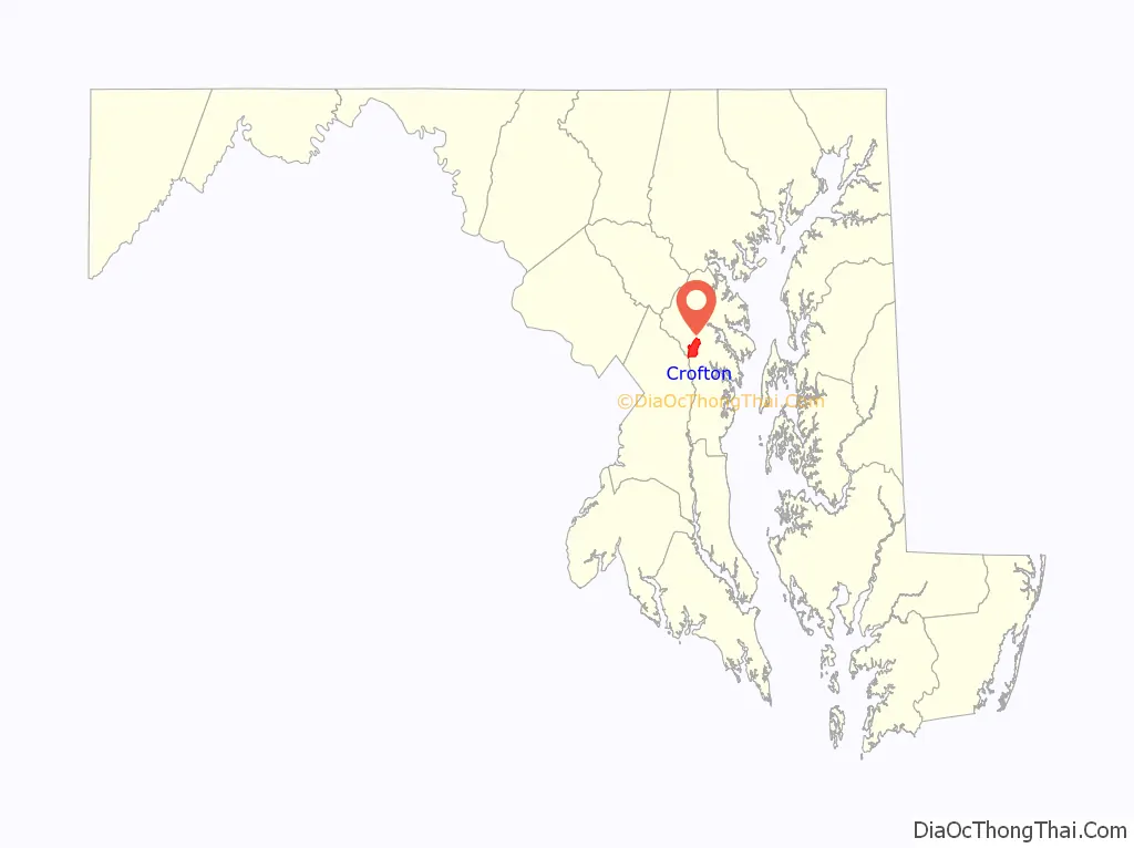
Crofton is a census-designated place and planned community in Anne Arundel County, Maryland, United States, located 9.8 miles (15.8 km) west of the state capital Annapolis, 24 miles (39 km) south of Baltimore, and 24 miles (39 km) east-northeast of Washington, D.C. The community was established in 1964 and as of the 2020 census, it had a population of 29,136.
| Name: | Crofton CDP |
|---|---|
| LSAD Code: | 57 |
| LSAD Description: | CDP (suffix) |
| State: | Maryland |
| County: | Anne Arundel County |
| Founded: | 1964 |
| Elevation: | 98 ft (30 m) |
| Total Area: | 6.61 sq mi (17.12 km²) |
| Land Area: | 6.61 sq mi (17.12 km²) |
| Water Area: | 0.00 sq mi (0.00 km²) |
| Total Population: | 29,641 |
| Population Density: | 4,483.59/sq mi (1,731.01/km²) |
| ZIP code: | 21114 |
| Area code: | 410, 443, and 667 |
| FIPS code: | 2420875 |
| GNISfeature ID: | 0590046 |
| Website: | www.croftoncommunity.org |
Online Interactive Map
Click on ![]() to view map in "full screen" mode.
to view map in "full screen" mode.
Crofton location map. Where is Crofton CDP?

History
Development
In 1963, after the Crawford Corporation accumulated over 1,600 acres (650 ha) of land, it announced that it would build a new community called Crofton. This new town and planned community was founded at the same time as Reston, Virginia (April 17, 1964) and Columbia, Maryland (1967). Crofton would be anchored by a community golf course, which later became the Crofton Country Club. Crofton was officially founded in the fall of 1964. The company considered picking an English name for the new town that “sounds well and implies that this is a pleasant place to live.” It ended up picking the name “Crofton”, named after a small township in Cumberland County, England. The English town was originally called Croft-town, derived from the word “Croft”, as the town standing upon the Crofts. Originally an exclusive gated community accused of racial exclusion and requiring a country club membership to purchase a home, Crofton’s gates were opened, and eventually removed entirely in 2022.
Crofton pond snakehead fish incident
Crofton was in the national news in late June and early July 2002 after a fish called the northern snakehead was discovered in a local pond. The infestation was found in water behind the Crofton post office and the adjacent shopping center, across Route 3 from local landmark Lake Louise.
The snakehead species is highly aggressive and voracious. In order to ensure that the fish were eliminated, in September 2002 the main pond and two nearby ponds were dosed heavily with rotenone and subsequently with potassium permanganate. Six adult snakeheads and more than one thousand juvenile fish were found and destroyed.
Ultimately, the incident initiated a national discussion on invasive species. One comparison case was the mute swan, also an invasive and destructive species of the Chesapeake Bay watershed but, in comparison, quite beautiful, and which garnered support from some environmental and animal rights groups.
Several movies were inspired by this incident. Syfy aired two movies in relation to the snakehead outbreak: in March 2004, a movie called Snakehead Terror was featured, and the movie Frankenfish was aired in June 2004. Ten Pound Films also produced a feature film titled Swarm of the Snakehead which related to this incident. In 2007, a documentary titled Fishzilla: Snakehead Invasion aired on the National Geographic Channel, discussing the ecological damage that the snakeheads found in Crofton have done to surrounding areas.
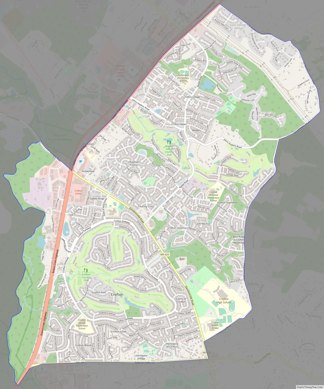
Crofton Road Map
Crofton city Satellite Map

Geography
The original community of Crofton was built on the Duvall family farm located within a triangle formed by three major roads: Crain Highway (Maryland Route 3) to the northwest, Davidsonville Road (Maryland Route 424) to the northeast, and Defense Highway (Maryland Route 450) to the south. Within the triangle, Crofton Parkway, a loop road 3.5 miles (5.6 km) long, encircles the center of the community.
The Crofton CDP now extends north and east from the triangle, including Crofton Park and reaching northeast as far as St. Stephens Church Road.
The Little Patuxent River borders Crofton on its southwest corner at the intersection of Route 3 and Route 450, providing a buffer between Anne Arundel and Prince Georges counties.
According to the United States Census Bureau, the Crofton CDP has a total area of 6.6 square miles (17.1 km), all land.
See also
Map of Maryland State and its subdivision: Map of other states:- Alabama
- Alaska
- Arizona
- Arkansas
- California
- Colorado
- Connecticut
- Delaware
- District of Columbia
- Florida
- Georgia
- Hawaii
- Idaho
- Illinois
- Indiana
- Iowa
- Kansas
- Kentucky
- Louisiana
- Maine
- Maryland
- Massachusetts
- Michigan
- Minnesota
- Mississippi
- Missouri
- Montana
- Nebraska
- Nevada
- New Hampshire
- New Jersey
- New Mexico
- New York
- North Carolina
- North Dakota
- Ohio
- Oklahoma
- Oregon
- Pennsylvania
- Rhode Island
- South Carolina
- South Dakota
- Tennessee
- Texas
- Utah
- Vermont
- Virginia
- Washington
- West Virginia
- Wisconsin
- Wyoming


