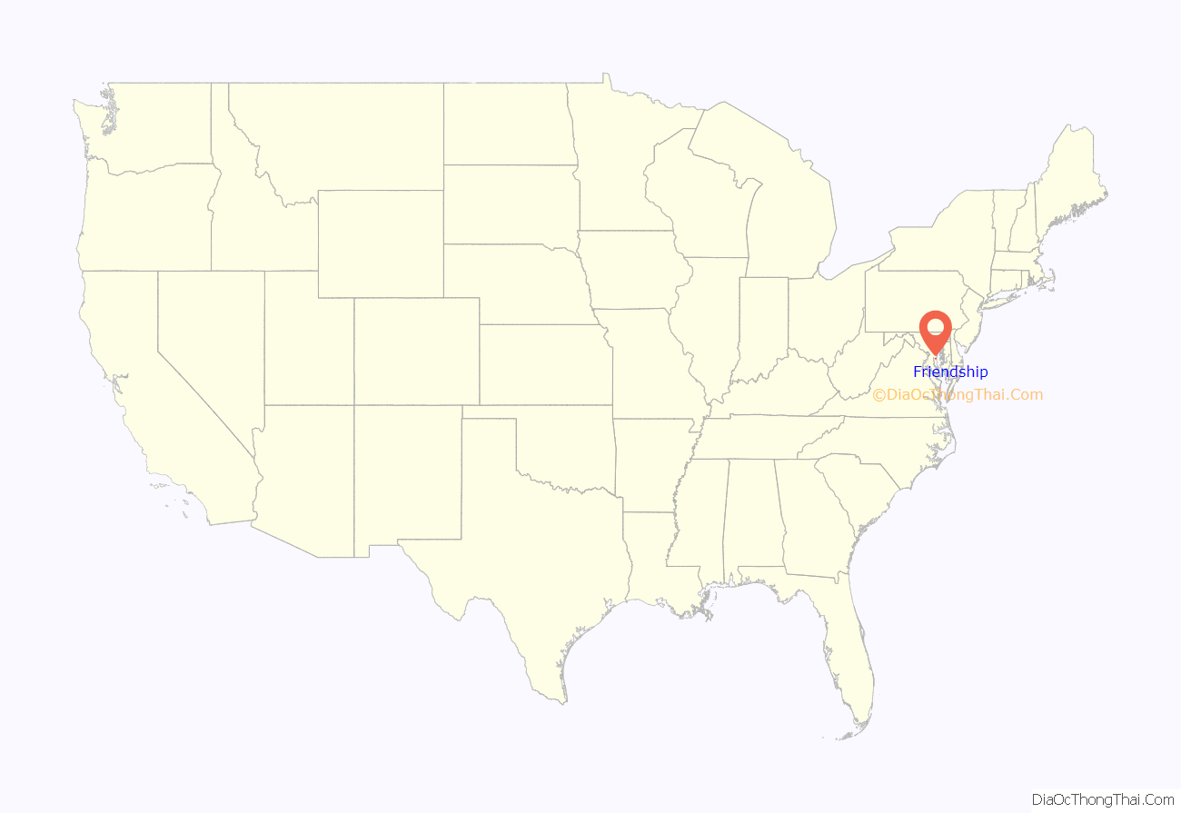
Friendship is an unincorporated community and census-designated place (CDP) in Anne Arundel County, Maryland, United States. As of the 2010 census, its population was 447.
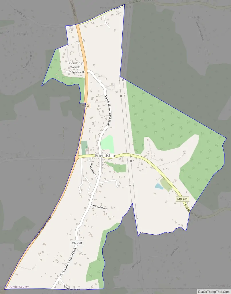
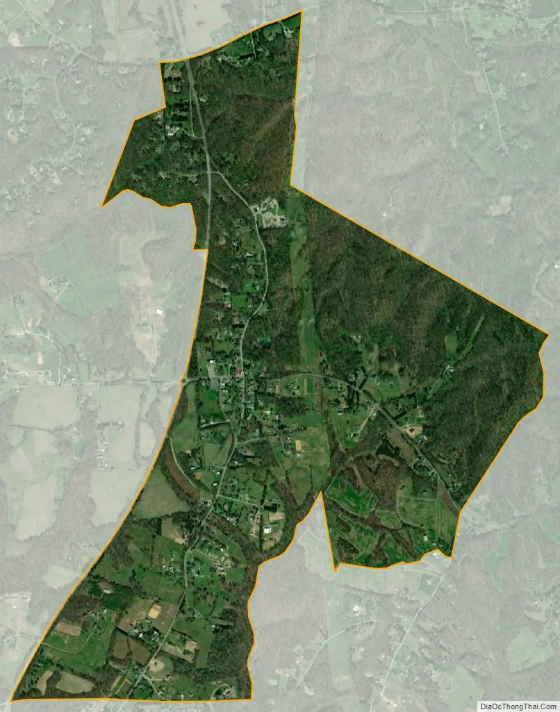
Friendship covers 1.794 square miles (2.887 km), and is located at the southern tip of Anne Arundel County along Maryland Route 2, by which road it is 22 miles (35 km) north to Annapolis, the state capital, and 15 miles (24 km) south to Prince Frederick, the seat of Calvert County.
| Name: | Friendship CDP |
|---|---|
| LSAD Code: | 57 |
| LSAD Description: | CDP (suffix) |
| State: | Maryland |
| County: | Anne Arundel County |
| Elevation: | 144 ft (44 m) |
| Total Area: | 1.80 sq mi (4.65 km²) |
| Land Area: | 1.80 sq mi (4.65 km²) |
| Water Area: | 0.00 sq mi (0.00 km²) |
| Total Population: | 384 |
| Population Density: | 213.81/sq mi (82.55/km²) |
| ZIP code: | 20758 |
| FIPS code: | 2430650 |
| GNISfeature ID: | 590257 |
Online Interactive Map
Click on ![]() to view map in "full screen" mode.
to view map in "full screen" mode.
Friendship location map. Where is Friendship CDP?
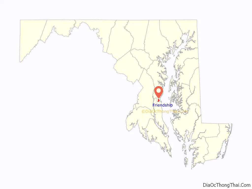
Friendship Road Map
Friendship city Satellite Map
See also
Map of Maryland State and its subdivision: Map of other states:- Alabama
- Alaska
- Arizona
- Arkansas
- California
- Colorado
- Connecticut
- Delaware
- District of Columbia
- Florida
- Georgia
- Hawaii
- Idaho
- Illinois
- Indiana
- Iowa
- Kansas
- Kentucky
- Louisiana
- Maine
- Maryland
- Massachusetts
- Michigan
- Minnesota
- Mississippi
- Missouri
- Montana
- Nebraska
- Nevada
- New Hampshire
- New Jersey
- New Mexico
- New York
- North Carolina
- North Dakota
- Ohio
- Oklahoma
- Oregon
- Pennsylvania
- Rhode Island
- South Carolina
- South Dakota
- Tennessee
- Texas
- Utah
- Vermont
- Virginia
- Washington
- West Virginia
- Wisconsin
- Wyoming


