Garrett Park is a town in Montgomery County, Maryland. It was named after a former president of the Baltimore and Ohio Railroad, Robert W. Garrett. The population was 992 at the 2010 census. Garrett Park is home to Garrett Park Elementary School, located just outside the town proper.
| Name: | Garrett Park town |
|---|---|
| LSAD Code: | 43 |
| LSAD Description: | town (suffix) |
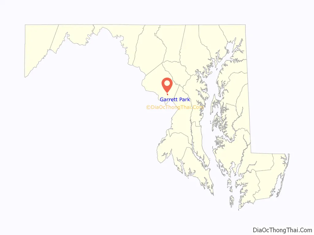
| State: | Maryland |
| County: | Montgomery County |
| Incorporated: | 1898 |
| Elevation: | 285 ft (87 m) |
| Total Area: | 0.25 sq mi (0.65 km²) |
| Land Area: | 0.25 sq mi (0.65 km²) |
| Water Area: | 0.00 sq mi (0.00 km²) |
| Total Population: | 996 |
| Population Density: | 3,968.13/sq mi (1,531.62/km²) |
| ZIP code: | 20896 |
| Area code: | 301, 240 |
| FIPS code: | 2431525 |
| GNISfeature ID: | 0584560 |
| Website: | www.garrettparkmd.gov |
Online Interactive Map
Click on ![]() to view map in "full screen" mode.
to view map in "full screen" mode.
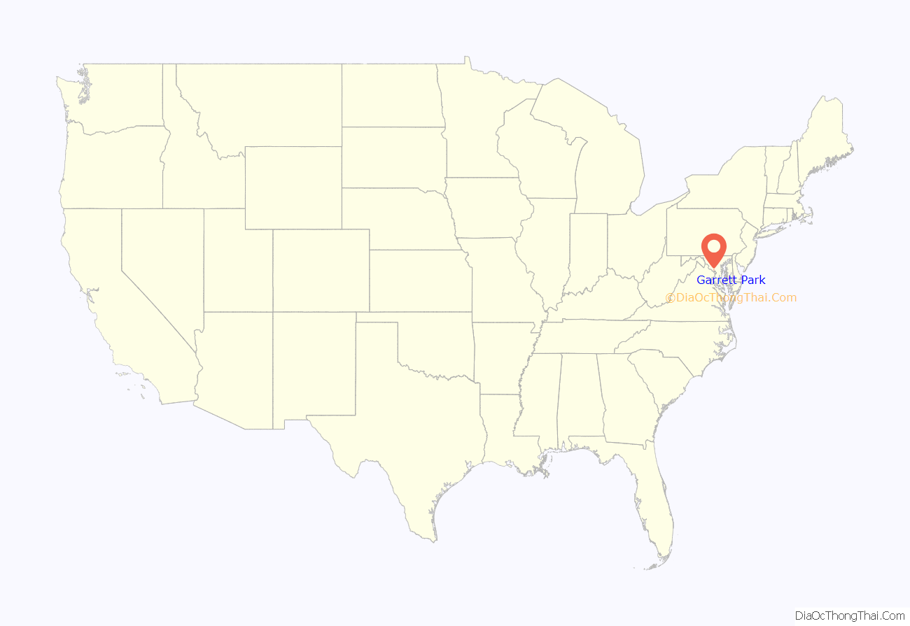
Garrett Park location map. Where is Garrett Park town?
History
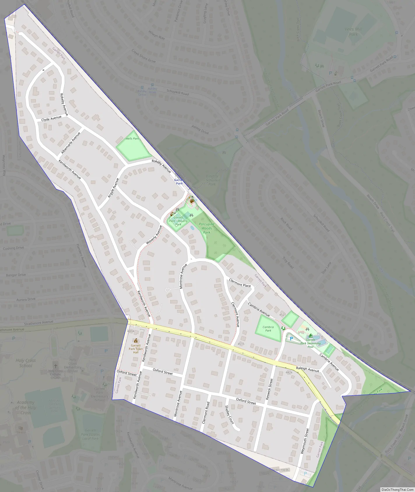
Garrett Park was an early planned community, originally promoted by businessman Henry W. Copp, who purchased the land in 1886. Copp wanted to build a suburban development reminiscent of an English village, and even went so far as to name the streets after locations in the novels of the English author Walter Scott, such as Kenilworth and Strathmore. Copp worked in conjunction with the Baltimore and Ohio Railroad, which in 1893 built a train station. Builders were given reduced rates to transport workers and materials to the town site, and new residents were given free trips to move in. The town lies along the former B&O railway corridor (now used by CSX, Amtrak, MARC). It was named for John Work Garrett, who had led the B&O for nearly three decades, including the American Civil War. Copp limited commercial development in the community. Today the Town has a 4-star restaurant, post office, and farmer’s market. Garrett Park incorporated as a town in 1898, at which time it had thirty buildings and approximately 100 residents. However, rail suburbs did not catch on, and the community stagnated as automobiles replaced commuter trains and streetcars. In the 1920s, another company built approximately 50 more houses, now including garages. Sections of the town are included in the Garrett Park Historic District, listed on the National Register of Historic Places in 1975. For example, Garrett Park’s first school house, designed in 1928 by prominent local architect Howard Wright Cutler and now preserved as part of a residential home, is a designated historic site by the Maryland Historical Trust. In 1977, the Town became a declared arboretum, maintaining a tree inventory of all town trees and a scheduled tree planting schedule. In May 1982 the townspeople of Garrett Park voted 245 to 46 to ban the production, transportation, storage, processing, disposal, or use of nuclear weapons within the town. This made Garrett Park the first nuclear-weapons free zone in the United States.
Garrett Park Road Map
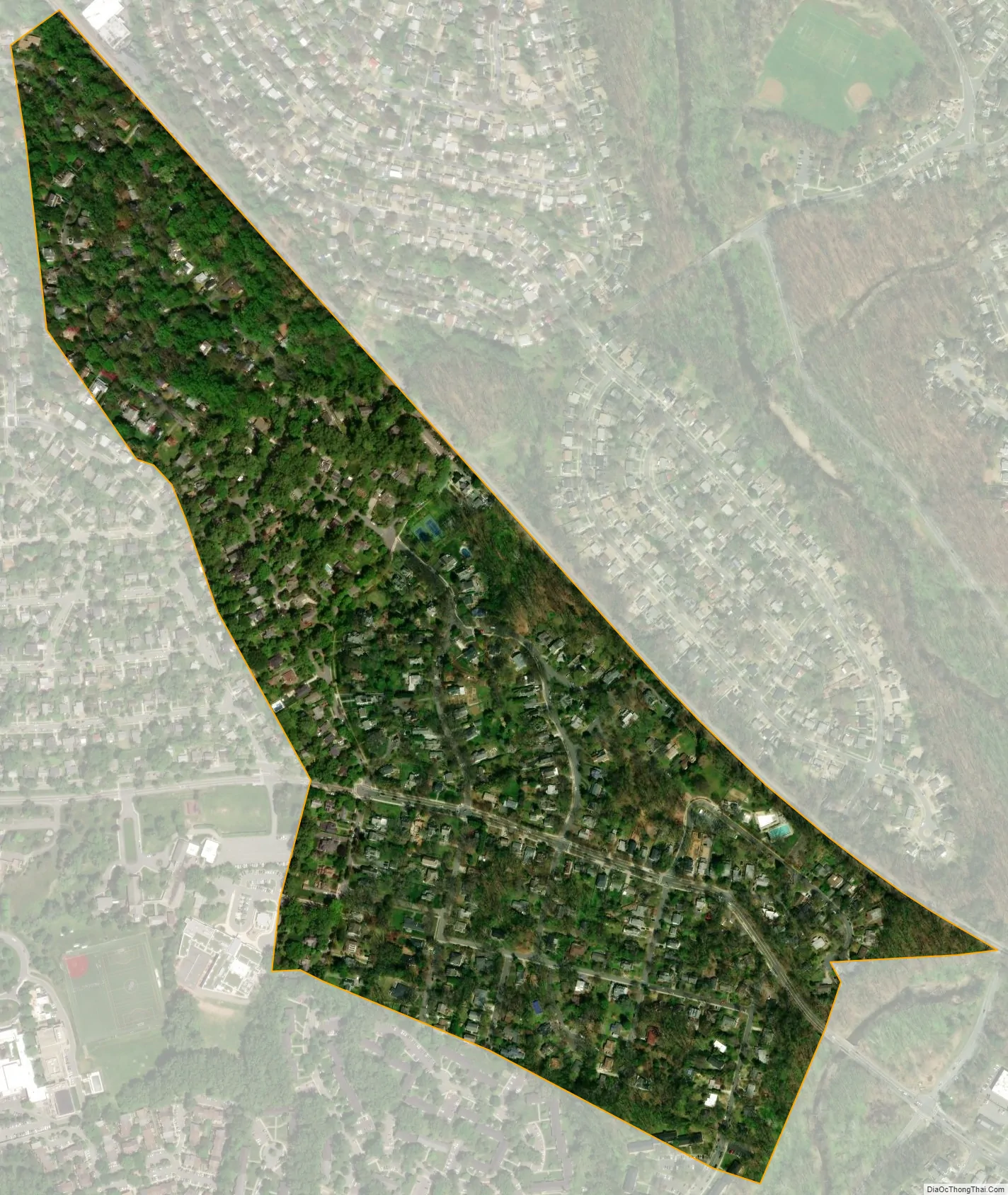
Garrett Park city Satellite Map
Geography
Garrett Park is located at 39°2′ North, 77°6′ West. It is just west of Kensington, due north of Bethesda, northwest of Silver Spring, and southeast of Rockville. It is approximately halfway between Rockville and Silver Spring. Rock Creek Park is located along the town’s southeast borders.
Its land area is 0.2 square miles (0.52 km). According to the United States Census Bureau, the town has a total area of 0.26 square miles (0.67 km), all of it land.
Garrett Park is primarily a residential town, with a post office, and a few small businesses. The only road open to automotive traffic into or out of Garrett Park is Maryland State Highway 547 (Strathmore Avenue). The town is served by the MARC Train Brunswick Line. The town is unusual in that residents pick up their mail at the post office in person, rather than having home delivery.
See also
Map of Maryland State and its subdivision: Map of other states:- Alabama
- Alaska
- Arizona
- Arkansas
- California
- Colorado
- Connecticut
- Delaware
- District of Columbia
- Florida
- Georgia
- Hawaii
- Idaho
- Illinois
- Indiana
- Iowa
- Kansas
- Kentucky
- Louisiana
- Maine
- Maryland
- Massachusetts
- Michigan
- Minnesota
- Mississippi
- Missouri
- Montana
- Nebraska
- Nevada
- New Hampshire
- New Jersey
- New Mexico
- New York
- North Carolina
- North Dakota
- Ohio
- Oklahoma
- Oregon
- Pennsylvania
- Rhode Island
- South Carolina
- South Dakota
- Tennessee
- Texas
- Utah
- Vermont
- Virginia
- Washington
- West Virginia
- Wisconsin
- Wyoming


