White Oak is a census-designated place and an unincorporated area in Montgomery County, Maryland, United States. It had a population of 16,347 in 2020.
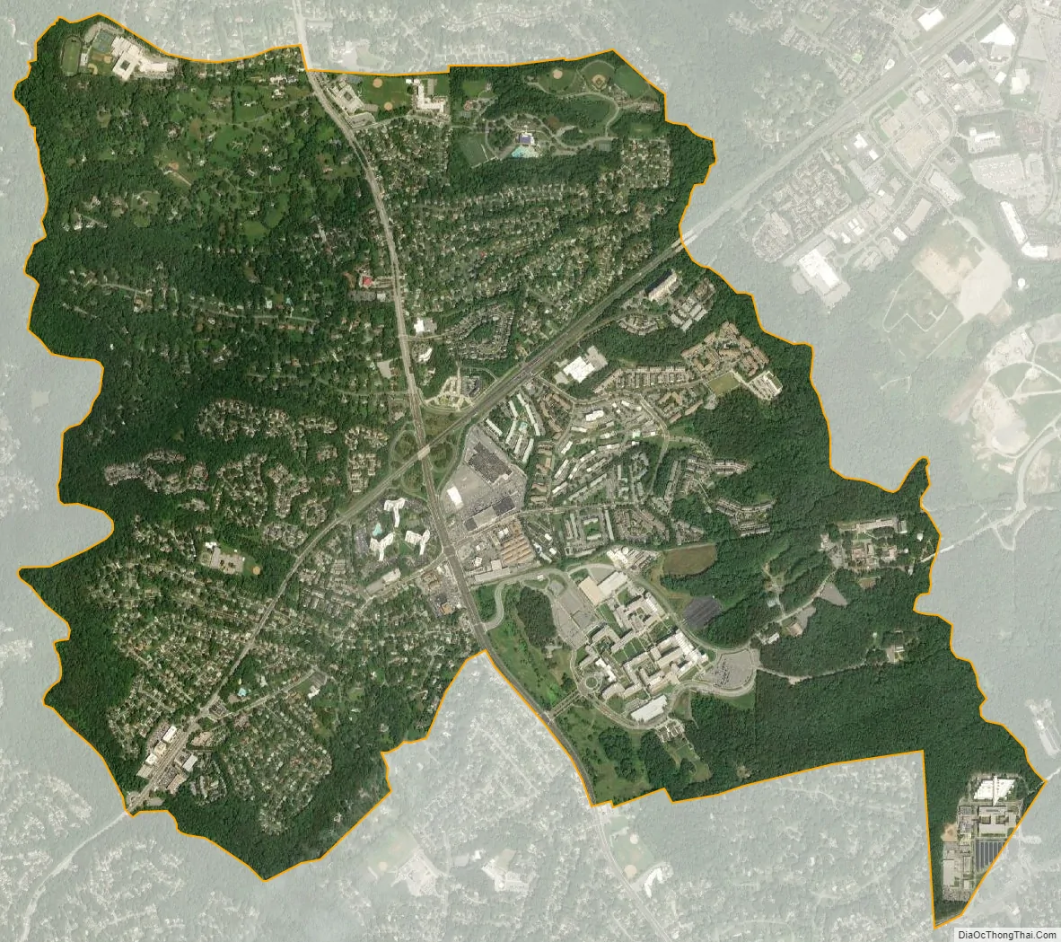
White Oak was known for its Naval Ordnance Laboratory, which was closed in 1994. The headquarters of the Food and Drug Administration now occupies the property, which has been renamed the Federal Research Center at White Oak. According to the United States Census Bureau, the locality has a total area of 3.78 square miles (9.79 km), all land.
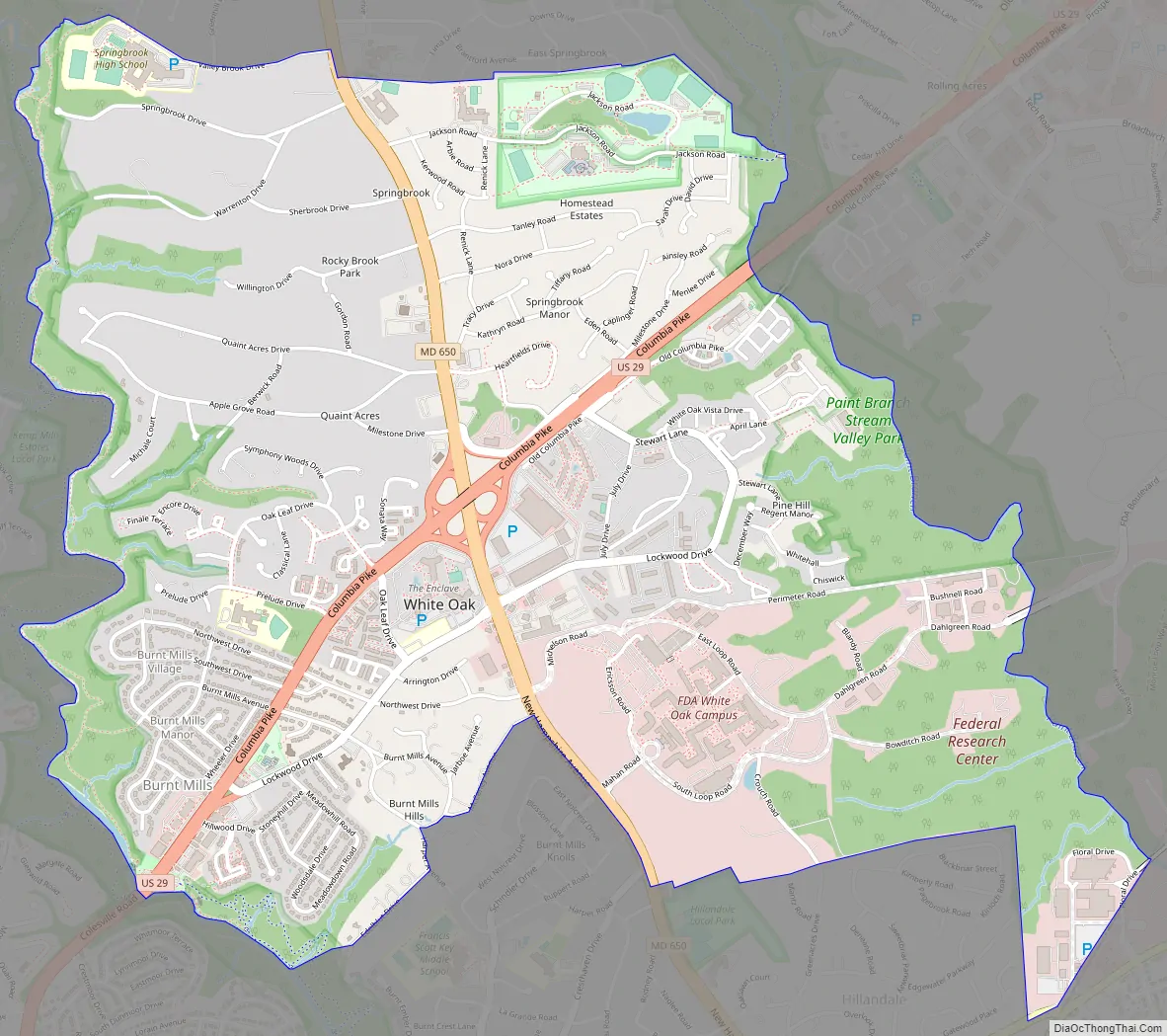
White Oak is a diverse neighborhood. The main area of White Oak is from Lockwood Drive starting from New Hampshire Avenue (MD 650) towards Stewart Lane, crossing Columbia Pike (U.S. 29).
| Name: | White Oak CDP |
|---|---|
| LSAD Code: | 57 |
| LSAD Description: | CDP (suffix) |
| State: | Maryland |
| County: | Montgomery County |
| Elevation: | 387 ft (118 m) |
| Total Area: | 3.12 sq mi (8.09 km²) |
| Land Area: | 3.12 sq mi (8.09 km²) |
| Water Area: | 0.00 sq mi (0.00 km²) |
| Total Population: | 16,347 |
| Population Density: | 5,234.39/sq mi (2,021.15/km²) |
| FIPS code: | 2484375 |
| GNISfeature ID: | 0591544 |
Online Interactive Map
Click on ![]() to view map in "full screen" mode.
to view map in "full screen" mode.
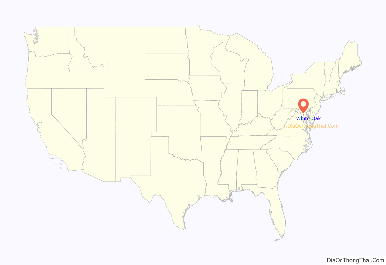
White Oak location map. Where is White Oak CDP?

White Oak Road Map
White Oak city Satellite Map
Geography
As an unincorporated area, White Oak’s boundaries are not officially defined by either a municipal government or by the government of Montgomery County. Boundaries for the White Oak census-designated place have been established by the United States Census Bureau, while the United States Geological Survey recognizes White Oak to be a populated place located at 39°02′23″N 76°59′35″W / 39.039832°N 76.993032°W / 39.039832; -76.993032 (39.039832, –76.993032). Many of its residents consider themselves to be residents of the White Oak neighborhood of Silver Spring, similar to how large cities have different neighborhoods within their borders.
See also
Map of Maryland State and its subdivision: Map of other states:- Alabama
- Alaska
- Arizona
- Arkansas
- California
- Colorado
- Connecticut
- Delaware
- District of Columbia
- Florida
- Georgia
- Hawaii
- Idaho
- Illinois
- Indiana
- Iowa
- Kansas
- Kentucky
- Louisiana
- Maine
- Maryland
- Massachusetts
- Michigan
- Minnesota
- Mississippi
- Missouri
- Montana
- Nebraska
- Nevada
- New Hampshire
- New Jersey
- New Mexico
- New York
- North Carolina
- North Dakota
- Ohio
- Oklahoma
- Oregon
- Pennsylvania
- Rhode Island
- South Carolina
- South Dakota
- Tennessee
- Texas
- Utah
- Vermont
- Virginia
- Washington
- West Virginia
- Wisconsin
- Wyoming


