Landover Hills is a town in Prince George’s County, Maryland, United States. Per the 2020 census, the population was 1,815. The town has a neighborhood named Defense Heights.
| Name: | Landover Hills town |
|---|---|
| LSAD Code: | 43 |
| LSAD Description: | town (suffix) |
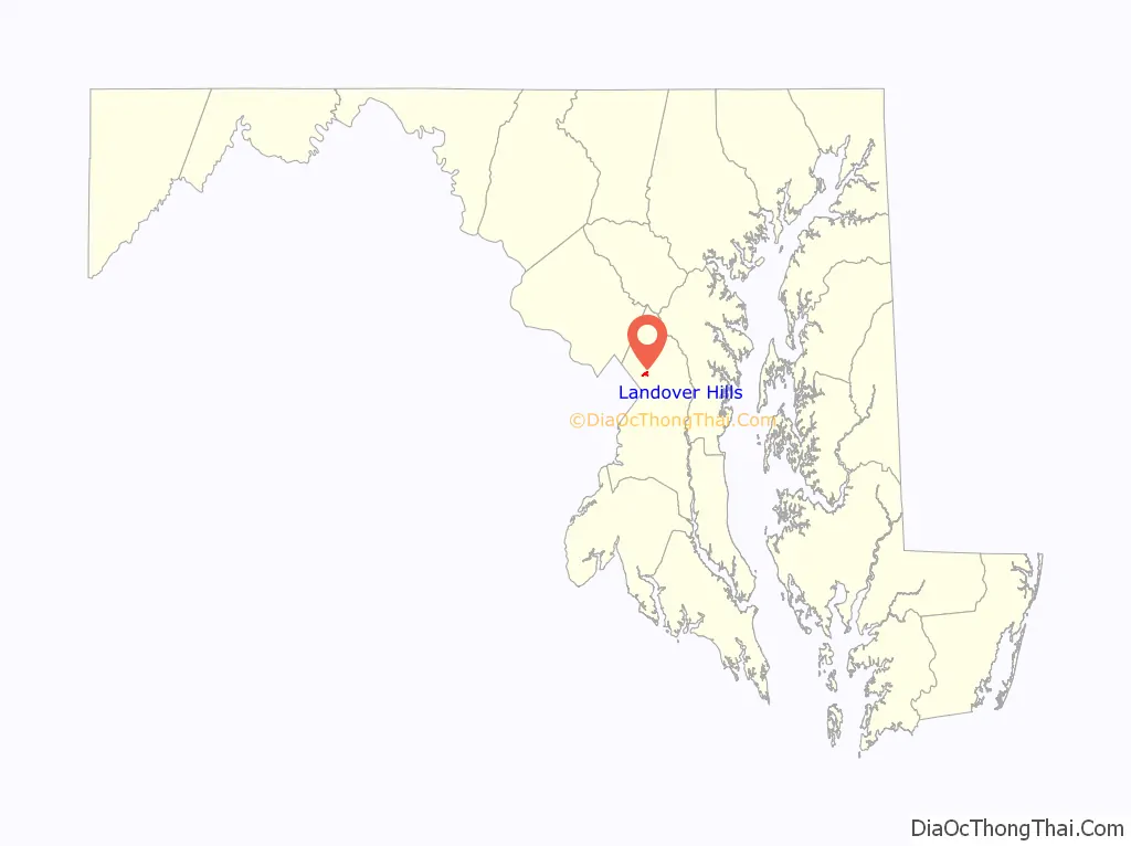
| State: | Maryland |
| County: | Prince George’s County |
| Incorporated: | 1945 |
| Elevation: | 164 ft (50 m) |
| Total Area: | 0.37 sq mi (0.95 km²) |
| Land Area: | 0.37 sq mi (0.95 km²) |
| Water Area: | 0.00 sq mi (0.00 km²) |
| Total Population: | 1,815 |
| Population Density: | 4,945.50/sq mi (1,908.74/km²) |
| ZIP code: | 20784 |
| Area code: | 301, 240 |
| FIPS code: | 2445400 |
| GNISfeature ID: | 0597656 |
Online Interactive Map
Click on ![]() to view map in "full screen" mode.
to view map in "full screen" mode.
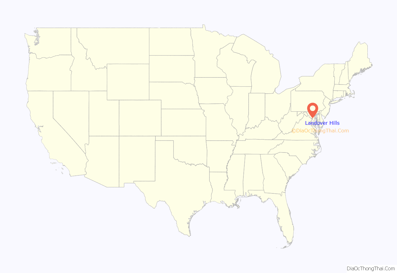
Landover Hills location map. Where is Landover Hills town?
History
Landover Hills was incorporated in 1945.
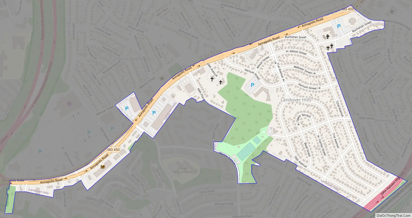
Landover Hills Road Map
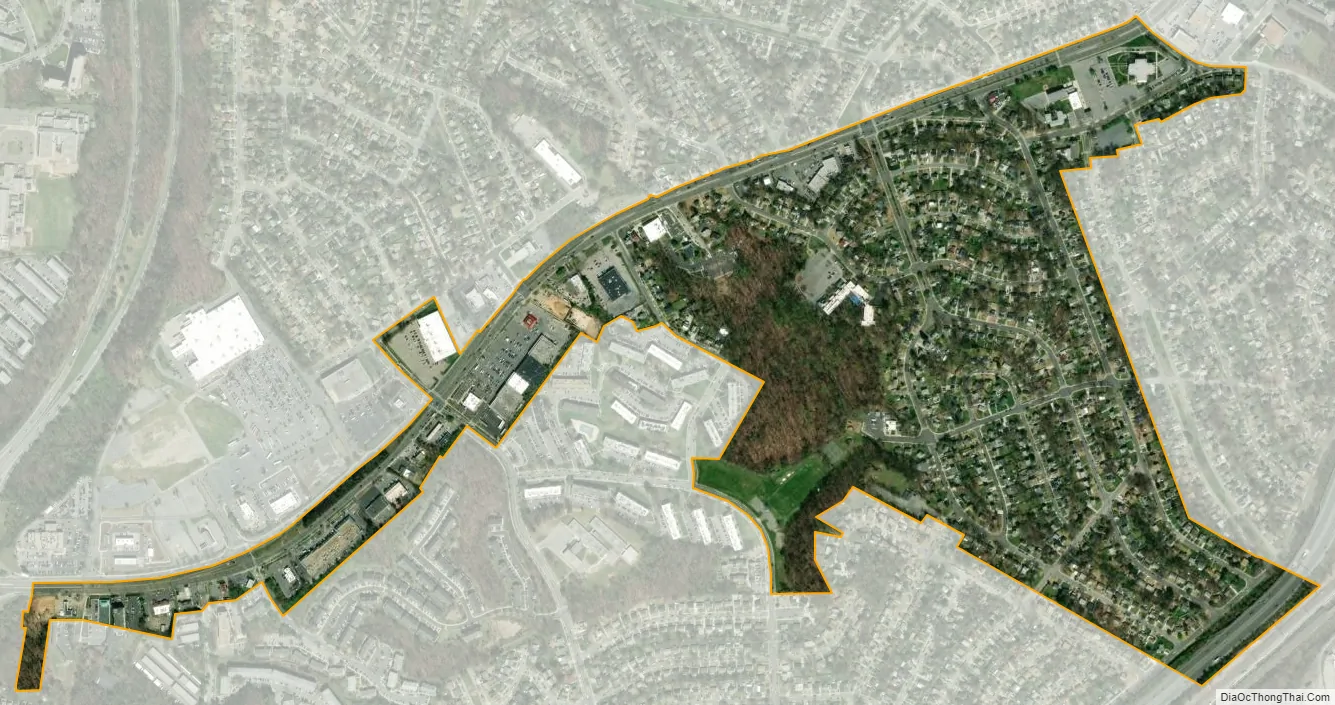
Landover Hills city Satellite Map
Geography
Landover Hills is located at 38°56’36” North, s76°53’27” West (38.943244, -76.890811).
According to the United States Census Bureau, the town has a total area of 0.30 square miles (0.78 km), all land.
Adjacent areas
- Woodlawn (northwest)
- Landover (south)
- East Riverdale (northeast)
- New Carrollton (northeast)
- Bladensburg (west)
- District of Columbia (west)
See also
Map of Maryland State and its subdivision: Map of other states:- Alabama
- Alaska
- Arizona
- Arkansas
- California
- Colorado
- Connecticut
- Delaware
- District of Columbia
- Florida
- Georgia
- Hawaii
- Idaho
- Illinois
- Indiana
- Iowa
- Kansas
- Kentucky
- Louisiana
- Maine
- Maryland
- Massachusetts
- Michigan
- Minnesota
- Mississippi
- Missouri
- Montana
- Nebraska
- Nevada
- New Hampshire
- New Jersey
- New Mexico
- New York
- North Carolina
- North Dakota
- Ohio
- Oklahoma
- Oregon
- Pennsylvania
- Rhode Island
- South Carolina
- South Dakota
- Tennessee
- Texas
- Utah
- Vermont
- Virginia
- Washington
- West Virginia
- Wisconsin
- Wyoming


