Layhill is an unincorporated community and census-designated place in Montgomery County, Maryland, United States. According to the United States Census Bureau, Layhill had a population of 5,764 in 2020.
| Name: | Layhill CDP |
|---|---|
| LSAD Code: | 57 |
| LSAD Description: | CDP (suffix) |
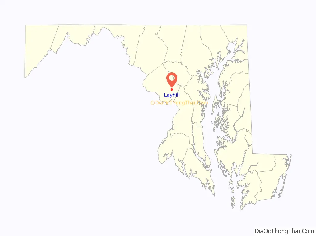
| State: | Maryland |
| County: | Montgomery County |
| Elevation: | 440 ft (130 m) |
| Total Area: | 1.60 sq mi (4.14 km²) |
| Land Area: | 1.59 sq mi (4.11 km²) |
| Water Area: | 0.01 sq mi (0.02 km²) |
| Total Population: | 5,764 |
| Population Density: | 3,627.44/sq mi (1,400.79/km²) |
| ZIP code: | 20906 |
| Area code: | 301 |
| FIPS code: | 2446150 |
| GNISfeature ID: | 590644 |
Online Interactive Map
Click on ![]() to view map in "full screen" mode.
to view map in "full screen" mode.
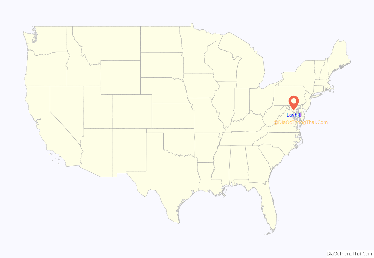
Layhill location map. Where is Layhill CDP?
History
Early history
A land patent for Lay Hill was issued on August 17, 1716. The size was recorded as 1,298 acres (2.0 sq mi; 5.3 km). The Northwest Branch ran through the tract, and the Norwood Turnpike passed its entire length. As of 1879, several farms, including those of Abraham Van Horn and A.J. Cashell, were located there.
Oak Chapel
The Victorian-style church now called Oak Chapel was originally built in 1887. The fieldstone for the foundation was gathered by ox cart from neighboring land, while the timber was donated by George Bonifant Sr. from his nearby farm. A local saw mill made the boards. The chapel’s cornerstone was laid on April 10, 1887. Lay Hill Methodist Episcopal Church, South was formally incorporated on October 26, 1886, and its first Board of Trustees consisted of George Bonifant, Andrew Johnson Cashell, John George Yewel Cashell, James William Godfrey, and Bennett Rufus Wilkerson. It was a congregation of the Methodist Episcopal Church, South, which had been formed in 1845 after the Methodist Episcopal Church had banned the ownership of enslaved people.
Since its founding, Lay Hill shared its pastor with eleven other Methodist Episcopal churches in the area, and the pastor rode a horse between each of the churches. In 1904, the Colesville Charge was formed, with Lay Hill, Four Corners, and Colesville sharing one minister between them. In 1947, Lay Hill was appointed its own student minister.
The adjacent church cemetery was dedicated by the Mullican family for use by the poor. The oldest headstone in the adjacent church cemetery is dated 1873.
The church shortened its name to Lay Hill Methodist Church in 1939. It became Lay Hill United Methodist Church in 1965 at the time of the unification of the Methodist and Evangelical United Bretheran Churches. In 1968, the church filed articles of amendment to change its name to Oak Chapel Methodist Church, which it did in order to differentiate itself from the nearby Lay Hill Free Methodist Church on Bonifant Road, which had been founded in 1915. Two additions were made to the church, one in 1940 and one in 1970, both built lower on the hill so not to change the appearance of the church from the road.
Just to the north of the church was Lay Hill Academy, a one-room public schoolhouse that opened after an 1839 state law established guidance for education for the first time in Maryland. In 1890, the schoolhouse was demolished and replaced by a larger school building. The school closed in 1926 when Glenmont School opened. The church bought the old Lay Hill Academy schoolhouse in 1945, and it used it as a kitchen until 1957, when it was demolished.
Illegal brewery
On May 23, 1932, after weeks of investigation, Montgomery County police raided a house in Layhill and found a 20-horsepower steam boiler still and two barrels of mash. The police officers arrested Alfred Crum of Kensington, charging him with possession of paraphernalia for manufacturing of intoxicants. Crum was sentenced to four months imprisonment.
Proposed cemetery
In 1952, H. Glenn Garvin planned to establish a cemetery on Bel Pre Road between Georgia Avenue and Layhill Road. The Montgomery County Council denied the permit.
Rodeo
A group of business people from Wheaton sponsored daily rodeos and stampedes off Layhill Road between July 2 and July 5, 1954. It was called the Flying E Ranch Rodeo, and 130 cowboys and 200 head of cattle performed for spectators. Members of local churches complained to police about the beer drinking. Radie Evans, who operated the rodeo, had claimed to own the land for the rodeo when he applied for beer licenses. The land turned out to be owned by Helen McGarvey Saul instead, and Evans was arrested and charged with perjury.
Proposed drive-in theater
A drive-in move theater was planned at the corner of Layhill Road and Bel Pre Road in 1955. The planned 54-acre (22 ha) drive-in would have had the capacity for 1,300 cars. After opposition from some residents of the neighboring Manor Club Estates, the Montgomery County Board of Appeals denied the zoning exception for the drive-in.
Argyle Country Club
Argyle Country Club was originally located on Georgia Avenue in Petworth in the District of Columbia beginning in 1921. After selling its land to a developer, the club moved to Four Corners, Maryland, on September 30, 1923. The club operated in Four Corners until selling its land to be used for housing in 1945. Argyle Country Club reopened at its present Layhill location on June 28, 1947.
Residential development
The Layhill South neighborhood was developed in 1963. Layhill Village and Layhill Forest were built in 1965. The Strathmore at Bel Pre neighborhood was built in 1968. Chaddsford was developed in 1969. Argyle Village subdivision was developed in 1985 adjacent to Argyle Country Club. Parker Farm was developed in 1994.
Plaza del Mercado
Plaza del Mercado, a shopping center built by Ziegler Corporation, opened in October 1969. Original stores included Giant Food, Peoples Drug, McDonald’s, and Hallmark Card Shop. Federal Realty Investment Trust bought Plaza del Mercado in October 2003. An Aldi grocery store opened there on December 1, 2016.
Widening of Layhill Road
In 1988, the Maryland State Highway Administration decided to widen Layhill Road. Residents were opposed when they learned that the widening would require destroying a 225-year-old 68-foot-tall oak tree that was a neighborhood landmark at the northwest corner of Layhill Road and Bel Pre Road. Forestry experts said the oak would not survive being moved across the street, and the State Highway Administration estimated that routing Layhill Road around the tree would cost $150,000. The plan continued, and the tree was cut down in October 1988.
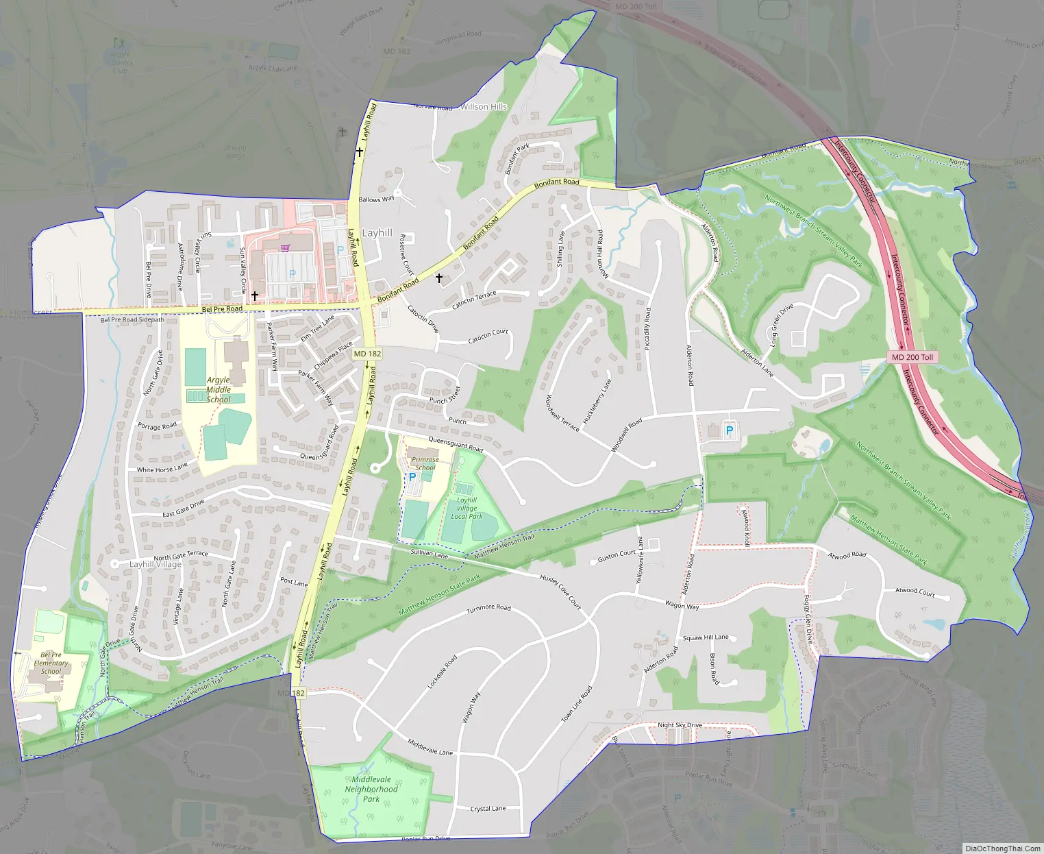
Layhill Road Map
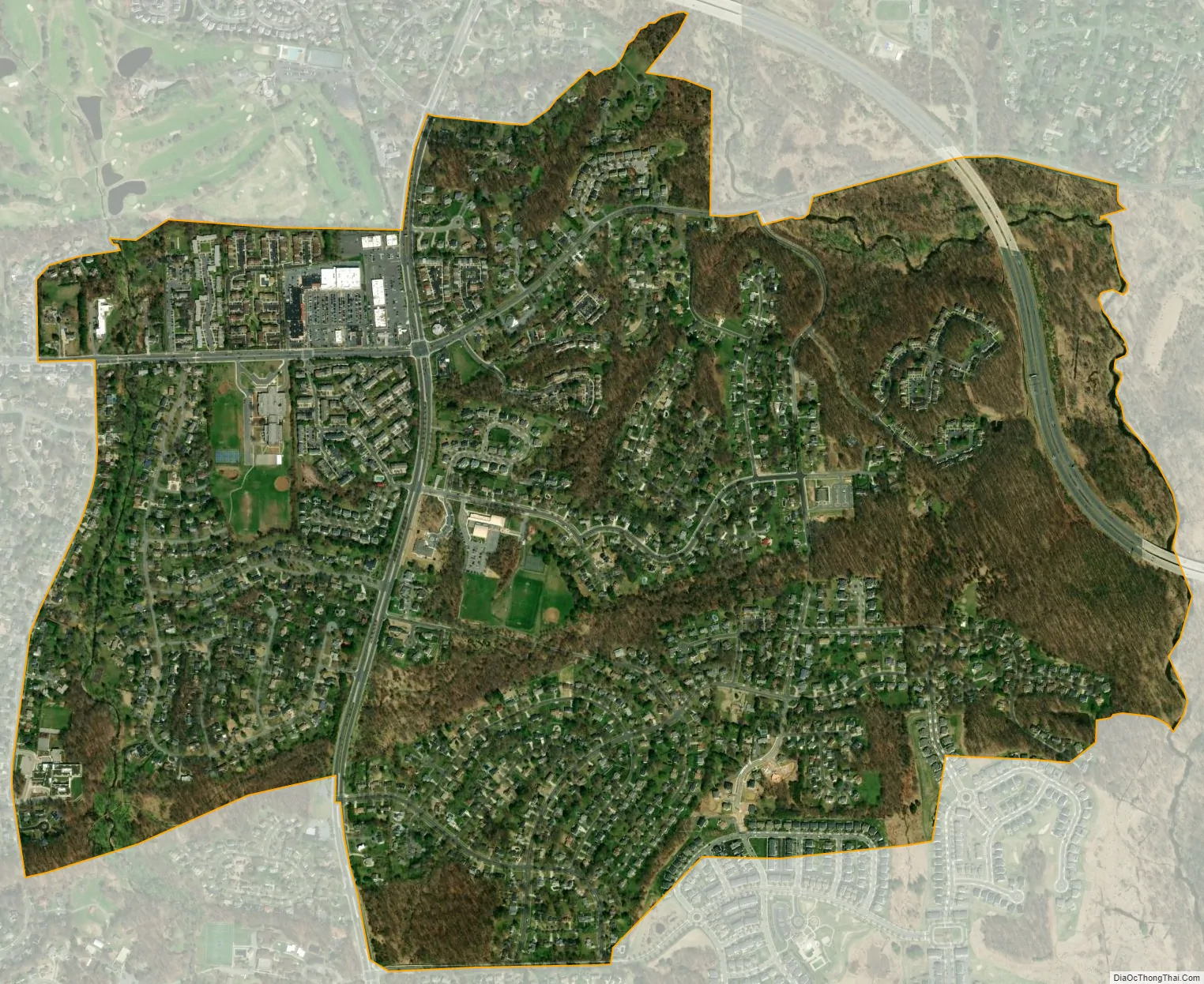
Layhill city Satellite Map
Geography
Due to its unincorporated nature, the boundaries are difficult to define precisely, but the center of the community is located at the intersection of Layhill Road and Bonifant Road/Bel Pre Road.
See also
Map of Maryland State and its subdivision: Map of other states:- Alabama
- Alaska
- Arizona
- Arkansas
- California
- Colorado
- Connecticut
- Delaware
- District of Columbia
- Florida
- Georgia
- Hawaii
- Idaho
- Illinois
- Indiana
- Iowa
- Kansas
- Kentucky
- Louisiana
- Maine
- Maryland
- Massachusetts
- Michigan
- Minnesota
- Mississippi
- Missouri
- Montana
- Nebraska
- Nevada
- New Hampshire
- New Jersey
- New Mexico
- New York
- North Carolina
- North Dakota
- Ohio
- Oklahoma
- Oregon
- Pennsylvania
- Rhode Island
- South Carolina
- South Dakota
- Tennessee
- Texas
- Utah
- Vermont
- Virginia
- Washington
- West Virginia
- Wisconsin
- Wyoming


