Leisure World is a census-designated place and unincorporated area in Montgomery County, Maryland, United States. It is an age-restricted, gated development primarily inhabited by retirees. Leisure World was formerly known as the Rossmoor census-designated place for the 2000 census. It currently has a population of 9,215.
| Name: | Leisure World CDP |
|---|---|
| LSAD Code: | 57 |
| LSAD Description: | CDP (suffix) |
| State: | Maryland |
| County: | Montgomery County |
| Elevation: | 436 ft (133 m) |
| Total Area: | 1.14 sq mi (2.94 km²) |
| Land Area: | 1.13 sq mi (2.92 km²) |
| Water Area: | 0.01 sq mi (0.02 km²) |
| Total Population: | 9,215 |
| Population Density: | 8,169.33/sq mi (3,153.90/km²) |
| ZIP code: | 20906 |
| Area code: | 301, 240 |
| FIPS code: | 2446375 |
| GNISfeature ID: | 2389782 |
| Website: | www.lwmc.com |
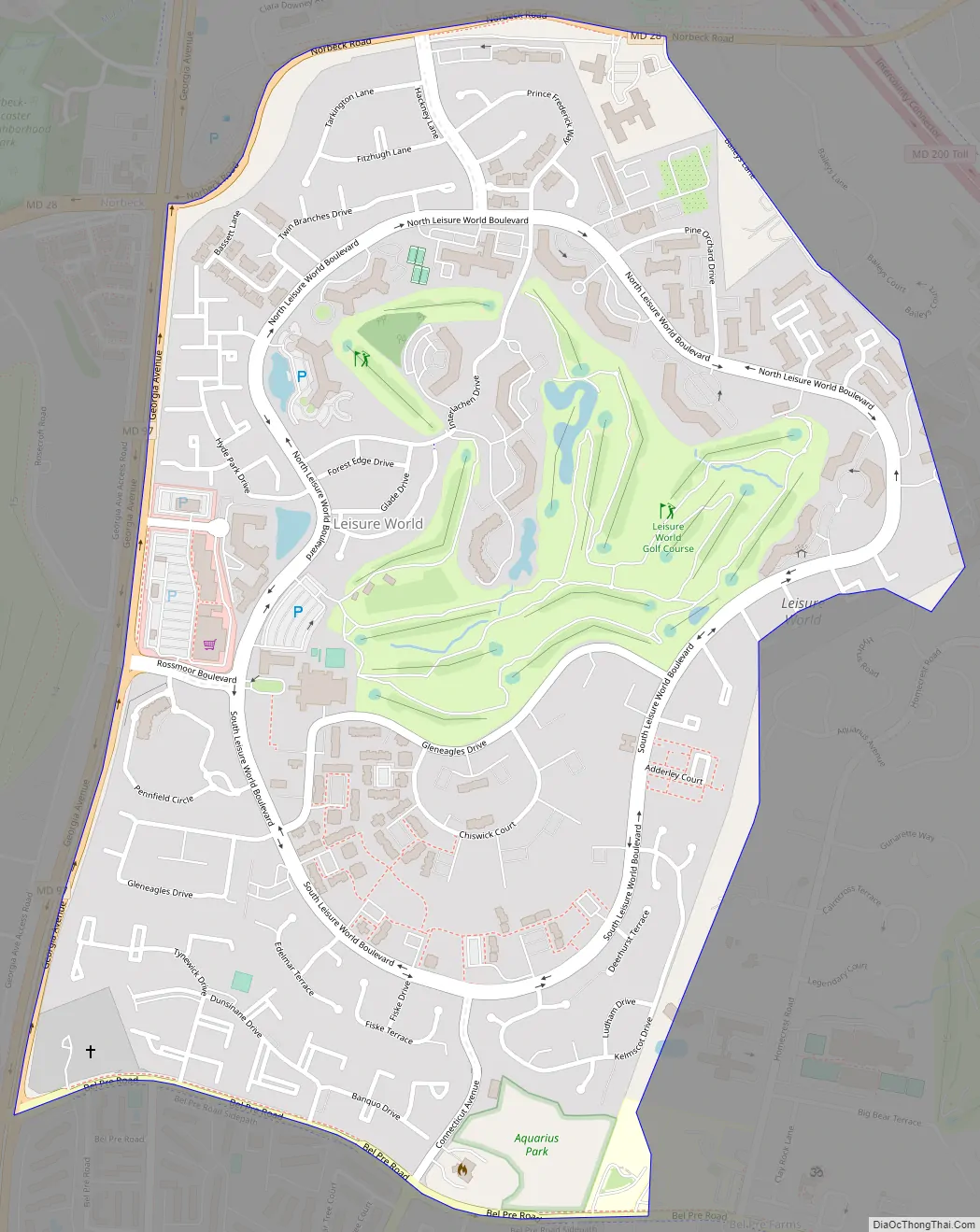
Online Interactive Map
Click on ![]() to view map in "full screen" mode.
to view map in "full screen" mode.
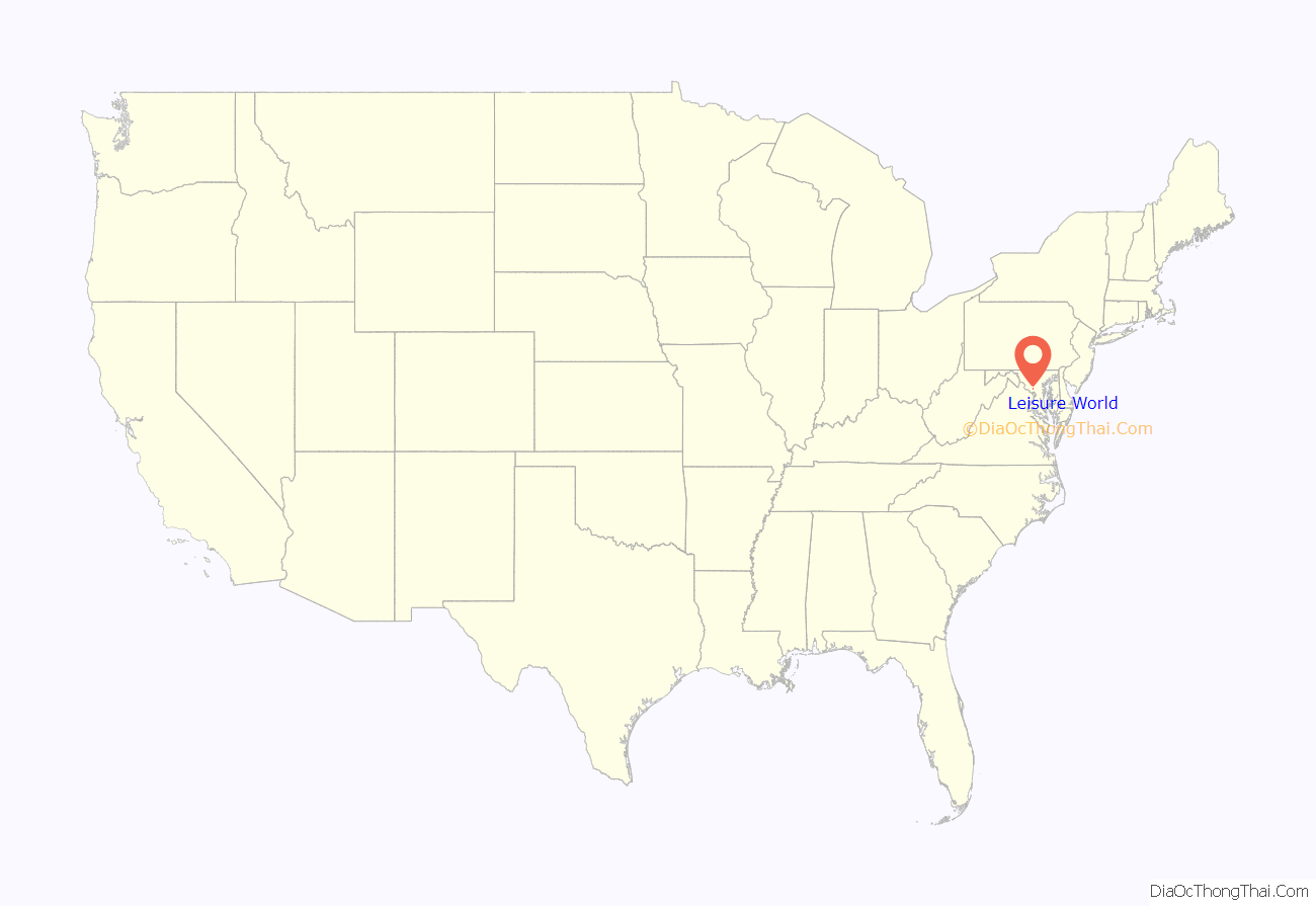
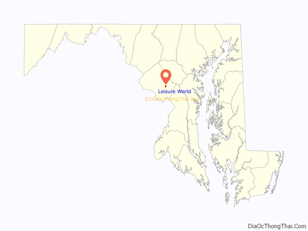
Leisure World location map. Where is Leisure World CDP?
History
Development
In 1963, developer Ross Cortese applied for a zoning amendment in order to build a 1,000-acre community of semi-detached homes, townhouses, and apartment buildings south of Norbeck, Maryland. Cortese’s company had acquired the option to buy the 1,000 acres of land, formerly known as the Nash tract, for $5,000,000, and Cortese expected it would cost another $750,000 to build the development according to the plans. The development would be restricted to residents who are at least 52 years old. Cortese planned to build clubhouses, a swimming pool, riding stables, an auditorium, a shopping center, medical facilities, a hotel for guests, an 18-hole golf course, and an 8-acre lake at the site. Sixty-five percent of the area would be undeveloped green space. The entire site would be surrounded by a wall, and full-time security guards would restrict access. According to the plans, co-op homes would be available for between $15,000 and $18,000, payable with a $1,000 down payment and monthly payments thereafter of between $140 and $180. Cortese had already built Rossmoor Leisure World at Seal Beach, California, in 1961, and he was then building Leisure World Laguna Hills in Laguna Hills, California, and another Leisure World in Walnut Creek, California.
The Montgomery County Council approved the zoning amendment by a vote of 3 to 1, with 3 abstentions. The one dissenting council member was Kathryn E. Diggs, who said she was skeptical that the development would be economically successful. Local citizen groups opposed building the development because they preferred the area to remain zoned for low-density development. The Council had been planning to extend Connecticut Avenue through the area, but the Council put that action on hold because of the proposed development. Within a few months, Washington Suburban Sanitary Commission approved 28,000 feet of water and sewer lines for the development. The architecture firm of Collins & Kronstadt designed the housing units and the community buildings. Thurman D. Donavan designed the landscaping, which received an award by the industrial landscaping committee of the American Association of Nurserymen in November 1966. A large rotating globe was installed at the front gate.
Leisure World’s sales office and model homes opened in August 1965; Loy Sigmon was the interior designer of the original seven model homes. J. Robert Conybeare served as general sales manager, and Angus T. Johnson was named the first administrator of the community.
The community was marketed to people who wanted to stay active while living there. While residence was restricted to people at least 52 years old (later reduced to 50 years old), proof of age was not originally required. Leisure World allowed people of all races to live in the community.
The community facilities were held in trust by the Foundation of Leisure World, a 501(c)(3) nonprofit organization, with former Under Secretary of the Navy Kenneth E. BeLieu as its first president. Homes were sold as co-ops, with prices starting at $15,000 and ongoing monthly maintenance payments of at least $85. Within six months, 400 home units had been pre-sold.
Shopping center
Plans for Leisure World’s 100,000-square-foot shopping center were announced in October 1965. The plan was to sell 9,200 residential units within five years, enough space for approximately 15,640 people to live. Commercial leases were signed with Safeway, Peoples Drug Stores, Hot Shoppes cafeteria-style restaurant, and Maryland National Bank for space at the adjoining shopping center. The Interfaith Meeting House broke ground on October 22, 1965, with plans for a capacity for 500 people.
First residents
The first residents moved in on August 15, 1965. The community held a welcoming ceremony at the eighteenth hole of the golf course for the first residents. The first residents lived in twelve units on Gleneagles Drive. The first nine holes of the golf course opened June 1, 1966.
Slowdown on sales
In early 1967, Leisure World changed its marketing focus from that of a retirement community to that of a country club community for adults. Sales of units at Leisure World were suspended in September 1967 after a tight mortgage market significantly increased prices and lower than expected interest. Sales resumed on January 1, 1968. Sales were still slow, the developer’s carrying costs on the remaining vacant land were large, and the U.S. state of Maryland had prohibited further development in the area until a new sewage treatment plant was built, all of which temporarily prevented additional construction. The developer said it would need to develop the remaining vacant land eventually, as the additional residents were needed in order to support the common facilities by way of monthly maintenance fees. In October 1974, Leisure World canceled the sales contracts for 480 semidetached homes and low-rise apartments because inflation had increased construction costs and it was no longer certain when the units would actually be built. Five months later, Leisure World offered the units for sale again at increased prices. In September 1976, the developer agreed to build the 300,000-gallon wastewater treatment plant. Almost one year later, the developer sued the state of Maryland, saying Washington Suburban Sanitary Commission failed to complete a 1965 contract to provide water and sewer connections to the area because the Maryland Department of Health and Mental Hygiene had ordered a halt to sewer connections in 1973. The developer also said it was strong-armed into building a sewage treatment facility by the Montgomery County government in order to avoid significant financial losses.
John E. Byrne, Jr., manager of Leisure World, agreed to buy Leisure World from Ross Coriese in August 1968, but the sale was not completed. In April 1969, Crane Company agreed to buy Leisure World from Coriese. That agreement was broken four months later by mutual consent. In February 1970, Zero Manufacturing Company agreed to buy Rossmoor Corporation, the developer of Leisure World.
Fires
On March 1, 1968, there was a fire in a model two-story townhouse on Gleneagles Drive at Leisure World. Approximately 100 firefighters reported to the fire. The fire caused damage to four townhouses, estimated at $100,000. There was one injury; Chief Sidney Bailey of Sandy Spring Fire Department was treated for burns to the eye. A fire killed a woman in her home on Chiswick Court in October 1969. In May 1976, there was a fire in a three-story apartment building on Glen Eagle Drive. One-hundred firefighters reported to the fire. The only injury was a firefighter with a broken thumb. The fire destroyed twelve homes, and those twelve families had to move in with friends and families. In November 2020, an early morning fire left one person dead and displaced 40 other residents.
Changes in plans
Leisure World asked Montgomery County for approval to reduce its resident age minimum from 50 to 40 years old, but Montgomery County disapproved the change. On August 12, 1968, Leisure World asked Montgomery County Planning Board to remove the age limit altogether, but the Montgomery County Planning Board disapproved the change. On August 23, 1968, Leisure World made another request to drop the age limit for almost half the land, and Montgomery County Planning Board disapproved the request again. Montgomery County Planning Board had agreed to change the land’s zoning from low density to higher density on the condition that all residents would be of age 50 or older and, in a vote of 4–1, Montgomery County Planning Board would not let Leisure World out of its agreement. On December 31, 1968, the Montgomery County Council voted to allow the change to the age limit for about 40 percent of the land, despite the objections by the Montgomery County Planning Board. A part of the negotiation, Leisure World agreed to develop the unrestricted portion of land as a separate development. In February 1971, three families living nearby filed a lawsuit to prevent construction of about 2,500 homes. The plaintiffs contended that the population of the 2,500 homes without age restrictions would be much larger than originally intended because many of the units would be occupied by families. The plaintiffs said that the additional residents would cause an increase in public service costs and a decrease in their property values.
Leisure World Road Map
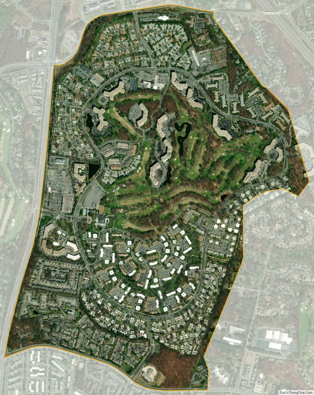
Leisure World city Satellite Map
Geography
As an unincorporated area, Leisure World’s boundaries are not officially defined, but are unofficially defined by a fence around the community.
Leisure World is, however, recognized by the United States Census Bureau as a census-designated place, and by the United States Geological Survey as a populated place located at 39°6′14″N 77°4′16″W / 39.10389°N 77.07111°W / 39.10389; -77.07111 (39.103825, −77.070982).
According to the United States Census Bureau, the place has a total area of 1.1 square miles (2.8 km), all land.
See also
Map of Maryland State and its subdivision: Map of other states:- Alabama
- Alaska
- Arizona
- Arkansas
- California
- Colorado
- Connecticut
- Delaware
- District of Columbia
- Florida
- Georgia
- Hawaii
- Idaho
- Illinois
- Indiana
- Iowa
- Kansas
- Kentucky
- Louisiana
- Maine
- Maryland
- Massachusetts
- Michigan
- Minnesota
- Mississippi
- Missouri
- Montana
- Nebraska
- Nevada
- New Hampshire
- New Jersey
- New Mexico
- New York
- North Carolina
- North Dakota
- Ohio
- Oklahoma
- Oregon
- Pennsylvania
- Rhode Island
- South Carolina
- South Dakota
- Tennessee
- Texas
- Utah
- Vermont
- Virginia
- Washington
- West Virginia
- Wisconsin
- Wyoming


