Mayo is a census-designated place (CDP) in Anne Arundel County, Maryland, United States. The population was 8,298 at the 2010 census. The Mayo CDP of 2010 includes all of the area that used to be counted as the Selby-on-the-Bay CDP. The beach in Mayo used to be a popular weekend resort.
| Name: | Mayo CDP |
|---|---|
| LSAD Code: | 57 |
| LSAD Description: | CDP (suffix) |
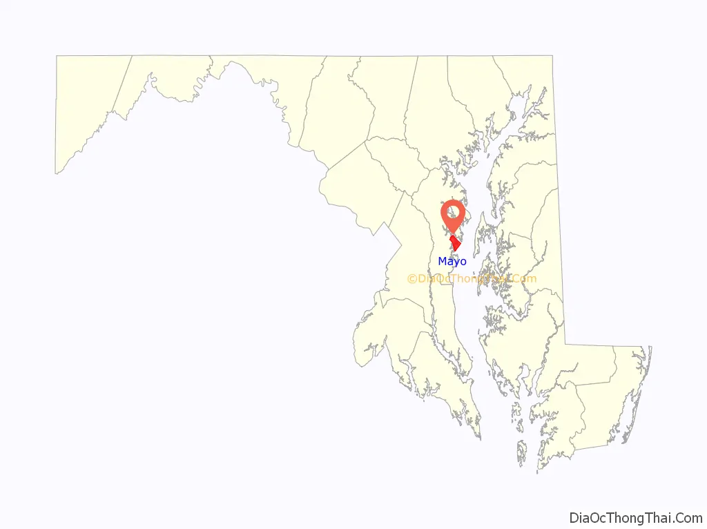
| State: | Maryland |
| County: | Anne Arundel County |
| Elevation: | 13 ft (4 m) |
| Total Area: | 9.44 sq mi (24.46 km²) |
| Land Area: | 5.62 sq mi (14.55 km²) |
| Water Area: | 3.82 sq mi (9.90 km²) |
| Total Population: | 8,832 |
| Population Density: | 1,571.81/sq mi (606.83/km²) |
| ZIP code: | 21106 |
| Area code: | 410, 443, and 667 |
| FIPS code: | 2451575 |
| GNISfeature ID: | 0590767 |
Online Interactive Map
Click on ![]() to view map in "full screen" mode.
to view map in "full screen" mode.
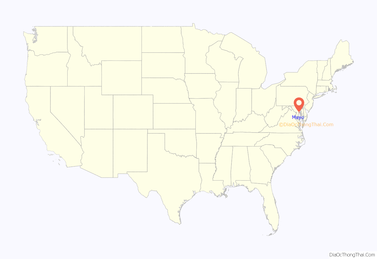
Mayo location map. Where is Mayo CDP?
History
Mayo takes its name from Commodore Isaac Mayo, who distinguished himself in the Mexican–American War. Commodore Mayo held a large tract of land on the South River, known in the early 1900s as “Mayo’s Neck”, that had been the home estate of Captain Nicholas Gassaway, the son of Maryland politician Colonel Nicholas Gassaway. His home, known as Gresham, was listed on the National Register of Historic Places in 1990.
Mayo Road Map
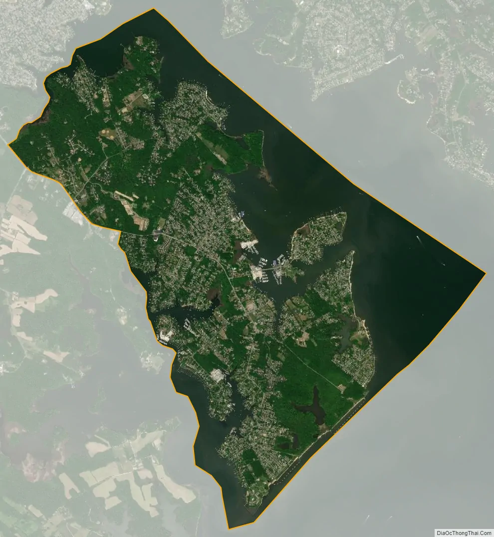
Mayo city Satellite Map
Geography
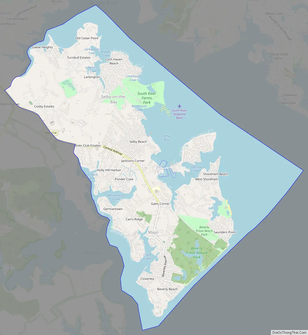
Mayo is located at 38°53′36″N 76°30′16″W / 38.89333°N 76.50444°W / 38.89333; -76.50444,(38.893264, −76.504371) south of Annapolis. It occupies a peninsula between the South River to the northeast and the Rhode River to the southwest, both of which are tidal arms of Chesapeake Bay. It is bordered by the CDP of Edgewater to the northwest, and (across the South River) by the CDP of Annapolis Neck to the northeast. Saunder’s Point, Shoreham Beach, Beverly Beach, Cloverlea, Turkey Point, Holly Hill Harbor, Selby Beach, and Cape Loch Haven are some of the neighborhoods found in Mayo.
Maryland Route 214 is the main road through the center of the CDP, coming to its eastern end in Beverly Beach on Chesapeake Bay.
According to the United States Census Bureau, the CDP has a total area of 9.5 square miles (24.5 km), of which 5.6 square miles (14.6 km) is land and 3.8 square miles (9.9 km), or 40.47%, is water.
See also
Map of Maryland State and its subdivision: Map of other states:- Alabama
- Alaska
- Arizona
- Arkansas
- California
- Colorado
- Connecticut
- Delaware
- District of Columbia
- Florida
- Georgia
- Hawaii
- Idaho
- Illinois
- Indiana
- Iowa
- Kansas
- Kentucky
- Louisiana
- Maine
- Maryland
- Massachusetts
- Michigan
- Minnesota
- Mississippi
- Missouri
- Montana
- Nebraska
- Nevada
- New Hampshire
- New Jersey
- New Mexico
- New York
- North Carolina
- North Dakota
- Ohio
- Oklahoma
- Oregon
- Pennsylvania
- Rhode Island
- South Carolina
- South Dakota
- Tennessee
- Texas
- Utah
- Vermont
- Virginia
- Washington
- West Virginia
- Wisconsin
- Wyoming


