New Carrollton is a city located in central Prince George’s County, Maryland, United States. As of the 2020 census, the population was 13,715. New Carrollton is located 10 miles (16 km) east of central Washington, D.C. The Mayor of New Carrollton is Katrina Dodro. Elected in 2023, Mayor Dodro is the second Black mayor of New Carrollton and the second woman elected as mayor.
| Name: | New Carrollton city |
|---|---|
| LSAD Code: | 25 |
| LSAD Description: | city (suffix) |
| State: | Maryland |
| County: | Prince George’s County |
| Incorporated: | April 11, 1953 |
| Elevation: | 79 ft (24 m) |
| Total Area: | 1.57 sq mi (4.05 km²) |
| Land Area: | 1.57 sq mi (4.05 km²) |
| Water Area: | 0.00 sq mi (0.00 km²) |
| Total Population: | 13,715 |
| Population Density: | 8,757.98/sq mi (3,382.41/km²) |
| ZIP code: | 20784 |
| Area code: | 301, 240 |
| FIPS code: | 2455400 |
| GNISfeature ID: | 0597805 |
| Website: | www.newcarrolltonmd.gov |
Online Interactive Map
Click on ![]() to view map in "full screen" mode.
to view map in "full screen" mode.
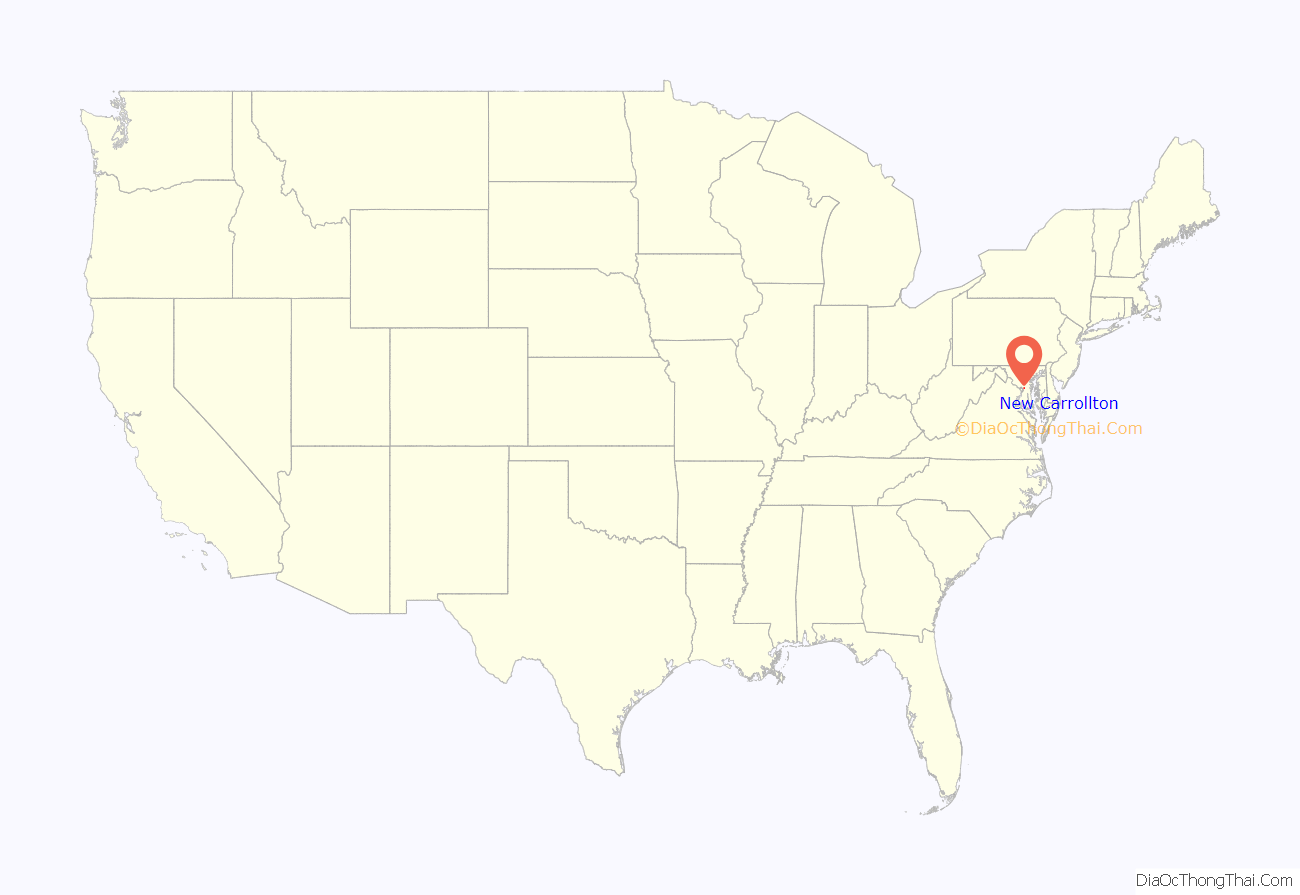
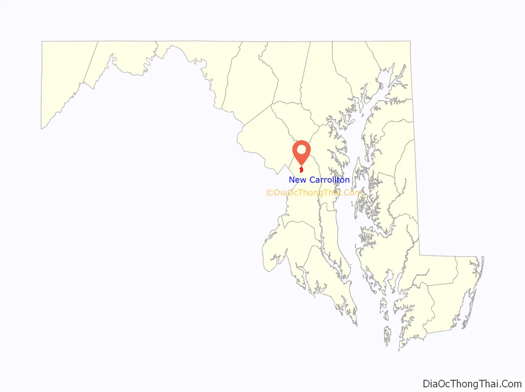
New Carrollton location map. Where is New Carrollton city?
History
New Carrollton is built on the former estate of a horse racing figure, Edward L. Mahoney. After Mahoney’s death in 1957, the land was acquired by developer Albert W. Turner, who sought to create a planned suburb. He had received a charter for a City of Carrollton from the Maryland General Assembly four years earlier, on April 11, 1953.
Carrollton was named after early Maryland settler Charles Carroll of Carrollton, a delegate to the Continental Congress and signatory of the Declaration of Independence. As two other Maryland communities were also named Carrollton, a voter referendum on May 2, 1966, approved the renaming of the community to New Carrollton.
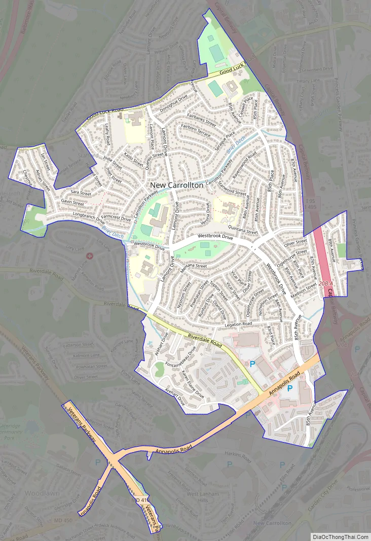
New Carrollton Road Map
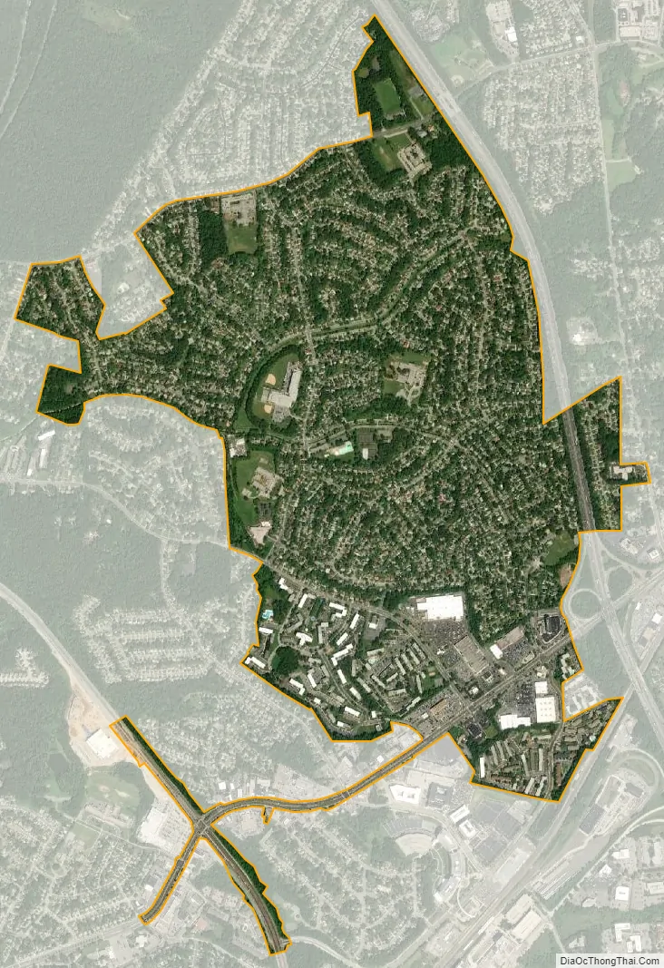
New Carrollton city Satellite Map
Geography
New Carrollton is located at 38°57′59″N 76°52′36″W / 38.96639°N 76.87667°W / 38.96639; -76.87667 (38.966360, -76.876643).
According to the United States Census Bureau, the city has a total area of 1.53 square miles (3.96 km), all land.
See also
Map of Maryland State and its subdivision: Map of other states:- Alabama
- Alaska
- Arizona
- Arkansas
- California
- Colorado
- Connecticut
- Delaware
- District of Columbia
- Florida
- Georgia
- Hawaii
- Idaho
- Illinois
- Indiana
- Iowa
- Kansas
- Kentucky
- Louisiana
- Maine
- Maryland
- Massachusetts
- Michigan
- Minnesota
- Mississippi
- Missouri
- Montana
- Nebraska
- Nevada
- New Hampshire
- New Jersey
- New Mexico
- New York
- North Carolina
- North Dakota
- Ohio
- Oklahoma
- Oregon
- Pennsylvania
- Rhode Island
- South Carolina
- South Dakota
- Tennessee
- Texas
- Utah
- Vermont
- Virginia
- Washington
- West Virginia
- Wisconsin
- Wyoming


