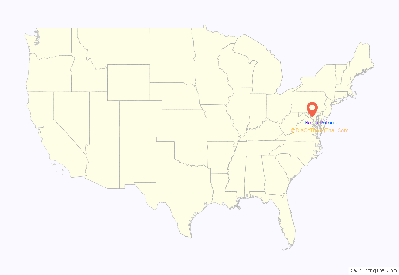
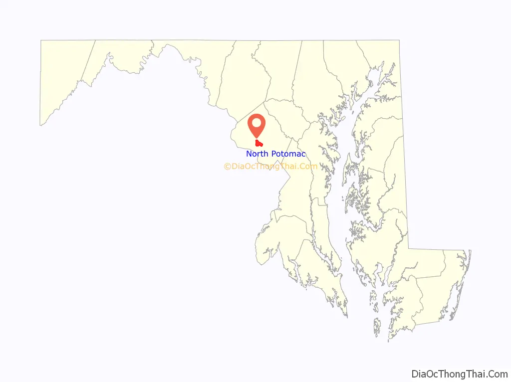
North Potomac is a census-designated place and unincorporated area in Montgomery County, Maryland, United States. It is located less than 5 miles (8.0 km) north of the Potomac River, and is about 20 miles (32 km) from Washington, D.C. It has a population of 23,790 as of 2020.
The region’s land was originally used for growing tobacco, which was replaced by wheat and dairy farming after the soil became depleted. The Chesapeake and Ohio Canal was used by local farmers to ship their grain (or flour made from the grain at the local mills), and two former canal locks are located less than 5 miles (8.0 km) away in the Chesapeake and Ohio Canal National Historical Park. In addition, infrastructure remains for what was one of the state’s leading dairy farms during the first half of the 20th century.
North Potomac did not get an identity of its own until 1989, when the United States Post Office allowed the use of the North Potomac name for what is mostly a collection of housing sub-divisions, farms, and wooded parks. The United States Census Bureau listed a North Potomac in 1970 but not 1980. In 2000, it began recognizing North Potomac as a census designated place. Today, the community benefits from its proximity to workplaces such as the Shady Grove Hospital area and the I-270 Technology Corridor. Washington, D.C. is accessible by automobile or public transportation. The median household income is nearly $160,000, and nearly half of the eligible residents have a graduate or professional degree.
| Name: | North Potomac CDP |
|---|---|
| LSAD Code: | 57 |
| LSAD Description: | CDP (suffix) |
| State: | Maryland |
| County: | Montgomery County |
| Elevation: | 390 ft (120 m) |
| Total Area: | 6.56 sq mi (16.99 km²) |
| Land Area: | 6.52 sq mi (16.89 km²) |
| Water Area: | 0.04 sq mi (0.10 km²) |
| Total Population: | 23,790 |
| Population Density: | 3,648.21/sq mi (1,408.48/km²) |
| ZIP code: | 20878, 20850 |
| Area code: | 301 and 240 |
| FIPS code: | 2456875 |
| GNISfeature ID: | 2389581 |
Online Interactive Map
Click on ![]() to view map in "full screen" mode.
to view map in "full screen" mode.
North Potomac location map. Where is North Potomac CDP?
History
Captain John Smith explored the Potomac River in 1608 and mapped the area, including land that would become Montgomery County. The first settlements were established in 1688, and were near Rock Creek and what became Rockville. The next stage of settlements was further west along the Potomac near Darnestown and Poolesville. The land had been occupied by Native Americans of the Piscataway Confederation. Modern-day Darnestown Road, which forms the northern border of North Potomac, was a trail of the indigenous Seneca people and is one of the oldest roads in Montgomery County.
Originally, the land around present-day North Potomac was used by European settlers for growing tobacco and corn. During the 19th century, a network of roads, mills, and the Chesapeake and Ohio Canal (a.k.a. C&O Canal) provided farmers with better access to markets. Dufief Mill Road, which runs through the center of North Potomac, leads to the DuFief Mill (established 1850)—one of the mills that were used by farmers in this part of Montgomery County. By 1840, much of the county’s soil was depleted. Quakers began introducing improved farming practices and agriculture was revitalized. By 1860, farmers were growing corn, wheat and oats.
In 1878, today’s North Potomac was still farmland. The nearest general stores and post offices were in Hunting Hill, Travilah, and Darnestown. The Hunting Hill Post Office and general store was located on Darnestown Road between Muddy Branch Road and Travilah Road, and it also provided wheelwright and blacksmith services. It operated from 1873 until 1929. Darnestown had three country stores, and the Windsor store also served as a Post Office until 1911. Travilah, located closer to the canal, had a general store but no name in 1878. The Travilah Post Office was established in 1883, and the community eventually took that name. Eventually, some of the farmland was sold. During the Great Depression, some farmers became eager to sell their land because of financial hardship. Wealthy individuals began buying property in the Potomac area as part of their search for land where they could ride horses and hunt. Some of this equestrian heritage continues in North Potomac today at the Potomac Horse Center. Mortgage banker Frederick Harting established this training facility, for horses and riders, in the early 1960s. It was purchased by Montgomery County in 1981 and has been the site of horse shows.
Several area farms, such as the 355-acre (144 ha) Maple Spring Farm, continued well into the 20th century. Much of this farm’s land was sold in the 1970s and became North Potomac’s Dufief subdivision. In 1970, the United States Census Bureau considered North Potomac an unincorporated place that was part of the Darnestown and Travilah areas. By 1989, North Potomac consisted of about 25 housing subdivisions mixed with old farms. About 80 percent of those subdivisions were built since 1983. In late 1989, the United States Postal Service approved the North Potomac name for a region surrounded by the Montgomery County communities of Darnestown, Travilah, Gaithersburg and Rockville. ZIP Codes were not changed, so most of North Potomac uses the 20878 code used by Gaithersburg and part of Darnestown. For 1990, North Potomac began being listed by the Census Bureau as a census-designated place, but census records show no data for 1980. The last major farm in the area is the Hanson Farm, and work began in 2009 for approval to build single-family homes on the farmland.
Historic places
The historic DuFief Mill site is located near the intersection of Turkey Foot Road and the Muddy Branch in Muddy Branch Regional Park. John L. DuFief built a mill complex in the 1850s that was about three miles (4.8 km) from the C&O Canal. A road connected his gristmill, blacksmith’s shop, and miller’s house to the Pennyfield Lock on the C&O Canal, where he operated a warehouse, barrel house, and wharf. The canal was necessary because the Potomac River was not navigable by ships and barges at Great Falls. Construction of the C&O Canal, which began in the 1830s and was completed in 1850, opened the region to important markets and lowered shipping costs. After DuFief established this mill and its access to the canal, more roads were constructed, which enabled him to serve farmers from as far away as Germantown and Damascus in addition to the local growers.
Three other sites of historic significance remain in North Potomac. The privately owned Maple Spring Barns are located at the intersection of Dufief Mill Road and Darnestown Road, and were part of one of the largest dairy farms in Maryland during the 20th century. The Pleasant View Historic Site consists of the Pleasant View Methodist Episcopal Church (chapel built in 1914), Pleasant View Cemetery, and the Quince Orchard Colored School (built in 1901). All structures are located on the south side of Darnestown Road near the Quince Orchard area. The church’s congregation was established around 1868. The Poplar Grove Baptist Church, located on Jones Lane, is the sole surviving 19th century Baptist church of an African-American congregation in Montgomery County. The church was built in 1893 near a tributary of the Muddy Branch, and immersion baptisms are said to have taken place in the tributary during the church’s early years.
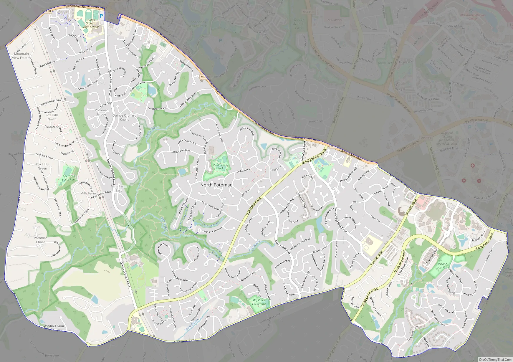
North Potomac Road Map
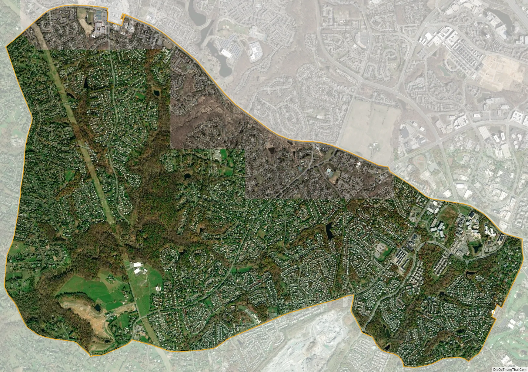
North Potomac city Satellite Map
Geography
As an unincorporated area, North Potomac’s boundaries are not officially defined. However, the United States Census Bureau recognized a North Potomac in the 1970 census, and then as a census-designated place (North Potomac CDP) in every census since 1990. As of the 2010 census, North Potomac is located north of the Potomac River in west central Montgomery County, roughly 20 miles (32 km) from Washington, D.C. It is bordered to the north by Gaithersburg, which lies beyond Maryland Route 28 (Darnstown Road). Rockville, along Glen Road, is on the east border, while the Travilah CDP, mostly along Travilah Road, forms the southern border. The Darnestown CDP along Jones Lane and Turkey Foot Road forms the western boundary. Like North Bethesda, residents have held misconceptions about North Potomac’s existence, incorrectly arguing that it is part of Gaithersburg and that the name is a neologism created by realtors.
Between the 1990 and 2000 census, North Potomac gained and lost land. The loss was caused when a portion of the North Potomac territory, plus Potomac territory, was used to create the Travilah census designated place. According to the United States Census Bureau, North Potomac has a total area of 6.6 square miles (17 km), virtually all land. The Muddy Branch and its tributary Rich Branch are streams that run through North Potomac, and the Muddy Branch empties into the Potomac River. The United States Geological Survey lists two features in Montgomery County with North Potomac in all or part of their name. The North Potomac Census Designated Place is listed with an elevation of 390 feet (120 m), while the North Potomac Populated Place has an elevation of 256 feet (78 m).
Climate
According to the Köppen Climate Classification system, North Potomac has a humid subtropical climate, abbreviated “Cfa” on climate maps. There are four distinct seasons, with winters typically cold with moderate snowfall, while summers are usually warm and humid. July is the warmest month, while January is the coldest. Average monthly precipitation ranges from about 2.5 to 4 inches (6.4 to 10.2 centimetres). The highest recorded temperature was 105.0 °F (40.6 °C) and the lowest recorded temperature was −13.0 °F (−25.0 °C). There is a 50 percent probability that the first frost of the season will occur by October 21, and a 50 percent probability that the final frost will occur by April 16.
See also
Map of Maryland State and its subdivision: Map of other states:- Alabama
- Alaska
- Arizona
- Arkansas
- California
- Colorado
- Connecticut
- Delaware
- District of Columbia
- Florida
- Georgia
- Hawaii
- Idaho
- Illinois
- Indiana
- Iowa
- Kansas
- Kentucky
- Louisiana
- Maine
- Maryland
- Massachusetts
- Michigan
- Minnesota
- Mississippi
- Missouri
- Montana
- Nebraska
- Nevada
- New Hampshire
- New Jersey
- New Mexico
- New York
- North Carolina
- North Dakota
- Ohio
- Oklahoma
- Oregon
- Pennsylvania
- Rhode Island
- South Carolina
- South Dakota
- Tennessee
- Texas
- Utah
- Vermont
- Virginia
- Washington
- West Virginia
- Wisconsin
- Wyoming


