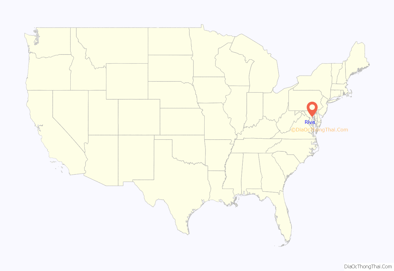
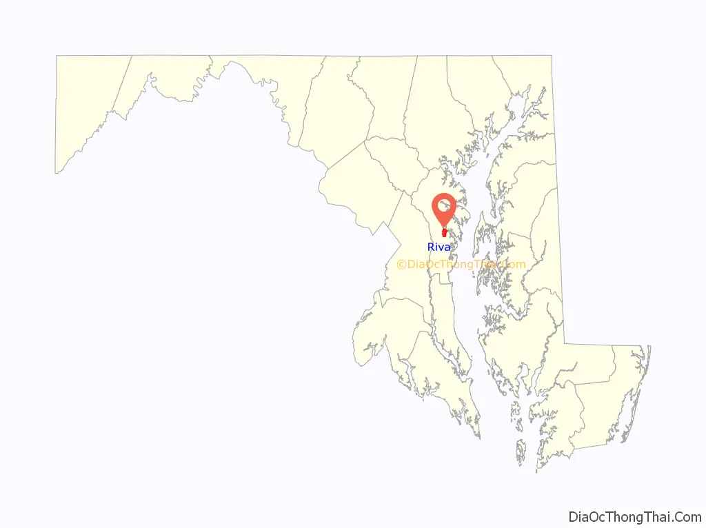
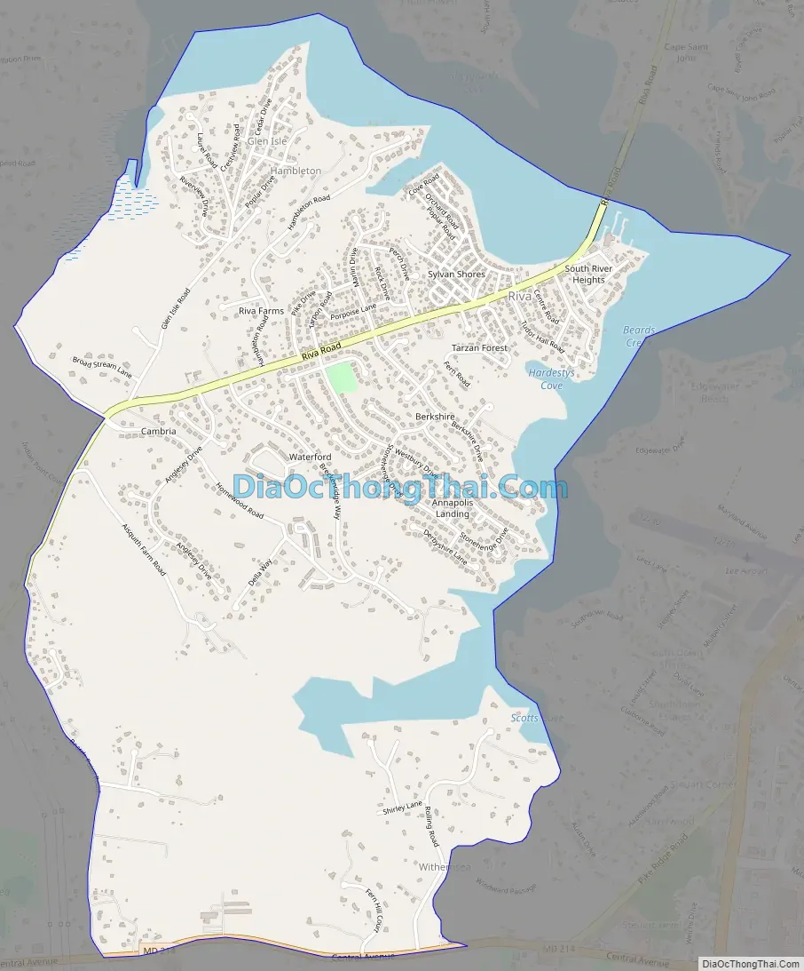
Riva is a census-designated place (CDP) in Anne Arundel County, Maryland, United States. The population was 4,076 at the 2010 census. The area is scenic, especially where the two-lane Riva Road crosses the South River on a bridge. The area is growing with large new homes as the suburbs of Annapolis grow outward. Riva is bordered by Annapolis to the north, Edgewater to the east, and Davidsonville to the west.
Currently Riva is served by Central Elementary School, Davidsonville Elementary School, Central Middle School, and South River High School in Edgewater, Maryland.
| Name: | Riva CDP |
|---|---|
| LSAD Code: | 57 |
| LSAD Description: | CDP (suffix) |
| State: | Maryland |
| County: | Anne Arundel County |
| Elevation: | 43 ft (13 m) |
| Total Area: | 2.90 sq mi (7.52 km²) |
| Land Area: | 2.46 sq mi (6.36 km²) |
| Water Area: | 0.45 sq mi (1.16 km²) |
| Total Population: | 4,257 |
| Population Density: | 1,732.60/sq mi (669.08/km²) |
| ZIP code: | 21140 |
| Area code: | 410, 443, and 667 |
| FIPS code: | 2466400 |
| GNISfeature ID: | 0591136 |
Online Interactive Map
Click on ![]() to view map in "full screen" mode.
to view map in "full screen" mode.
Riva location map. Where is Riva CDP?
History
Aisquith Farm E Archeological Site was listed on the National Register of Historic Places in 1991.
There have been several large developments made in Riva over the years.
Sylvan Shores
Riva Farms
Berkshire 1978 – 1981
Annapolis Landing 1979 –
Riva Road Map
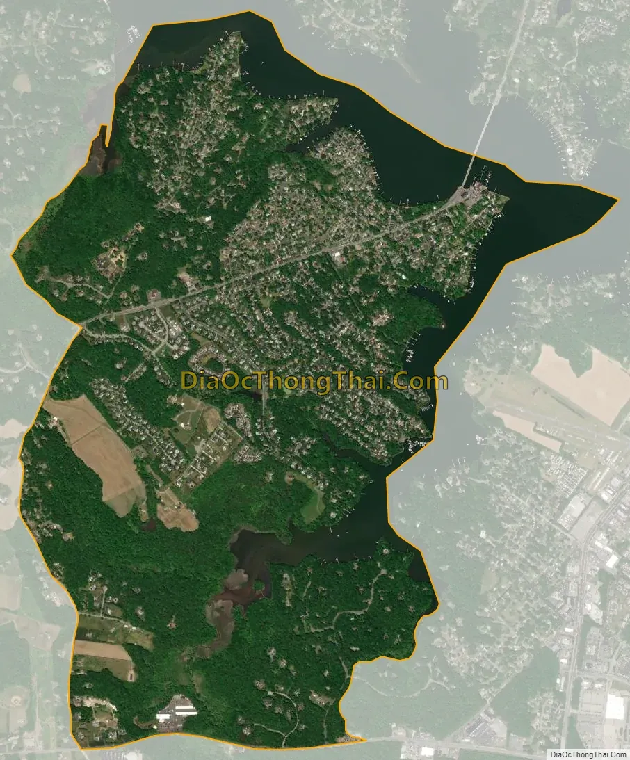
Riva city Satellite Map
Geography
Riva is located at 38°57′7″N 76°34′56″W / 38.95194°N 76.58222°W / 38.95194; -76.58222 (38.952079, −76.582135).
According to the United States Census Bureau, the CDP has a total area of 2.9 square miles (7.5 km), of which 2.5 square miles (6.4 km) is land and 0.46 square miles (1.2 km), or 15.37%, is water.
See also
Map of Maryland State and its subdivision: Map of other states:- Alabama
- Alaska
- Arizona
- Arkansas
- California
- Colorado
- Connecticut
- Delaware
- District of Columbia
- Florida
- Georgia
- Hawaii
- Idaho
- Illinois
- Indiana
- Iowa
- Kansas
- Kentucky
- Louisiana
- Maine
- Maryland
- Massachusetts
- Michigan
- Minnesota
- Mississippi
- Missouri
- Montana
- Nebraska
- Nevada
- New Hampshire
- New Jersey
- New Mexico
- New York
- North Carolina
- North Dakota
- Ohio
- Oklahoma
- Oregon
- Pennsylvania
- Rhode Island
- South Carolina
- South Dakota
- Tennessee
- Texas
- Utah
- Vermont
- Virginia
- Washington
- West Virginia
- Wisconsin
- Wyoming


