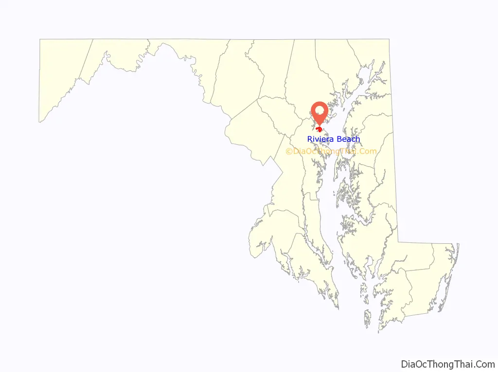
Riviera Beach is a census-designated place in Anne Arundel County, Maryland, United States. The population was 12,677 at the 2010 U.S. census.
| Name: | Riviera Beach CDP |
|---|---|
| LSAD Code: | 57 |
| LSAD Description: | CDP (suffix) |
| State: | Maryland |
| County: | Anne Arundel County |
| Elevation: | 10 ft (3 m) |
| Total Area: | 3.21 sq mi (8.31 km²) |
| Land Area: | 2.63 sq mi (6.81 km²) |
| Water Area: | 0.58 sq mi (1.49 km²) |
| Total Population: | 12,384 |
| Population Density: | 4,708.75/sq mi (1,817.78/km²) |
| ZIP code: | 21122-21123 |
| Area code: | 410 |
| FIPS code: | 2466850 |
| GNISfeature ID: | 0591144 |
Online Interactive Map
Click on ![]() to view map in "full screen" mode.
to view map in "full screen" mode.
Riviera Beach location map. Where is Riviera Beach CDP?

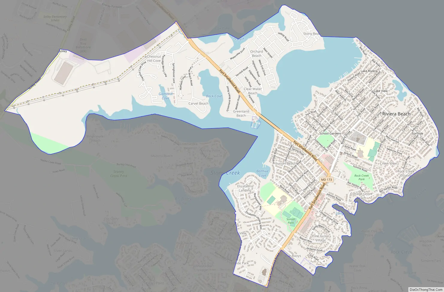
Riviera Beach Road Map
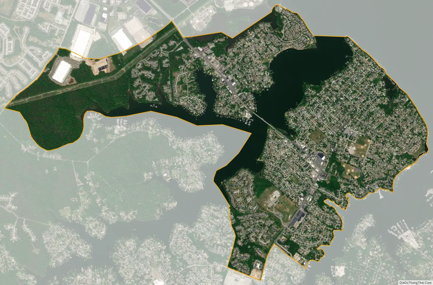
Riviera Beach city Satellite Map
Geography
Riviera Beach is located at 39°09′43″N 76°31′05″W / 39.162008°N 76.517982°W / 39.162008; -76.517982, on the southwest shore of the tidal Patapsco River, the waterway which forms Baltimore‘s harbor to the northwest. The community is bounded by two tidal inlets of the Patapsco, Rock Creek to the southeast and Stoney Creek to the northwest.
According to the United States Census Bureau, the CDP has a total area of 3.2 square miles (8.3 km), of which 2.6 square miles (6.8 km) is land and 0.58 square miles (1.5 km), or 17.96%, is water.
See also
Map of Maryland State and its subdivision: Map of other states:- Alabama
- Alaska
- Arizona
- Arkansas
- California
- Colorado
- Connecticut
- Delaware
- District of Columbia
- Florida
- Georgia
- Hawaii
- Idaho
- Illinois
- Indiana
- Iowa
- Kansas
- Kentucky
- Louisiana
- Maine
- Maryland
- Massachusetts
- Michigan
- Minnesota
- Mississippi
- Missouri
- Montana
- Nebraska
- Nevada
- New Hampshire
- New Jersey
- New Mexico
- New York
- North Carolina
- North Dakota
- Ohio
- Oklahoma
- Oregon
- Pennsylvania
- Rhode Island
- South Carolina
- South Dakota
- Tennessee
- Texas
- Utah
- Vermont
- Virginia
- Washington
- West Virginia
- Wisconsin
- Wyoming


