Thurmont is a town in Frederick County, Maryland, United States. The population was 6,935 at the 2020 census. The town is located in the northern part of Frederick County (north of Frederick, the county seat), approximately ten miles from the Pennsylvania border, along U.S. Highway 15. It is very close to Cunningham Falls State Park and Catoctin Mountain Park, the latter of which contains the presidential retreat of Camp David. Thurmont is also home to Catoctin Colorfest, an arts and crafts festival that draws in about 125,000 people each autumn.
In 2005, Thurmont was designated as a Maryland Main Street Community and in 2005 Thurmont was designated a National Main Street under the National Trust for Historic Preservation.
| Name: | Thurmont town |
|---|---|
| LSAD Code: | 43 |
| LSAD Description: | town (suffix) |
| State: | Maryland |
| County: | Frederick County |
| Founded: | 1751 |
| Incorporated: | 1831 (as Mechanicstown), 1894 (as Thurmont) |
| Elevation: | 518 ft (158 m) |
| Total Area: | 3.12 sq mi (8.08 km²) |
| Land Area: | 3.11 sq mi (8.05 km²) |
| Water Area: | 0.01 sq mi (0.03 km²) |
| Total Population: | 6,213 |
| Population Density: | 1,999.68/sq mi (772.12/km²) |
| ZIP code: | 21788 |
| Area code: | 301, 240 |
| FIPS code: | 2477825 |
| GNISfeature ID: | 0587792 |
| Website: | www.thurmont.com |
Online Interactive Map
Click on ![]() to view map in "full screen" mode.
to view map in "full screen" mode.
Thurmont location map. Where is Thurmont town?


History
Name change
Originally incorporated as the Town of Mechanicstown in 1751, the name of the town was changed to Thurmont by an act of Maryland General Assembly on January 18, 1894. This name change was due to several other nearby towns having similar names, such as Mechanicsburg, Pennsylvania and Mechanicsville, Maryland. Charles E. Cassell, editor of the local newspaper Catoctin Clarion was the one to suggest the name Thurmont and promoted debate about the name change in the Clarion. Some of the names considered included Beaufort, Eastmont, Glenmont, Monduru, Fern Glen, and Blue Point. Eventually, the options were pared down to two main contenders: Cassell’s suggestion of Thurmont, and local real estate broker Charles Shipley’s suggestion of Blue Mountain City, which he argued was “appropriate” and “pretty” during an address at a town meeting in December 1893. In the December 14, 1893 issue, the Clarion printed the following:
By the end of December 1893, there had been several rounds of voting, and Thurmont had been officially chosen as the town’s new name. The Clarion noted, however, that “the reception of a letter from the Postoffice Department saying that the name ‘Blue Mountain City’ would not be approved by the Department as there is an office called ‘Blue Mountain’ in the State, probably defeated the choice of that name.”
The name Thurmont is derived from thur, the German word for gateway or entrance, and mons, the Latin word for mountain, roughly translating to “Gateway to the Mountains.”
Railroads
The Western Maryland Railway built its main railroad through Thurmont, connecting the town with Baltimore, and later with Hagerstown and Cumberland. On June 17, 1905, 16 men from Thurmont were killed in a railway wreck in Ransom, Maryland when a westbound freight train collided head-on with another train. All Thurmont businesses were closed on the Monday following the accident, and it became an event that had a lasting effect on the entire community. Another large railway accident occurred on June 25, 1915 when the Blue Mountain Express train hit another train head-on just west of Thurmont, killing 6 people. Charles Eyler, who was 17 years old at the time of the crash, said the following: “People were still wondering the next day how the two engines had stayed on the rails. But it was easy to see how the wreck had occurred. The bridge is ‘blind’ from both directions.”
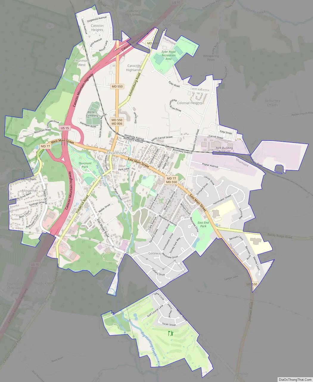
Thurmont Road Map
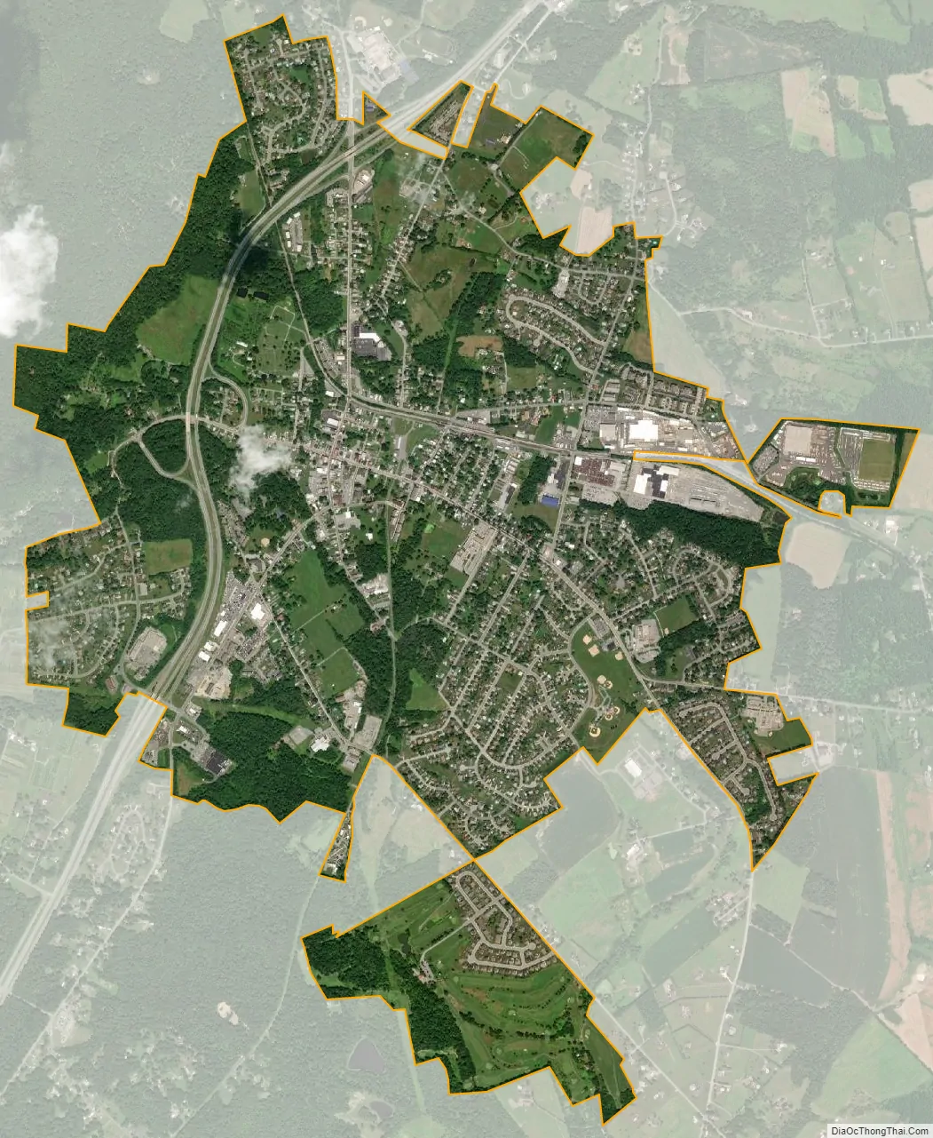
Thurmont city Satellite Map
Geography
Thurmont is located at the eastern foothill of the Catoctin spur of the Blue Ridge Mountains.
Thurmont is located at 39°37′30″N 77°24′37″W / 39.62500°N 77.41028°W / 39.62500; -77.41028 (39.624974, -77.410245).
According to the United States Census Bureau, the town has a total area of 3.13 square miles (8.11 km), of which 3.12 square miles (8.08 km) is land and 0.01 square miles (0.03 km) is water.
Climate
The climate in this area is characterized by hot, humid summers and generally mild to cool winters. According to the Köppen Climate Classification system, Thurmont has a humid subtropical climate, abbreviated “Cfa” on climate maps.
See also
Map of Maryland State and its subdivision: Map of other states:- Alabama
- Alaska
- Arizona
- Arkansas
- California
- Colorado
- Connecticut
- Delaware
- District of Columbia
- Florida
- Georgia
- Hawaii
- Idaho
- Illinois
- Indiana
- Iowa
- Kansas
- Kentucky
- Louisiana
- Maine
- Maryland
- Massachusetts
- Michigan
- Minnesota
- Mississippi
- Missouri
- Montana
- Nebraska
- Nevada
- New Hampshire
- New Jersey
- New Mexico
- New York
- North Carolina
- North Dakota
- Ohio
- Oklahoma
- Oregon
- Pennsylvania
- Rhode Island
- South Carolina
- South Dakota
- Tennessee
- Texas
- Utah
- Vermont
- Virginia
- Washington
- West Virginia
- Wisconsin
- Wyoming


