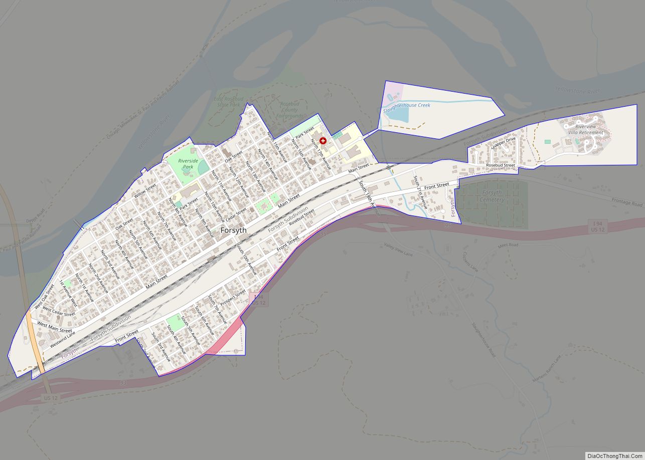
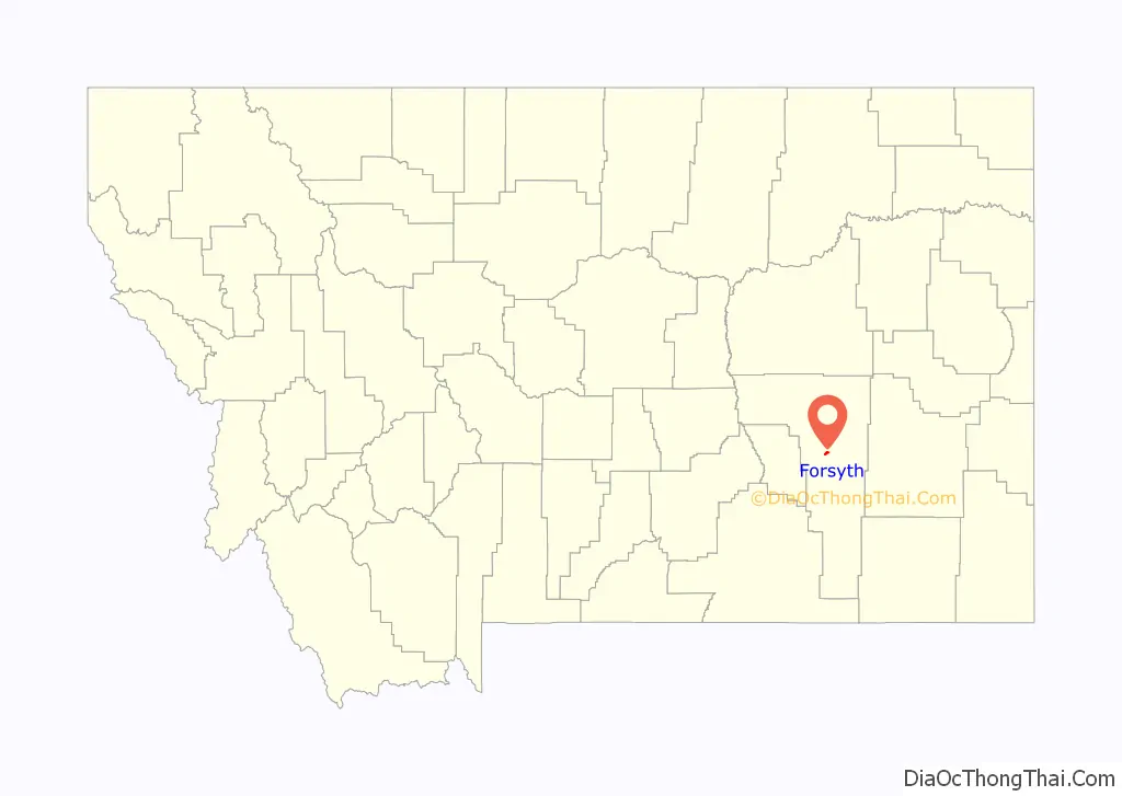
Forsyth is a city in and the county seat of Rosebud County, Montana, United States. The population was 1,647 at the 2020 census. Forsyth was established in 1876 as the first settlement on the Yellowstone River, and in 1882 residents named the town after General James William Forsyth who commanded Fort Maginnis, Montana during the Indian Wars and the 7th Cavalry at the Wounded Knee Massacre. The town has long been a transportation nexus, starting with steamboats on the river and progressing to the Northern Pacific Railway and Interstate 94.
| Name: | Forsyth city |
|---|---|
| LSAD Code: | 25 |
| LSAD Description: | city (suffix) |
| State: | Montana |
| County: | Rosebud County |
| Elevation: | 2,520 ft (770 m) |
| Total Area: | 1.17 sq mi (3.03 km²) |
| Land Area: | 1.15 sq mi (2.98 km²) |
| Water Area: | 0.02 sq mi (0.05 km²) |
| Total Population: | 1,647 |
| Population Density: | 1,432.17/sq mi (552.89/km²) |
| ZIP code: | 59327 |
| Area code: | 406 |
| FIPS code: | 3027700 |
| GNISfeature ID: | 0771501 |
| Website: | www.forsythmt.com |
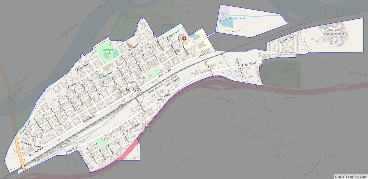
Online Interactive Map
Click on ![]() to view map in "full screen" mode.
to view map in "full screen" mode.
Forsyth location map. Where is Forsyth city?

History
Forsyth was established as a settlement on the Yellowstone in 1876 as a steamboat landing supporting United States Army operations in the Indian Wars.
in 1882, Thomas Alexander traded land to the Northern Pacific Railway to start the town, and developed four buildings on main street.
On April 21, 1894, several hundred men of Coxey’s Army, inspired by Jacob Coxey and led by William Hogan, commandeered a Northern Pacific Railway train in Butte, Montana headed for Washington, DC. After stopping in Bozeman, they fought Federal Marshals in Billings with one man killed and several wounded. They were finally apprehended in Forsyth on April 25, by five companies of the 22nd Infantry Regiment and Troop L, 8th Cavalry from Fort Keogh, Cheyenne soldiers known as “Casey’s scouts.” The incident marked one of the few instances in American history where U.S. Native American troops were used against white civilians. Although some escapes occurred, 331 of the Coxeyites were taken to Helena as prisoners.
In the 1980s Forsyth served as the home of the United States Air Force 1st Combat Evaluation Group Detachment 18, evaluating radar observability for B-52s on training runs.
Forsyth Road Map
Forsyth city Satellite Map

Geography
Forsyth is located along the south bank of the Yellowstone River. The city is served by Interstate 94 and US routes 12 and 10.
According to the United States Census Bureau, the city has a total area of 0.99 square miles (2.56 km), all land.
Climate
According to the Köppen Climate Classification system, Forsyth has a cold semi-arid climate, abbreviated “BSk” on climate maps.
See also
Map of Montana State and its subdivision:- Beaverhead
- Big Horn
- Blaine
- Broadwater
- Carbon
- Carter
- Cascade
- Chouteau
- Custer
- Daniels
- Dawson
- Deer Lodge
- Fallon
- Fergus
- Flathead
- Gallatin
- Garfield
- Glacier
- Golden Valley
- Granite
- Hill
- Jefferson
- Judith Basin
- Lake
- Lewis and Clark
- Liberty
- Lincoln
- Madison
- McCone
- Meagher
- Mineral
- Missoula
- Musselshell
- Park
- Petroleum
- Phillips
- Pondera
- Powder River
- Powell
- Prairie
- Ravalli
- Richland
- Roosevelt
- Rosebud
- Sanders
- Sheridan
- Silver Bow
- Stillwater
- Sweet Grass
- Teton
- Toole
- Treasure
- Valley
- Wheatland
- Wibaux
- Yellowstone
- Alabama
- Alaska
- Arizona
- Arkansas
- California
- Colorado
- Connecticut
- Delaware
- District of Columbia
- Florida
- Georgia
- Hawaii
- Idaho
- Illinois
- Indiana
- Iowa
- Kansas
- Kentucky
- Louisiana
- Maine
- Maryland
- Massachusetts
- Michigan
- Minnesota
- Mississippi
- Missouri
- Montana
- Nebraska
- Nevada
- New Hampshire
- New Jersey
- New Mexico
- New York
- North Carolina
- North Dakota
- Ohio
- Oklahoma
- Oregon
- Pennsylvania
- Rhode Island
- South Carolina
- South Dakota
- Tennessee
- Texas
- Utah
- Vermont
- Virginia
- Washington
- West Virginia
- Wisconsin
- Wyoming