Haledon (/heɪldən/ HAIL-don) is a borough in Passaic County, in the U.S. state of New Jersey. As of the 2020 United States census, the borough’s population was 9,052, an increase of 734 (+8.8%) from the 2010 census count of 8,318, which in turn reflected an increase of 66 (+0.8%) from the 8,252 counted in the 2000 census,.
Haledon was incorporated as a borough by an act of the New Jersey Legislature on April 8, 1908, replacing the now-defunct Manchester Township, based on the results of a referendum held on May 21, 1908.
| Name: | Haledon borough |
|---|---|
| LSAD Code: | 21 |
| LSAD Description: | borough (suffix) |
| State: | New Jersey |
| County: | Passaic County |
| Incorporated: | May 21, 1908 |
| Elevation: | 217 ft (66 m) |
| Total Area: | 1.22 sq mi (3.15 km²) |
| Land Area: | 1.22 sq mi (3.15 km²) |
| Water Area: | 0.00 sq mi (0.00 km²) 0.08% |
| Total Population: | 9,052 |
| Population Density: | 7,450.2/sq mi (2,876.5/km²) |
| Area code: | 973 |
| FIPS code: | 3429070 |
| GNISfeature ID: | 0885240 |
| Website: | www.haledonboronj.com |
Online Interactive Map
Click on ![]() to view map in "full screen" mode.
to view map in "full screen" mode.
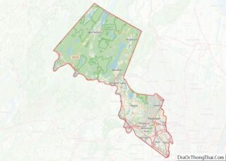
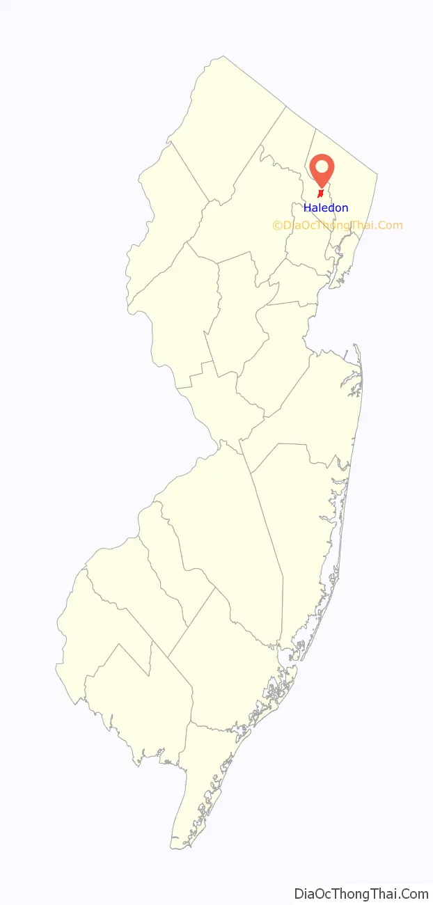
Haledon location map. Where is Haledon borough?

History
Haledon developed along the northern side of the industrial city of Paterson. It was settled by farmers with colonial Dutch heritage including the Van Riper, Berdan, Banta, Post and Zabriskie families. Prior to the Civil War they were joined by the Roe, Leonhard and Stansfield families, who helped establish St. Mary’s Episcopal Church and leading businesses including a general store and the Leonhard Wax Company.
The area became a streetcar suburb of Paterson in the years following the Civil War, with the central area known as Haledon, while the area surrounding the large pond along High Mountain Road was called Oldham. The Paterson and Haledon Horse Rail Road Company, formed in 1871, laid trolley tracks from Paterson along the current-day Belmont Avenue, which were electrified by 1888. Many of the trolley company’s owners were among the founders of the Cedar Cliff Land Company, which bought up large portions of the area, and the street names in the borough reflect these industrialists and businessmen: Morrissee, Hoxey, Van Dyke, John Ryle and Barbour. The flat, lower part of the community was laid out in city-sized lots of 25′ by 100′ while the hillsides were plated as sites for larger Victorian “villas” for such individuals as Vice President Garret A. Hobart (now the location of William Paterson University) and the Barbour family of linen flax manufacturers. Haledon’s villa development was always rather limited and throughout much of the 20th century Haledon was a typical blue-collar community set by the small property sizes planned by the Cedar Cliff Land Company. A never-constructed grand hotel was planned for the highest point of the community above the intersection of the current day Central and West Haledon Avenues. The Cedar Cliff Land Company ran newspaper advertisements targeted at upwardly mobile immigrants who worked in Paterson’s silk industry, offering the city-sized lots for sale at auctions (with free lunches and brass bands) held at St. Mary’s Parish Hall, and also opened the Cedar Cliff Silk Mill, which became one of several silk mills in the community. The residential appeal of Haledon was to escape the crowded industrial city and still have access to the textile mills by using the trolley. As a result of the land sales of Cedar Cliff Land Company and also of independent landowner William Bushmann, the town was settled by immigrants who came as skilled workers from textile centers in Europe.
Haledon was incorporated in 1908, having been the Oldham district of the former Passaic County municipality of Manchester Township.
Socialist William Bruekmann was elected mayor in 1912 by the borough’s immigrant resident base of skilled silk workers. During the 1913 Paterson silk strike, Haledon’s mayor offered the strikers the opportunity to hold meetings in Haledon, as worker meetings were prohibited in Paterson. The Pietro and Maria Botto House, located on the side of a hill surrounded by open spaces, provided a natural amphitheater for labor leaders of the day to address thousands of people who gathered to hear Big Bill Haywood, Carlo Tresca, Elizabeth Gurley Flynn and John Reed. The Botto House is now a National Historic Landmark and the home of the American Labor Museum.
In 2008, Councilman Alan Souto, at the time an officer with the Passaic County Sheriff’s Department, was arrested for stealing heroin and cocaine from the evidence room from the sheriff’s department in order to distribute narcotics, amounting to over $250,000. After being found guilty, he was sentenced to 85 months in federal prison in May 2009. Souto was replaced in April 2008 by Marc Battle, a commercial litigator and former civil rights attorney.
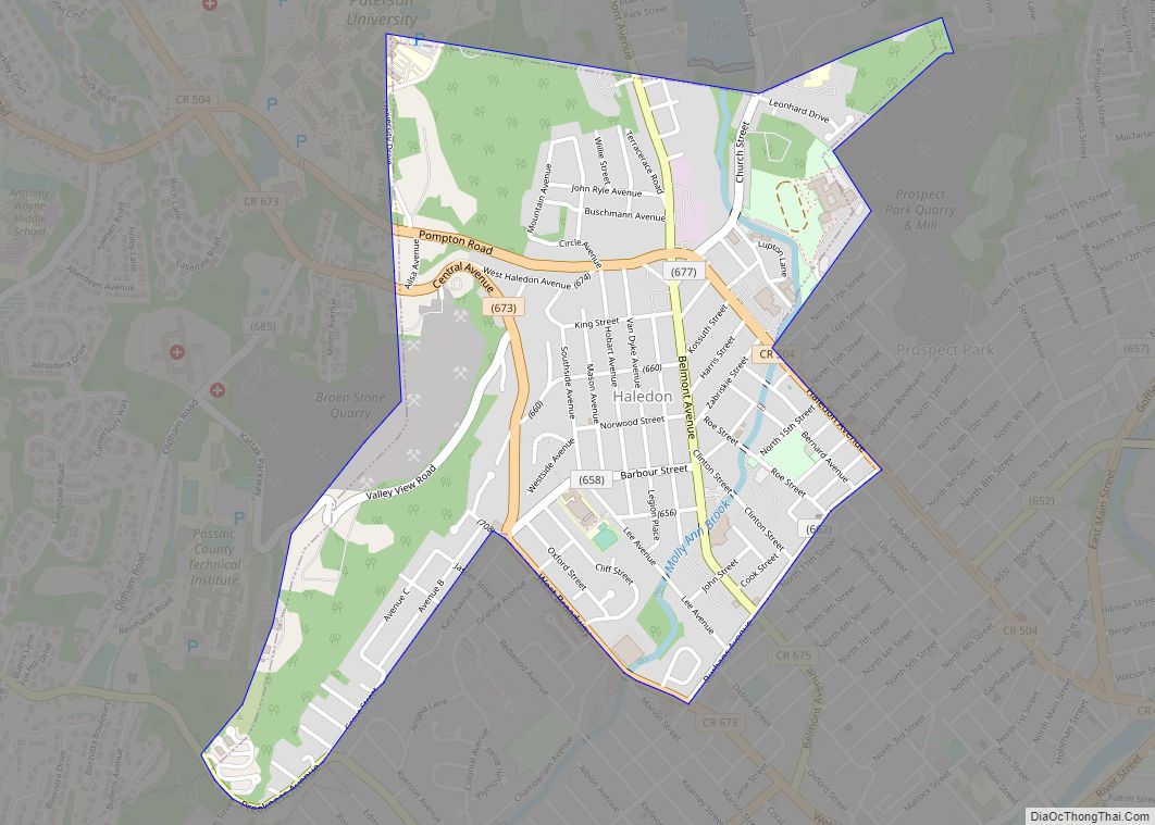
Haledon Road Map
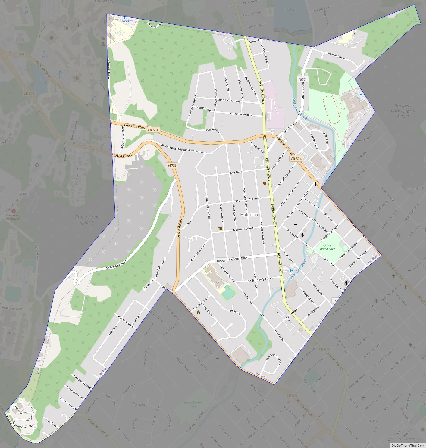
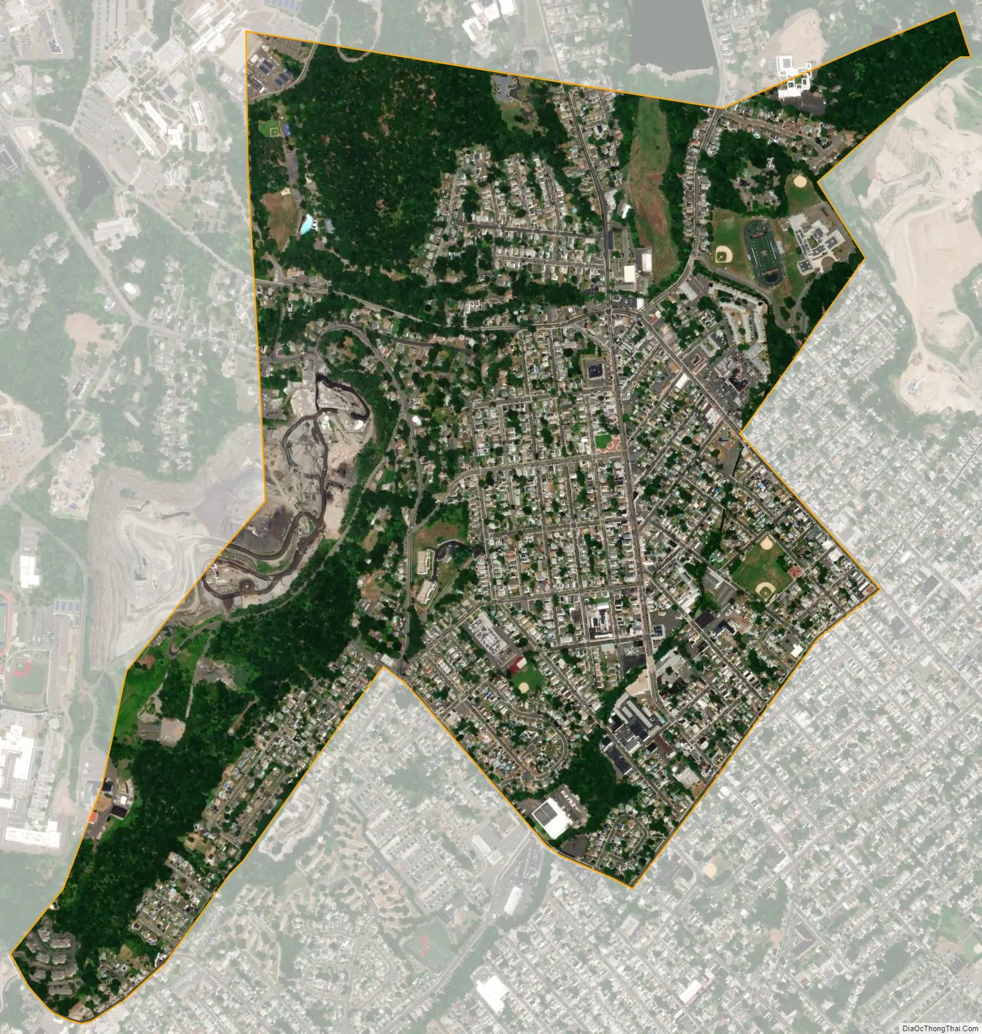
Haledon city Satellite Map
Geography
According to the United States Census Bureau, the borough had a total area of 1.22 square miles (3.15 km), including 1.22 square miles (3.15 km) of land and <0.01 square miles (<0.01 km) of water (0.08%). The borough is home of a Passaic River inlet known as Molly Ann Brook.
Unincorporated communities, localities and place names located partially or completely within the township include Bridges Pond and Valley View.
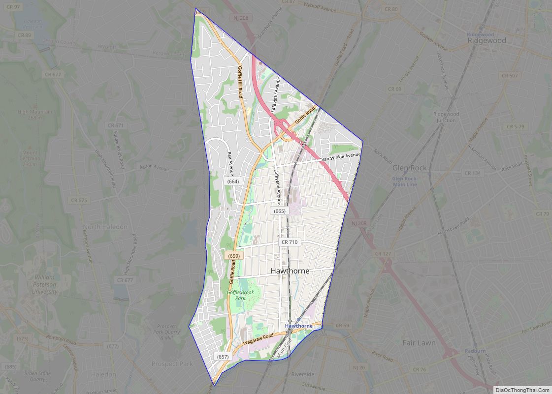
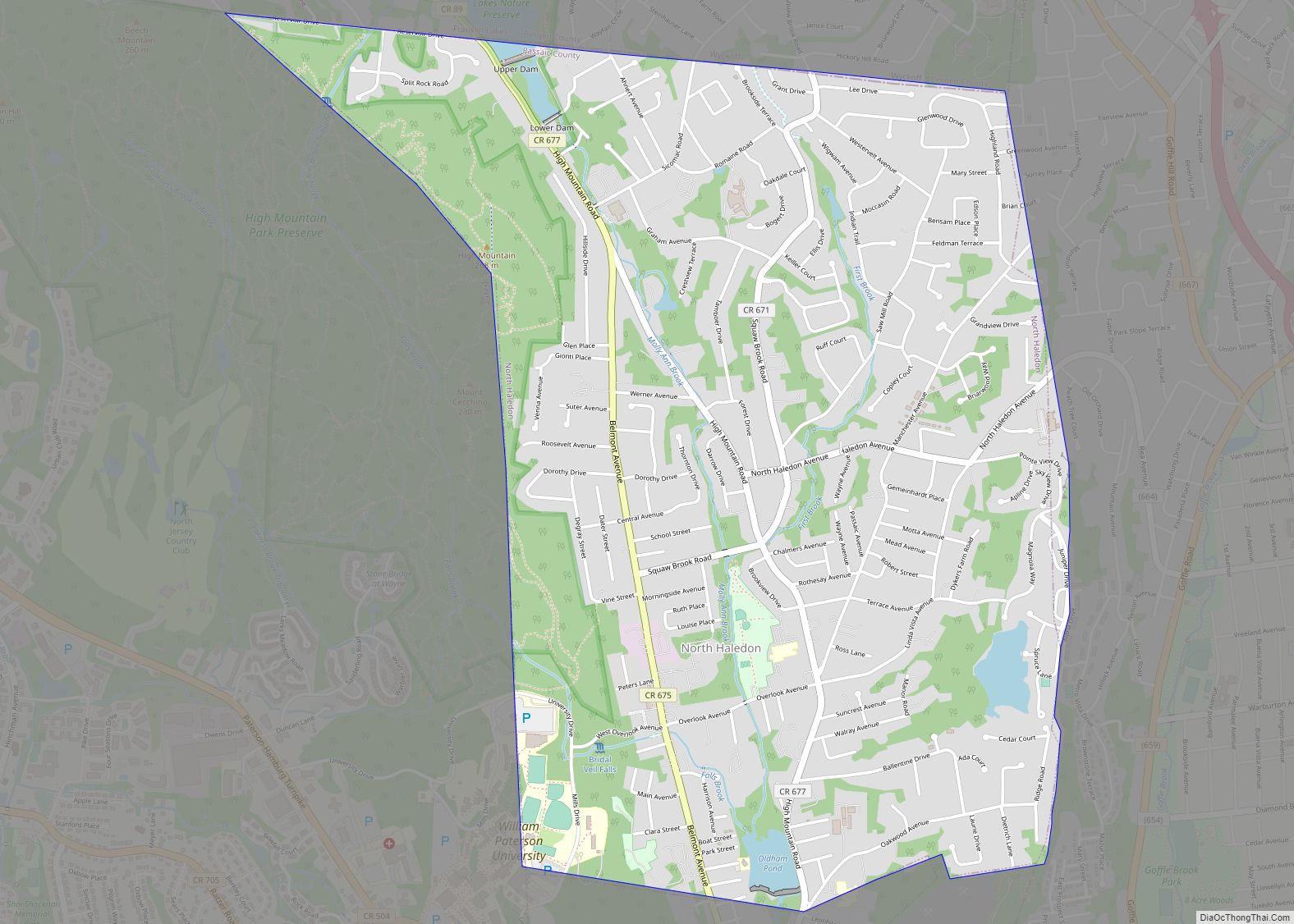
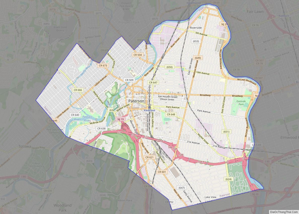
The borough borders the Passaic County communities of North Haledon, Paterson, Prospect Park, Totowa and Wayne.
See also
Map of New Jersey State and its subdivision: Map of other states:- Alabama
- Alaska
- Arizona
- Arkansas
- California
- Colorado
- Connecticut
- Delaware
- District of Columbia
- Florida
- Georgia
- Hawaii
- Idaho
- Illinois
- Indiana
- Iowa
- Kansas
- Kentucky
- Louisiana
- Maine
- Maryland
- Massachusetts
- Michigan
- Minnesota
- Mississippi
- Missouri
- Montana
- Nebraska
- Nevada
- New Hampshire
- New Jersey
- New Mexico
- New York
- North Carolina
- North Dakota
- Ohio
- Oklahoma
- Oregon
- Pennsylvania
- Rhode Island
- South Carolina
- South Dakota
- Tennessee
- Texas
- Utah
- Vermont
- Virginia
- Washington
- West Virginia
- Wisconsin
- Wyoming