Passaic (/pəˈseɪ.ɪk/ pə-SAY-ik or locally /pəˈseɪk/ pə-SAYK) is a city in Passaic County, in the U.S. state of New Jersey. As of the 2020 United States census, the city was the state’s 16th-most-populous municipality, with a population of 70,537, falling behind Bayonne (ranked 16th in 2010), an increase of 756 (+1.1%) from the 2010 census count of 69,781, which in turn reflected an increase of 1,920 residents (+2.8%) from the 2000 census population of 67,861. The Census Bureau’s Population Estimates Program calculated that the city’s population was 69,633 in 2021, ranking the city the 541st-most-populous in the country. Among cities with more than 50,000 people, Passaic was the fifth-most-densely-populated municipality in the United States, with more than 22,000 people per square mile.
Located north of Newark on the Passaic River, it was first settled in 1678 by Dutch traders, as Acquackanonk Township. The city and river get their name from the Lenape word “pahsayèk” which has been variously attributed to mean “valley” or “place where the land splits.”
| Name: | Passaic city |
|---|---|
| LSAD Code: | 25 |
| LSAD Description: | city (suffix) |
| State: | New Jersey |
| County: | Passaic County |
| Incorporated: | April 2, 1873 |
| Elevation: | 98 ft (30 m) |
| Total Area: | 3.24 sq mi (8.39 km²) |
| Land Area: | 3.13 sq mi (8.11 km²) |
| Water Area: | 0.11 sq mi (0.28 km²) 3.33% |
| Total Population: | 70,537 |
| Population Density: | 22,514.2/sq mi (8,692.8/km²) |
| ZIP code: | 07055 |
| Area code: | 973 |
| FIPS code: | 3456550 |
| GNISfeature ID: | 0885342 |
| Website: | www.cityofpassaic.com |
Online Interactive Map
Click on ![]() to view map in "full screen" mode.
to view map in "full screen" mode.
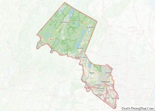
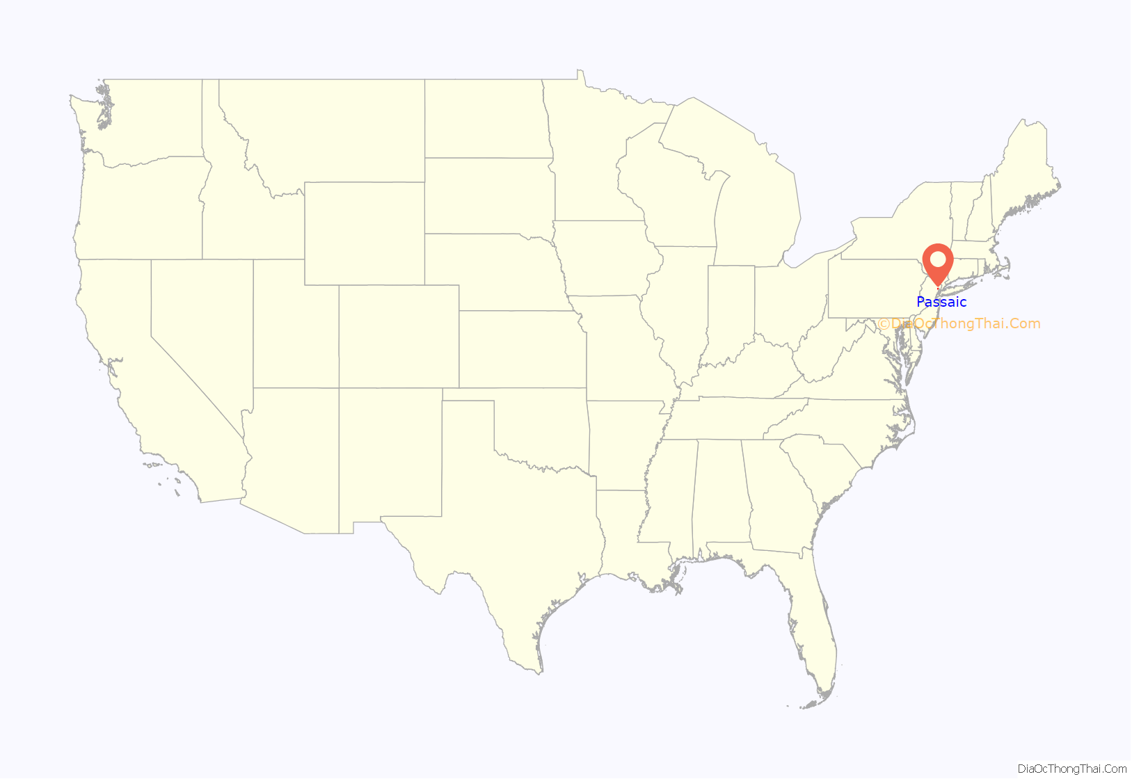
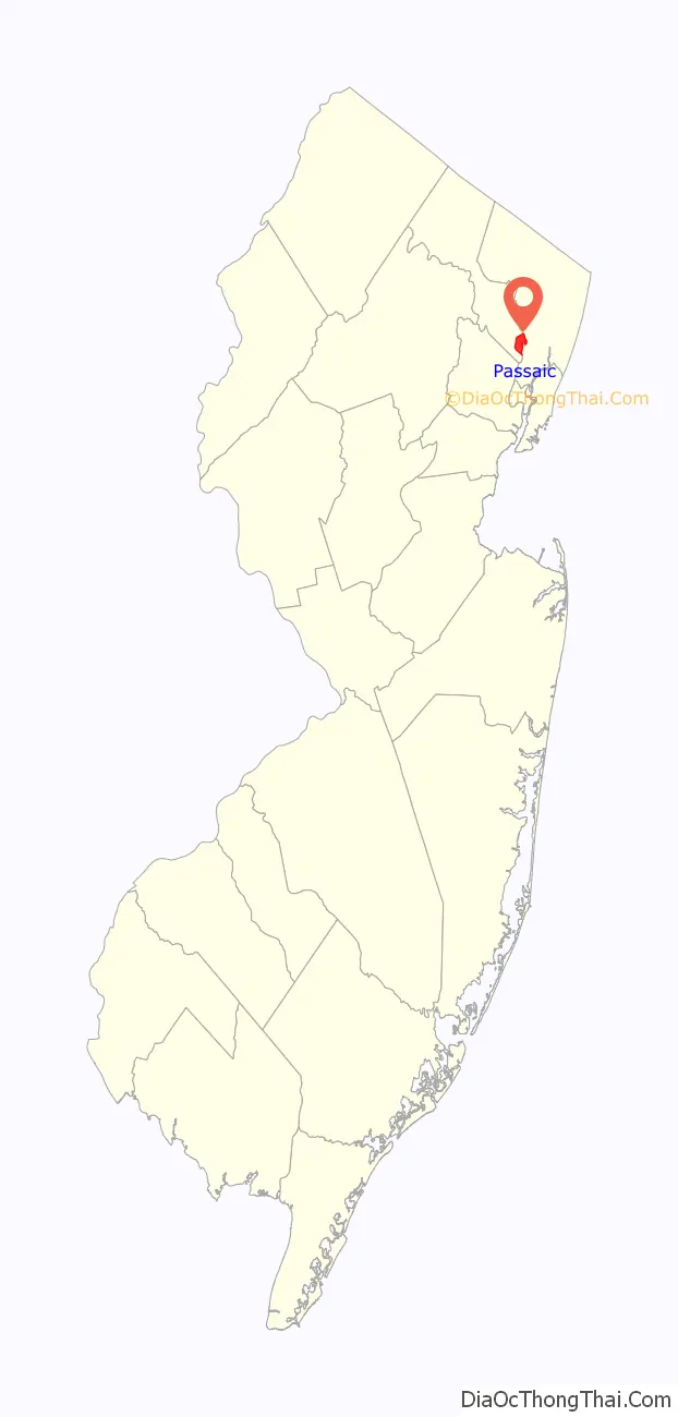
Passaic location map. Where is Passaic city?
History
The city originated from a Dutch settlement on the Passaic River established in 1679 which was called Acquackanonk. Industrial growth began in the 19th century, as Passaic became a textile and metalworking center.
A commercial center formed around a wharf at the foot of present-day Main Avenue. This came to be commonly known as Acquackanonk Landing, and the settlement that grew around it became known as the Village of Acquackanonk Landing or simply Acquackanonk Landing Settlement. In 1854 Alfred Speer (later owner of the city’s first newspaper and public hall) and Judge Henry Simmons were the principals in a political battle over the naming of village. Simmons wished to keep the old name while Speer wanted to simplify it to Passaic Village. Speer was losing the battle however he convinced the U.S. Postmaster General to adopt the name, and hung a Passaic sign at the local railroad depot. The de facto name change was effective.
Passaic was formed as an unincorporated village within Acquackanonk Township (now Clifton) on March 10, 1869. It was incorporated as an independent village on March 21, 1871. Passaic was chartered as a city on April 2, 1873.
The Okonite company owned an industrial site here from 1878 to 1993. It was the company’s headquarters and primary manufacturing plant for most of the company’s history. Early uses of the company’s insulated wires include some of the earliest telegraph cables, and the wiring for Thomas Edison’s first generating plant, Pearl Street Station in Lower Manhattan. The property was then turned into a furniture factory, whose owners have been attempting to redevelop the property into an upscale mall since 2015.
The 1926 Passaic Textile Strike led by union organizer Albert Weisbord saw 36,000 mill workers leave their jobs to oppose wage cuts demanded by the textile industry. The workers successfully fought to keep their wages unchanged but did not receive recognition of their union by the mill owners.
Passaic has been called “The Birthplace of Television”. In 1931, experimental television station W2XCD began transmitting from DeForest Radio Corporation in Passaic. It has been called the first television station to transmit to the home, and was the first such station to broadcast a feature film. Allen B. DuMont, formerly DeForest’s chief engineer, opened pioneering TV manufacturer DuMont Laboratories in Passaic in 1937, and started the DuMont Television Network, the world’s first commercial television network, in 1946.
In 1992, the voters of Passaic Township in Morris County voted to change the name of their municipality to Long Hill Township, to avoid confusion between the City of Passaic and the largely rural community 22 miles (35 km) away, as well as association with the more urban city.
Passaic is served by two regional newspapers, The Record and Herald News which are both owned by the Gannett company and its predecessor North Jersey Media Group.
The city previously had many of its own newspaper companies, among them Speer’s The Passaic Item (1870–1904), the Passaic City Herald (1872–1899), the Passaic Daily Times (1882–1887), the Passaic City Record (1890–1907), the Passaic Daily News (1891–1929), the Passaic Daily Herald (1899–1929), and the Passaic Herald News (1932–1987). The Passaic Herald News went through several mergers with other Passaic County newspapers to become the current Herald News.
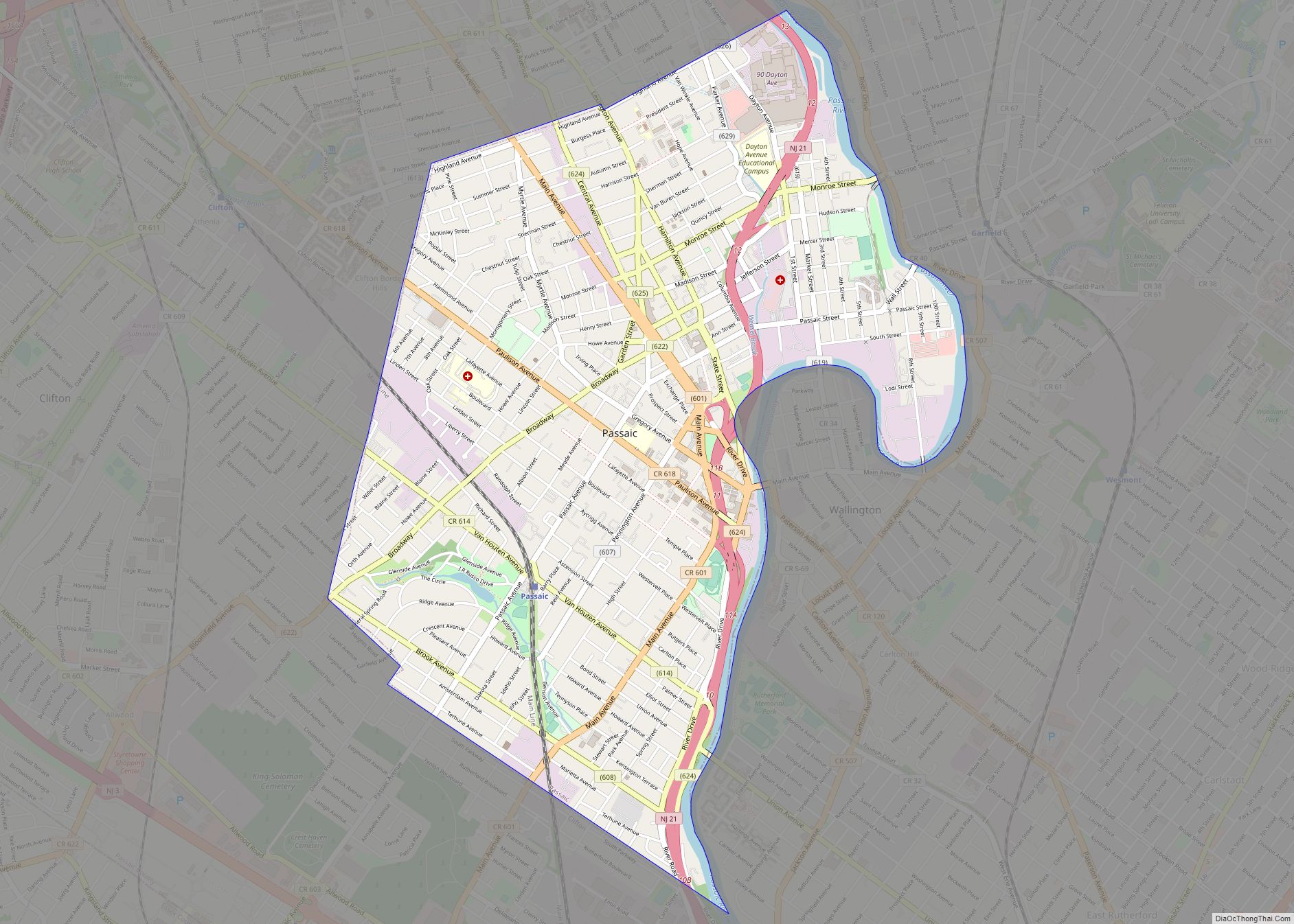
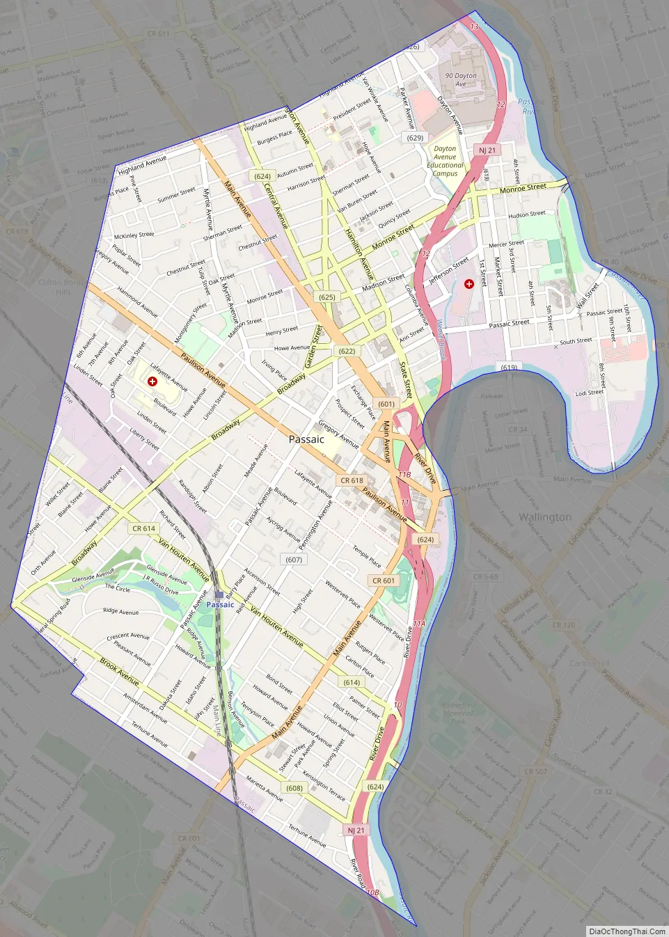
Passaic Road Map
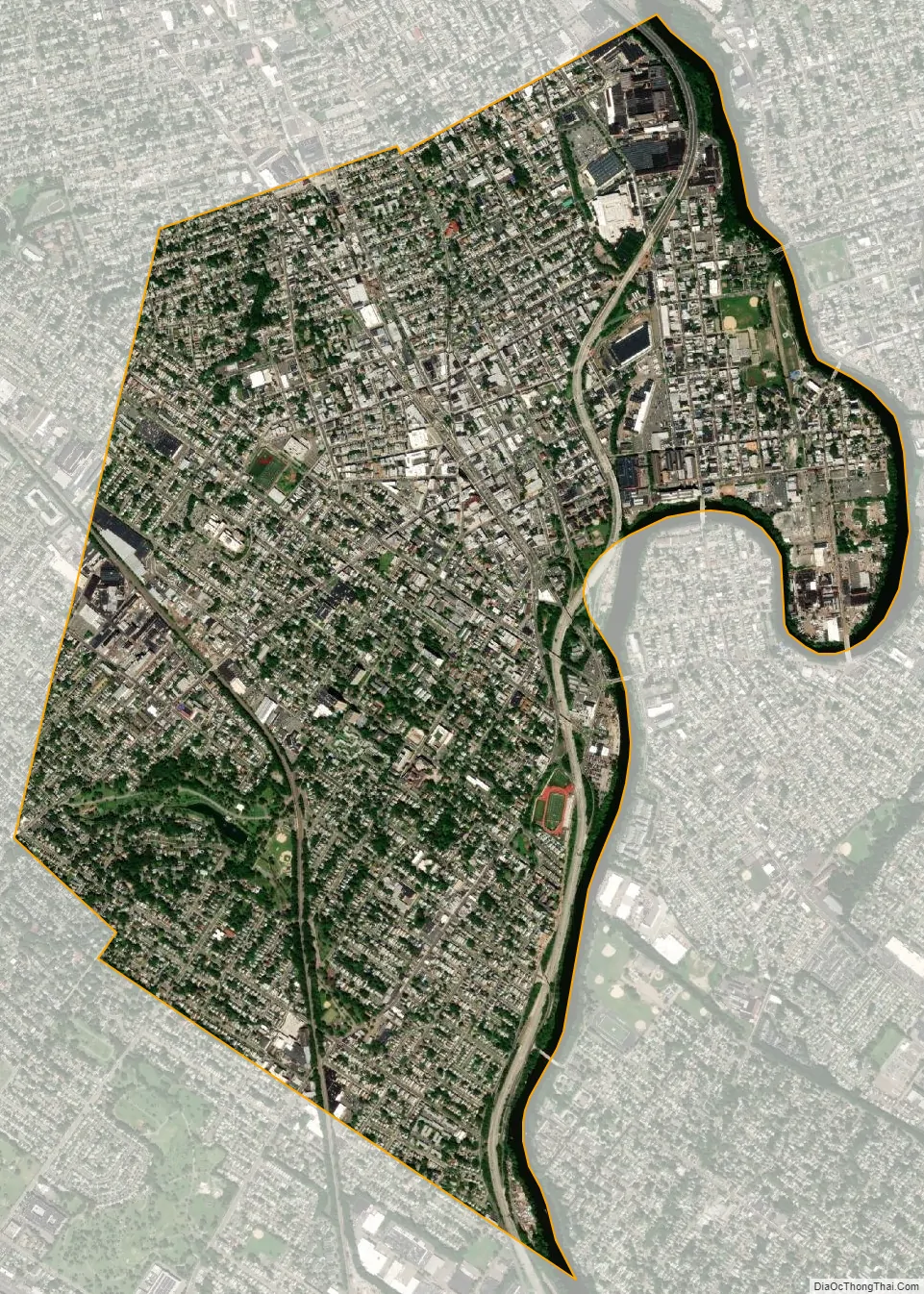
Passaic city Satellite Map
Geography
According to the U.S. Census Bureau, the city had a total area of 3.24 square miles (8.39 km), including 3.13 square miles (8.11 km) of land and 0.11 square miles (0.28 km) of water (3.33%).
Passaic’s only land border is with neighboring Clifton, which borders Passaic to the north, south, and west. The namesake Passaic River forms the eastern border of Passaic. Four additional neighboring municipalities in southern Bergen County, immediately across the river from Passaic, are East Rutherford, Garfield, Rutherford, and Wallington.
Passaic and Wallington are connected via the Gregory Avenue, Market Street, and Eighth Street bridges. The city connects with Garfield at both the Monroe and Passaic Street Bridges. The road connection with Rutherford is via the Union Avenue Bridge, which is located on an extension off the northbound lanes of Route 21. One cannot cross from Passaic into East Rutherford by vehicle directly, however, as there is no bridge directly connecting the two municipalities. Drivers wanting to cross from Passaic to East Rutherford must use either the Gregory Avenue Bridge, which is located near Wallington‘s line with East Rutherford, or the Union Avenue Bridge, where East Rutherford can be accessed via surface streets briefly passing through Rutherford.
Passaic is located 10 miles (16 km) from New York City, and 12 miles (19 km) from Newark Airport.
The city
Passaic has several business districts: Main Avenue begins in Passaic Park and follows the curve of the river to downtown. Broadway runs east–west through the center of the city, ending at Main Avenue in downtown. Main Avenue has many shops, restaurants, and businesses reflecting the city’s growing Latino, and declining Eastern European populations in the city.
The city is home to several architecturally notable churches, including St. John’s Lutheran Church, First Presbyterian of Passaic, and St. John’s Episcopal Church.
Many residents of Southwest Passaic, also known as Passaic Park, or Third Ward Park, are part of various Orthodox Jewish communities. With over 1,300 families, estimated at a total population of 15,000, Passaic is one of the state’s fastest-growing Orthodox communities. It is home to over 20 yeshivas and other educational institutions, as well as many kosher food and other shopping establishments.
The Passaic Park section is noted for its large park and large homes of various architectural styles, especially Queen Anne and Tudor. Several condominium and cooperative apartment complexes are also located here including:
- Carlton Tower, a condominium of 21 stories, the city’s tallest structure
- The Towers, rental across the street from Carlton Towers
- Barry Gardens, co-operative garden apartments next door to The Towers
- Presidential Towers, condominium
Climate
The climate in this area is characterized by hot, humid summers and generally mild to cool winters. According to the Köppen Climate Classification system, Passaic has a humid subtropical climate, abbreviated “Cfa” on climate maps.
See also
Map of New Jersey State and its subdivision: Map of other states:- Alabama
- Alaska
- Arizona
- Arkansas
- California
- Colorado
- Connecticut
- Delaware
- District of Columbia
- Florida
- Georgia
- Hawaii
- Idaho
- Illinois
- Indiana
- Iowa
- Kansas
- Kentucky
- Louisiana
- Maine
- Maryland
- Massachusetts
- Michigan
- Minnesota
- Mississippi
- Missouri
- Montana
- Nebraska
- Nevada
- New Hampshire
- New Jersey
- New Mexico
- New York
- North Carolina
- North Dakota
- Ohio
- Oklahoma
- Oregon
- Pennsylvania
- Rhode Island
- South Carolina
- South Dakota
- Tennessee
- Texas
- Utah
- Vermont
- Virginia
- Washington
- West Virginia
- Wisconsin
- Wyoming