Union Beach is a borough on the Jersey Shore of Monmouth County, in the U.S. state of New Jersey. As of the 2020 United States census, the borough’s population was 5,723, a decrease of 522 (−8.4%) from the 2010 census count of 6,245, which in turn reflected a decline of 404 (−6.1%) from the 6,649 counted at the 2000 census.
Union Beach was formed as a borough by an act of the New Jersey Legislature on March 16, 1925, from portions of Raritan Township (now Hazlet), based on the results of a referendum held on April 16, 1925. A 100-acre (40 ha) farm in the future borough was owned by the Poole family since the days of the American Revolutionary War. Following the development of the Central Railroad of New Jersey, the Poole Farm became the site of the Union Subdivision in 1908, while an area that had been called East Point Beach Estates was renamed Union Beach by developer Charles Carr in 1920.
The borough is part of the Bayshore Regional Strategic Plan, an effort by nine municipalities in northern Monmouth County to reinvigorate the area’s economy by emphasizing the traditional downtowns, dense residential neighborhoods, maritime history, and the natural beauty of the Raritan Bayshore coastline.
| Name: | Union Beach borough |
|---|---|
| LSAD Code: | 21 |
| LSAD Description: | borough (suffix) |
| State: | New Jersey |
| County: | Monmouth County |
| Incorporated: | April 16, 1925 |
| Elevation: | 3 ft (0.9 m) |
| Total Area: | 1.88 sq mi (4.87 km²) |
| Land Area: | 1.78 sq mi (4.61 km²) |
| Water Area: | 0.10 sq mi (0.26 km²) 5.32% |
| Total Population: | 5,723 |
| Population Density: | 3,211.6/sq mi (1,240.0/km²) |
| ZIP code: | 07735 |
| Area code: | 732 |
| FIPS code: | 3474540 |
| GNISfeature ID: | 0885423 |
| Website: | www.ubnj.net |
Online Interactive Map
Click on ![]() to view map in "full screen" mode.
to view map in "full screen" mode.
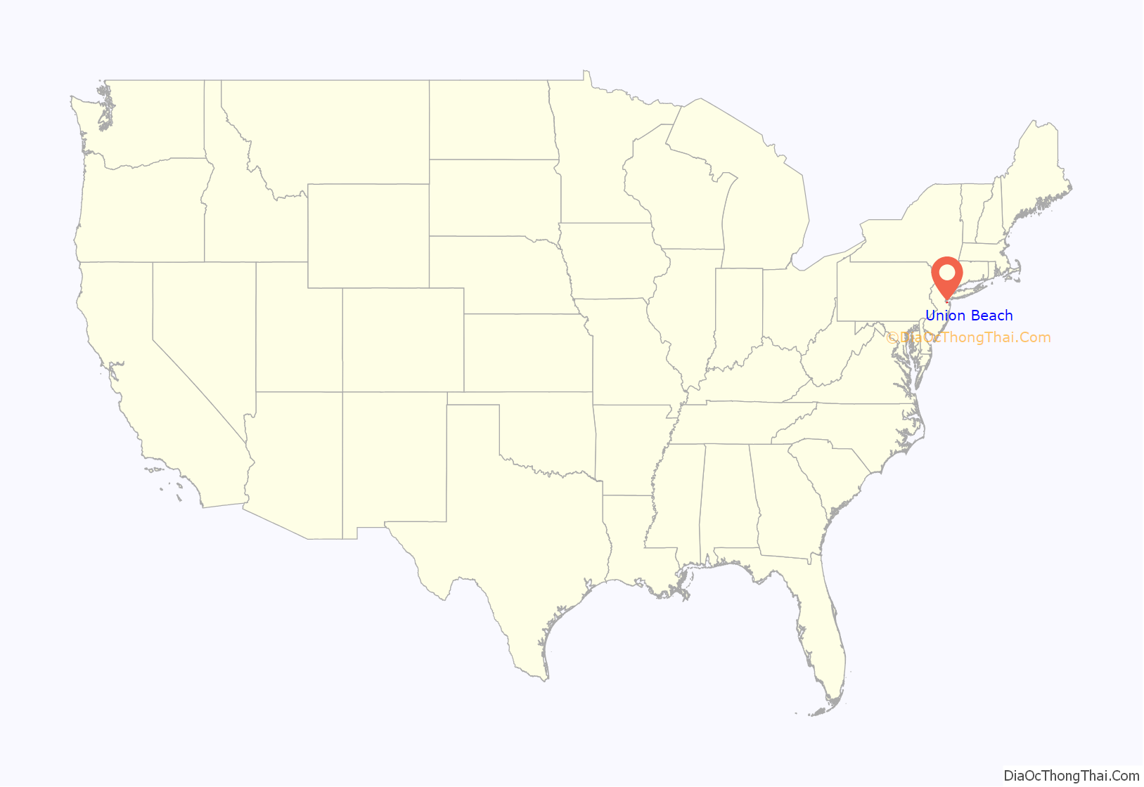
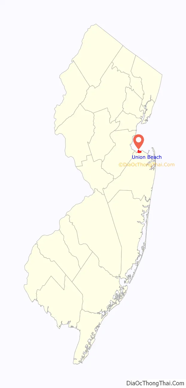
Union Beach location map. Where is Union Beach borough?
History
Hurricane Sandy
On October 28, 2012, at 4:00pm, the mayor issued a mandatory evacuation for the borough in preparation for Hurricane Sandy—the second-costliest hurricane in United States history. When the hurricane arrived, approximately one third of the borough’s 6,200 residents had left.
By the morning of October 29, of the estimated 2,143 households in the borough, approximately 200 homes and businesses were damaged, 400 took on more than 6 feet (1.8 m) of water, and 62 were “completely missing”. An additional 100 that had shifted off foundations and were no longer habitable. The borough’s police department borrowed several police cruisers from other municipalities such as Wilmington, NC and Clay County, Florida. Most cars were destroyed when flooding reached police headquarters. Former residents from around the country mobilized and organized relief efforts: sending relief supplies; including advising and assisting public servants in acquiring replacements of lost emergency vehicles. In total, the borough lost 14 police cars, three ambulances and four fire trucks. Madison Township and Wanaque each gave repurposed police cruisers fully decaled with Union Beach logos, as well as other relief. Some local agencies sold old police cruisers for one dollar each or donated police cars, and donations of two cars each came from North Carolina and Florida. EMS and fire trucks were also donated from near and far.
Jakeabob’s Bay, a restaurant and waterfront tiki bar and one of the major employers in town, which survived Hurricane Irene in 2011, was destroyed in the hurricane. The storm surge completely washed through the building, pushing out tables, chairs, menus and displays. The restaurant owner, Gigi Liaguno-Dorr, organized the relief and rebuilding efforts for Union Beach. The building was razed when the insurance companies that covered the restaurant would not pay out. A new temporary restaurant was built but did not manage to renew its lease due to insurance disputes with the Federal Emergency Management Agency.
Union Beach Memorial School, the borough’s only school, was inundated with floodwaters and debris when the storm surge and extreme high tide swept through the borough. The school had been used as an evacuation center but began taking on water as the storm raged. Hundreds of library books and teaching materials were destroyed along with thousands of dollars worth of instruments. After several months of emergency repairs by volunteers, including students and teachers, the renovations including new floors, walls, desks and murals were finished prior to the end of the school year.
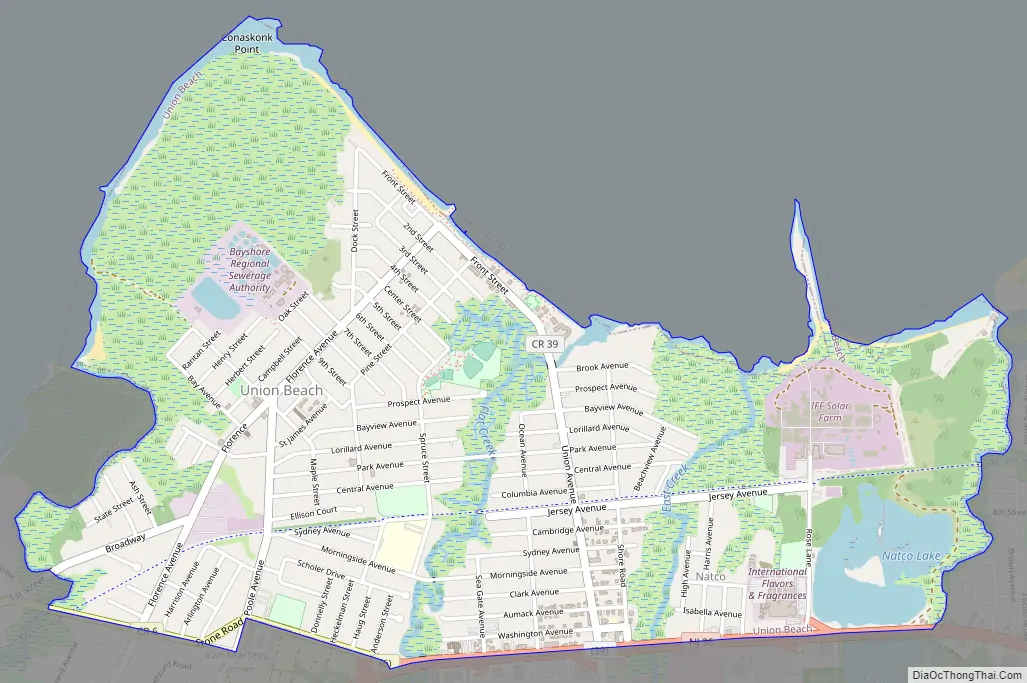
Union Beach Road Map
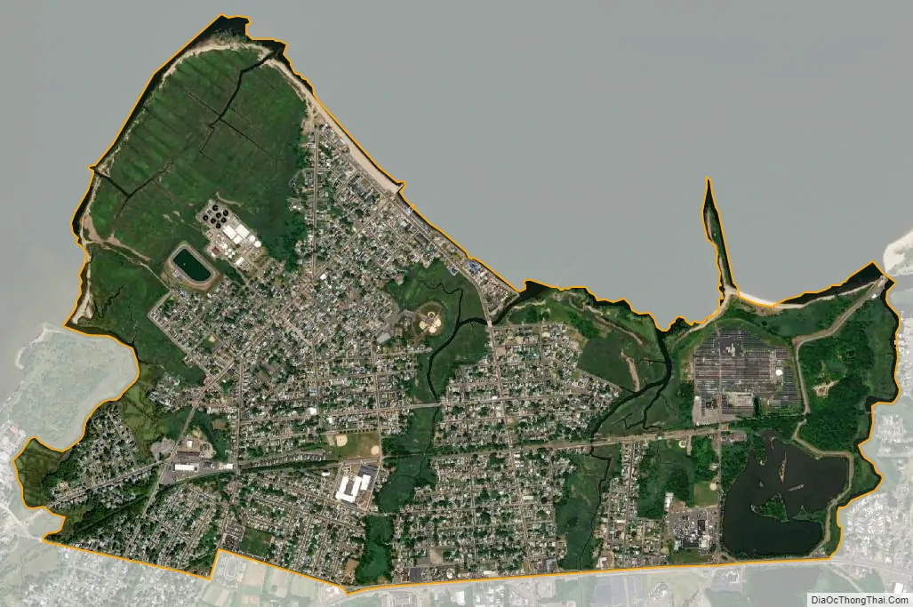
Union Beach city Satellite Map
Geography
According to the United States Census Bureau, the borough had a total area of 1.88 square miles (4.87 km), including 1.78 square miles (4.61 km) of land and 0.10 square miles (0.26 km) of water (5.32%).
Union Beach has undergone extensive restoration of its beach front, which offers a view of the New York City skyline and the Verazanno-Narrows Bridge.
A monument to the victims of the September 11, 2001 terrorist attacks, constructed of black stone and dedicated in June 2002, is positioned to allow visitors to see past the memorial towards the location where the World Trade Center towers were visible from the borough.
Unincorporated communities, localities and place names within the borough include Lorrillard Beach, Natco, Union Gardens and Van Marters Corner.
The borough borders the Monmouth County municipalities of Hazlet, Keansburg (maritime border) and Keyport.
See also
Map of New Jersey State and its subdivision: Map of other states:- Alabama
- Alaska
- Arizona
- Arkansas
- California
- Colorado
- Connecticut
- Delaware
- District of Columbia
- Florida
- Georgia
- Hawaii
- Idaho
- Illinois
- Indiana
- Iowa
- Kansas
- Kentucky
- Louisiana
- Maine
- Maryland
- Massachusetts
- Michigan
- Minnesota
- Mississippi
- Missouri
- Montana
- Nebraska
- Nevada
- New Hampshire
- New Jersey
- New Mexico
- New York
- North Carolina
- North Dakota
- Ohio
- Oklahoma
- Oregon
- Pennsylvania
- Rhode Island
- South Carolina
- South Dakota
- Tennessee
- Texas
- Utah
- Vermont
- Virginia
- Washington
- West Virginia
- Wisconsin
- Wyoming


