Monett is the most-populous city in the Barry and Lawrence counties in the U.S. state of Missouri. The city is located in the Ozarks, just south of Interstate 44 between Joplin and Springfield. According to the 2020 census, the population of the town was estimated to be 9,576 individuals.
| Name: | Monett city |
|---|---|
| LSAD Code: | 25 |
| LSAD Description: | city (suffix) |
| State: | Missouri |
| County: | Barry County, Lawrence County |
| Founded: | 1870 |
| Incorporated: | 1887 |
| Elevation: | 1,309 ft (399 m) |
| Total Area: | 8.82 sq mi (22.83 km²) |
| Land Area: | 8.79 sq mi (22.77 km²) |
| Water Area: | 0.02 sq mi (0.06 km²) |
| Total Population: | 9,576 |
| Population Density: | 1,089.05/sq mi (420.48/km²) |
| ZIP code: | 65708 |
| Area code: | 417 |
| FIPS code: | 2949196 |
| GNISfeature ID: | 2395370 |
| Website: | cityofmonett.com |
Online Interactive Map
Click on ![]() to view map in "full screen" mode.
to view map in "full screen" mode.
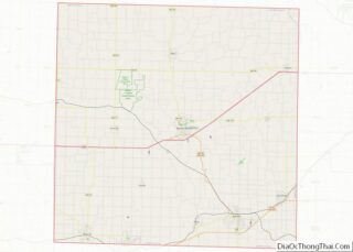
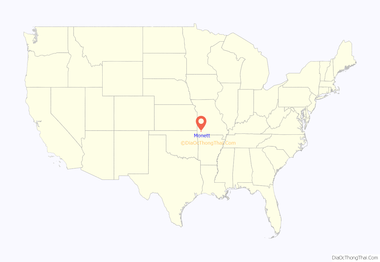
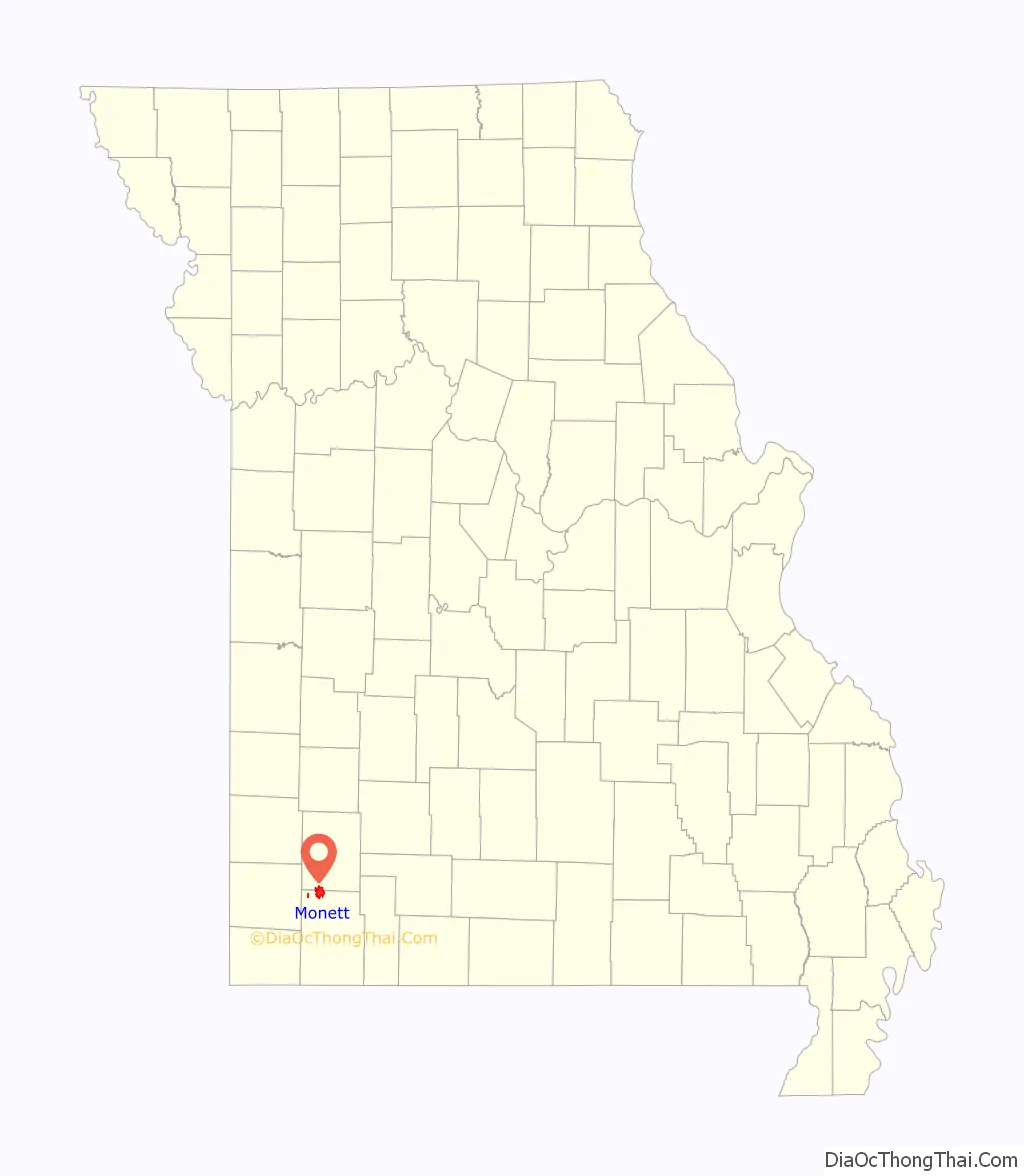
Monett location map. Where is Monett city?
History
Southwest Missouri, including the area of what is now Monett, was inhabited by Native Americans of the Osage Nation until their forced removal to Indian Territory.
Settlement: 1870-1900
Monett was created as a railroad town by the St. Louis–San Francisco Railway (“Frisco Line”), which was extended into the area in 1870, and a branch line going to Paris, Texas, was built. Both lines are still in existence and operated by the BNSF Railway. During this time the area went through several names including Kings Prairie Depot, Plymouth, Plymouth Junction (when the southern branch was built in 1880), Gonten (named for the local postmaster because the Post Service said there were other Plymouths); and finally Monett in 1887 when the area was formally platted and the Monett name was applied to the post office. It was named for Henry Monett who was a popular general station agent for various railroads including the New York, Chicago and St. Louis Railroad (“Nickel Plate Railroad”) before becoming an agent for the New York Central Railroad shortly before his death at the age of 35 in 1888.
The community was very much noted for being a rail town and had a Harvey House operating at the Frisco train station from 1896 until 1930. The community in the Ozark Mountains also had a thriving fruit business and was nicknamed the “Strawberry Capital of the Midwest.” The Ozark Fruit Growers Association building, which was built in 1927, is part of the Downtown Monett Historic District and is on the National Register of Historic Places.
The David W. Courdin House, Downtown Monett Historic District, and Waldensian Church and Cemetery of Stone Prairie are listed on the National Register of Historic Places.
In 1894, a lynching and race riot in took place in Monett before the violence spread to Pierce City and other southwestern Missouri towns. Monett became a sundown town, banning African Americans from living or staying there after dark, with a sign across the main street saying: “Nigger, don’t let the sun go down.” A newspaper in another Missouri town reported in 1906 that “Monett, Pierce City, Rogers, Ark., and several other towns around here have driven the negros out.” When Pierce City drove out its African American population in an act of ethnic cleansing, the St. Louis Post-Dispatch said the town had been “Monettized”.
20th century
From about 1908 through 1911, Monett investors led by L. B. Durnil and U. S. Barnsley sought to build an airplane. Their most successful attempt was the DeChenne aeroplane. The DeChenne aeroplane gave its first public demonstration flight in Monett on July 4, 1911, flown by Monett pharmacist Logan McKee. It then made an exhibition tour in Oklahoma and Texas.
The population had reached 4,177 by 1910, due in large part to the railroad and its roundhouse. By 1937, a promotional pamphlet reported one out of eight people in Monett worked for the railroad.
In a postwar industrialization effort, the Monett Industrial Development Corporation brought light industry to the town, further diversifying the local and broader economy. This diversification nearly doubled the population during the century, to 7,396 by 2000.
21st century
Through a combination of private investment and public resources, numerous restoration and revitalization projects have been undertaken in the historic downtown to restore its architectural quality, upgrade the infrastructure, drive local business success, and improve the quality of life.
In 2018, Missouri Governor Eric Greitens and Senator Roy Blunt announced an “Opportunity Zone” in Monett, allocating state and federal tax incentives for businesses that invest in the areas designated. In 2018, Monett adopted the complete streets policy, the 39th city in Missouri to do so.
Monett Road Map
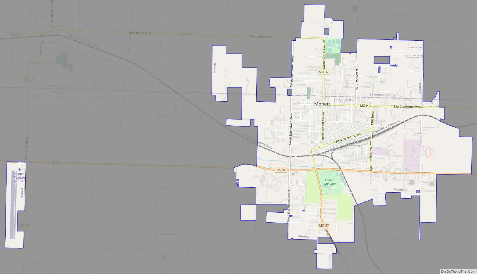
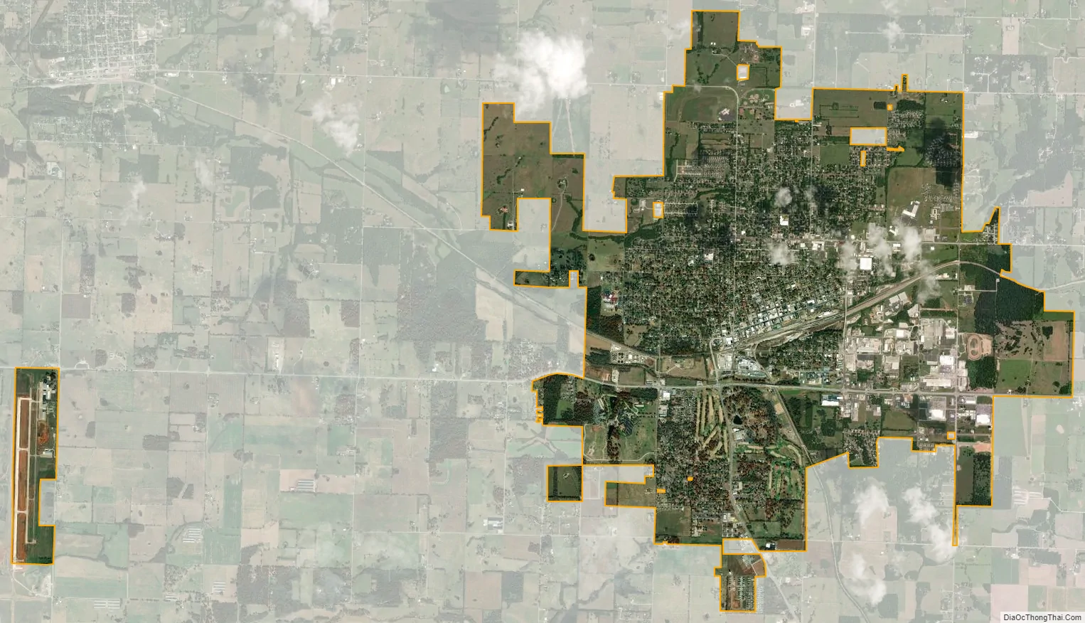
Monett city Satellite Map
Geography
Monett is located at 36°55′25″N 93°55′20″W / 36.92361°N 93.92222°W / 36.92361; -93.92222 (36.923725, -93.922332).
According to the United States Census Bureau, the city has a total area of 8.45 square miles (21.89 km), of which 8.43 square miles (21.83 km) is land and 0.02 square miles (0.05 km) is water.
Climate
Climate is characterized by relatively high temperatures and evenly distributed precipitation throughout the year. The Köppen Climate Classification subtype for this climate is “Cfa” (Humid Subtropical Climate).
See also
Map of Missouri State and its subdivision:- Adair
- Andrew
- Atchison
- Audrain
- Barry
- Barton
- Bates
- Benton
- Bollinger
- Boone
- Buchanan
- Butler
- Caldwell
- Callaway
- Camden
- Cape Girardeau
- Carroll
- Carter
- Cass
- Cedar
- Chariton
- Christian
- Clark
- Clay
- Clinton
- Cole
- Cooper
- Crawford
- Dade
- Dallas
- Daviess
- De Kalb
- Dent
- Douglas
- Dunklin
- Franklin
- Gasconade
- Gentry
- Greene
- Grundy
- Harrison
- Henry
- Hickory
- Holt
- Howard
- Howell
- Iron
- Jackson
- Jasper
- Jefferson
- Johnson
- Knox
- Laclede
- Lafayette
- Lawrence
- Lewis
- Lincoln
- Linn
- Livingston
- Macon
- Madison
- Maries
- Marion
- McDonald
- Mercer
- Miller
- Mississippi
- Moniteau
- Monroe
- Montgomery
- Morgan
- New Madrid
- Newton
- Nodaway
- Oregon
- Osage
- Ozark
- Pemiscot
- Perry
- Pettis
- Phelps
- Pike
- Platte
- Polk
- Pulaski
- Putnam
- Ralls
- Randolph
- Ray
- Reynolds
- Ripley
- Saint Charles
- Saint Clair
- Saint Francois
- Saint Louis
- Sainte Genevieve
- Saline
- Schuyler
- Scotland
- Scott
- Shannon
- Shelby
- Stoddard
- Stone
- Sullivan
- Taney
- Texas
- Vernon
- Warren
- Washington
- Wayne
- Webster
- Worth
- Wright
- Alabama
- Alaska
- Arizona
- Arkansas
- California
- Colorado
- Connecticut
- Delaware
- District of Columbia
- Florida
- Georgia
- Hawaii
- Idaho
- Illinois
- Indiana
- Iowa
- Kansas
- Kentucky
- Louisiana
- Maine
- Maryland
- Massachusetts
- Michigan
- Minnesota
- Mississippi
- Missouri
- Montana
- Nebraska
- Nevada
- New Hampshire
- New Jersey
- New Mexico
- New York
- North Carolina
- North Dakota
- Ohio
- Oklahoma
- Oregon
- Pennsylvania
- Rhode Island
- South Carolina
- South Dakota
- Tennessee
- Texas
- Utah
- Vermont
- Virginia
- Washington
- West Virginia
- Wisconsin
- Wyoming