Jet is a town in Alfalfa County, Oklahoma, United States. The population was 213 at the 2010 census.
| Name: | Jet town |
|---|---|
| LSAD Code: | 43 |
| LSAD Description: | town (suffix) |
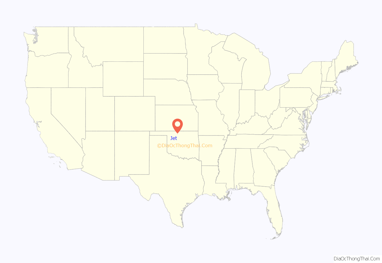
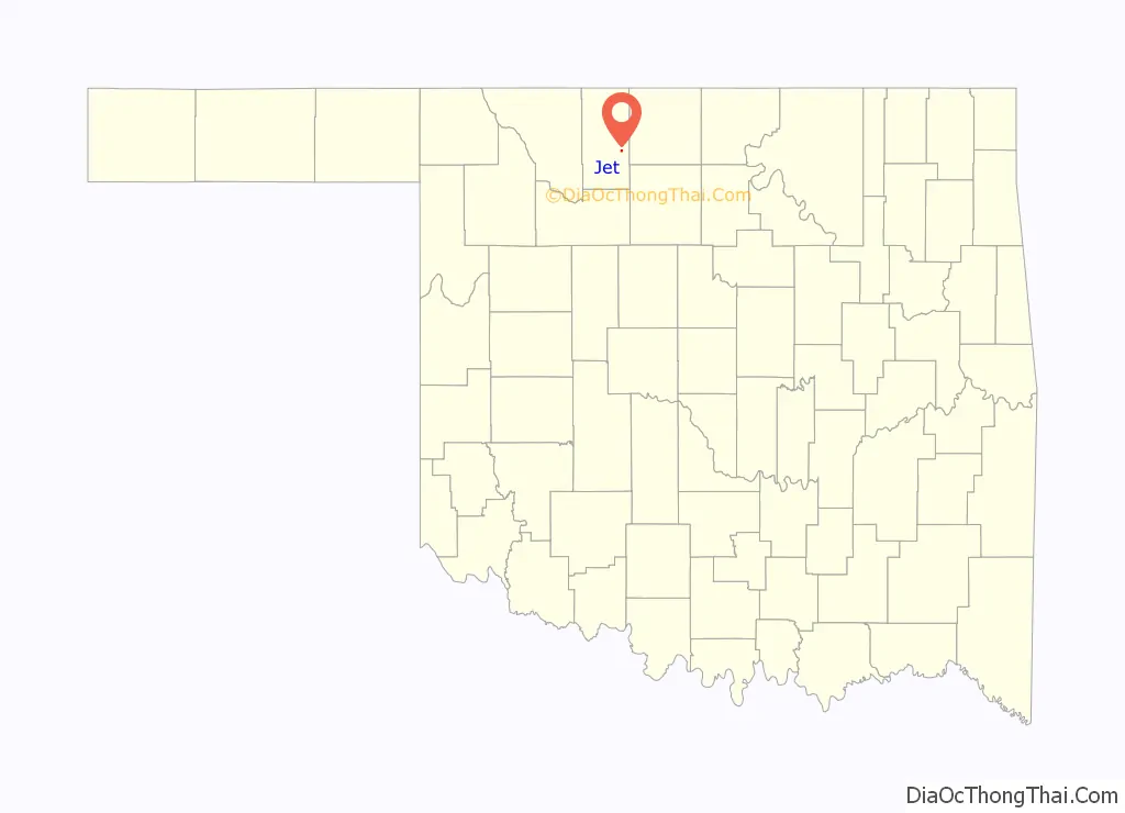
| State: | Oklahoma |
| County: | Alfalfa County |
| Elevation: | 1,243 ft (379 m) |
| Total Area: | 0.27 sq mi (0.70 km²) |
| Land Area: | 0.27 sq mi (0.70 km²) |
| Water Area: | 0.00 sq mi (0.00 km²) |
| Total Population: | 197 |
| Population Density: | 724.26/sq mi (279.91/km²) |
| ZIP code: | 73749 |
| Area code: | 580 |
| FIPS code: | 4038000 |
| GNISfeature ID: | 1094222 |
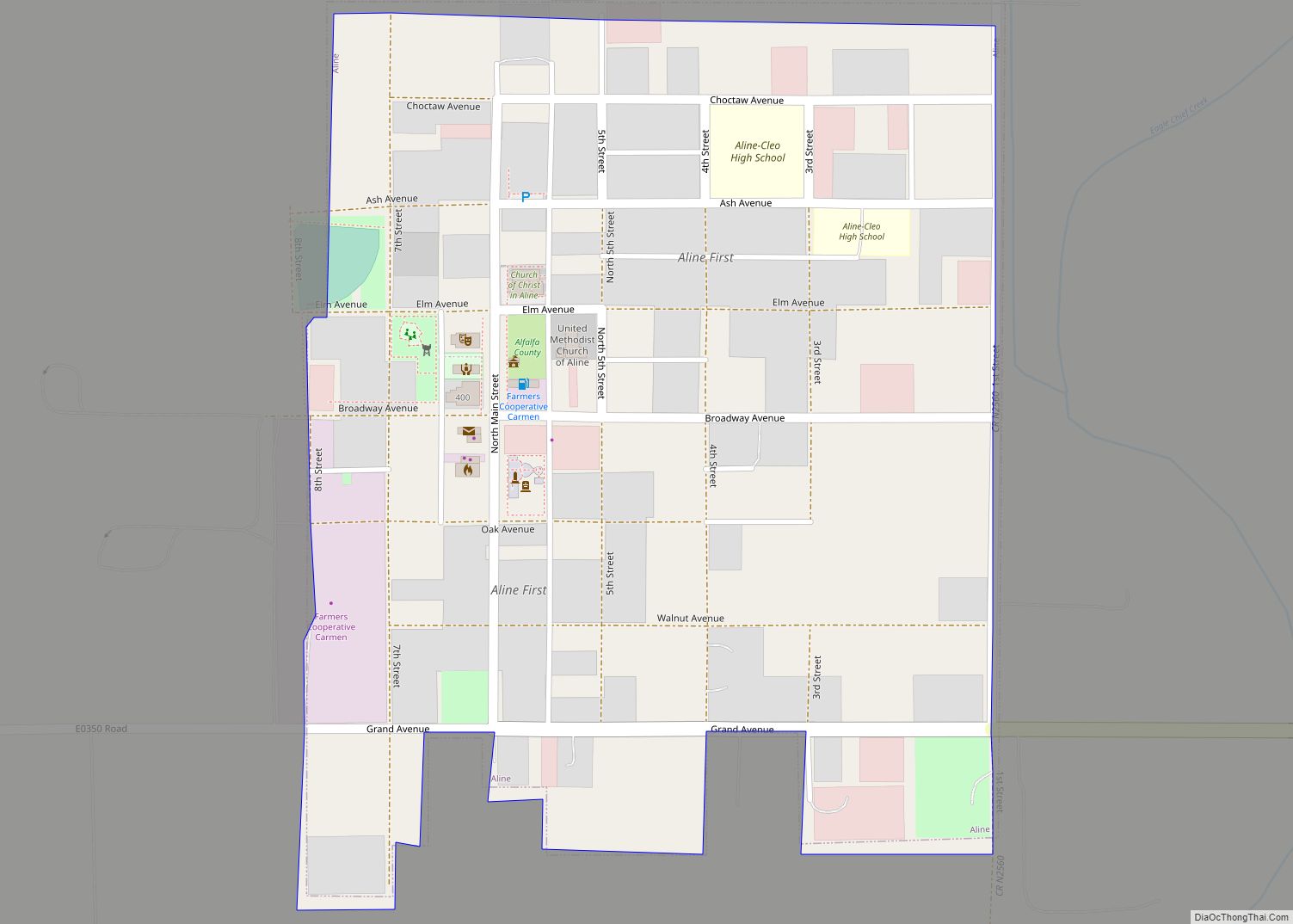
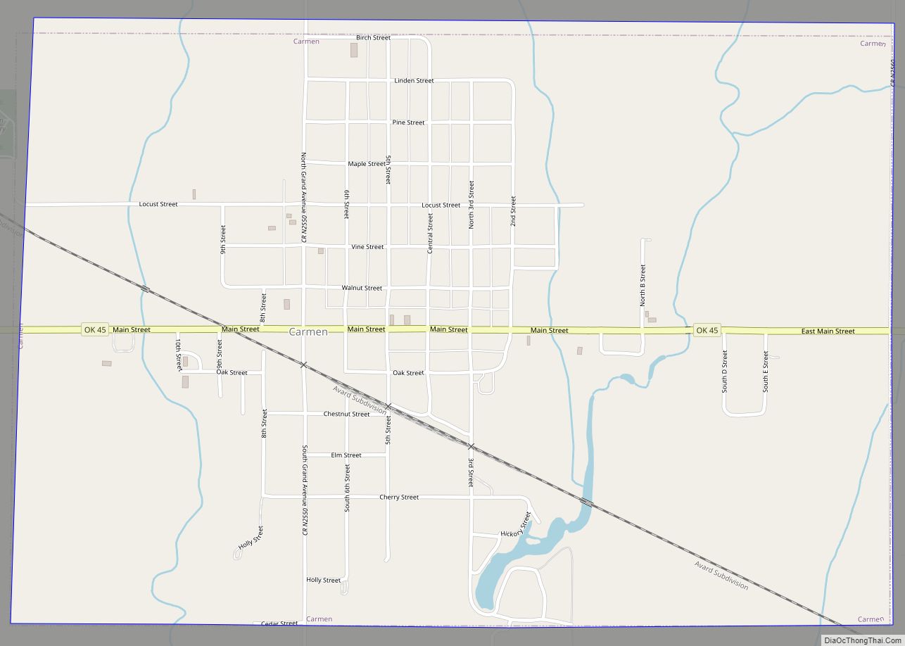
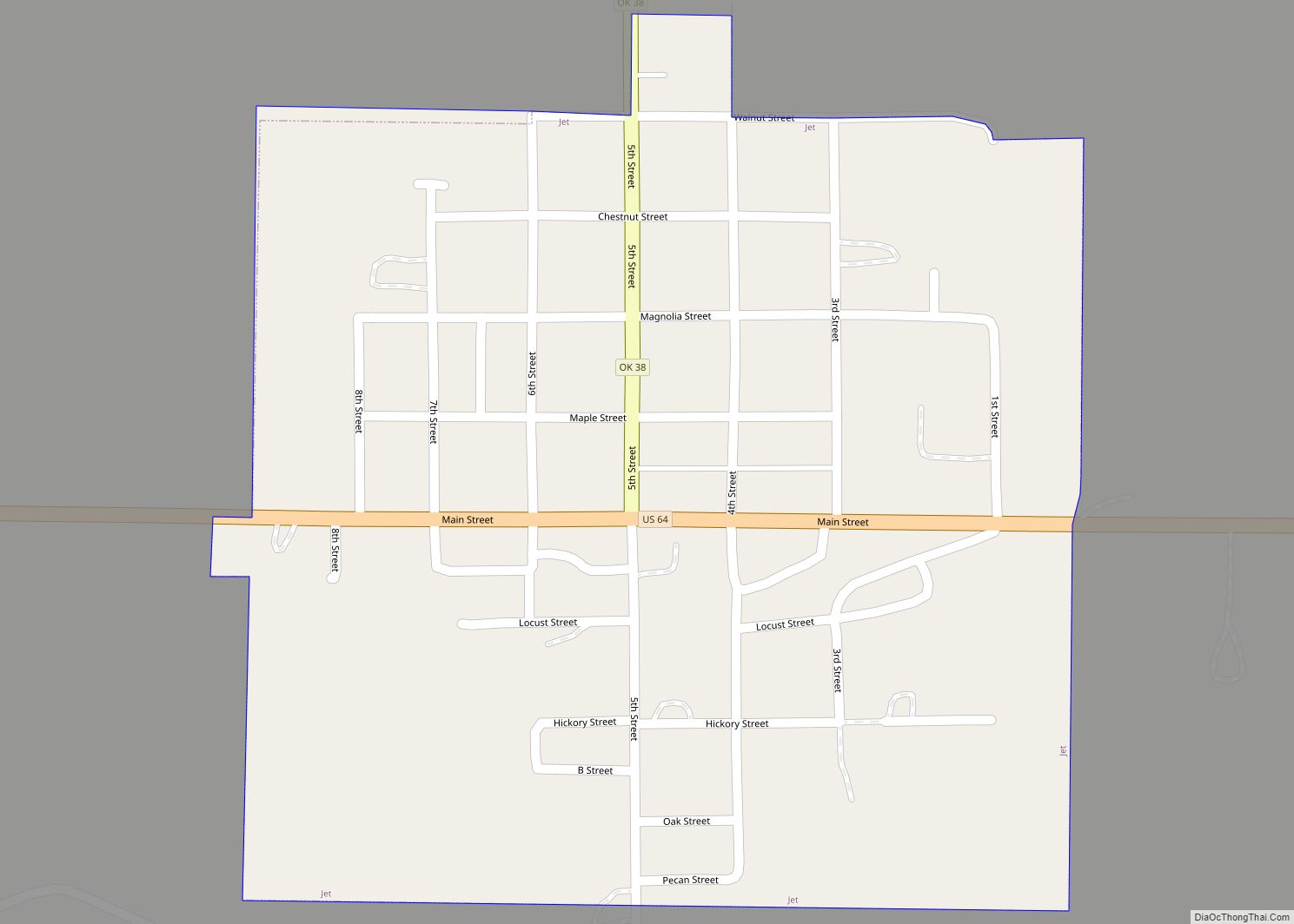
Online Interactive Map
Click on ![]() to view map in "full screen" mode.
to view map in "full screen" mode.
Jet location map. Where is Jet town?
History
The community of Jet was founded by the Jett brothers, six unmarried brothers named Joseph, Trigg, Newt, Warner, John, and Richard Jett, who established homesteads in the former Cherokee Outlet, shortly after its opening to settlement by non-Indians. The brothers erected buildings and opened a general store on Richard’s land. The Jet post office was established in 1894, when it was moved from nearby Barrel Springs which was about 1.5 miles northeast . Warner Jett as the first postmaster. The community grew into a small town, and Jet incorporated in 1900.
The Frisco Townsite Company, owned by the Denver, Enid and Gulf Railroad (DE&G) (acquired by the Atchison, Topeka and Santa Fe Railway in 1907), surveyed a plot of land about 2 miles (3.2 km) west of the original town and relocated Jet during 1905-1906. By August, 1907, the town had Baptist, Mennonite, Methodist, and Presbyterian churches in addition to seven general stores, two banks, two hotels, two grain elevators, plus a small school under construction. At the time of statehood in 1907, Jet had a population of 213 people.
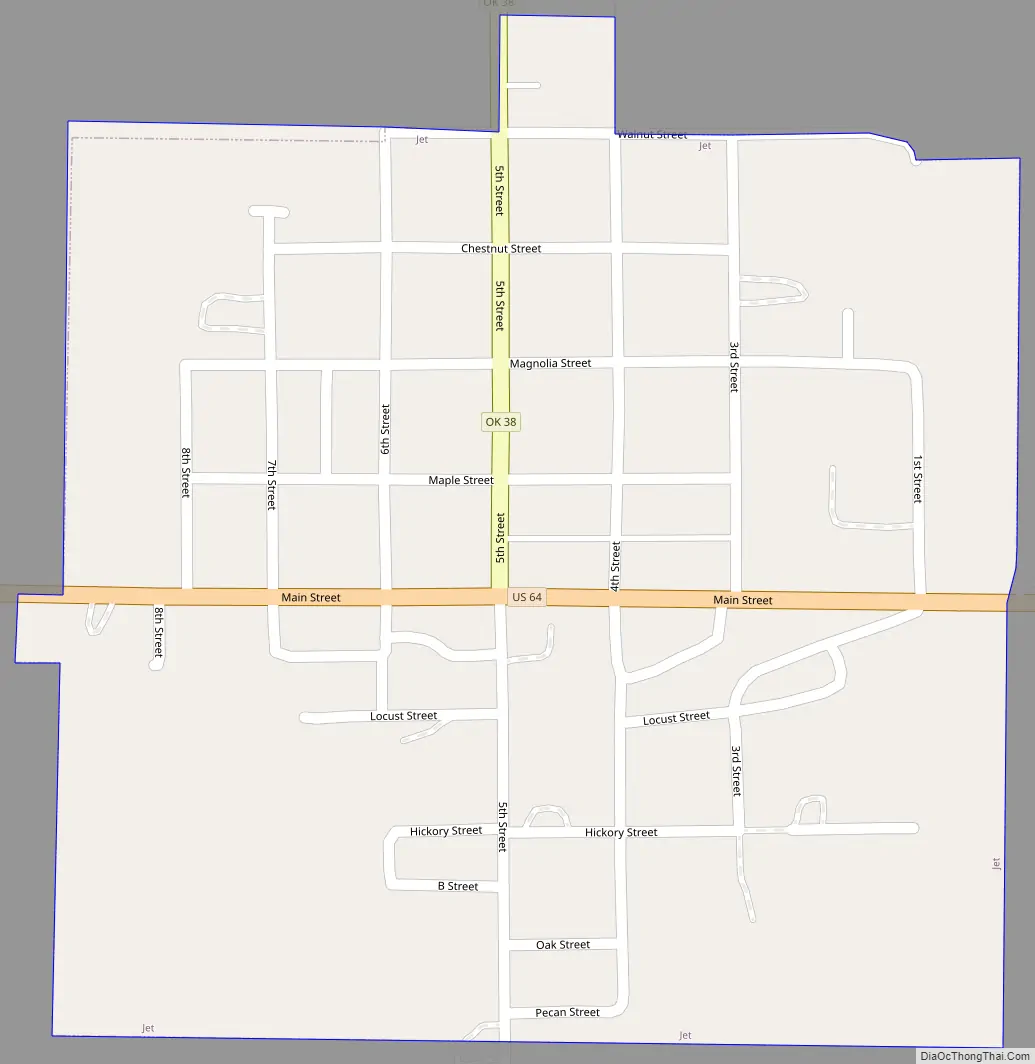
Jet Road Map
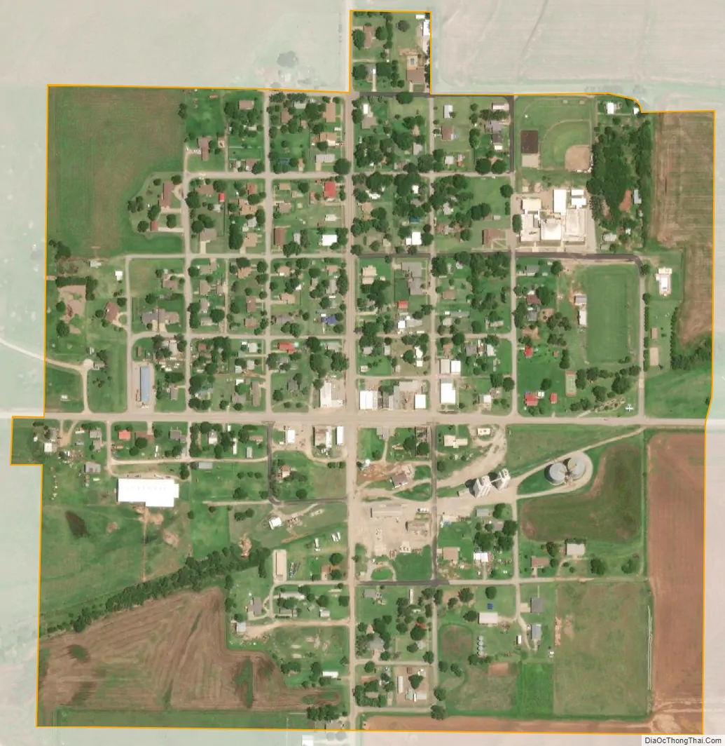
Jet city Satellite Map
Geography
Jet is 12 miles (19 km) east-southeast of the county seat, Cherokee.
Jet is located at the intersection of U.S. Highway 64 and State Highway 38. This intersection is the southern terminus of SH-38.
According to the United States Census Bureau, the town has a total area of 0.3 square miles (0.78 km), all land.
Climate
See also
Map of Oklahoma State and its subdivision:- Adair
- Alfalfa
- Atoka
- Beaver
- Beckham
- Blaine
- Bryan
- Caddo
- Canadian
- Carter
- Cherokee
- Choctaw
- Cimarron
- Cleveland
- Coal
- Comanche
- Cotton
- Craig
- Creek
- Custer
- Delaware
- Dewey
- Ellis
- Garfield
- Garvin
- Grady
- Grant
- Greer
- Harmon
- Harper
- Haskell
- Hughes
- Jackson
- Jefferson
- Johnston
- Kay
- Kingfisher
- Kiowa
- Latimer
- Le Flore
- Lincoln
- Logan
- Love
- Major
- Marshall
- Mayes
- McClain
- McCurtain
- McIntosh
- Murray
- Muskogee
- Noble
- Nowata
- Okfuskee
- Oklahoma
- Okmulgee
- Osage
- Ottawa
- Pawnee
- Payne
- Pittsburg
- Pontotoc
- Pottawatomie
- Pushmataha
- Roger Mills
- Rogers
- Seminole
- Sequoyah
- Stephens
- Texas
- Tillman
- Tulsa
- Wagoner
- Washington
- Washita
- Woods
- Woodward
- Alabama
- Alaska
- Arizona
- Arkansas
- California
- Colorado
- Connecticut
- Delaware
- District of Columbia
- Florida
- Georgia
- Hawaii
- Idaho
- Illinois
- Indiana
- Iowa
- Kansas
- Kentucky
- Louisiana
- Maine
- Maryland
- Massachusetts
- Michigan
- Minnesota
- Mississippi
- Missouri
- Montana
- Nebraska
- Nevada
- New Hampshire
- New Jersey
- New Mexico
- New York
- North Carolina
- North Dakota
- Ohio
- Oklahoma
- Oregon
- Pennsylvania
- Rhode Island
- South Carolina
- South Dakota
- Tennessee
- Texas
- Utah
- Vermont
- Virginia
- Washington
- West Virginia
- Wisconsin
- Wyoming