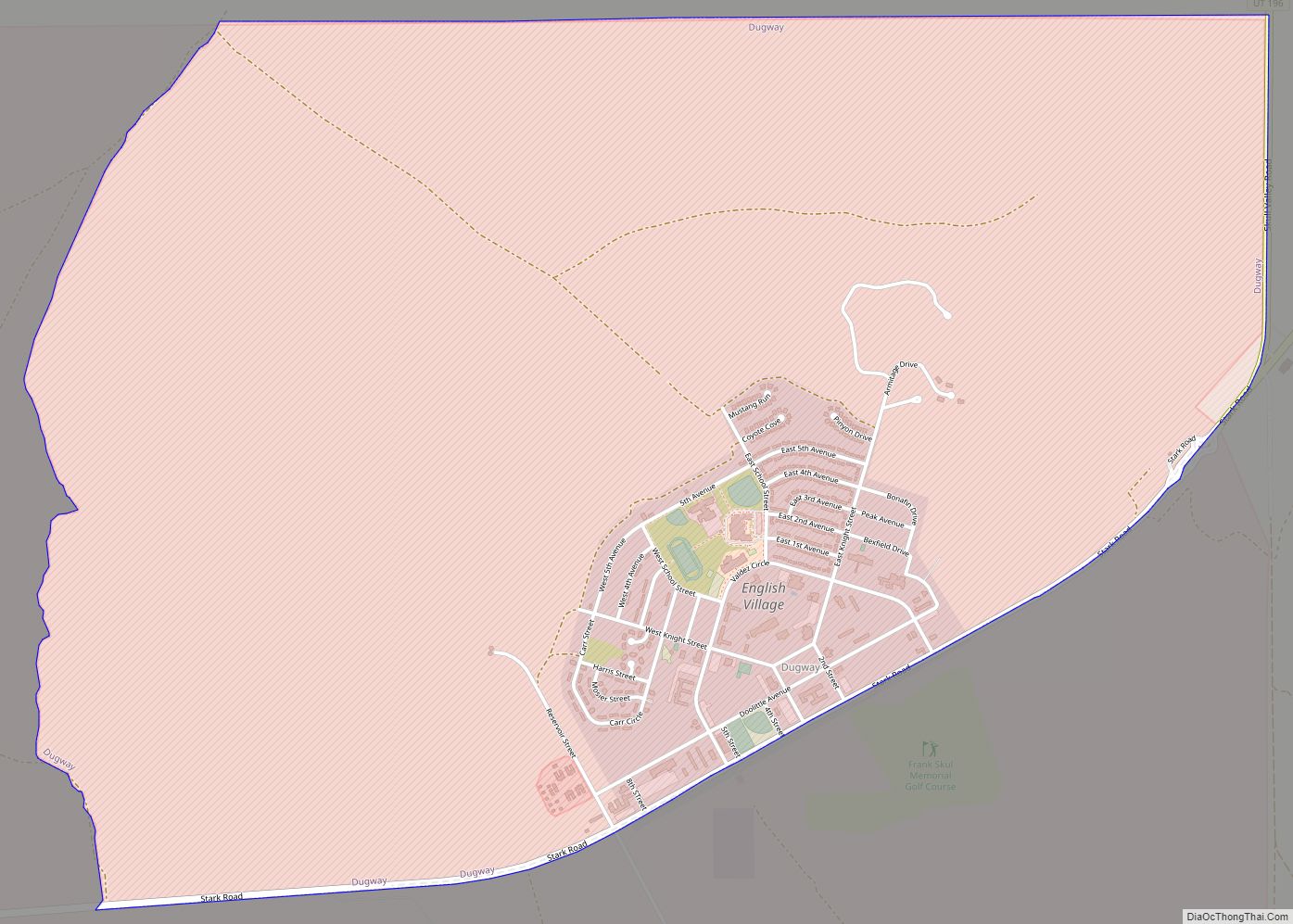
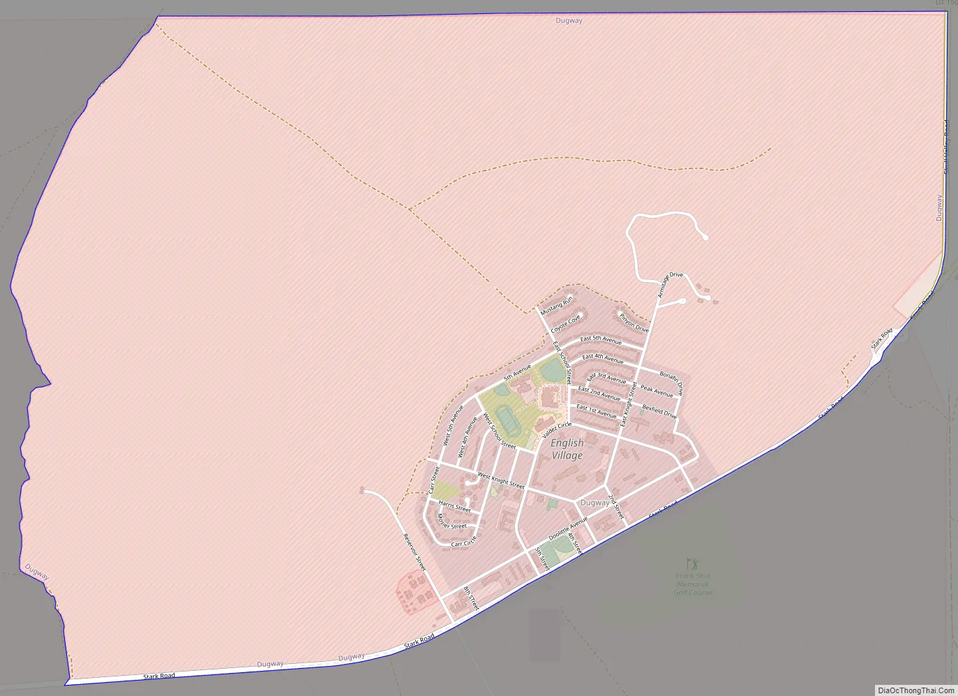
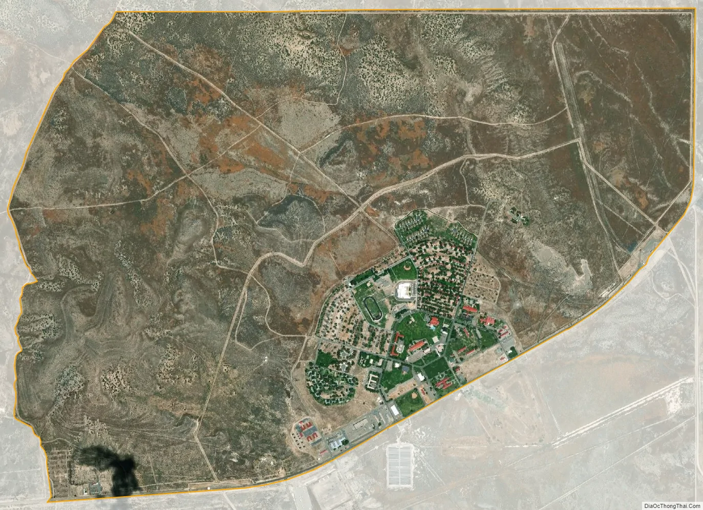
Dugway is a census-designated place (CDP) in southeastern Tooele County, Utah, United States. The population was 2,016, at the 2000 census, a modest increase over the 1990 figure of 1,761. The town is located inside the United States Army’s large weapons testing facility, Dugway Proving Ground, making it a closed city, as the only roads leading to the town pass through military checkpoints at the boundaries of the base. Non-resident civilians must request advance authorization to enter the town. The housing area designated for military and civilian personnel is referred to as “English Village.”
The name “Dugway” comes from a technique to dig a trench along a hillside to keep a wagon from tipping.
| Name: | Dugway CDP |
|---|---|
| LSAD Code: | 57 |
| LSAD Description: | CDP (suffix) |
| State: | Utah |
| County: | Tooele County |
| Total Area: | 5.2 sq mi (13.5 km²) |
| Land Area: | 5.2 sq mi (13.5 km²) |
| Water Area: | 0.0 sq mi (0.0 km²) |
| Total Population: | 2,016 |
| Population Density: | 387.4/sq mi (149.6/km²) |
| ZIP code: | 84022 |
| Area code: | 435 |
| FIPS code: | 4920450 |
Online Interactive Map
Click on ![]() to view map in "full screen" mode.
to view map in "full screen" mode.
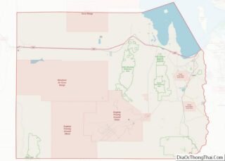
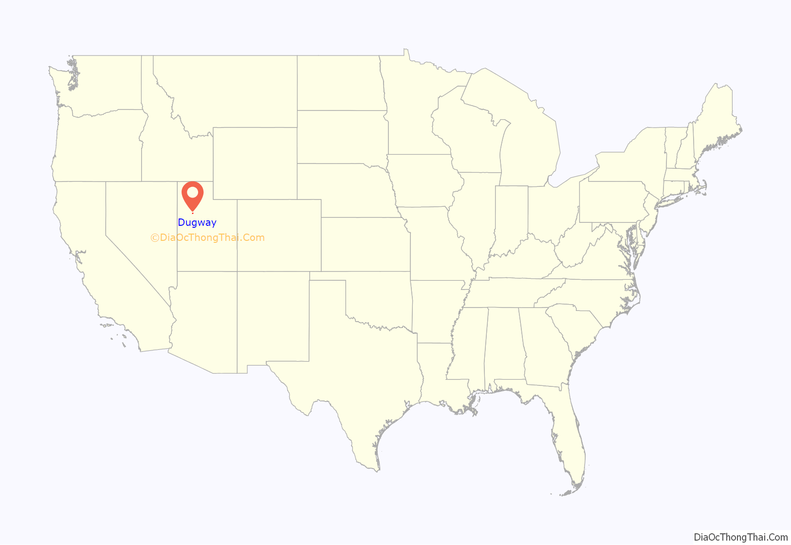
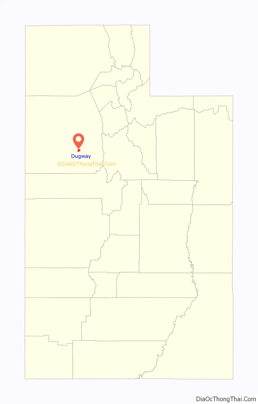
Dugway location map. Where is Dugway CDP?
Dugway Road Map
Dugway city Satellite Map
Geography
According to the United States Census Bureau, the CDP has a total area of 5.2 square miles (13.5 km), all land.
Climate
According to the Köppen Climate Classification system, Dugway has a semi-arid climate, abbreviated “BSk” on climate maps.
See also
Map of Utah State and its subdivision: Map of other states:- Alabama
- Alaska
- Arizona
- Arkansas
- California
- Colorado
- Connecticut
- Delaware
- District of Columbia
- Florida
- Georgia
- Hawaii
- Idaho
- Illinois
- Indiana
- Iowa
- Kansas
- Kentucky
- Louisiana
- Maine
- Maryland
- Massachusetts
- Michigan
- Minnesota
- Mississippi
- Missouri
- Montana
- Nebraska
- Nevada
- New Hampshire
- New Jersey
- New Mexico
- New York
- North Carolina
- North Dakota
- Ohio
- Oklahoma
- Oregon
- Pennsylvania
- Rhode Island
- South Carolina
- South Dakota
- Tennessee
- Texas
- Utah
- Vermont
- Virginia
- Washington
- West Virginia
- Wisconsin
- Wyoming