Howell is a town located in the Blue Creek Valley in northeast Box Elder County, Utah, United States. The population was 245 at the 2010 census.
| Name: | Howell town |
|---|---|
| LSAD Code: | 43 |
| LSAD Description: | town (suffix) |
| State: | Utah |
| County: | Box Elder County |
| Incorporated: | 1941 |
| Elevation: | 4,561 ft (1,390 m) |
| Total Area: | 35.47 sq mi (91.87 km²) |
| Land Area: | 35.27 sq mi (91.36 km²) |
| Water Area: | 0.20 sq mi (0.51 km²) |
| Total Population: | 245 |
| Population Density: | 7.20/sq mi (2.78/km²) |
| ZIP code: | 84316 |
| Area code: | 435 |
| FIPS code: | 4936620 |
| GNISfeature ID: | 1437591 |
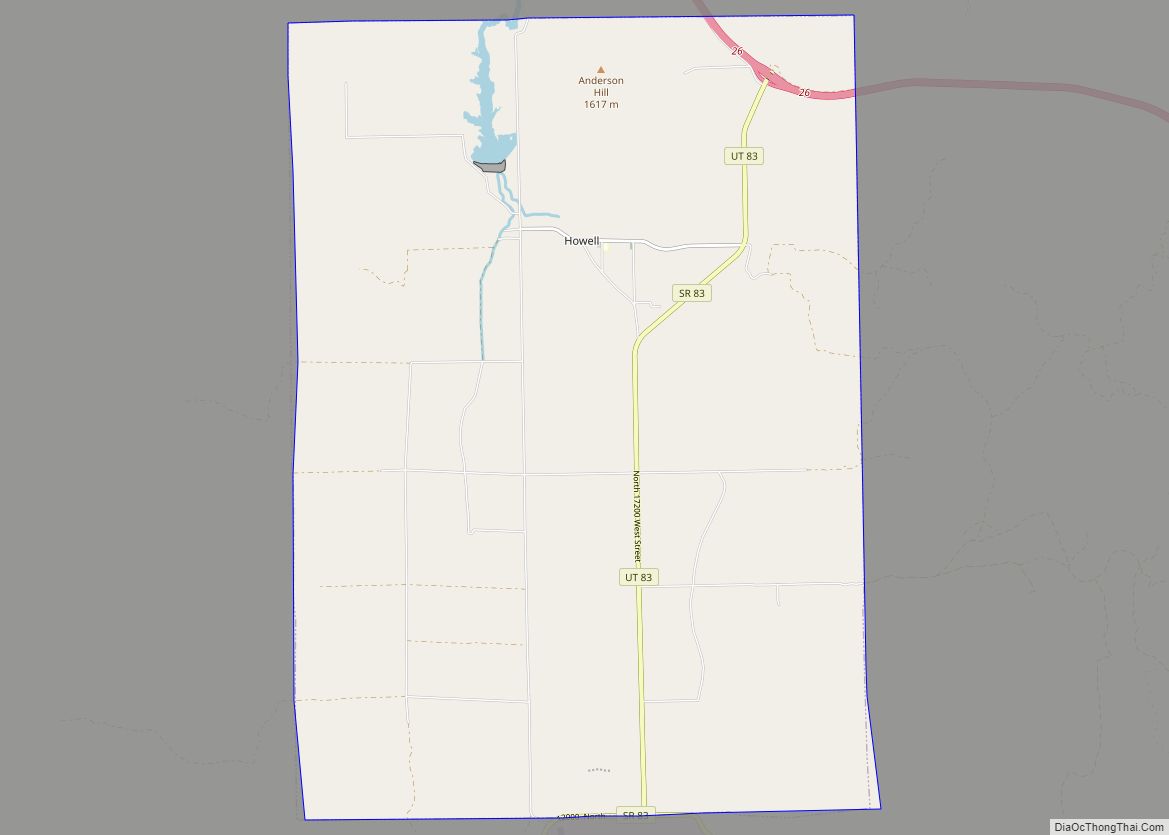
Online Interactive Map
Click on ![]() to view map in "full screen" mode.
to view map in "full screen" mode.
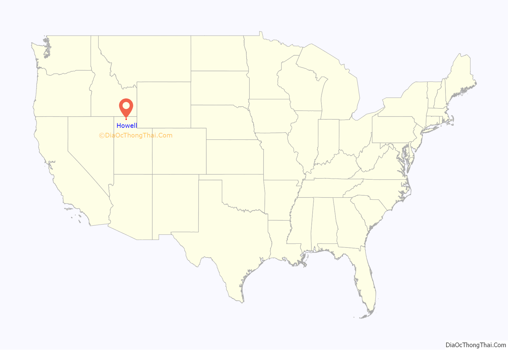
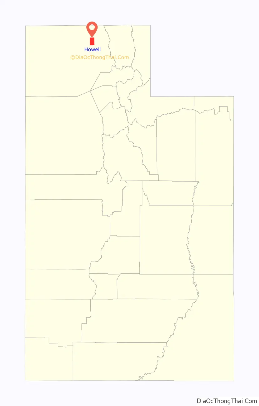
Howell location map. Where is Howell town?
History
Howell lies in the Blue Creek Valley that stretches north-south between four mountain ranges, Promontory Mountains, south, North Promontory Mountains, west, West Hills, northeast, and Blue Spring Hills, southeast. The northeast Great Salt Lake lies to the south of Howell, and north of Howell finds Interstate 84, roughly the area known to locals as Blue Creek. Nomadic Shoshone Indians used the area to travel between the Great Salt Lake and areas to the north.
Charles Crocker, a California developer and business man oversaw development of the First transcontinental railroad, which passed through Promontory, about 10 miles (16 km) south of Howell. The Golden Spike was driven near Promontory (at Lampo) in 1869. Crocker formed the Promontory Land and Livestock Company in this time period, which had land holdings that stretched from the Great Salt Lake north to Idaho, and west to Nevada. The area was used for cattle ranching, with headquarters in Promontory, Howell, and the Dilly Ranch. The company disbanded in 1909.
In 1909 the newly created Promontory-Curlew Land Company purchased the Promontory Land and Livestock Company’s Utah and Idaho land holdings. Howell is named after Utah Congressman Joseph Howell who was involved with the Promontory-Curlew Land Company.
In 1910 Nephi Nessen purchased 1,000 acres (4.0 km) from the Promontory-Curlew Land Company, and established the first private and permanent residence in Howell. Nessen was born in Logan, Utah in 1867, the son of Danish immigrants and converts to the Church of Jesus Christ of Latter-day Saints who crossed the plains from the east as part of a Handcart company. Other settler families included Andersen, Baxter, Cravens, Gunnell, Bailey, Carlsen, Douglas, Fonnesbeck, Rock, Wood, Allen, Barber, and Maughn.
The Bar M Ranch was headquartered near what is now the town center. A school was opened in 1910 in a Bar M Ranch building. In 1911, a new school was opened (pictured above), which has now been converted into a community center. In 1980, a modern school was built for kindergarten through third grades, but closed in 2008.
In 1904, the Blue Creek Reservoir was built on Blue Creek, 1 mile (1.6 km) northwest of Howell. However, the reservoir is now located almost entirely within the town limits
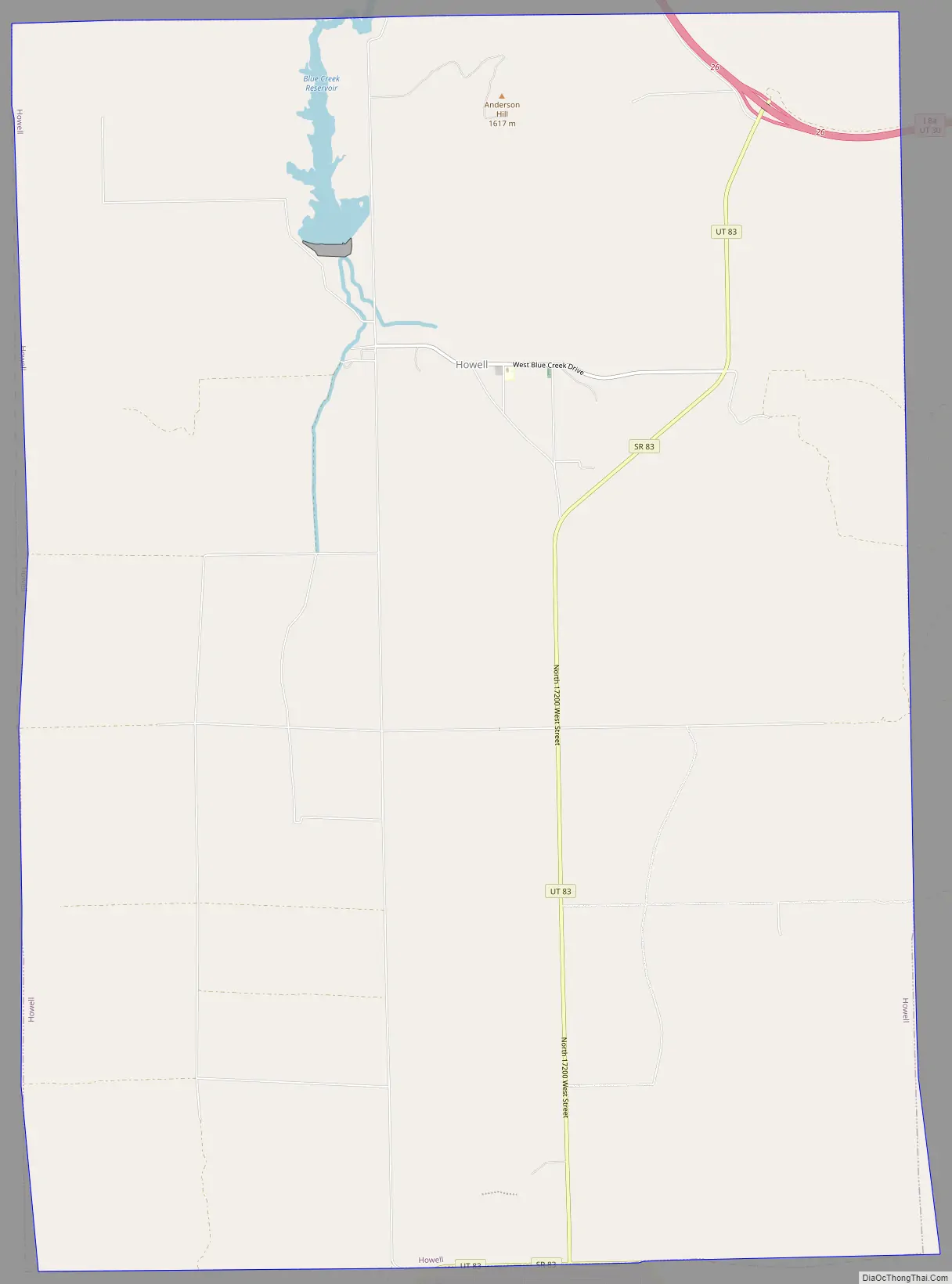
Howell Road Map
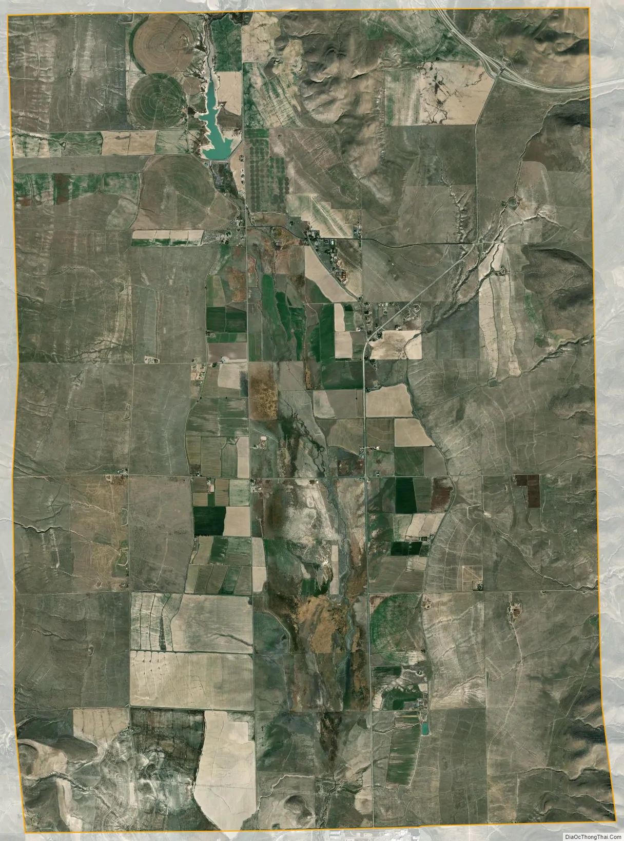
Howell city Satellite Map
Geography
According to the United States Census Bureau, the town has a total area of 35.6 square miles (92 km), of which 35.4 square miles (92 km) is land and 0.2 square miles (0.52 km) (0.56%) is water.
See also
Map of Utah State and its subdivision: Map of other states:- Alabama
- Alaska
- Arizona
- Arkansas
- California
- Colorado
- Connecticut
- Delaware
- District of Columbia
- Florida
- Georgia
- Hawaii
- Idaho
- Illinois
- Indiana
- Iowa
- Kansas
- Kentucky
- Louisiana
- Maine
- Maryland
- Massachusetts
- Michigan
- Minnesota
- Mississippi
- Missouri
- Montana
- Nebraska
- Nevada
- New Hampshire
- New Jersey
- New Mexico
- New York
- North Carolina
- North Dakota
- Ohio
- Oklahoma
- Oregon
- Pennsylvania
- Rhode Island
- South Carolina
- South Dakota
- Tennessee
- Texas
- Utah
- Vermont
- Virginia
- Washington
- West Virginia
- Wisconsin
- Wyoming