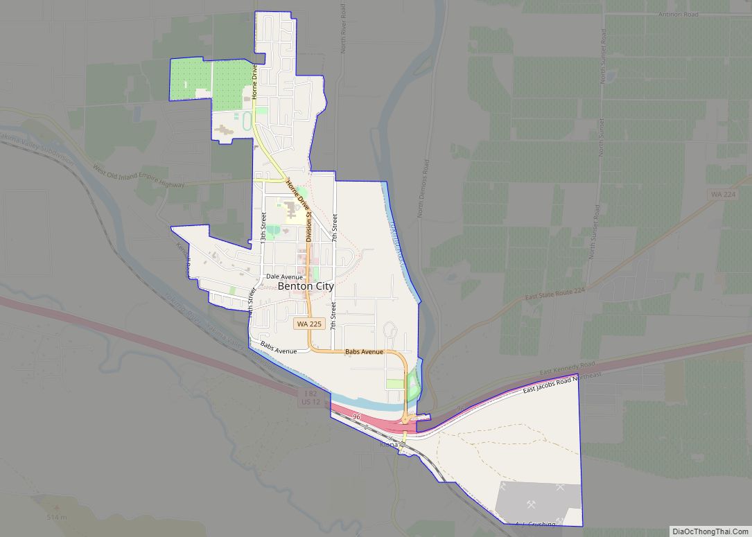
Benton City is a city in Benton County, Washington, United States. The population was 3,479 at the 2020 census. The city shares a school district with the adjacent unincorporated community of Kiona.
| Name: | Benton City city |
|---|---|
| LSAD Code: | 25 |
| LSAD Description: | city (suffix) |
| State: | Washington |
| County: | Benton County |
| Elevation: | 499 ft (152 m) |
| Total Area: | 2.53 sq mi (6.56 km²) |
| Land Area: | 2.47 sq mi (6.39 km²) |
| Water Area: | 0.07 sq mi (0.17 km²) |
| Total Population: | 3,479 |
| Population Density: | 1,416.13/sq mi (546.79/km²) |
| ZIP code: | 99320 |
| Area code: | 509 |
| FIPS code: | 5305560 |
| GNISfeature ID: | 1503314 |
| Website: | ci.benton-city.wa.us |
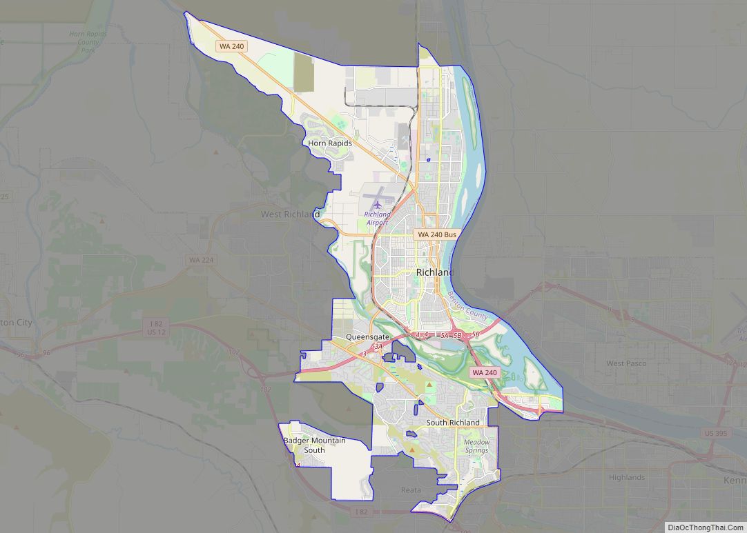
Online Interactive Map
Click on ![]() to view map in "full screen" mode.
to view map in "full screen" mode.
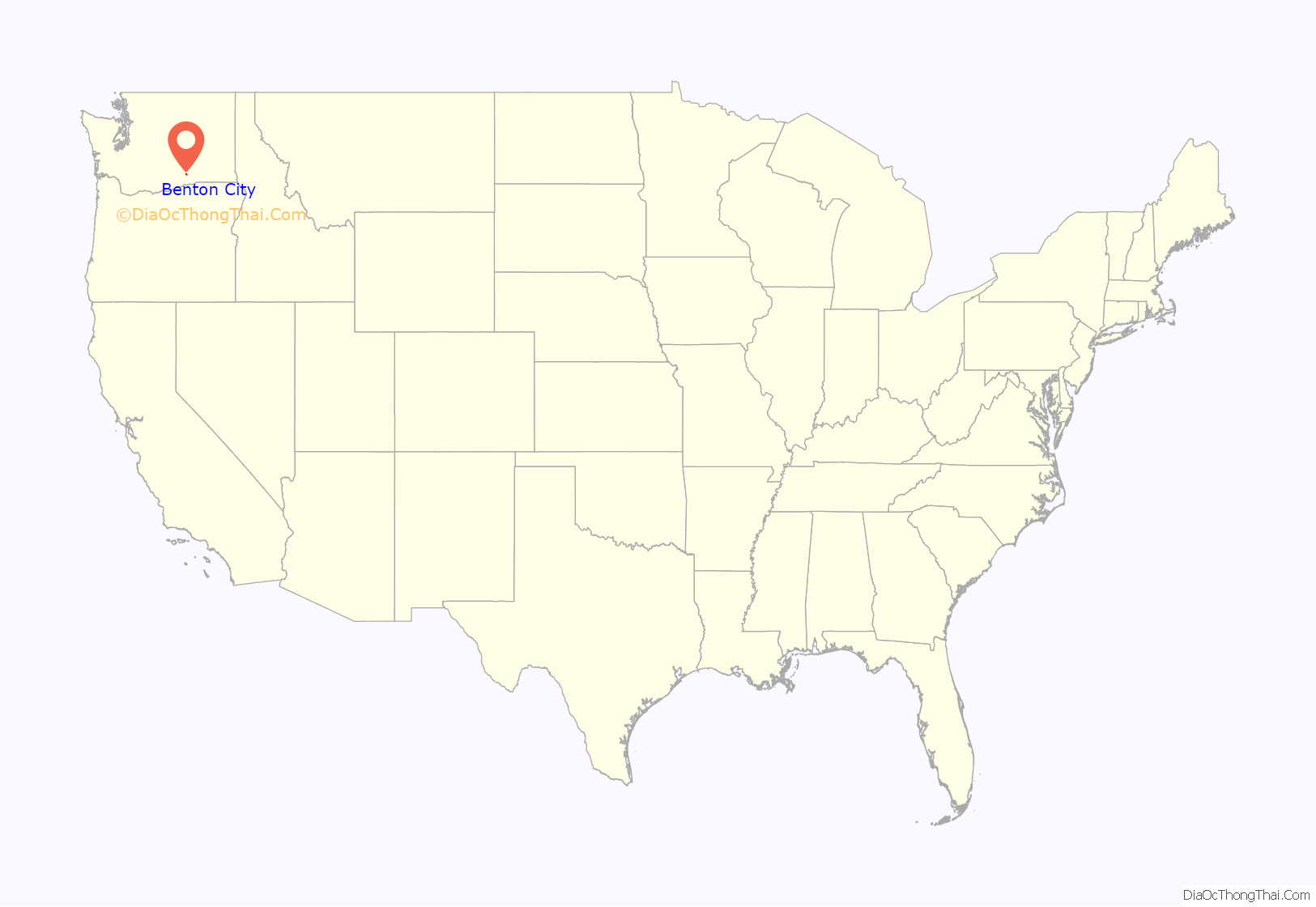
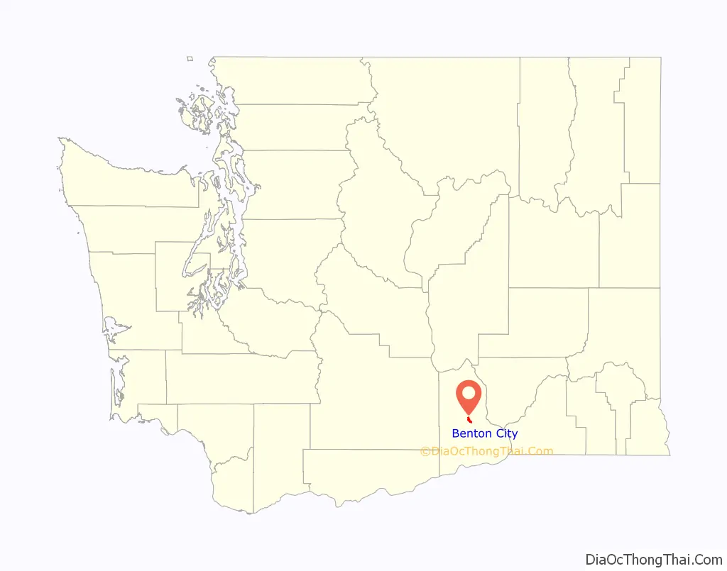
Benton City location map. Where is Benton City city?
History
Pre-incorporation
Benton City was originally platted by the North Coast Railroad in 1909. The line was originally conceived as the North Coast Railroad in 1909, then came under ownership of the Oregon Washington Railroad and Navigation Company in 1913 when North Coast was merged with Oregon Railroad and Navigation Company before becoming part of the Union Pacific Railroad. [1] It took its name from Benton S. Groscup (and not the county’s namesake), who was influential in the separation of Benton County from Yakima County. Freight and passenger depots were built by the railroad in 1910.
Post-incorporation
The town was officially incorporated July 2, 1945. Irrigation water was brought to the area via the Sunnyside Canal in 1947, allowing the area to grow considerably.
In 2002, the Benton City – Kiona Bridge over the Yakima River at Benton City was added to the National Register of Historic Places.
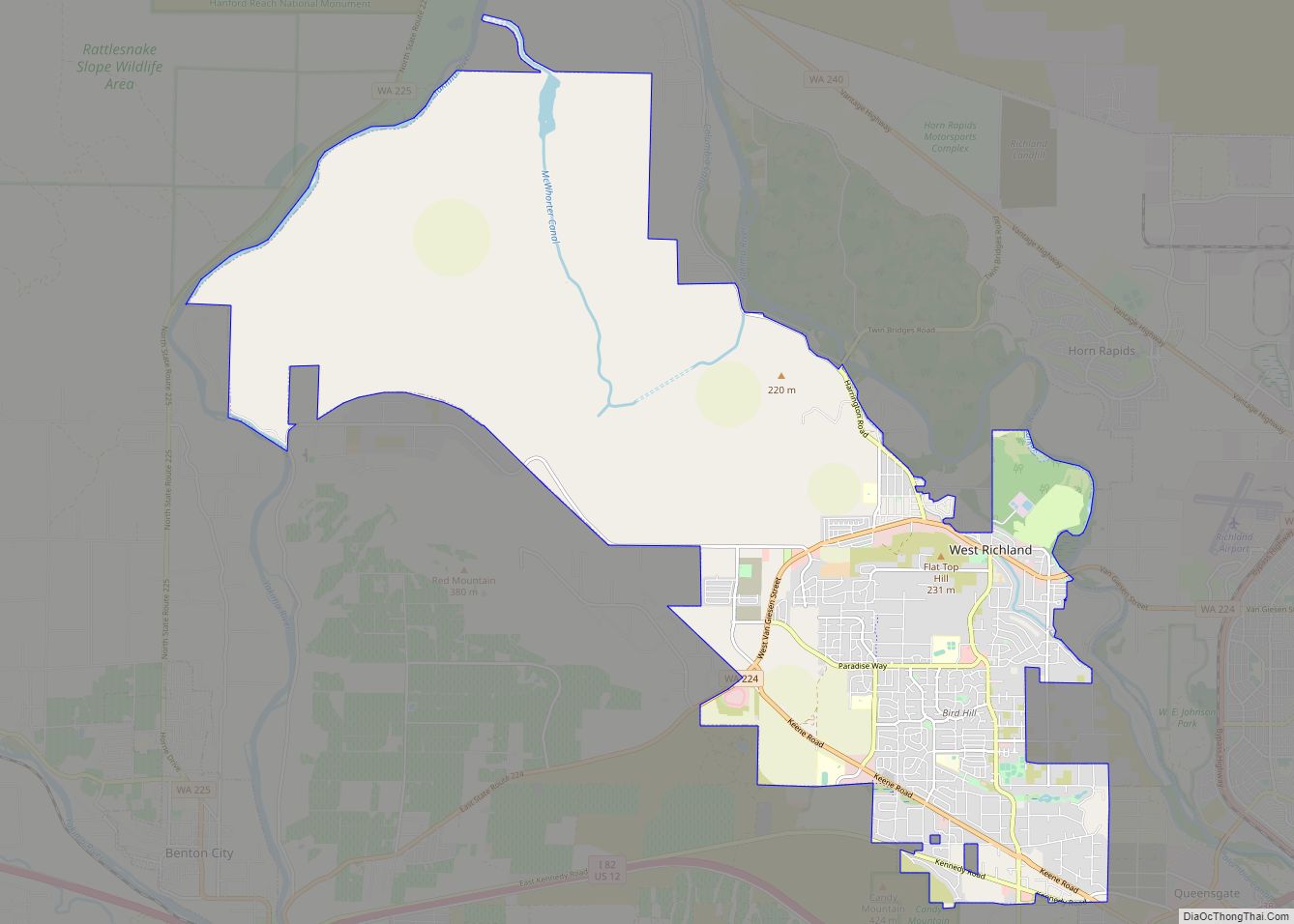
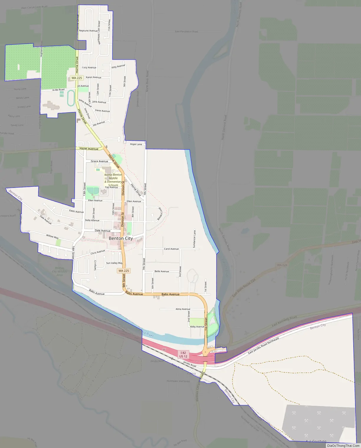
Benton City Road Map
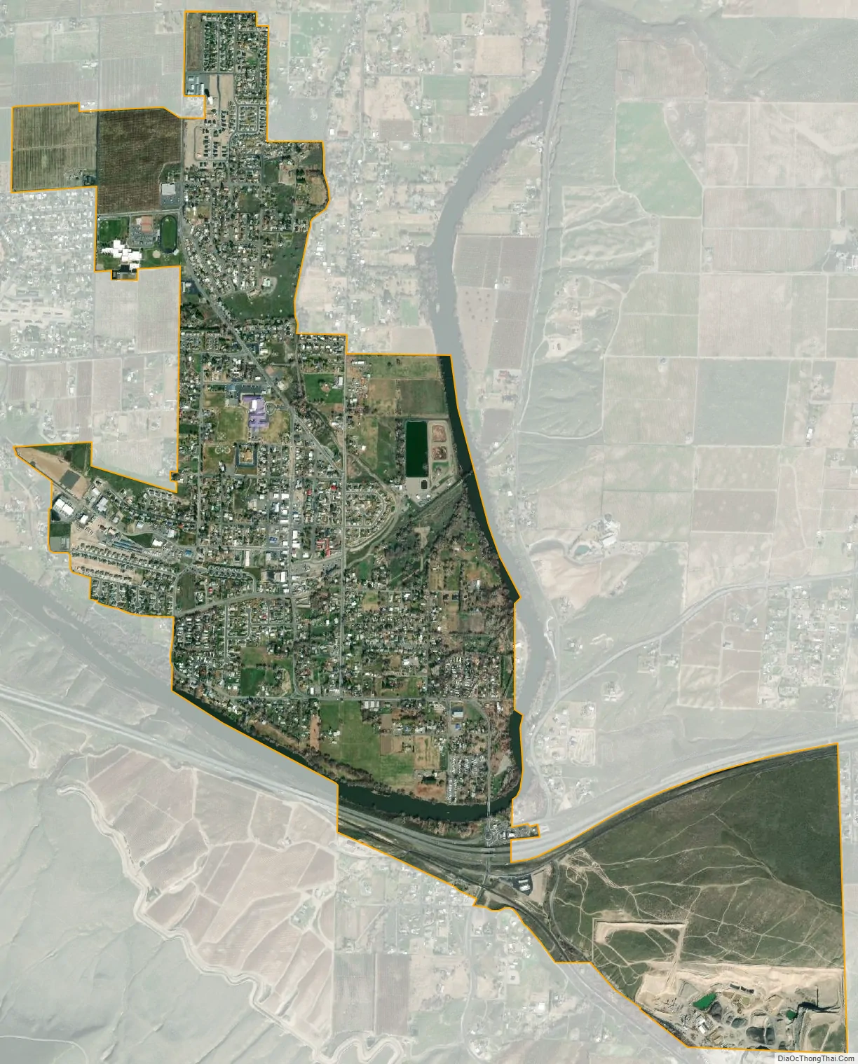
Benton City city Satellite Map
Geography
Benton City is located near the center of Benton County at 46°16′4″N 119°29′18″W / 46.26778°N 119.48833°W / 46.26778; -119.48833 (46.267872, -119.488230). It is situated on the inside of a bend on the north side of the Yakima River. The unincorporated community of Kiona is along the southern border of the city.
Interstate 82 and U.S. Route 12 pass through Benton City south of the Yakima River, with access from Exit 96. It is 22 miles (35 km) east to downtown Kennewick on the Columbia River and 65 miles (105 km) northwest to Yakima.
According to the United States Census Bureau, Benton City has a total area of 2.49 square miles (6.45 km), of which 2.46 square miles (6.37 km) is land and 0.03 square miles (0.08 km) is water.
Topography
Climate
See also
Map of Washington State and its subdivision:- Adams
- Asotin
- Benton
- Chelan
- Clallam
- Clark
- Columbia
- Cowlitz
- Douglas
- Ferry
- Franklin
- Garfield
- Grant
- Grays Harbor
- Island
- Jefferson
- King
- Kitsap
- Kittitas
- Klickitat
- Lewis
- Lincoln
- Mason
- Okanogan
- Pacific
- Pend Oreille
- Pierce
- San Juan
- Skagit
- Skamania
- Snohomish
- Spokane
- Stevens
- Thurston
- Wahkiakum
- Walla Walla
- Whatcom
- Whitman
- Yakima
- Alabama
- Alaska
- Arizona
- Arkansas
- California
- Colorado
- Connecticut
- Delaware
- District of Columbia
- Florida
- Georgia
- Hawaii
- Idaho
- Illinois
- Indiana
- Iowa
- Kansas
- Kentucky
- Louisiana
- Maine
- Maryland
- Massachusetts
- Michigan
- Minnesota
- Mississippi
- Missouri
- Montana
- Nebraska
- Nevada
- New Hampshire
- New Jersey
- New Mexico
- New York
- North Carolina
- North Dakota
- Ohio
- Oklahoma
- Oregon
- Pennsylvania
- Rhode Island
- South Carolina
- South Dakota
- Tennessee
- Texas
- Utah
- Vermont
- Virginia
- Washington
- West Virginia
- Wisconsin
- Wyoming