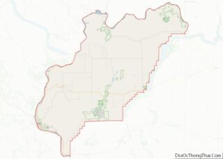
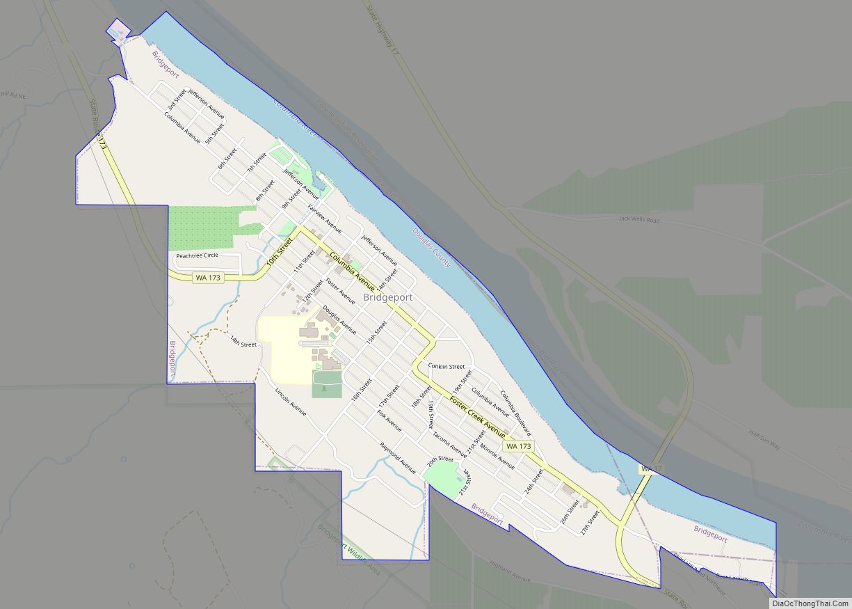
Bridgeport is a city in Douglas County, Washington. It is part of the Wenatchee−East Wenatchee Metropolitan Statistical Area. Bridgeport’s population was 2,409 at the 2010 census. Bridgeport is located near the Chief Joseph Dam.
| Name: | Bridgeport city |
|---|---|
| LSAD Code: | 25 |
| LSAD Description: | city (suffix) |
| State: | Washington |
| County: | Douglas County |
| Elevation: | 850 ft (259 m) |
| Total Area: | 1.30 sq mi (3.36 km²) |
| Land Area: | 1.07 sq mi (2.78 km²) |
| Water Area: | 0.23 sq mi (0.59 km²) |
| Total Population: | 2,409 |
| Population Density: | 2,437.50/sq mi (940.75/km²) |
| ZIP code: | 98813 |
| Area code: | 509 |
| FIPS code: | 5307870 |
| GNISfeature ID: | 1503541 |
Online Interactive Map
Click on ![]() to view map in "full screen" mode.
to view map in "full screen" mode.
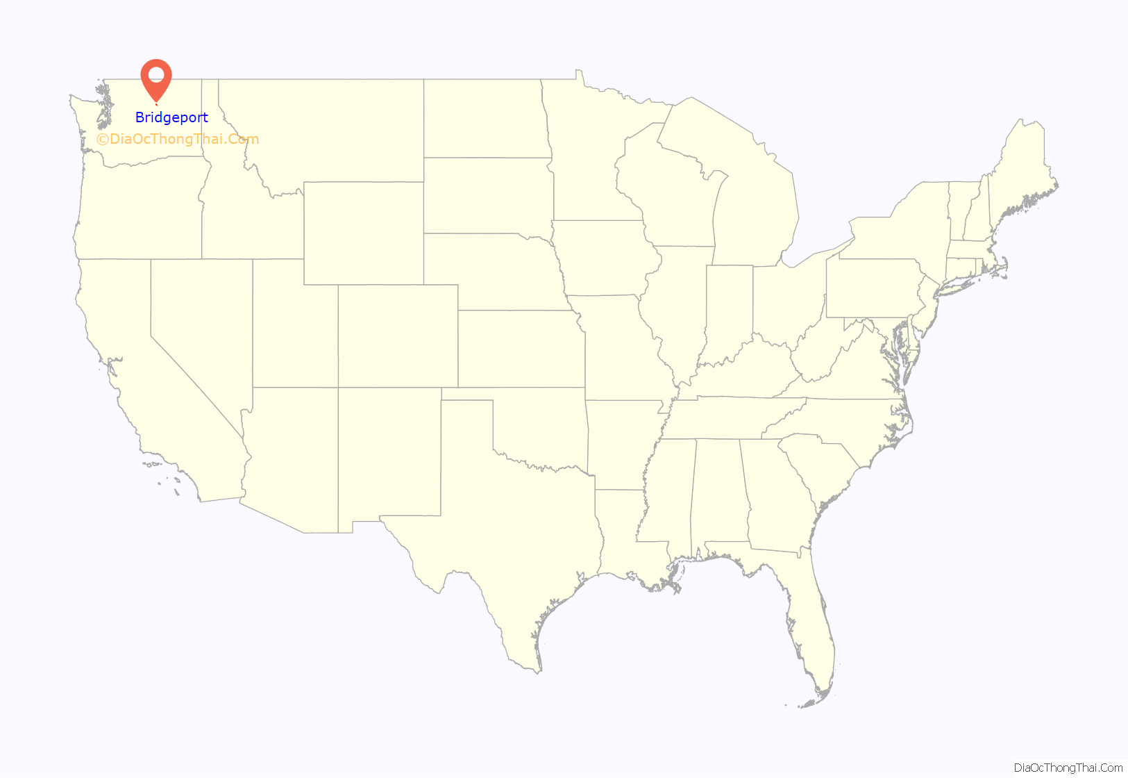
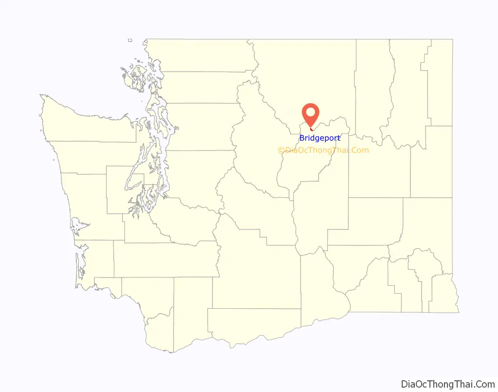
Bridgeport location map. Where is Bridgeport city?
History
The area that is now Bridgeport was settled in the late 19th century and originally named Westfield. Some of the earliest settlers in the area were Chinese miners extracting gold from the banks of the Columbia River. Developers purchased the town in 1892 and renamed it Bridgeport after where they had come from, Bridgeport, Connecticut. The city of Bridgeport was officially incorporated on March 21, 1910. The biggest economic boom to come to the city came from the building of the massive Foster Creek Dam, later renamed the Chief Joseph Dam, just upstream from the city limits.
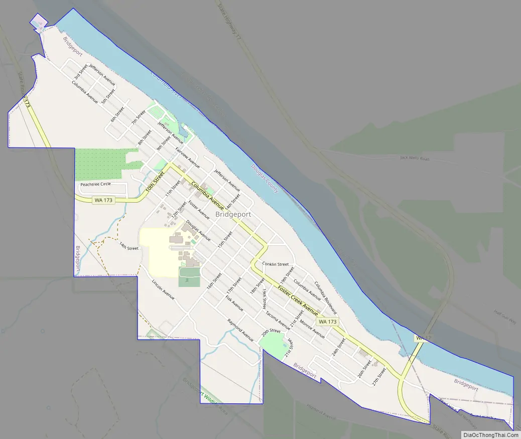
Bridgeport Road Map
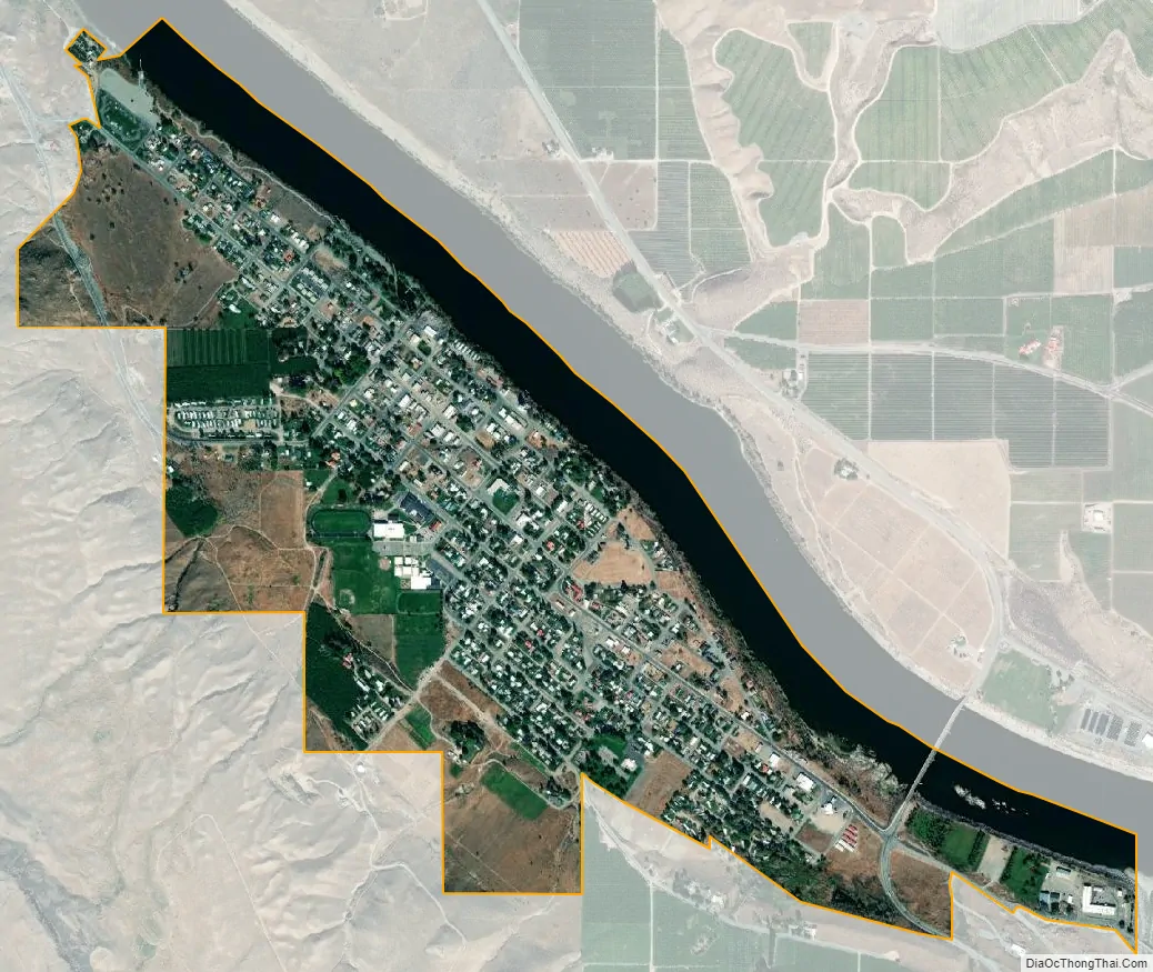
Bridgeport city Satellite Map
Geography
Bridgeport is located at 48°0′22″N 119°40′18″W / 48.00611°N 119.67167°W / 48.00611; -119.67167 (48.006238, -119.671540).
According to the United States Census Bureau, the city has a total area of 1.05 square miles (2.72 km), all of it land. Bridgeport has over 1½ miles of Columbia River Waterfront that is within the City Limits. Bridgeport is currently experiencing expansion and development of waterfront properties with a re-newed energy.
Chief Joseph Dam is located upstream about 1½ miles upstream from Bridgeport. Bridgeport is located directly adjacent to the Okanogan County border connected by the north-south Rufus Woods Lake. Its nearby recreational tourism destination is situated in Okanogan County north of the city.
See also
Map of Washington State and its subdivision:- Adams
- Asotin
- Benton
- Chelan
- Clallam
- Clark
- Columbia
- Cowlitz
- Douglas
- Ferry
- Franklin
- Garfield
- Grant
- Grays Harbor
- Island
- Jefferson
- King
- Kitsap
- Kittitas
- Klickitat
- Lewis
- Lincoln
- Mason
- Okanogan
- Pacific
- Pend Oreille
- Pierce
- San Juan
- Skagit
- Skamania
- Snohomish
- Spokane
- Stevens
- Thurston
- Wahkiakum
- Walla Walla
- Whatcom
- Whitman
- Yakima
- Alabama
- Alaska
- Arizona
- Arkansas
- California
- Colorado
- Connecticut
- Delaware
- District of Columbia
- Florida
- Georgia
- Hawaii
- Idaho
- Illinois
- Indiana
- Iowa
- Kansas
- Kentucky
- Louisiana
- Maine
- Maryland
- Massachusetts
- Michigan
- Minnesota
- Mississippi
- Missouri
- Montana
- Nebraska
- Nevada
- New Hampshire
- New Jersey
- New Mexico
- New York
- North Carolina
- North Dakota
- Ohio
- Oklahoma
- Oregon
- Pennsylvania
- Rhode Island
- South Carolina
- South Dakota
- Tennessee
- Texas
- Utah
- Vermont
- Virginia
- Washington
- West Virginia
- Wisconsin
- Wyoming