Brinnon is a census-designated place (CDP) in Jefferson County, Washington, United States. The population was 797 at the 2010 census. The community is named for Ewell P. Brinnon, who in 1860 took a donation land claim at the mouth of the Duckabush River. Its known landmarks include Dosewallips State Park and Black Point Marina. Camp Parsons, founded in 1919 and the oldest Boy Scout camp west of the Mississippi River, sits just outside the north end of the CDP.
| Name: | Brinnon CDP |
|---|---|
| LSAD Code: | 57 |
| LSAD Description: | CDP (suffix) |
| State: | Washington |
| County: | Jefferson County |
| Elevation: | 56 ft (17 m) |
| Total Area: | 9.86 sq mi (25.54 km²) |
| Land Area: | 9.61 sq mi (24.89 km²) |
| Water Area: | 0.25 sq mi (0.66 km²) |
| Total Population: | 797 |
| Population Density: | 83/sq mi (32.0/km²) |
| ZIP code: | 98320 |
| Area code: | 360 |
| FIPS code: | 5308080 |
| GNISfeature ID: | 1516959 |
Online Interactive Map
Click on ![]() to view map in "full screen" mode.
to view map in "full screen" mode.
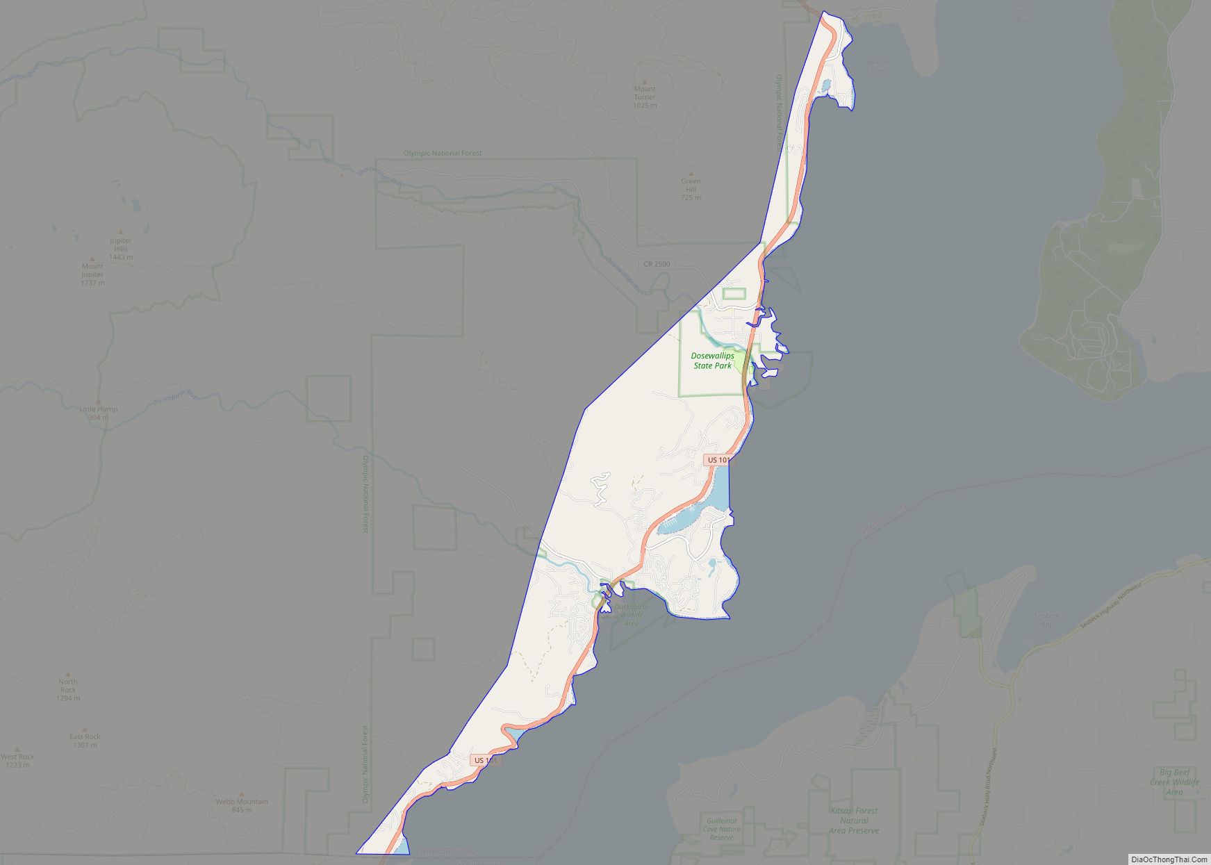
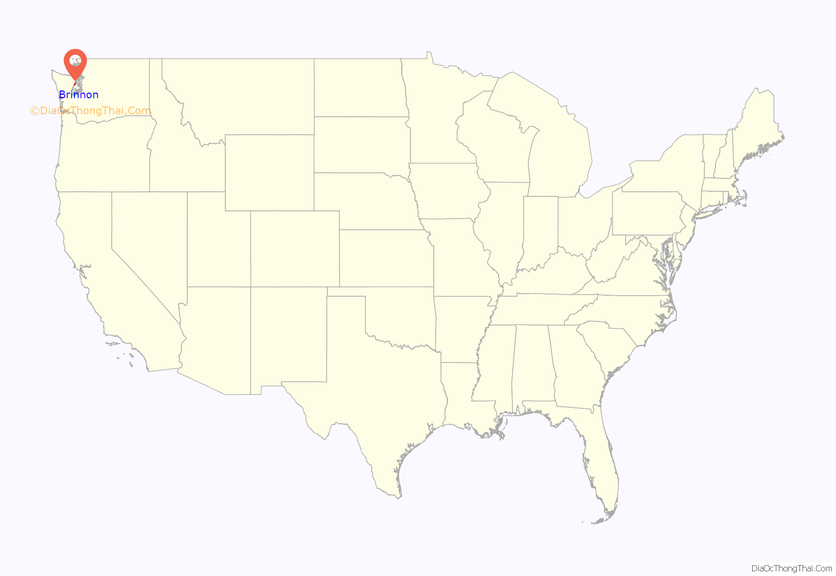
Brinnon location map. Where is Brinnon CDP?
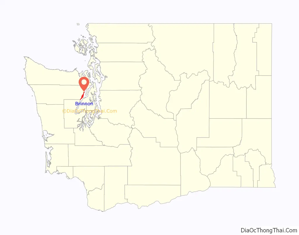
Brinnon Road Map
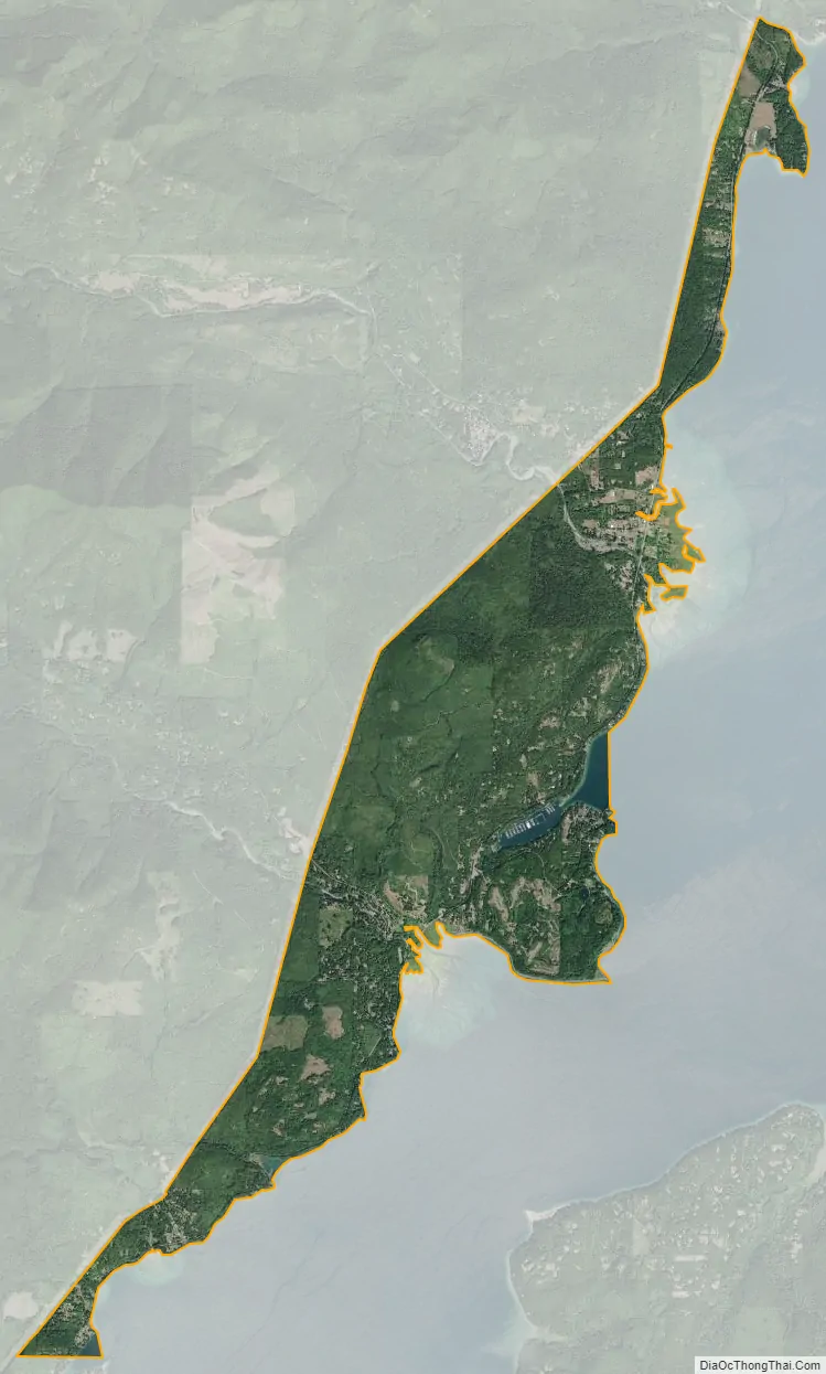
Brinnon city Satellite Map
Geography
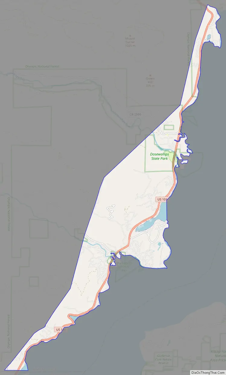
Brinnon is located at 47°39′56″N 122°55′30″W / 47.66556°N 122.92500°W / 47.66556; -122.92500 (47.665652, -122.924952), approximately 61 miles (98 km) north of Olympia, on the Olympic Peninsula’s east side. It sits on the west side of Hood Canal on the eastern edge of the Olympic National Forest. U.S. Route 101 runs the length of the community, leading south to Olympia and north 59 miles (95 km) to Port Angeles.
According to the United States Census Bureau, the CDP has a total area of 9.8 square miles (25.5 km), of which 9.6 square miles (24.9 km) are land and 0.3 square miles (0.7 km), or 2.57%, are water. The CDP extends from Wawa Point in the north, just south of Jackson Cove, to the Mason County line in the south at Triton Cove, and includes the unincorporated communities (from north to south) of Seal Rock, Brinnon, and Duckabush. The Dosewallips River crosses the north-central part of the CDP and enters Hood Canal at Brinnon Flats just north of the settlement of Brinnon, while the Duckabush River crosses the south-central part of the CDP, entering Hood Canal at Duckabush village, just south of Black Point.
Climate
Brinnon experiences an oceanic climate (Köppen climate classification Cfb) and is almost categorised as part of the Csb climate category, receiving slightly more than 30 mm (1.2 in), the threshold for Cfb inclusion.
See also
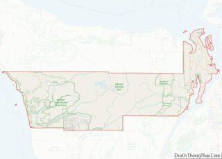
Map of Washington State and its subdivision:- Adams
- Asotin
- Benton
- Chelan
- Clallam
- Clark
- Columbia
- Cowlitz
- Douglas
- Ferry
- Franklin
- Garfield
- Grant
- Grays Harbor
- Island
- Jefferson
- King
- Kitsap
- Kittitas
- Klickitat
- Lewis
- Lincoln
- Mason
- Okanogan
- Pacific
- Pend Oreille
- Pierce
- San Juan
- Skagit
- Skamania
- Snohomish
- Spokane
- Stevens
- Thurston
- Wahkiakum
- Walla Walla
- Whatcom
- Whitman
- Yakima
- Alabama
- Alaska
- Arizona
- Arkansas
- California
- Colorado
- Connecticut
- Delaware
- District of Columbia
- Florida
- Georgia
- Hawaii
- Idaho
- Illinois
- Indiana
- Iowa
- Kansas
- Kentucky
- Louisiana
- Maine
- Maryland
- Massachusetts
- Michigan
- Minnesota
- Mississippi
- Missouri
- Montana
- Nebraska
- Nevada
- New Hampshire
- New Jersey
- New Mexico
- New York
- North Carolina
- North Dakota
- Ohio
- Oklahoma
- Oregon
- Pennsylvania
- Rhode Island
- South Carolina
- South Dakota
- Tennessee
- Texas
- Utah
- Vermont
- Virginia
- Washington
- West Virginia
- Wisconsin
- Wyoming