Cle Elum (/kli ˈɛləm/ klee ELL-um) is a city in Kittitas County, Washington, United States. The population was 1,872 at the 2010 census. About 84 miles (135 km) by car from Seattle, Cle Elum is a popular area for camping and outdoor activities.
| Name: | Cle Elum city |
|---|---|
| LSAD Code: | 25 |
| LSAD Description: | city (suffix) |
| State: | Washington |
| County: | Kittitas County |
| Founded: | February 12, 1902 |
| Elevation: | 1,909 ft (582 m) |
| Land Area: | 4.49 sq mi (11.63 km²) |
| Water Area: | 0.01 sq mi (0.01 km²) |
| Population Density: | 453.57/sq mi (175.12/km²) |
| ZIP code: | 98922 |
| Area code: | 509 |
| FIPS code: | 5312945 |
| GNISfeature ID: | 1517819 |
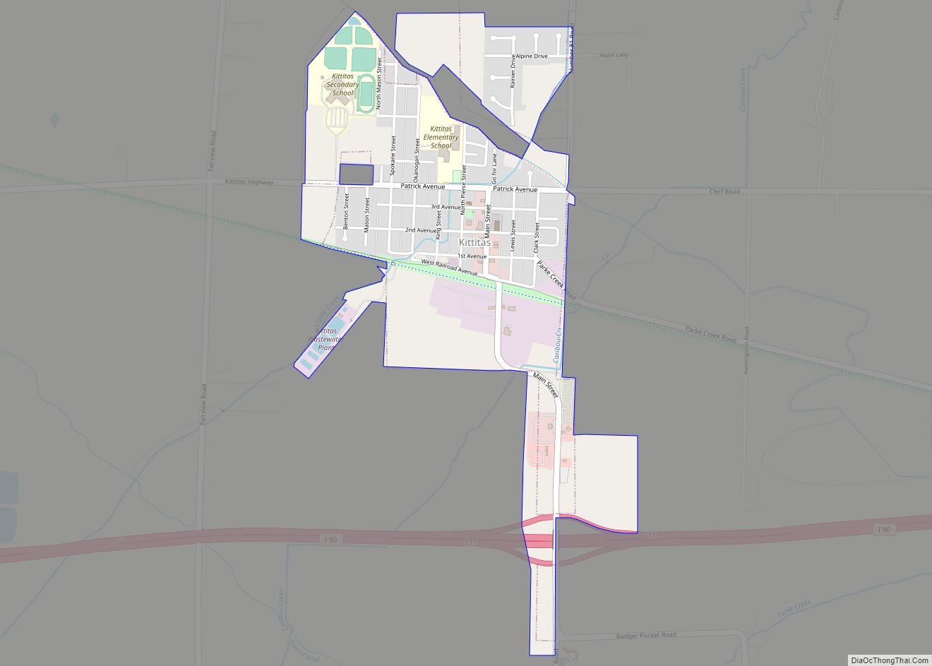
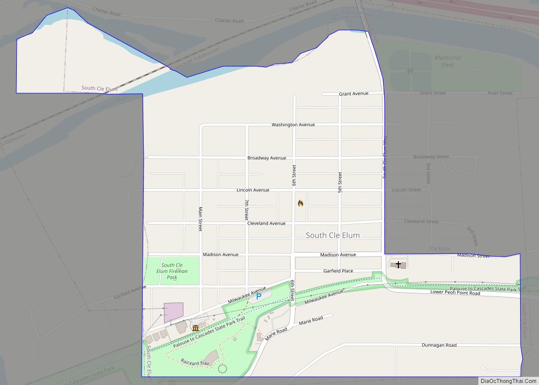
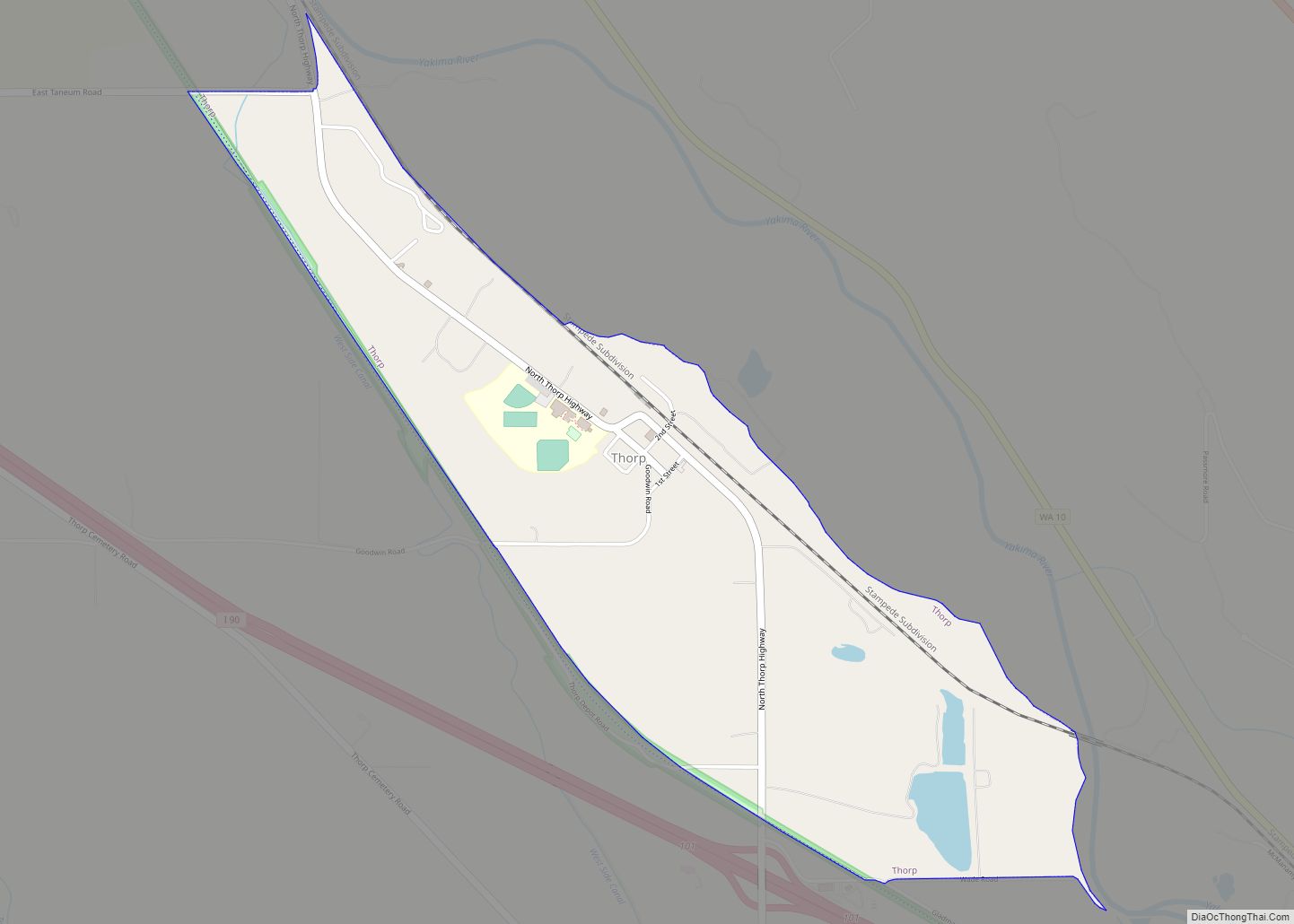
Online Interactive Map
Click on ![]() to view map in "full screen" mode.
to view map in "full screen" mode.
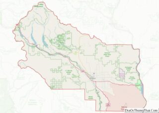
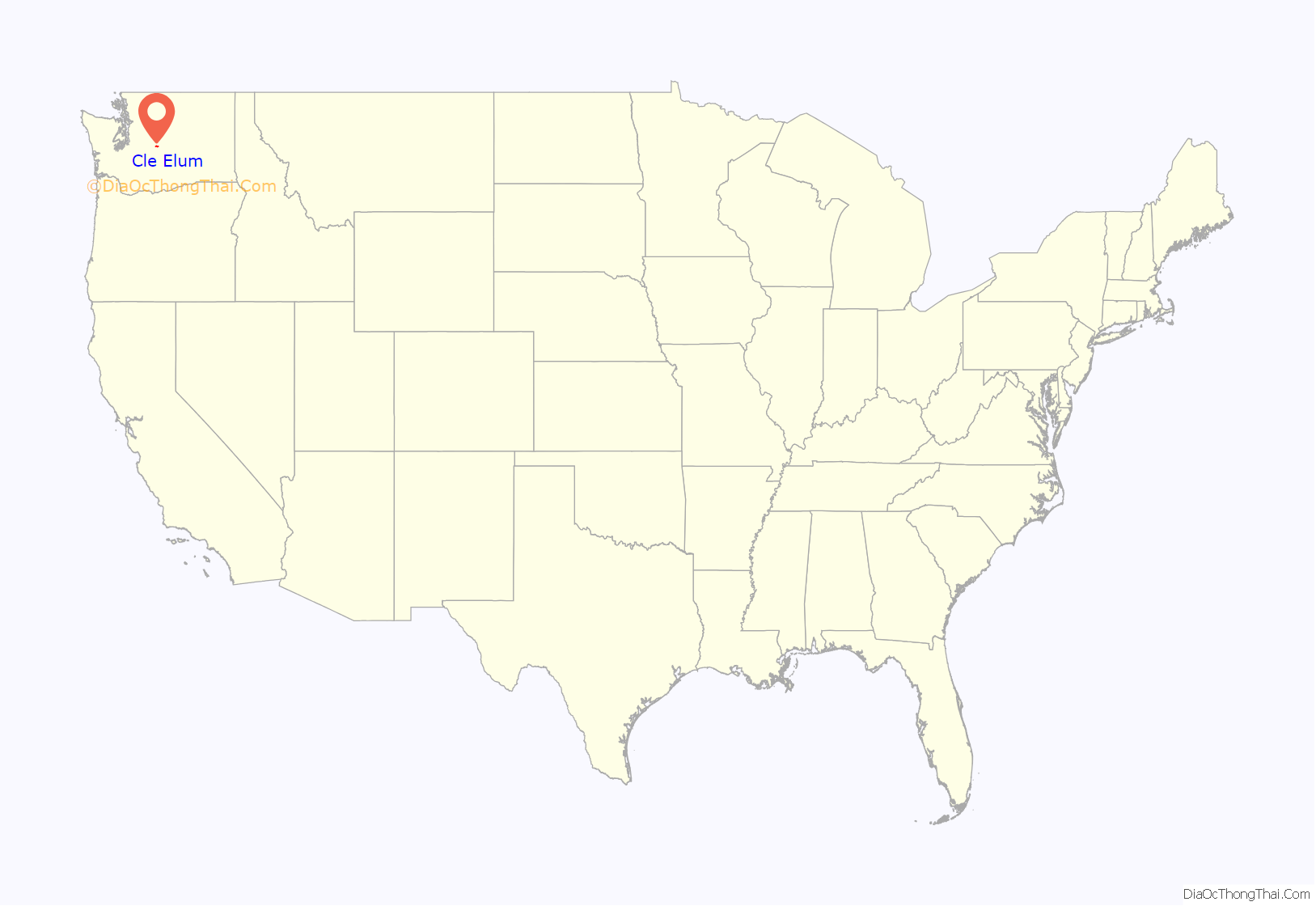
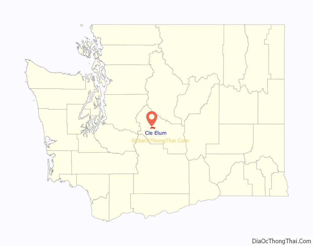
Cle Elum location map. Where is Cle Elum city?
History
Native history
Cle Elum was originally inhabited by the Kittitas band of the Yakama tribe. The tribe fished salmon, steelhead, and trout from the Yakima River. The Salmon la Sac trails in the northern area of the region were created by the Kittitas people and were used as layovers for journeys into the higher altitudes of the Cascade Range. In 1855, after the arrival of Catholic missionaries, and the passing through of settlers and coal miners on their way to the Puget Sound, a treaty resulted in the Yakamas ceding most of their land for a reservation in the lower Yakima Valley and guaranteed access to fish, including what would later be incorporated as Cle Elum. By 1859, the Kittitas had been forced to relocate to the Yakama Indian Reservation.
Early years and industries
In the spring of 1886, Northern Pacific Railway surveyors Virgil Bogue and Herbert Huson were making their way through the region with the intent of establishing a station. At the site of the future city, a depot was named Clealum after the Kittitas name Tle-el-Lum (tlielləm), meaning “swift water”, referring to the Cle Elum River. Maps of the United States Postal Guide used two words while other early maps show it as one word: Clealum. In 1908, Clealum was altered to Cle Elum. The name was given to the river, the city, and Cle Elum Lake. Walter Reed entered into a partnership with Thomas Johnson of Ellensburg and laid out sixty-five acres as a town site which was legally dedicated on July 26, 1886. Mr. Johnson had owned a sawmill on Wilson Creek, in Grant County and he moved the mill to the new location in the vicinity of the new town. The partners Reed and Johnson established what was undoubtedly the largest mill up to that time in central or Eastern Washington, cutting 40,000 feet of board lumber per day. At the same time, Frederick Leonhard, who, with his brother-in-law, Gerrit d’Ablaing, had been carrying on a mill on Cooke Creek and later on the Naneum, moved to the vicinity of Cle Elum. They cut a large part of the lumber for the Stampede Tunnel.
The early 20th century
Cle Elum was officially incorporated on February 12, 1902.
Tragedy struck the area when on July 16, 1908, two carloads of blasting powder being unloaded by the Northwest Improvement Company exploded, killing at least nine people including miners, NIC store employees and a family with children living in a tent near the building. The explosion, located about three-quarters of a mile from Cle Elum’s downtown, scattered debris and human remains and shattered windows across town. Accounts from residents equated the explosion to an earthquake.
In December 1910, loggers working for the Cascade Lumber Company near Cle Elum went on strike after the company reduced pay and began charging $5 per week for board. (equivalent to $145 in 2021)
In 1913, steps were taken to improve automobile access across the Cascade Mountains via Snoqualmie Pass. A $1,500,000 levy (equivalent to $41,100,000 in 2021) was approved in 1913 to improve and expand the state’s highways. The majority of the levy ($590,743) went to construction of the Sunset Highway between Spokane and Seattle. This major cross-state highway would pass directly through Cle Elum’s business district, and as it was one of the first towns reached after traveling east across the pass, would greatly benefit from its construction. That same year, reflecting on the prosperity of the coal mines, the city’s second bank was chartered. By 1914, Cle Elum’s population had risen to 3,000 from about 100 at the turn of the 20th century.
Great fire of 1918
Cle Elum’s greatest disaster occurred on June 25, 1918, when a huge fire wiped out over seventy acres of the city (29 city blocks) causing over $500,000 (about $9.01 million today) in damages. The cause was later determined to most likely to be a cigarette butt thrown into a pile of garbage behind a theater. Thirty businesses and 205 houses were destroyed, leaving more than 1,800 people homeless. Following the incident, aid from across the state began pouring in. The Red Cross brought tents from Camp Lewis to house displaced citizens while soldiers were sent from Ellensburg to guard businesses. Yakima and Portland also sent aid to the city. No people died in the incident.
High insurance rates on Cle Elum’s many wooden structures inhibited many people from purchasing them. One of the few buildings in downtown Cle Elum to survive the fire was the Cle Elum State Bank Building, built in 1906; it still stands today. The rest of downtown was quickly rebuilt with brick and many of these buildings still stand.
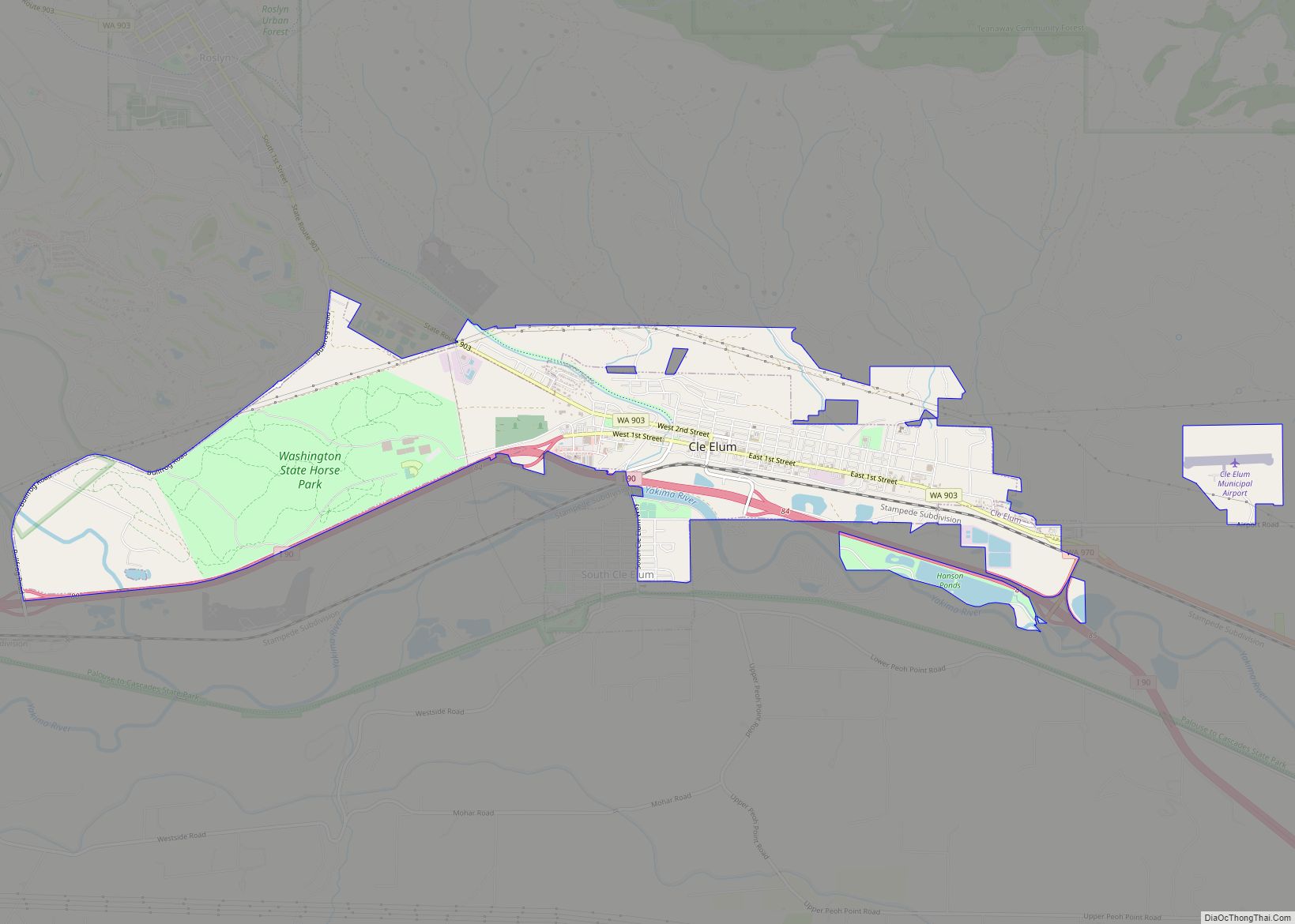
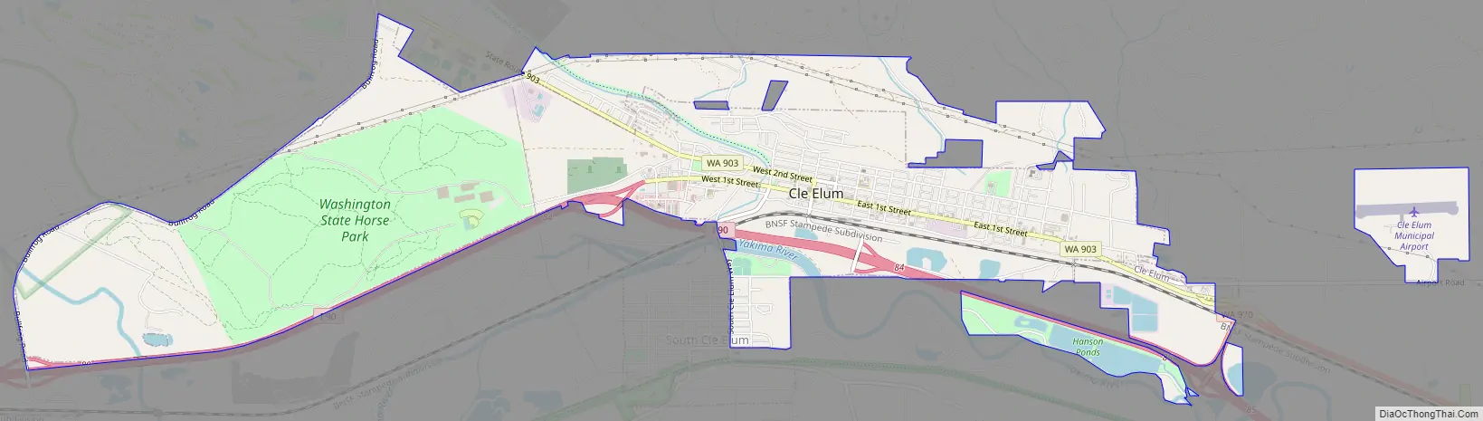
Cle Elum Road Map
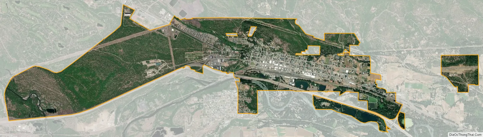
Cle Elum city Satellite Map
Geography
Cle Elum is located 71 miles (114 km) ESE of Seattle, 45 miles (73 km) NNW of Yakima, and 35 miles (56 km) WSW of Wenatchee.
According to the United States Census Bureau, the city has a total area of 3.83 square miles (9.92 km), of which 3.82 square miles (9.89 km) is land and 0.01 square miles (0.03 km) is water. It borders South Cle Elum and Roslyn.
Climate
Cle Elum has a humid continental climate, Köppen subtype Dsb. The elevation is 1909 feet and temperatures are cooler than areas to the east. The coldest month is December, a trait common in the Pacific Northwest. But hot temperatures still occur, and not just in summer: on March 18, 1968, the temperature soared to 95 °F. Cle Elum, lying on the less extreme part of the Cascade Range rain shadow, also sees more precipitation than more arid regions to the east but also less than the areas to the west. Thi
The climate has warmed in tandem with surrounding areas; climate data further back shows that winters were once colder, and that January was historically the coldest month.
See also
Map of Washington State and its subdivision:- Adams
- Asotin
- Benton
- Chelan
- Clallam
- Clark
- Columbia
- Cowlitz
- Douglas
- Ferry
- Franklin
- Garfield
- Grant
- Grays Harbor
- Island
- Jefferson
- King
- Kitsap
- Kittitas
- Klickitat
- Lewis
- Lincoln
- Mason
- Okanogan
- Pacific
- Pend Oreille
- Pierce
- San Juan
- Skagit
- Skamania
- Snohomish
- Spokane
- Stevens
- Thurston
- Wahkiakum
- Walla Walla
- Whatcom
- Whitman
- Yakima
- Alabama
- Alaska
- Arizona
- Arkansas
- California
- Colorado
- Connecticut
- Delaware
- District of Columbia
- Florida
- Georgia
- Hawaii
- Idaho
- Illinois
- Indiana
- Iowa
- Kansas
- Kentucky
- Louisiana
- Maine
- Maryland
- Massachusetts
- Michigan
- Minnesota
- Mississippi
- Missouri
- Montana
- Nebraska
- Nevada
- New Hampshire
- New Jersey
- New Mexico
- New York
- North Carolina
- North Dakota
- Ohio
- Oklahoma
- Oregon
- Pennsylvania
- Rhode Island
- South Carolina
- South Dakota
- Tennessee
- Texas
- Utah
- Vermont
- Virginia
- Washington
- West Virginia
- Wisconsin
- Wyoming