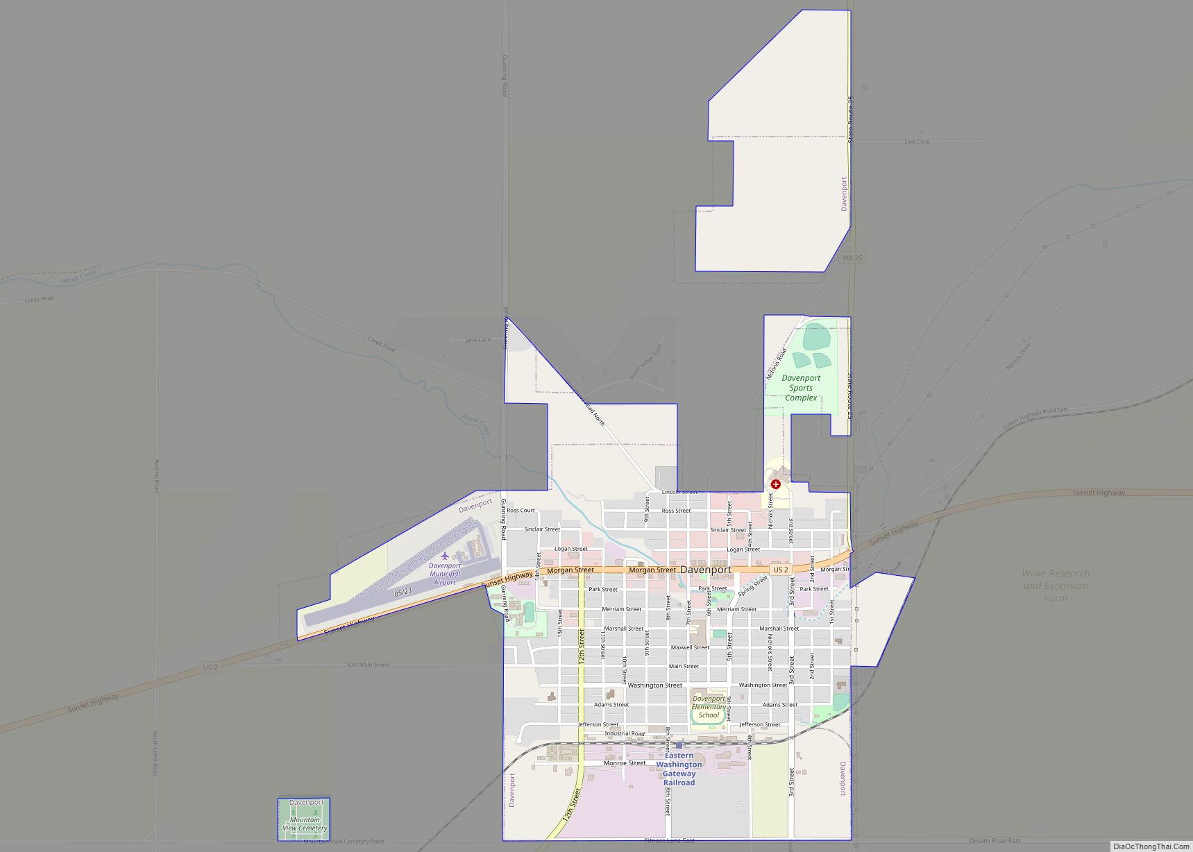
Davenport is the county seat of and largest city in Lincoln County, Washington, United States. The population was 1,703 at the 2020 census. As the seat of government for the county and its largest population center, Davenport serves as an important hub for business, medical and educational services in Lincoln County.
| Name: | Davenport city |
|---|---|
| LSAD Code: | 25 |
| LSAD Description: | city (suffix) |
| State: | Washington |
| County: | Lincoln County |
| Elevation: | 2,375 ft (724 m) |
| Total Area: | 1.67 sq mi (4.32 km²) |
| Land Area: | 1.67 sq mi (4.32 km²) |
| Water Area: | 0.00 sq mi (0.00 km²) |
| Total Population: | 1,703 |
| Population Density: | 1,019.7/sq mi (394.2/km²) |
| ZIP code: | 99122 |
| Area code: | 509 |
| FIPS code: | 5316795 |
| GNISfeature ID: | 1504329 |
| Website: | www.davenportwa.us |
Online Interactive Map
Click on ![]() to view map in "full screen" mode.
to view map in "full screen" mode.
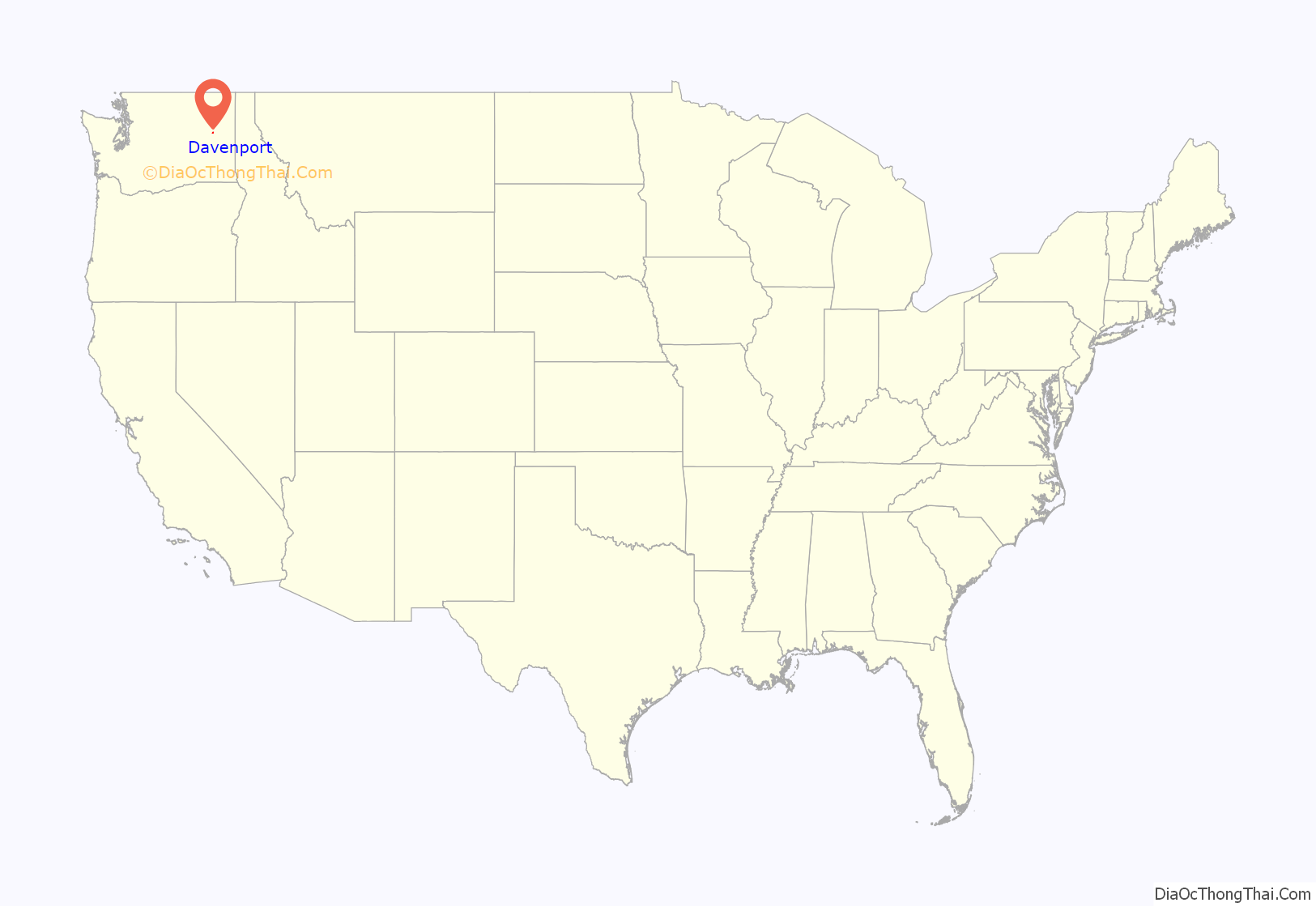
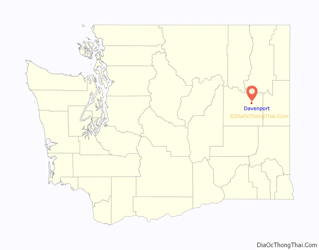
Davenport location map. Where is Davenport city?
History
Prior to European settlement, the area around what would become Davenport was home to the Lower Band of the Spokane. The location was also along a popular east-west trade route, and the spring at present day Davenport was seen as an oasis and place for rest and camping along the journey.
That trail would eventually bring white settlers to the area, with prospectors passing through on their way to goldfields in Montana. Like the Spokane before them, these settlers used the springs at the present site of Davenport to collect water, rest and camp. The setting of the springs in the otherwise semi-arid region attracted some of these new arrivals to settle at the location, and in 1880 Aloysius Harry Harker became the first non-native permanent settler at the location, with John and Emma Eads Nicholls arriving soon after. The settlement was located at the springs and known as Cottonwood Springs. John C. Davenport founded a separate settlement on higher ground nearby in 1883, which was destroyed by fire the following year. Davenport’s settlement relocated to Cottonwood Springs, taking Davenport’s name with it. The city was made the county seat of Lincoln County on December 15, 1896, after an election that had chosen Davenport over then-seat Sprague, which had been destroyed in a fire, and Harrington.
Davenport gained early prominence in the north central part of the Columbia Basin of eastern Washington with the arrival of the Washington Central branch of the transcontinental Northern Pacific Railway (NP) railroad line, which reached Davenport in February 1889. The Seattle Lake Shore & Eastern Railway (SLS&E) arrived later that year. A branch line of the Great Northern Railway (GN) was built to Davenport from Bluestem in the 1920s. Davenport’s train depot, built in 1889 with the arrival of the railroads, lasted almost 100 years before being demolished in 1988.
Primary State Highway #2 (a.k.a. “Sunset Highway”) closely followed the CW railroad from Coulee City through Davenport to Spokane. The route is now known as U.S. Route 2, but does not follow the original Sunset Highway in many places. Primary State Highway #7 also intersected with PSH #2 in Davenport, and is now part of State Route 28. PSH #22 ran north from Davenport to the Canada–US border near Northport. This is State Route 25 now.
Davenport Road Map
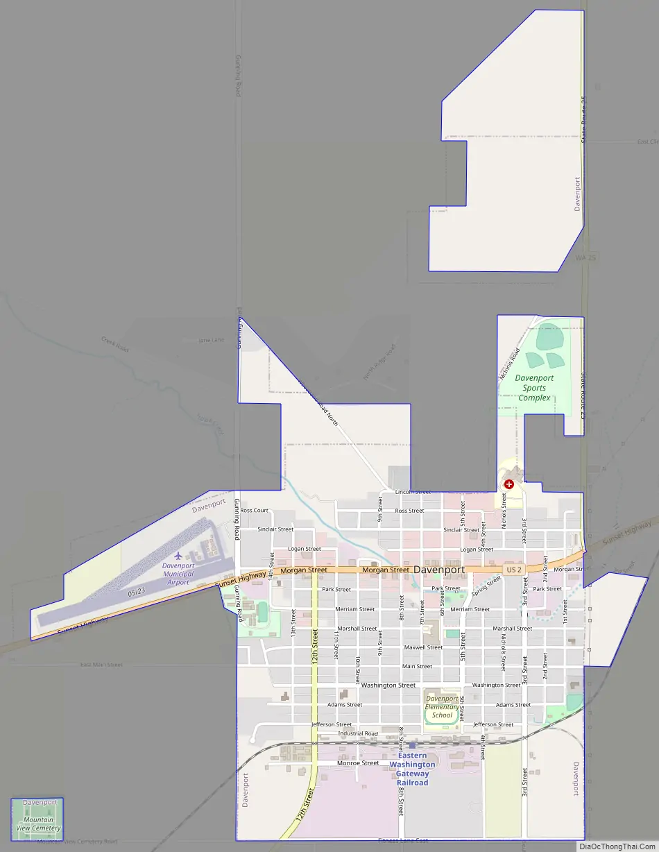
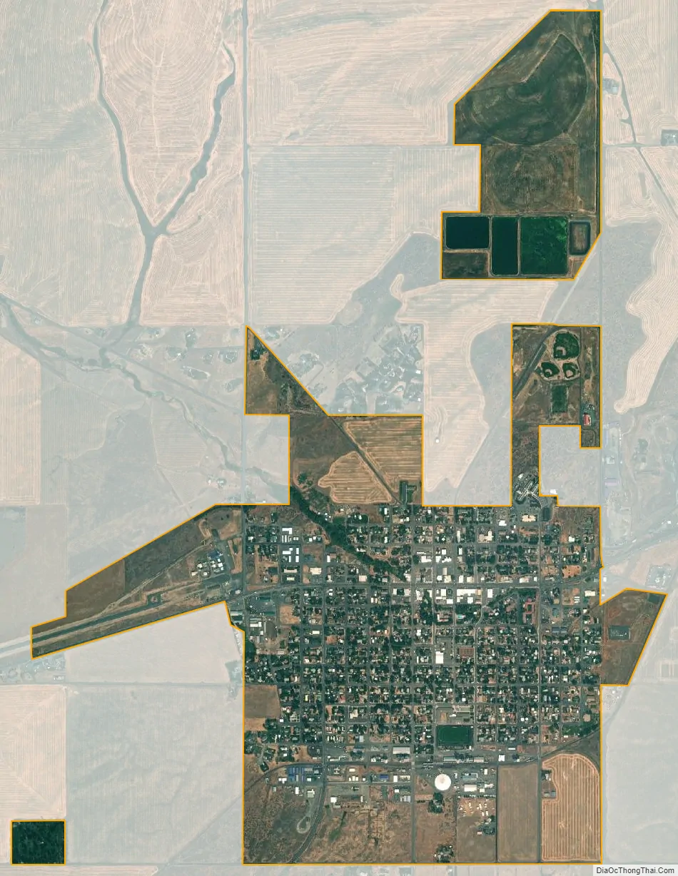
Davenport city Satellite Map
Geography
Davenport is located at 47°39′4″N 118°9′6″W / 47.65111°N 118.15167°W / 47.65111; -118.15167 (47.651157, -118.151627). Davenport itself is largely flat, lying in the shallow valley of Cottonwood Creek, but the surrounding region is characterized by the Channeled Scablands scoured by the Missoula Floods during the last ice age. Davenport lies on the northern edge of the scablands, with more familiar drainage patterns taking over the terrain a few miles to the north of the city. Cottonwood Creek is an example of those more typical drainage patterns, as it flows northwest into the Columbia River at Hawk Creek Bay. Crystal Spring, which helps feed the creek, is located near the center of town.
Davenport is served by U.S. Route 2, which runs through the heart of the city. U.S. Route 2 connects Davenport with the region’s primary city, Spokane, which is located 35 miles to the east. Two state highways also serve Davenport. State Route 28 has its eastern terminus in Davenport, connecting the city the rural areas to its southwest. State Route 25 has its southern terminus in Davenport, from which it stretches north to the Canadian border.
Davenport is centrally located in the northern wheat belt of the Columbia Basin, where dryland wheat farming on the hills not washed away in the great Missoula Floods some 14,000 years ago, is critical to the agricultural economy of the region. Davenport Union Warehouse and Odessa Union Warehouse operate multiple elevators of varying age and design on the southern part of the city. A few of these structures date to the early days of the city. Davenport still serves as a central collection point for wheat, with most of it shipped out by truck or railcar. While most of the wheat goes to export, some of it does find its way to the ADM flour mills in Spokane and Cheney. Locally grown barley also finds its way to various west coast breweries and other users.
According to the United States Census Bureau, the city has a total area of 1.82 square miles (4.71 km), all of it land.
See also
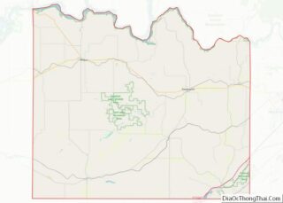
Map of Washington State and its subdivision:- Adams
- Asotin
- Benton
- Chelan
- Clallam
- Clark
- Columbia
- Cowlitz
- Douglas
- Ferry
- Franklin
- Garfield
- Grant
- Grays Harbor
- Island
- Jefferson
- King
- Kitsap
- Kittitas
- Klickitat
- Lewis
- Lincoln
- Mason
- Okanogan
- Pacific
- Pend Oreille
- Pierce
- San Juan
- Skagit
- Skamania
- Snohomish
- Spokane
- Stevens
- Thurston
- Wahkiakum
- Walla Walla
- Whatcom
- Whitman
- Yakima
- Alabama
- Alaska
- Arizona
- Arkansas
- California
- Colorado
- Connecticut
- Delaware
- District of Columbia
- Florida
- Georgia
- Hawaii
- Idaho
- Illinois
- Indiana
- Iowa
- Kansas
- Kentucky
- Louisiana
- Maine
- Maryland
- Massachusetts
- Michigan
- Minnesota
- Mississippi
- Missouri
- Montana
- Nebraska
- Nevada
- New Hampshire
- New Jersey
- New Mexico
- New York
- North Carolina
- North Dakota
- Ohio
- Oklahoma
- Oregon
- Pennsylvania
- Rhode Island
- South Carolina
- South Dakota
- Tennessee
- Texas
- Utah
- Vermont
- Virginia
- Washington
- West Virginia
- Wisconsin
- Wyoming