Granite Falls is a city in Snohomish County, Washington, United States. It is located between the Pilchuck and Stillaguamish rivers in the western foothills of the Cascade Range, northeast of Lake Stevens and Marysville. The city is named for a waterfall north of downtown on the Stillagumish River, also accessible via the Mountain Loop Highway. It had a population of 3,364 at the 2010 census.
The site of Granite Falls was originally a portage for local Coast Salish tribes prior to the arrival of American settlers. The settlement was founded in 1883 and prospered after the discovery of gold and silver in the Monte Cristo mines located east of Granite Falls on the Everett and Monte Cristo Railway. Granite Falls was platted in 1891 and incorporated as a fourth-class town on November 8, 1903.
| Name: | Granite Falls city |
|---|---|
| LSAD Code: | 25 |
| LSAD Description: | city (suffix) |
| State: | Washington |
| County: | Snohomish County |
| Elevation: | 407 ft (124 m) |
| Land Area: | 2.19 sq mi (5.68 km²) |
| Water Area: | 0.02 sq mi (0.05 km²) |
| Population Density: | 1,931.57/sq mi (745.77/km²) |
| ZIP code: | 98252 |
| Area code: | 360 |
| FIPS code: | 5327995 |
| GNISfeature ID: | 1520218 |
| Website: | granitefallswa.gov |
Online Interactive Map
Click on ![]() to view map in "full screen" mode.
to view map in "full screen" mode.
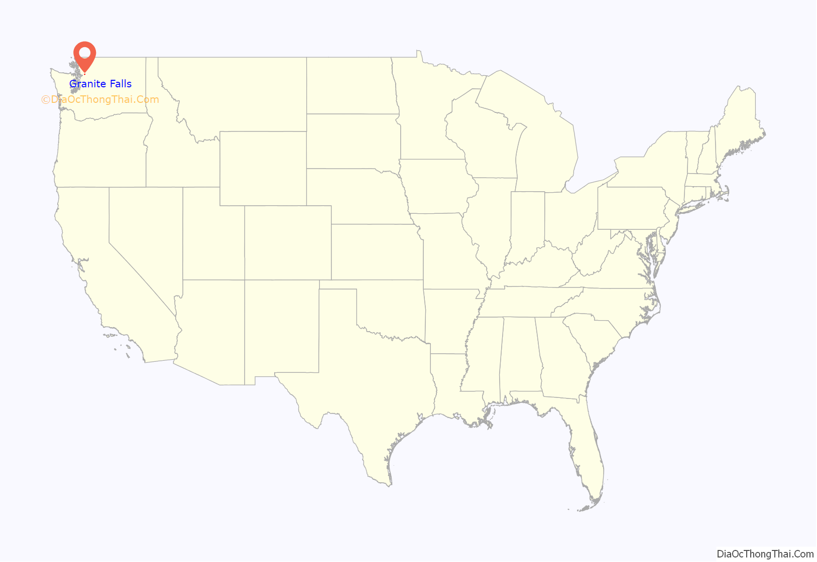
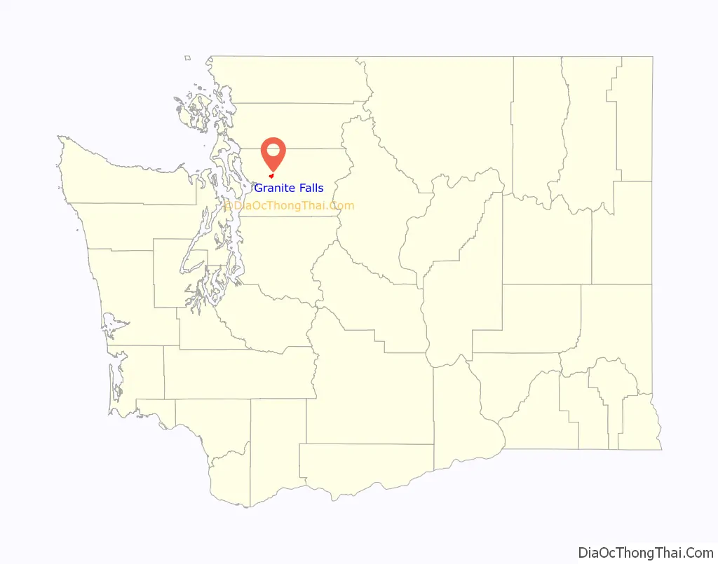
Granite Falls location map. Where is Granite Falls city?
History
The Pilchuck River and Upper Stillaguamish basin was historically inhabited by the Skykomish people, who used the modern-day site of Granite Falls as a portage along with other Coast Salish tribes. Several Skykomish archaeological sites were discovered in the 1970s between modern-day Granite Falls and Lochsloy, with over 700 artifacts recovered from later excavation.
The first permanent European settler was Joseph Sous Enas from the Azores, who staked a homestead claim in 1883 on land south of the present city. He was joined by other homesteaders who took advantage of open land that had been cleared by an earlier wildfire, nicknamed “the Big Burn”. A school district was established in 1886, initially using an abandoned cabin as a one-room schoolhouse until a permanent school was built in 1893. The discovery of gold and silver in the Cascades, particularly around Monte Cristo, lured miners and settlers to the Granite Falls area.
A general store and post office were established in 1890 at the corner of four homesteads, which would later form the center of the townsite platted in August 1891. The name “Granite Falls” was chosen for the settlement to replace the earlier name of “Portage”. The Everett and Monte Cristo Railway reached Granite Falls on October 16, 1892, building a station for the town on the route between Monte Cristo and the county seat of Everett.
On November 8, 1903, Granite Falls voted to become a city. It was officially incorporated as a fourth-class city on December 21, 1903. At the time, it had approximately 600 residents and several lumber mills. Electricity, sewers, sidewalks, telephones, cars, and all the amenities of modern life soon followed. A power plant was also constructed at the falls.
By World War I, the once bustling mining towns of Monte Cristo and Silverton were no longer shipping out ore. The railroad, now owned by Northern Pacific, stopped running and the tracks were torn out in the early 1930s to make way for the Mountain Loop Highway.
Granite Falls between the world wars was a lumber town; logging companies felled trees, sawmills created lumber and shingle mills created shingles. The Great Depression, however, took its toll. By 1935, the population of Granite Falls was half what it was in 1925. Mills closed and people left to find work elsewhere. On April 26, 1933, a fire destroyed the Cascade Hotel in downtown Granite Falls and threatened other buildings. The historic hotel was rebuilt at the same site.
At the end of World War II, things looked bleak. The opening of Miller Shingle in 1946 (now the country’s largest specialty lumber mill) meant jobs both in the woods and at the mill. Construction booms through Snohomish and King counties also meant jobs at the gravel pits dotted around Granite Falls. The city later became a bedroom community for commuters working in Everett and Lake Stevens for large companies.
Hard times would come again. In 1986, the United States Forest Service severely limited logging in old-growth forests under its protection in an effort to save the northern spotted owl from extinction. In June, 1990, the U.S. Fish and Wildlife Department declared the spotted owl an endangered species, and in 1991, a federal court judge ruled the Forest Service’s logging plan to save the owl was inadequate. Over one-fourth of old-growth forest on both public and private land were put off-limits to logging.
In the 21st century, Granite Falls has focused on attracting visitors to the natural environment and recreational opportunities along the Mt. Loop Highway. Expanded housing development has brought an increased population of families who commute to Everett, Seattle, and the Eastside to work. In 2001, the Tsubaki Grand Shrine of America was given a 17-acre (7 ha) plot of land next to Kannagara Jinja (built by the Reverend of the shrine) in Granite Falls, which was built upon, combining the two places.
A truck bypass around the north side of downtown Granite Falls opened in 2010 to serve several quarries to the northeast. A new high school campus was built near the bypass, along with a housing development with 327 homes in the late 2010s.
A downtown revitalization project began in the 2000s with renovations to buildings and a small city park. A new civic center is planned along South Granite Avenue, including a city hall that opened in 2019, a public plaza, a community center, and a gymnasium for the Boys & Girls Club that will also serve as an emergency shelter. The city government has also proposed promoting Granite Falls as a location for outdoor recreation retailers and businesses.
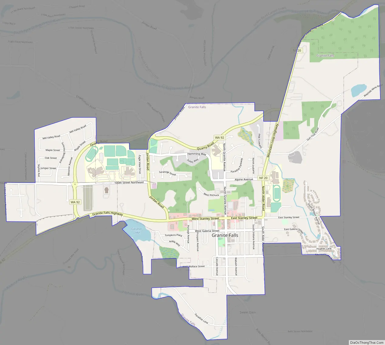
Granite Falls Road Map
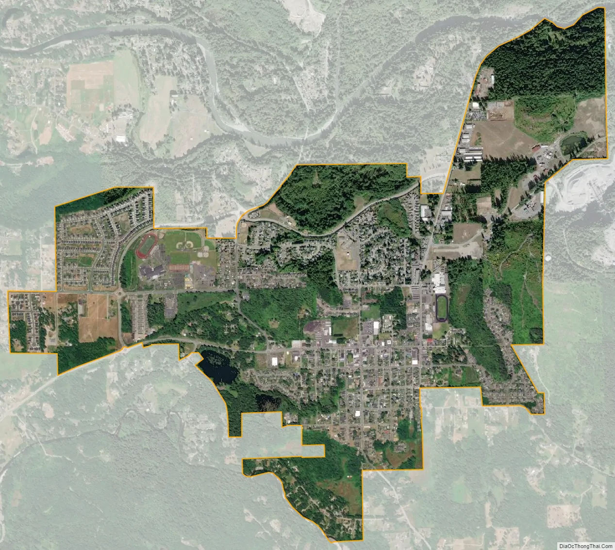
Granite Falls city Satellite Map
Geography
Granite Falls is located in Snohomish County, approximately 17 miles (27 km) east of Everett, the county seat, and 45 miles (72 km) northeast of Seattle. It lies on a plateau in the western foothills of the Cascade Range between the South Fork Stillaguamish River to the north and the Pilchuck River to the south. Granite Falls is also the southern entrance to the Mountain Loop Highway, a scenic highway that continues into the Cascades to Darrington.
The city limits are defined to the north by the Stillaguamish River, to the east by Iron Mountain, to the south by the Pilchuck River, and to the west by 174th Avenue Northeast. According to the United States Census Bureau, the city has a total area of 2.20 square miles (5.70 km), of which, 2.18 square miles (5.65 km) is land and 0.02 square miles (0.05 km) is water.
It is situated where the South Fork of the Stillaguamish River leaves its narrow mountain valley, which includes the namesake Granite Falls. The falls has a 540-foot (160 m) fishway and a 280-foot (85 m) tunnel that were built in 1954, at the time the longest fish tunnel in the world. The area where the city was founded was called the “portage” by native tribes in the area, who used the flat area between the two rivers to portage their canoes when traveling. Iron Mountain, which sits at 1,240 feet (380 m) above sea level, lies east of downtown and is home to a quarry. The Rogers Belt, a series of local faults, runs northwest from Granite Falls towards Mount Vernon.
Climate
The climate in this area has mild differences between highs and lows, and most of the rainfall occurs between October and May. Temperatures in the summer can be up to 10 degrees warmer than nearby Everett, due to its slightly inland location. According to the Köppen Climate Classification system, Granite Falls has a marine west coast climate, abbreviated “Cfb” on climate maps.
See also
Map of Washington State and its subdivision:- Adams
- Asotin
- Benton
- Chelan
- Clallam
- Clark
- Columbia
- Cowlitz
- Douglas
- Ferry
- Franklin
- Garfield
- Grant
- Grays Harbor
- Island
- Jefferson
- King
- Kitsap
- Kittitas
- Klickitat
- Lewis
- Lincoln
- Mason
- Okanogan
- Pacific
- Pend Oreille
- Pierce
- San Juan
- Skagit
- Skamania
- Snohomish
- Spokane
- Stevens
- Thurston
- Wahkiakum
- Walla Walla
- Whatcom
- Whitman
- Yakima
- Alabama
- Alaska
- Arizona
- Arkansas
- California
- Colorado
- Connecticut
- Delaware
- District of Columbia
- Florida
- Georgia
- Hawaii
- Idaho
- Illinois
- Indiana
- Iowa
- Kansas
- Kentucky
- Louisiana
- Maine
- Maryland
- Massachusetts
- Michigan
- Minnesota
- Mississippi
- Missouri
- Montana
- Nebraska
- Nevada
- New Hampshire
- New Jersey
- New Mexico
- New York
- North Carolina
- North Dakota
- Ohio
- Oklahoma
- Oregon
- Pennsylvania
- Rhode Island
- South Carolina
- South Dakota
- Tennessee
- Texas
- Utah
- Vermont
- Virginia
- Washington
- West Virginia
- Wisconsin
- Wyoming


