Lake Stevens is a city in Snohomish County, Washington, United States, that is named for the lake it surrounds. It is located 6 miles (9.7 km) east of Everett and borders the cities of Marysville to the northwest and Snohomish to the south. The city’s population was 28,069 at the 2010 census, but has since grown to an estimated 33,911.
The lake was named in 1859 for territorial governor Isaac Stevens and was originally home to the Skykomish in the Pilchuck River basin. The first modern settlement on Lake Stevens was founded at the northeastern corner of the lake in 1889. It was later sold to the Rucker Brothers, who opened a sawmill in 1907 that spurred early growth in the area, but closed in 1925 after the second of two major fires. The Lake Stevens area then became a resort community before developing into a commuter town in the 1960s and 1970s.
Lake Stevens was incorporated as a city in 1960, following an exodus of businesses from the downtown area to a new shopping center. The city has since grown through annexations to encompass most of the lake, including the original shopping center, and quadrupled in population from 2000 to 2010. A revitalized downtown area is planned alongside new civic buildings in the 2020s.
| Name: | Lake Stevens city |
|---|---|
| LSAD Code: | 25 |
| LSAD Description: | city (suffix) |
| State: | Washington |
| County: | Snohomish County |
| Founded: | 1889 |
| Incorporated: | November 29, 1960 |
| Elevation: | 217 ft (66 m) |
| Total Area: | 9.30 sq mi (24.09 km²) |
| Land Area: | 9.17 sq mi (23.74 km²) |
| Water Area: | 0.14 sq mi (0.35 km²) |
| Total Population: | 28,069 |
| Population Density: | 3,699.65/sq mi (1,428.40/km²) |
| ZIP code: | 98258 |
| Area code: | 425 |
| FIPS code: | 5337900 |
| GNISfeature ID: | 1512695 |
| Website: | lakestevenswa.gov |
Online Interactive Map
Click on ![]() to view map in "full screen" mode.
to view map in "full screen" mode.
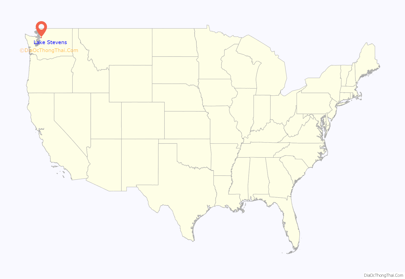
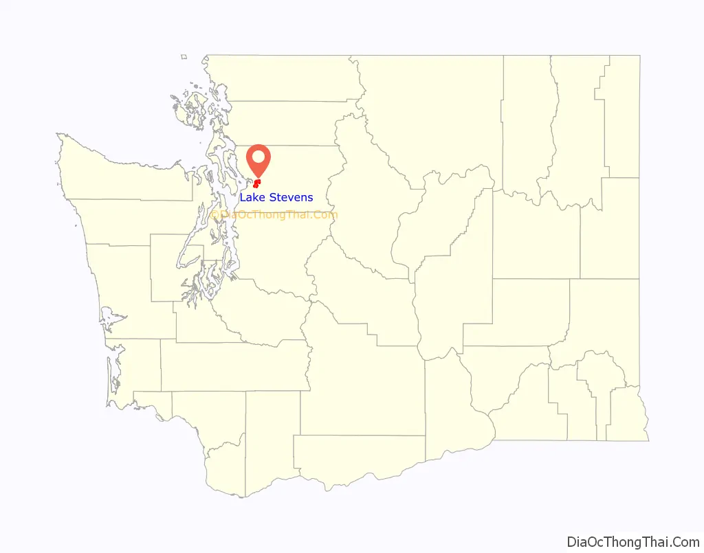
Lake Stevens location map. Where is Lake Stevens city?
History
Lake Stevens was named in 1859 for territorial governor Isaac Stevens and was originally listed as “Stevens Lake” on early maps. The area around the lake was used for berry gathering by the indigenous Skykomish, who also used most of the Pilchuck River basin for hunting. The first homesteads around the lake were established by emigrants in the 1880s, beginning with Joseph William Davison’s 160-acre (0.65 km) claim along the east shore filed in 1886. A two-block townsite at the northeast end of the lake named “Outing” was claimed on October 8, 1889, by Charles A. Missimer and platted the following year. The construction of the Seattle, Lake Shore and Eastern Railway along the eastern side of the Pilchuck River Valley in 1889 spurred the creation of more settlements in the area. Among them were Machias in 1890, which was followed by Hartford (originally named “Ferry”), later a major junction for the Everett and Monte Cristo Railway completed in 1892.
Outing was later vacated and sold between various investors before the townsite was acquired in 1905 by the Rucker Brothers, who planned to build a sawmill after a previous venture by Jacob Falconer had failed. The Rucker Brothers constructed a railroad spur from Hartford and redirected the flow of Cassidy Creek, the main outlet of the lake, to prepare land for their shingle mill, which opened in 1907. A plat for the town of Lake Stevens was filed by the Rucker Brothers on February 8, 1908, including a business district and residences to accommodate the mill’s 250 workers. The sawmill, one of the largest in the United States, was partially destroyed in a 1919 fire and later rebuilt. It was permanently closed after a second fire in 1925 and dismantled, causing many residents to leave the area. One of the remnants from the old mill was a locomotive that sunk in the early 1910s and was rediscovered in 1995 by a U.S. Navy training team, following a request from the local historical society.
By the mid-1920s, the entire shoreline of Lake Stevens had been divided into small lots and tracts for summer homes and resorts. Following the demise of the Rucker mill, Lake Stevens was primarily a resort community that drew 3,000 visitors on busy days to fish, swim, and water-ski on the lake. While the major lakeside resorts were successful, the Lake Stevens area saw little residential and commercial development for several decades as the downtown area stagnated. The first Hewitt Avenue Trestle was completed in 1939, providing an elevated highway over the Snohomish River floodplain between Everett and Cavalero Hill, with onward connections to areas around Lake Stevens.
Suburban development around Lake Stevens began in the 1950s, shortly after plans were announced to build a large shopping center named Frontier Village at the intersection of two state highways west of the lake (later State Route 9 and State Route 204). Business owners in downtown Lake Stevens proposed incorporation in 1958 to prevent retailers from relocating to the new shopping center, offering local control of policing and street maintenance with no increase in taxes. On November 19, 1960, Lake Stevens voted 299–40 in favor of incorporating as a city, which was certified by the state government on November 29. The town boundaries were set around downtown and included an estimated 900 residents. The city government purchased a former post office building for use as a city hall, which included a jail that was never used due to a change in state laws.
The development of resorts around Lake Stevens also caused water quality to deteriorate, necessitating the creation of a voluntary drainage district in 1932 to manage runoff and pollution. It was replaced in 1963 by an independent sewer district, which mandated vegetation buffers for homes and later installed a large aeration system to slow the growth of algae in the lake. Frontier Village opened in 1960 and later expanded as State Route 9 and State Route 204 were improved through the area. A new highway bypassing downtown, State Route 92, opened at the end of the decade. The area around Frontier Village was developed into a suburban commuter town in the 1970s and 1980s with the construction of several residential subdivisions. Hewlett-Packard won approval from the county government to build a 125-acre (51 ha) manufacturing plant northwest of Lake Stevens in 1983, despite opposition from local residents looking to preserve the area’s rural character.
By the late 1990s, the city had over 5,700 residents and was among the fastest-growing cities in the state. The unincorporated areas to the west of the lake also grew to over 20,000 people, adding multi-family housing to its existing inventory of single-family neighborhoods, and rejected an attempt to build a second shopping center and commercial complex on Cavalero Hill. Lake Stevens unsuccessfully attempted to annex the western neighborhoods in 1993, but adopted plans to create “one community around the lake” and revitalize its downtown. The first major annexations were completed in 2006, adding 1,563 acres (633 ha) around Frontier Village and the north end of the lake. From 2000 to 2010, the city quadrupled in population to nearly 30,000 people and added 5 square miles (13 km). The largest annexation, consisting of 9 square miles (23 km) in the southwest corner of the Lake Stevens urban growth area, was completed in December 2009 and added more than 10,000 residents. Further annexations of areas to the southeast of the lake are planned to complete the full encirclement of Lake Stevens.
The city government adopted plans in 2018 to redevelop downtown Lake Stevens with denser housing and commercial use, including mixed-use buildings and walkable streets. The former city hall in downtown was demolished in 2017 as part of an expansion for North Cove Park, with city services temporarily relocated at an adjacent building until a permanent replacement is built. The police station was relocated to an abandoned fire station and will open a new headquarters building on Chapel Hill in the 2020s. An earlier plan to combine city services, the police station, and a new library at a civic campus on Chapel Hill fell through after the failure of a library bond measure. The 3-acre (1.2 ha) property had been acquired in 2016 and is planned to be rezoned for commercial use.
Lake Stevens Road Map
Lake Stevens city Satellite Map

Geography
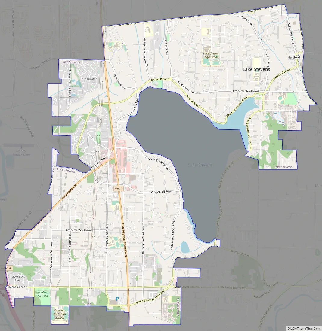
Lake Stevens is located 35 miles (56 km) northeast of Seattle and 6 miles (9.7 km) northeast of Everett, between the cities of Marysville and Snohomish. The city’s boundaries are generally defined to the north by State Route 92, to the east by the Centennial Trail, to the south by 28th Street Southeast, and to the west by State Route 204. According to the United States Census Bureau, the city has a total area of 8.90 square miles (23.05 km), of which 8.88 square miles (23.00 km) is land and 0.02 square miles (0.05 km) is water. The eponymous lake is not part of the city, but is part of the unincorporated urban growth area that also covers several neighborhoods on the southeast side of the lake. The urban growth area has been sought for annexations in the early 21st century.
The city lies on a plateau between the Snohomish River delta, which separates it from Everett and Ebey Island to the west, and the foothills of the Cascade Mountains. It surrounds the north and east sides of Lake Stevens, the largest and deepest lake in Snohomish County, with an area of 1,040 acres (4.2 km) and an average depth of 64 feet (20 m). The lake has 7.1 miles (11.4 km) of shoreline and is fed by Lundeen Creek, Mitchell (Kokanee) Creek, and Stitch Creek. It drains into Catherine Creek, which then flows to the Pilchuck River. The lake’s relatively small watershed, at 4,371 acres (1,769 ha), minimizes the effect of upstream pollution but reduces flow to remove pollutants. Lake Stevens installed aeration system in the 1990s to control the release of phosphorus from lake sediments, which caused unwanted algae growth. Most of the shoreline is heavily developed, with little remaining native vegetation, and Lake Stevens is used for recreational fishing, swimming, boating, and skiing.
Lake Stevens has two major commercial centers: downtown and Frontier Village. Downtown Lake Stevens is located on the northeastern arm of the lake and has been undergoing redevelopment since the 1990s. Frontier Village is located west of the lake at the intersection of State Route 9 and State Route 204 and is a traditional suburban shopping center with strip malls and big box stores. The city government also has several designated neighborhoods and planning areas: Cavalero Hill, Frontier Village, the Hartford Industrial Area, and Machias.
See also
Map of Washington State and its subdivision:- Adams
- Asotin
- Benton
- Chelan
- Clallam
- Clark
- Columbia
- Cowlitz
- Douglas
- Ferry
- Franklin
- Garfield
- Grant
- Grays Harbor
- Island
- Jefferson
- King
- Kitsap
- Kittitas
- Klickitat
- Lewis
- Lincoln
- Mason
- Okanogan
- Pacific
- Pend Oreille
- Pierce
- San Juan
- Skagit
- Skamania
- Snohomish
- Spokane
- Stevens
- Thurston
- Wahkiakum
- Walla Walla
- Whatcom
- Whitman
- Yakima
- Alabama
- Alaska
- Arizona
- Arkansas
- California
- Colorado
- Connecticut
- Delaware
- District of Columbia
- Florida
- Georgia
- Hawaii
- Idaho
- Illinois
- Indiana
- Iowa
- Kansas
- Kentucky
- Louisiana
- Maine
- Maryland
- Massachusetts
- Michigan
- Minnesota
- Mississippi
- Missouri
- Montana
- Nebraska
- Nevada
- New Hampshire
- New Jersey
- New Mexico
- New York
- North Carolina
- North Dakota
- Ohio
- Oklahoma
- Oregon
- Pennsylvania
- Rhode Island
- South Carolina
- South Dakota
- Tennessee
- Texas
- Utah
- Vermont
- Virginia
- Washington
- West Virginia
- Wisconsin
- Wyoming


