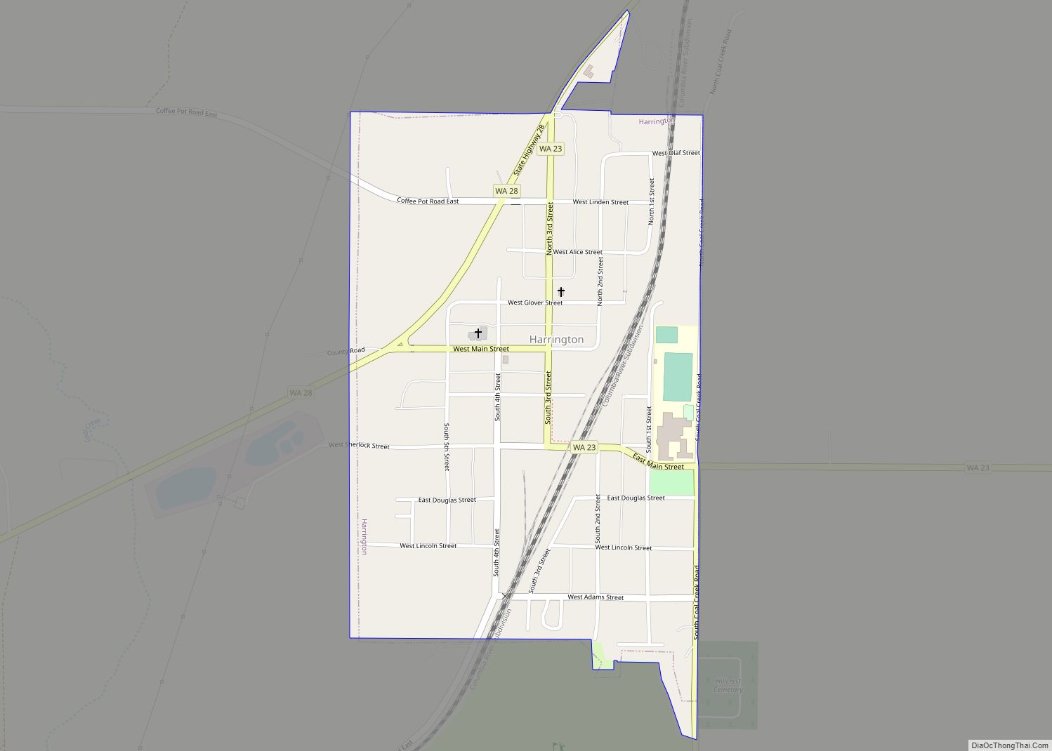
Harrington is a city in Lincoln County, Washington, United States. The population was 424 at the 2010 census. It was named after W.P. Harrington, a banker from Colusa, California, who had heavily invested in local land.
| Name: | Harrington city |
|---|---|
| LSAD Code: | 25 |
| LSAD Description: | city (suffix) |
| State: | Washington |
| County: | Lincoln County |
| Elevation: | 2,146 ft (654 m) |
| Total Area: | 0.39 sq mi (1.01 km²) |
| Land Area: | 0.39 sq mi (1.01 km²) |
| Water Area: | 0.00 sq mi (0.00 km²) |
| Total Population: | 424 |
| Population Density: | 1,071.79/sq mi (413.63/km²) |
| ZIP code: | 99134, 99154 |
| Area code: | 509 |
| FIPS code: | 5329745 |
| GNISfeature ID: | 1505401 |
| Website: | www.harringtonbiz.com |
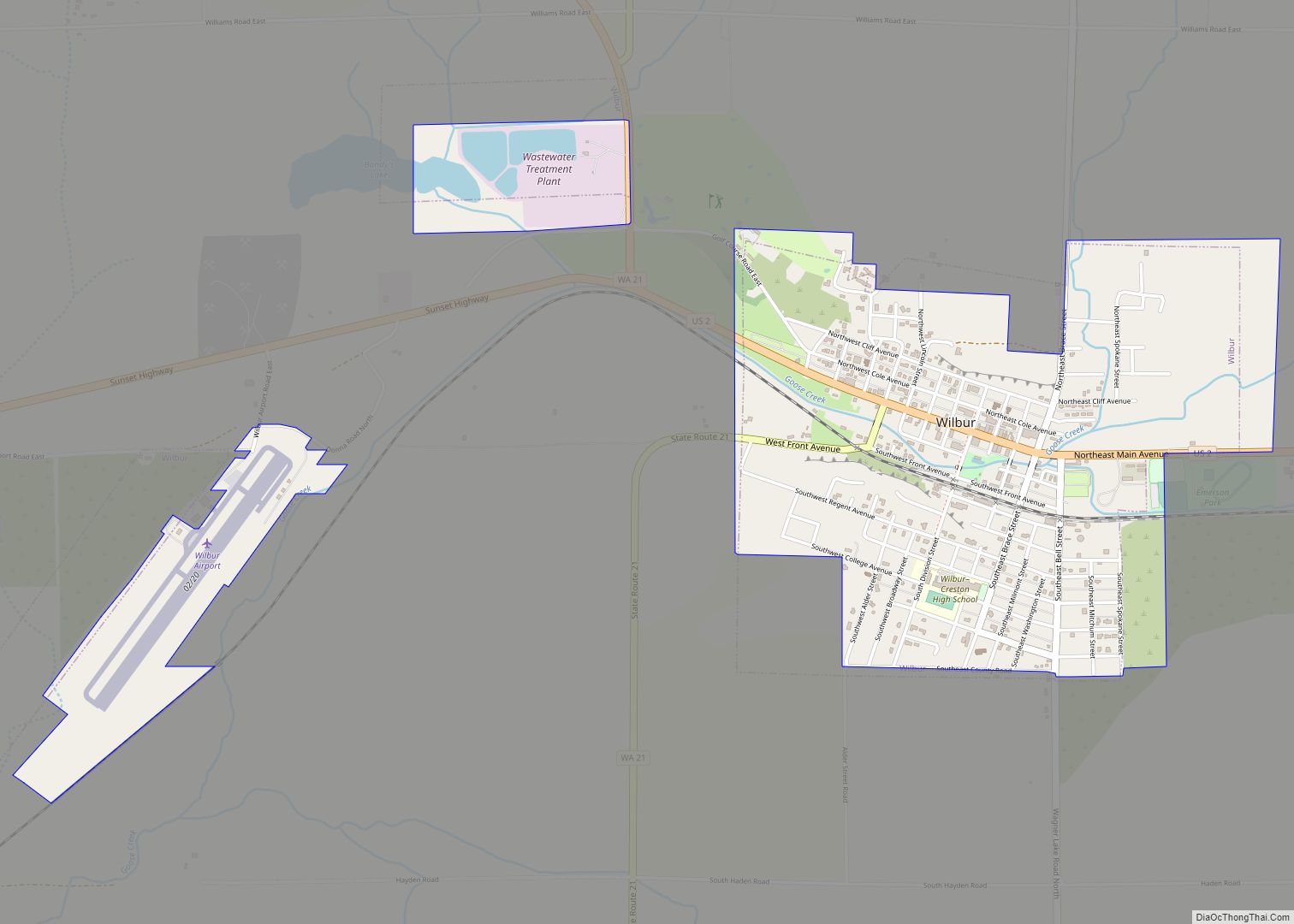
Online Interactive Map
Click on ![]() to view map in "full screen" mode.
to view map in "full screen" mode.
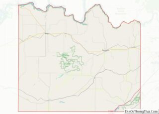
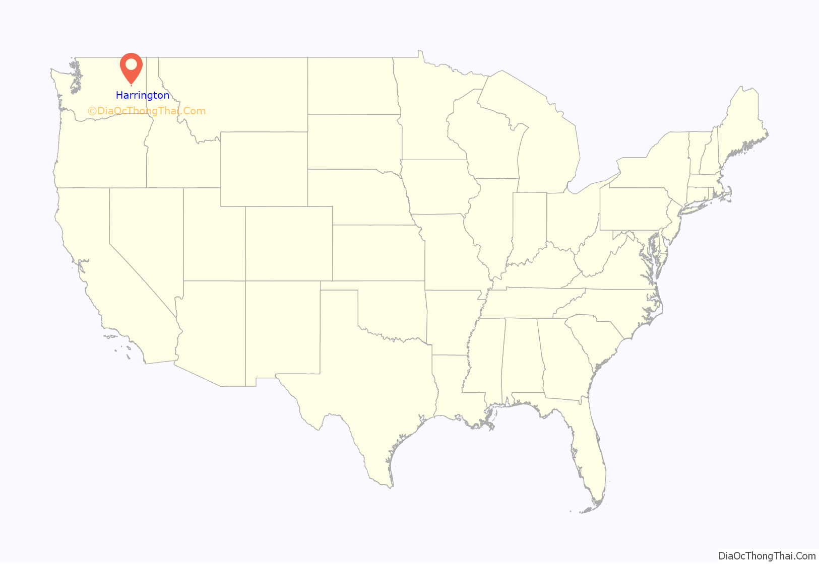
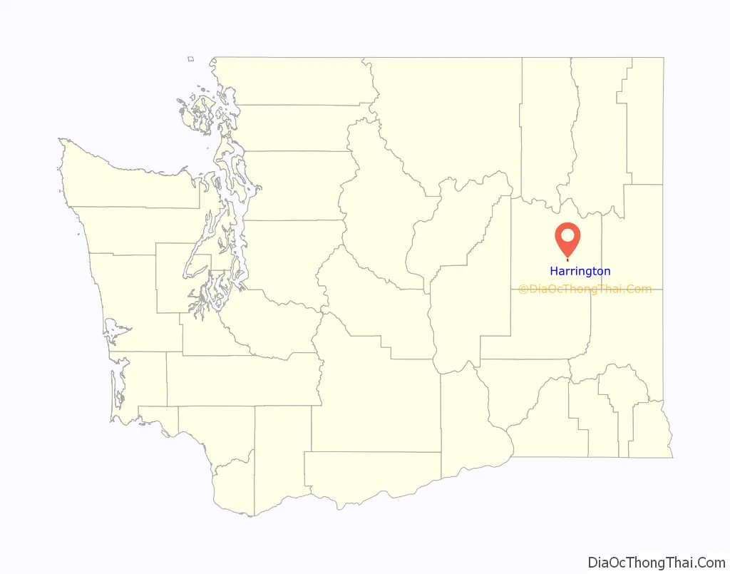
Harrington location map. Where is Harrington city?
History
Harrington was first settled in 1879 by Adam Edward Ludy and Jacob Ludy. Harrington was officially incorporated on April 17, 1902.
Harrington Road Map
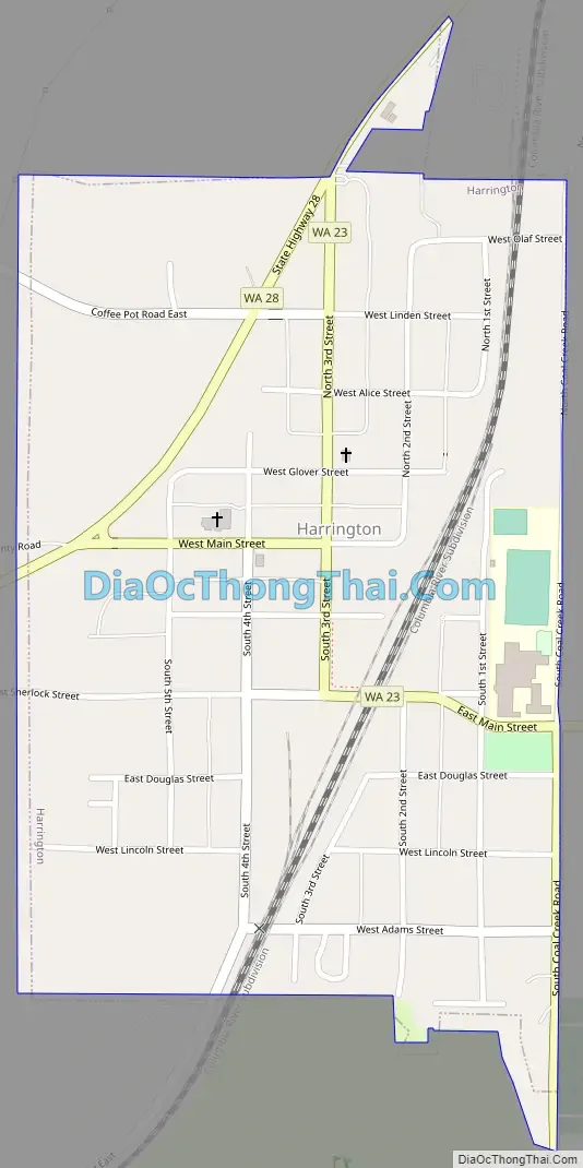
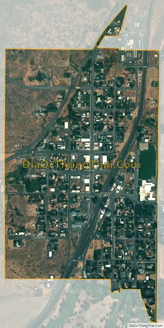
Harrington city Satellite Map
Geography
Harrington is located at 47°28′49″N 118°15′20″W / 47.48028°N 118.25556°W / 47.48028; -118.25556 (47.480251, -118.255422).
According to the United States Census Bureau, the city has a total area of 0.38 square miles (0.98 km), all of it land.
Climate
According to the Köppen Climate Classification system, Harrington has a dry-summer Humid continental climate, abbreviated “Dsb” on climate maps.
See also
Map of Washington State and its subdivision:- Adams
- Asotin
- Benton
- Chelan
- Clallam
- Clark
- Columbia
- Cowlitz
- Douglas
- Ferry
- Franklin
- Garfield
- Grant
- Grays Harbor
- Island
- Jefferson
- King
- Kitsap
- Kittitas
- Klickitat
- Lewis
- Lincoln
- Mason
- Okanogan
- Pacific
- Pend Oreille
- Pierce
- San Juan
- Skagit
- Skamania
- Snohomish
- Spokane
- Stevens
- Thurston
- Wahkiakum
- Walla Walla
- Whatcom
- Whitman
- Yakima
- Alabama
- Alaska
- Arizona
- Arkansas
- California
- Colorado
- Connecticut
- Delaware
- District of Columbia
- Florida
- Georgia
- Hawaii
- Idaho
- Illinois
- Indiana
- Iowa
- Kansas
- Kentucky
- Louisiana
- Maine
- Maryland
- Massachusetts
- Michigan
- Minnesota
- Mississippi
- Missouri
- Montana
- Nebraska
- Nevada
- New Hampshire
- New Jersey
- New Mexico
- New York
- North Carolina
- North Dakota
- Ohio
- Oklahoma
- Oregon
- Pennsylvania
- Rhode Island
- South Carolina
- South Dakota
- Tennessee
- Texas
- Utah
- Vermont
- Virginia
- Washington
- West Virginia
- Wisconsin
- Wyoming