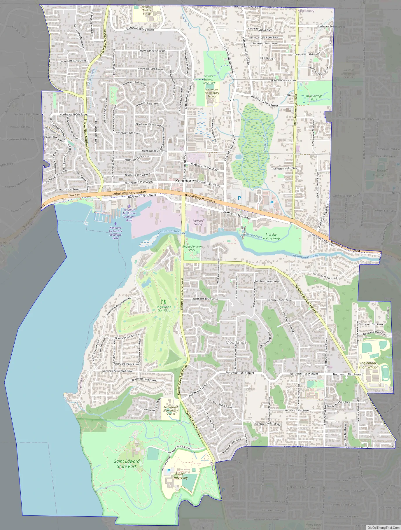
Kenmore is a city in King County, Washington, United States, along the northernmost shore of Lake Washington. It is a suburban commuter town at the mouth of the Sammamish River, 12 miles (19 km) northeast of downtown Seattle and 2 miles (3.2 km) west of Bothell. The population was 20,460 at the 2010 census. Kenmore Air Harbor is the largest seaplane-only passenger facility of its kind in the United States.
Kenmore is connected to nearby areas by State Route 522 and the Burke-Gilman Trail, which both run east–west along the lakeshore. The city limits stretch north to the Snohomish County line and south to a border with Kirkland south of Saint Edward State Park and Bastyr University. Kenmore’s official flower is the dahlia, bird the great blue heron, and evergreen the rhododendron.
| Name: | Kenmore city |
|---|---|
| LSAD Code: | 25 |
| LSAD Description: | city (suffix) |
| State: | Washington |
| County: | King County |
| Incorporated: | August 31, 1998 |
| Elevation: | 30 ft (9 m) |
| Total Area: | 7.22 sq mi (18.69 km²) |
| Land Area: | 6.15 sq mi (15.92 km²) |
| Water Area: | 1.07 sq mi (2.77 km²) |
| Total Population: | 20,460 |
| Population Density: | 3,756.22/sq mi (1,450.40/km²) |
| ZIP code: | 98028 |
| Area code: | 425 |
| FIPS code: | 5335170 |
| GNISfeature ID: | 1512345 |
| Website: | kenmorewa.gov |
Online Interactive Map
Click on ![]() to view map in "full screen" mode.
to view map in "full screen" mode.
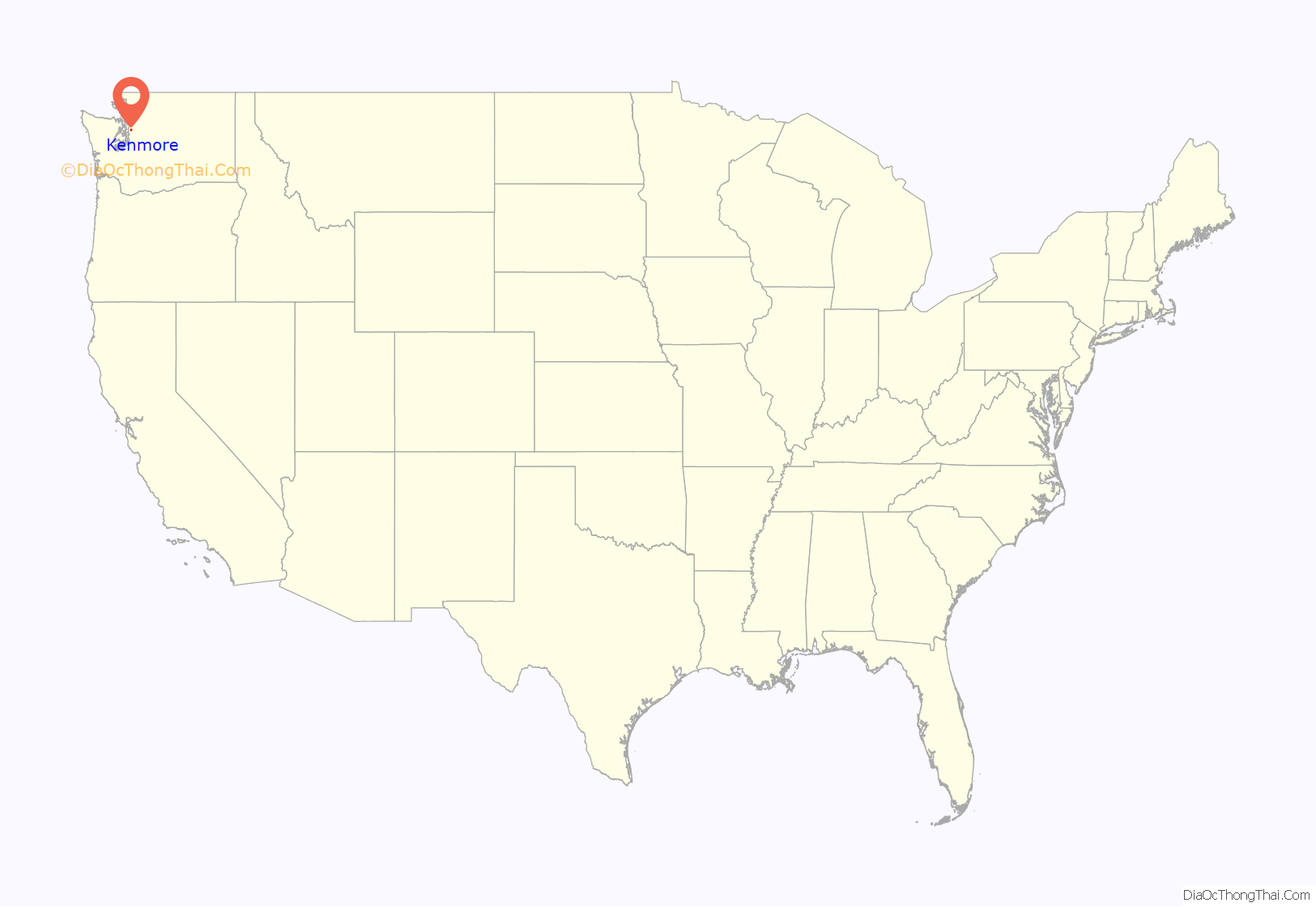
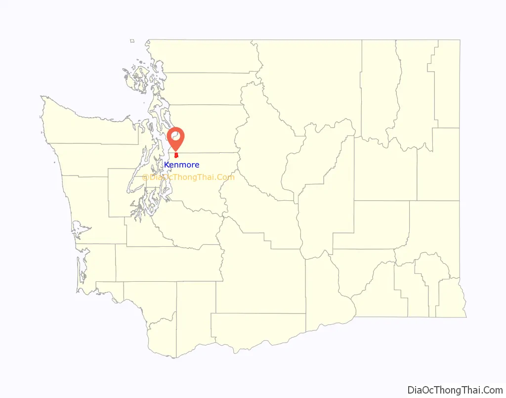
Kenmore location map. Where is Kenmore city?
History
Founded in 1901, Kenmore’s name comes third-hand from the Scottish village of Kenmore, via town founder home town of Kenmore, Ontario. John McMasters and his wife Annie arrived in Puget Sound circa 1889 from Canada, intending to establish themselves in the shingle-making trade. They opened a shingle mill on the northern shore of Lake Washington on land leased from Watson C. Squire. By 1903, Kenmore had established a school system and post office, but it did not formally incorporate as a city until August 31, 1998.
Early 20th century
Despite cargo railway service passing through the area as early as 1887 via the Seattle, Lake Shore and Eastern Railway, most access to the city in its early days was by boat, with regular ferry service to Seattle, Bothell, and Woodinville starting in 1906. The city later gained a passenger railroad stop. The first improved road connection to Seattle and Bothell—the Red Brick Road—opened between 1913 and 1914, with bus service following the laying of the bricks. As a result, Kenmore became a country retreat for weekend gardeners with local landowners selling off clear-cut “garden plots” to Seattlites with automobiles and green thumbs. It attracted at least two short-lived nudist camps during the 1920s.
Far more striking, however, was the impact of Prohibition. Kenmore quickly became famous in Seattle for its fine country dining and, more importantly, its fine country drinking, as a substantial illegal alcohol industry developed to meet the demands of Jazz Age Seattle nightlife. Although relatively close to Seattle proper thanks to Bothell Way’s status as one of the few improved roads then heading north from downtown it was nonetheless far enough out that Department of Revenue officers could, for the most part, ignore it.
The Blind Pig, a roadhouse on Shuter’s Landing at Lake Washington, was probably the most famous of the Kenmore speakeasys. At the lakeside, its illegal hooch could be dumped into the lake quickly and easily should it become necessary. Few people were fooled; the name itself was, in fact, a well-known slang term meaning “speakeasy”. But despite its notoriety, the Pig was not even the city’s most infamous saloon. Routine violence and fist-fights at the Inglewood Tavern earned that establishment an alternative name: the Bucket of Blood.
This archipelago of dining and entertainment – over 30 different restaurants, dance halls, bars, and clubs in a three-block area – remained a major part of Kenmore’s identity through the 1940s.
Post-war redevelopment
Once the Great Depression hit, Kenmore became home for a small settlement of workers under President Franklin D. Roosevelt’s Back to the Land program. Paid by the Works Progress Administration, a small number of workers settled in an area of northwestern Kenmore which became known as “Voucherville”, after the vouchers the WPA paid in lieu of a cash salary.
After the end of World War II, Kenmore became home to US Army Nike Hercules missile batteries as part of cold-war era defense plans. These nuclear-tipped anti-aircraft missiles were intended to protect Seattle and environs from Soviet bombers, should war break out. They were removed in 1974.
The post-war era largely transformed downtown. Kenmore Air Harbor, which today is one of the world’s largest seaplane-only airports, opened not far from the old location of the Blind Pig; Kenmore Air itself today runs a fleet of seaplanes serving waterside destinations throughout Cascadia. At the same time, Kenmore’s immediate proximity to Seattle—just two miles (3 km) north of modern Seattle city limits— made it an early target of post-war housing development. The first plats in the new Uplake neighborhood were sold in 1954. Housing development continued throughout the Kenmore area for the next several decades, mostly following the postwar suburban model; industrial and commercial growth followed quickly behind, and within a few decades, most of the old Kenmore dining and drinking had vanished, replaced by shopping centers, industrial development, and housing. However, one part of this new development brought its own history along with it: the Jewel Box Building in downtown Kenmore is a Seattle World’s Fair artifact, moved from Seattle Center to Kenmore after the end of the fair in October, 1962.
The city gained its first college in 1996, with the relocation of Bastyr University from Seattle onto the grounds of the former St. Edward Seminary.
Incorporation and downtown revitalization
Kenmore residents considered incorporation many times since the town’s founding; one such incorporation vote failed in 1954. The idea gained popular support through the 1990s, however, partly in response to the passage of the Washington State Growth Management Act of 1990. Formation of an exploration committee in 1995 led to a successful public vote shortly thereafter, and the city formally incorporated on August 31, 1998, 97 years after its original founding.
Following incorporation, the new government set about devising a local set of zoning codes and a downtown development plan with the intent of reviving and rebuilding the traditional core areas of the city. A significant component of this plan involves extensive use of land now owned by the city, in the area known within the plan as the Northwest Quadrant. An open invitation was extended to all architects and developers to submit development plans for this newly available area in December, 2005. The City Council chose to negotiate primarily with Kenmore Partners LLC in April 2006. Design plans were submitted to the city the following summer, with a conceptual overview made available to the public at the same time.
Kenmore’s oldest roads, now known most often by their county-assigned number systems, originally had more traditional names such as Cat’s Whiskers Road (61st Avenue NE), Squire Boulevard (later Red Brick Road, now Bothell Way/SR 522), and Remington Drive (NE 181st Street). These traditional names were reinstated in 2007 as secondary names in the downtown area.
Kenmore Road Map
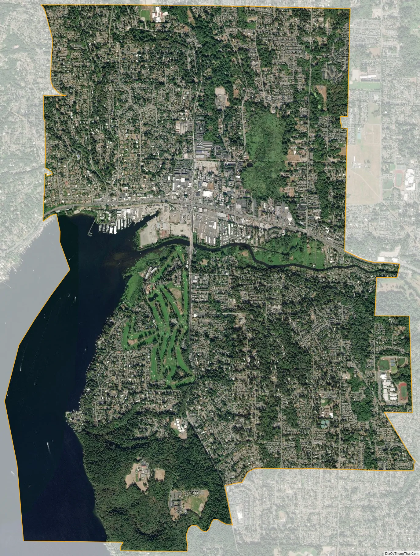
Kenmore city Satellite Map
Geography
Kenmore is located at 47°45′10″N 122°14′50″W / 47.75278°N 122.24722°W / 47.75278; -122.24722 (47.752870, -122.247360), with borders encompassing all of the north shore and a significant portion of the northeastern shore of Lake Washington. The local terrain is typical of the Puget Sound lowlands, consisting largely of rolling hills formed from glacial till, occasionally interrupted by flatlands typically found near substantial bodies of water. The largest river is the Sammamish, which connects Lake Sammamish to Lake Washington, and divides the city into northern and southern halves. Additionally, the northeastern corner of the city includes a narrow set of swamps and marshlands running north to south along Swamp Creek.
According to the United States Census Bureau, the city has a total area of 6.26 square miles (16.21 km), of which, 6.15 square miles (15.93 km) is land and 0.11 square miles (0.28 km) is water.
Surrounding cities & lake
Climate
The climate of Kenmore is substantially similar to that of nearby Seattle, being defined principally by its latitude, proximity to the Pacific Ocean and Puget Sound, and inclusion in the Puget Sound Convergence Zone. As such, it is usually considered Marine west coast in nature, with damp, cool winters, and mild, dry summers, despite being further north than cities such as Toronto, Ontario and Montreal, Quebec.
Neighborhoods
Kenmore has several distinct neighborhoods. These include:
- Arrowhead, in southern Kenmore, on the west (or lake) side, saw its first house built in 1888. This was a small summer cabin; the oldest house still standing dates from 1929.
- Inglewood, in southern Kenmore, was first platted in 1953, with large-scale suburban development appearing by 1962.
- Lower Moorlands, in eastern Kenmore, saw its first house in 1904. The significant development occurring in this area after World War I included the 1927 landmark Charles and Elvera Thomsen House.
- Upper Moorlands, also in eastern Kenmore, saw initial building in 1938-1939 but stayed quite rural due to the lack of a good water system until suburban development arrived in the mid-1950s.
- Central (or downtown) Kenmore hugs Bothell Way and formed the original core of the city. Today it is Kenmore’s commercial and industrial core.
- Northlake Terrace, an early residential neighborhood just north of town, is now a mix of commercial and residential development. Much of the eastern portion of this area is to be redeveloped as part of the new Downtown Plan.
- Linwood Heights, in northwest Kenmore, was first founded as part of the “Back to the Land” movement during the Great Depression. Then derisively referred to as Voucherville, it has long since been redeveloped and is now largely suburban housing. Portions were annexed by Lake Forest Park in 1995, predating Kenmore’s formal incorporation.
- Kenlake Vista, in northern Kenmore, is post-war residential suburban housing.
- Uplake Terrace, a suburban neighborhood developed started in 1953.
- Kenmore Terrace
- Northshore Summit
See also
Map of Washington State and its subdivision:- Adams
- Asotin
- Benton
- Chelan
- Clallam
- Clark
- Columbia
- Cowlitz
- Douglas
- Ferry
- Franklin
- Garfield
- Grant
- Grays Harbor
- Island
- Jefferson
- King
- Kitsap
- Kittitas
- Klickitat
- Lewis
- Lincoln
- Mason
- Okanogan
- Pacific
- Pend Oreille
- Pierce
- San Juan
- Skagit
- Skamania
- Snohomish
- Spokane
- Stevens
- Thurston
- Wahkiakum
- Walla Walla
- Whatcom
- Whitman
- Yakima
- Alabama
- Alaska
- Arizona
- Arkansas
- California
- Colorado
- Connecticut
- Delaware
- District of Columbia
- Florida
- Georgia
- Hawaii
- Idaho
- Illinois
- Indiana
- Iowa
- Kansas
- Kentucky
- Louisiana
- Maine
- Maryland
- Massachusetts
- Michigan
- Minnesota
- Mississippi
- Missouri
- Montana
- Nebraska
- Nevada
- New Hampshire
- New Jersey
- New Mexico
- New York
- North Carolina
- North Dakota
- Ohio
- Oklahoma
- Oregon
- Pennsylvania
- Rhode Island
- South Carolina
- South Dakota
- Tennessee
- Texas
- Utah
- Vermont
- Virginia
- Washington
- West Virginia
- Wisconsin
- Wyoming


