Lake Forest Park is a suburban city in King County, Washington, United States, located northeast of Seattle. It was developed in the 20th century as a bedroom community with single-family housing on medium to large-sized lots. Less than 4% of the city’s land is zoned commercial, largely concentrated in one location, and there are no industrial areas.
The city is situated at the northwest end of Lake Washington along State Route 522, which provides connections to Seattle and Bothell. Lake Forest Park includes several parks and nature reserves, access to the Burke–Gilman Trail, and organized summer events. The population of the city was 12,598 at the 2010 census.
| Name: | Lake Forest Park city |
|---|---|
| LSAD Code: | 25 |
| LSAD Description: | city (suffix) |
| State: | Washington |
| County: | King County |
| Incorporated: | 1961 |
| Elevation: | 69 ft (21 m) |
| Total Area: | 4.15 sq mi (10.74 km²) |
| Land Area: | 3.52 sq mi (9.11 km²) |
| Water Area: | 0.63 sq mi (1.63 km²) |
| Total Population: | 12,598 |
| Population Density: | 3,839.64/sq mi (1,482.51/km²) |
| ZIP code: | 98155 |
| Area code: | 206 |
| FIPS code: | 5337270 |
| GNISfeature ID: | 1512366 |
| Website: | cityoflfp.gov |
Online Interactive Map
Click on ![]() to view map in "full screen" mode.
to view map in "full screen" mode.
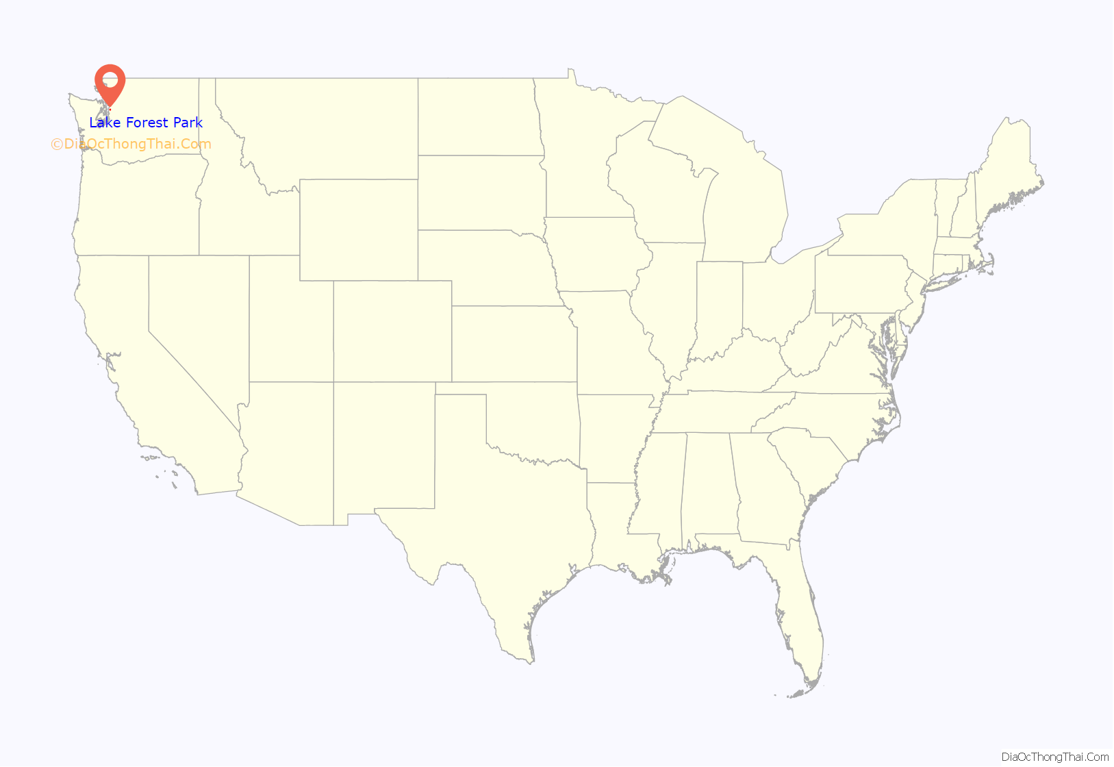
Lake Forest Park location map. Where is Lake Forest Park city?
History
Lake Forest Park was founded in 1912 by Ole Hanson as one of the Seattle area’s first planned communities. Envisioned as a picturesque retreat for professionals, the developers planned roads and lots in strict consideration for natural landmarks. The original prospectus for lot sales declared:
Until 1914 and completion of the Red Brick Road (now Bothell Way, part of State Route 522) to nearby Kenmore and Bothell, it also marked the literal end of improved roads heading north from Seattle, with the best access to points further north and east being by boat across Lake Washington or the Seattle, Lake Shore and Eastern Railway.
Lake Forest Park officially incorporated on June 20, 1961, in large part to help maintain its specific identity. The town remained small – under 5,000 in population – until the 1990s, when a series of annexations expanded city borders significantly and more than doubled the official population.
The 3/4 acre Lyon Creek Park was created in the late 1990s on land purchased by the city in 1998. For the prior fifty years, the lot had belonged to Marcia and Robert Morris, who had built a modernist home and a horse stable on the property. Both buildings were torn down as part of the park conversion, which also included replanting the park with 5,000 native shrubs and plants. The replanting portion of the project involved the labor of hundreds of citizen volunteers.
Lake Forest Park Town Center, the city’s commercial core, was built in 1964 and hugs Bothell Way, not far from the lakeshore. In late 2005, city government began holding public meetings to discuss the future of the town center. The decision was made to renovate Lake Forest Park Town Center and it now spans 18 acres and offers many shopping and dining options along with entertainment. Lake Forest Park Town Center is also home to a branch of the King County Library System, Third Place Books, and Third Place Commons community center.
Lake Forest Park Road Map
Lake Forest Park city Satellite Map
Geography
Lake Forest Park is situated at the north end of Lake Washington. The city’s southern boundary begins at the city limit of Seattle. To the north, Lake Forest Park ends at the Snohomish county line, where the adjacent towns of Mountlake Terrace and Brier border it. To the east, the city is bounded by Lake Washington and at 55th Avenue NE where the city of Kenmore begins; the Burke-Gilman Trail runs in parallel to the lake shore, following the shoreline into Kenmore to the north, and Seattle to the south. The city’s western boundary is at the City of Shoreline’s city limit, mostly following 25th Avenue NE.
According to the United States Census Bureau, the city has a total area of 3.65 square miles (9.45 km), of which, 3.53 square miles (9.14 km) is land and 0.12 square miles (0.31 km) is water. The two largest streams are Lyon Creek and McAleer Creek, both of which provide habitat for salmon. The shoreline includes two private beach clubs but no public boat access to Lake Washington; however, Lyon Creek Waterfront Preserve offers 100 feet of Lake Washington shoreline and a viewing dock that extends out into the lake.
Parks
- Horizon View Park is located at the highest point in Lake Forest Park and offers fields, a children’s playground with swings and a play train, a basketball half-court, tennis court, play field, picnic tables, and paved pathways through a natural, wooded area. Horizon View covers 8.4 acres and is located at 19800 47th Ave NE (198th St at 47th Ave NE).
- Pfingst Animal Acres Park is located at NE 178th St and Brookside Blvd and features picnic tables, a 0.25 mile walking loop, a salmon viewing platform, and a beautiful dogwood flower-shaped drinking fountain for people and dogs. The park is also home to a bust of Admiral Miguel Grau Seminario that was presented to the City of Lake Forest Park by the Consulate General of Peru and the Peruvian Navy in 2011.
- Grace Cole Nature Park is a 15.2 acre wetland named after distinguished State Representative Grace Cole and is located at 30th Ave NE at NE 166th St. The Lake Forest Park Stewardship Foundation hosts regular “ivy out” work parties in the summer to restore and preserve the wildlife habitat.
- Lyon Creek Waterfront Preserve is located across the street from the Lake Forest Park Town Center at 17337 Beach Drive NE, next to the Lake Forest Park Civic Club. A short trail and boardwalk are perfect for viewing where Lyon Creek meets Lake Washington. This park includes 100 feet of Lake Washington shoreline.
- Whispering Willow Park is found at 17038 44th Ave NE. The park features a short boardwalk, seating, and a natural children’s play area. It connects 44th Ave NE with the Lake Forest Park Town Center.
See also
Map of Washington State and its subdivision:- Adams
- Asotin
- Benton
- Chelan
- Clallam
- Clark
- Columbia
- Cowlitz
- Douglas
- Ferry
- Franklin
- Garfield
- Grant
- Grays Harbor
- Island
- Jefferson
- King
- Kitsap
- Kittitas
- Klickitat
- Lewis
- Lincoln
- Mason
- Okanogan
- Pacific
- Pend Oreille
- Pierce
- San Juan
- Skagit
- Skamania
- Snohomish
- Spokane
- Stevens
- Thurston
- Wahkiakum
- Walla Walla
- Whatcom
- Whitman
- Yakima
- Alabama
- Alaska
- Arizona
- Arkansas
- California
- Colorado
- Connecticut
- Delaware
- District of Columbia
- Florida
- Georgia
- Hawaii
- Idaho
- Illinois
- Indiana
- Iowa
- Kansas
- Kentucky
- Louisiana
- Maine
- Maryland
- Massachusetts
- Michigan
- Minnesota
- Mississippi
- Missouri
- Montana
- Nebraska
- Nevada
- New Hampshire
- New Jersey
- New Mexico
- New York
- North Carolina
- North Dakota
- Ohio
- Oklahoma
- Oregon
- Pennsylvania
- Rhode Island
- South Carolina
- South Dakota
- Tennessee
- Texas
- Utah
- Vermont
- Virginia
- Washington
- West Virginia
- Wisconsin
- Wyoming
