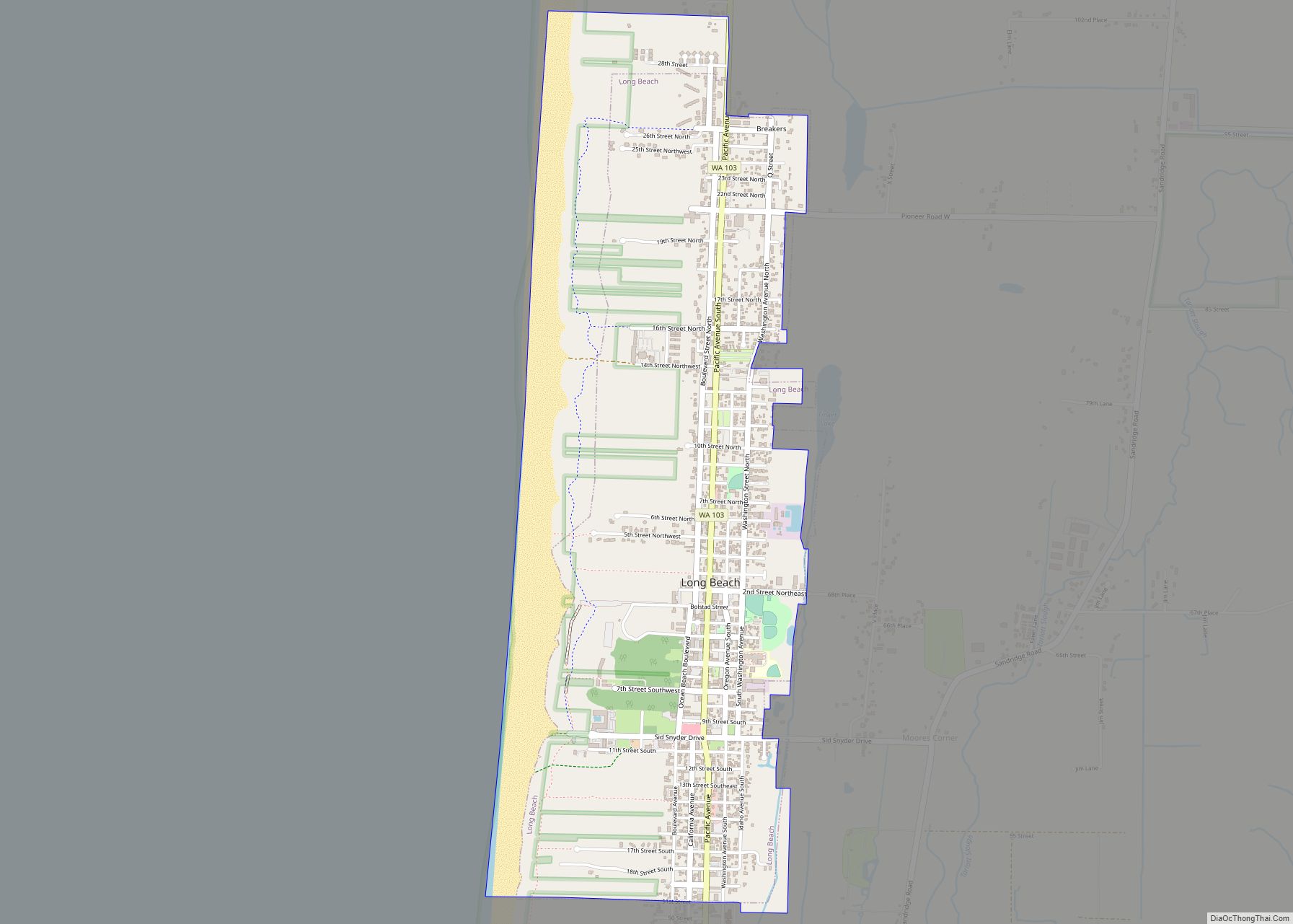
Long Beach is a city in Pacific County, Washington, United States. The population was 1,392 at the 2010 census.
| Name: | Long Beach city |
|---|---|
| LSAD Code: | 25 |
| LSAD Description: | city (suffix) |
| State: | Washington |
| County: | Pacific County |
| Incorporated: | January 18, 1922 |
| Elevation: | 10 ft (3 m) |
| Total Area: | 1.89 sq mi (4.90 km²) |
| Land Area: | 1.38 sq mi (3.57 km²) |
| Water Area: | 0.51 sq mi (1.33 km²) |
| Total Population: | 1,392 |
| Population Density: | 1,084.84/sq mi (418.72/km²) |
| ZIP code: | 98631 |
| Area code: | 360 |
| FIPS code: | 5340070 |
| GNISfeature ID: | 1512400 |
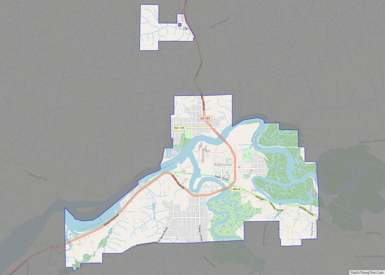
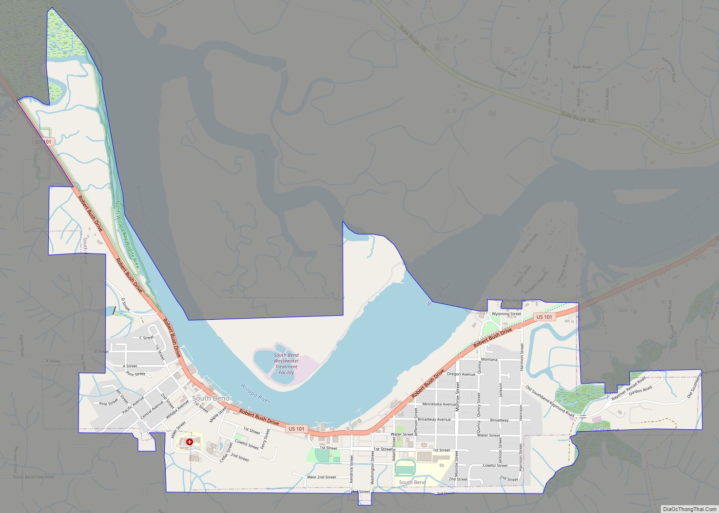
Online Interactive Map
Click on ![]() to view map in "full screen" mode.
to view map in "full screen" mode.
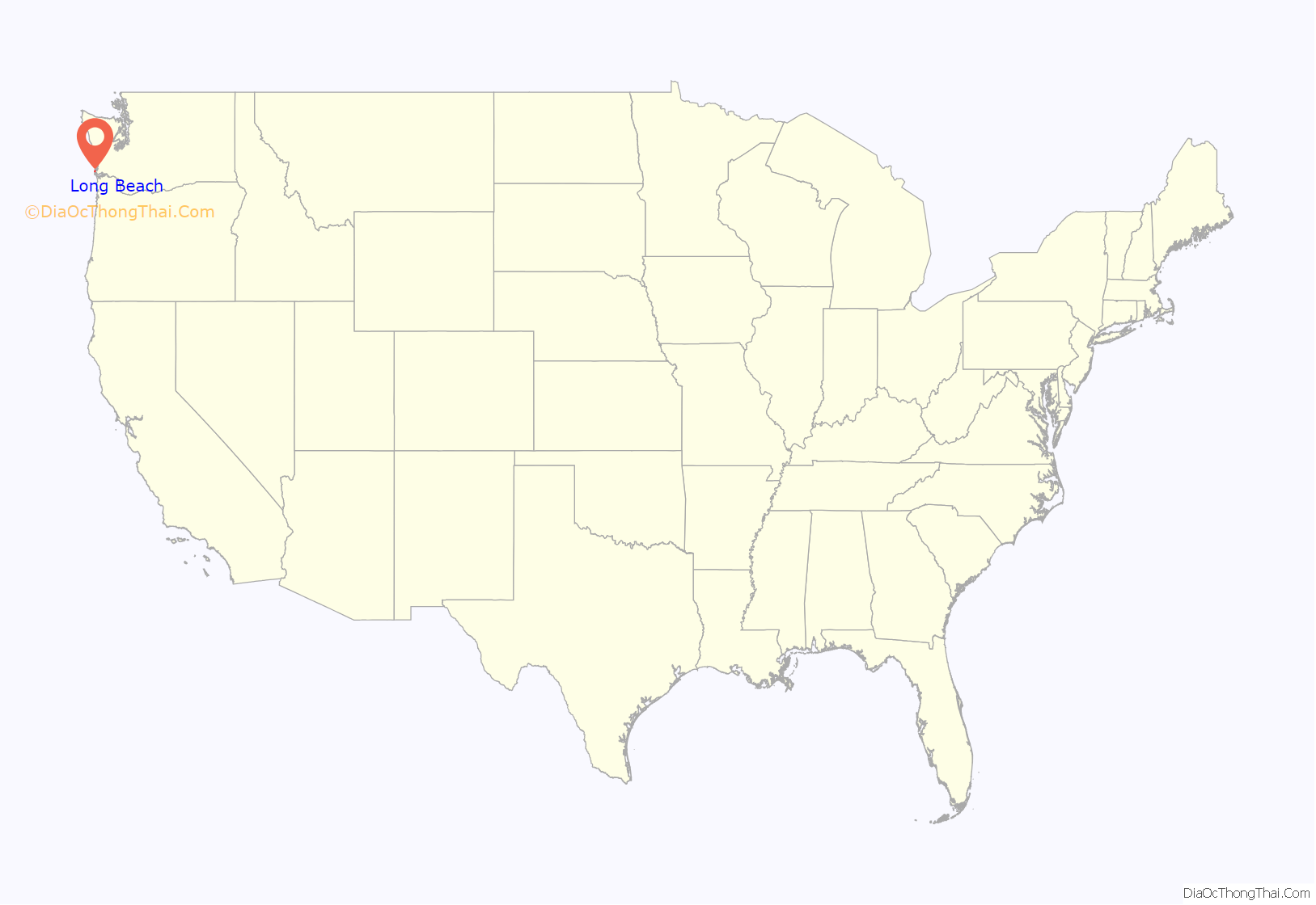
Long Beach location map. Where is Long Beach city?

History
Long Beach began when Henry Harrison Tinker bought a land claim from Charles E. Reed in 1880. He platted the town and called it “Tinkerville.” Long Beach was officially incorporated on January 18, 1922. From 1889 to 1930, a narrow-gauge railroad called the Ilwaco Railway and Navigation Company ran up the whole peninsula.
The Long Beach depot was built between First and Second Streets on the east side of the track, which ran north along “B” Street. A major destination in Long Beach was Tinker’s Hotel, later renamed the Long Beach Hotel, and built very close to the station. This was the second hotel built at the site by Henry Harrison Tinker, the founder of Long Beach. Tinker’s first hotel burned down in 1894. He built another one just a few feet to the east and south of the rail depot. The image in the gallery shows a crowd waiting for the train sometime between 1901 and 1907. Just across the tracks (which doubled in this area) from Tinker’s Hotel in Long Beach was the Portland Hotel. The Portland Hotel, owned by the Hanniman family featured an enormous round (and unique) turret-like structure. The Portland Hotel burned down on December 6, 1914, and was not replaced. The Driftwood Hotel was another common Long Beach destination.
The boardwalk area near the station was known as “Rubberneck Row.” Businesses existing in August 1911 that can be identified along Rubberneck Row from photographs (see images in this article) include, on the west side of the tracks, an establishment advertising “Baths” (possibly the Crystal Baths, an indoor swimming pool), Milton York Candies, a “Postal Shop,” and a soda fountain just across from the station advertising “Milk Shake.” A somewhat earlier photograph shows a sign for a livery stable immediately to the west across the tracks from Tinker’s Hotel, followed (proceeding southwards) by a barber shop, “Vincent’s Souvenirs,” and “The Candy Man”. A banner stretching above the tracks advertises a restaurant. The photo published by Feagans shows it was produced by H.A. Vincent, Ilwaco and Long Beach, who was probably the owner of Vincent’s Souvenirs. Then, in the late 1980s, Marsh’s Free Museum was made, to show people the wonders of the Northwest.
Long Beach Road Map
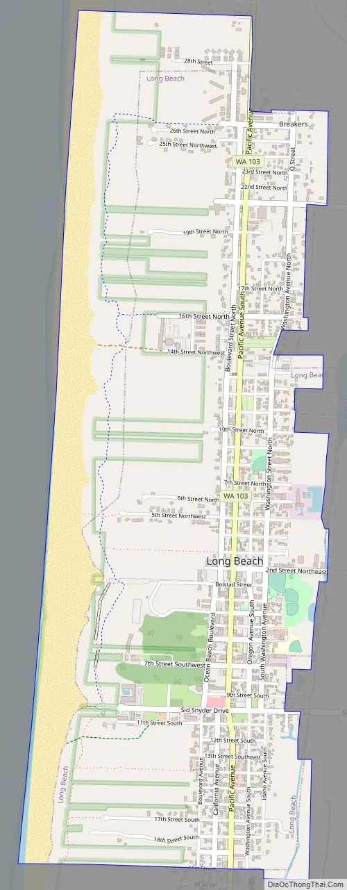
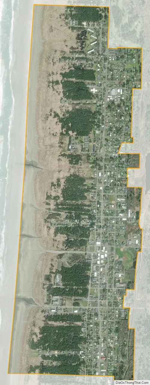
Long Beach city Satellite Map
Geography
Long Beach is located at 46°21′3″N 124°3′13″W / 46.35083°N 124.05361°W / 46.35083; -124.05361 (46.350959, -124.053643) on the Long Beach Peninsula. According to the United States Census Bureau, the city has a total area of 1.35 square miles (3.50 km), all of it land.
Climate
According to the Köppen climate classification system, Long Beach and the Long Beach Peninsula have a moist, cool oceanic climate (Cfb). Both extreme heat and extreme cold are rare. The record high temperature is 99 °F (37 °C) on August 10, 1981, and June 27, 2021, and the record low is 0 °F (−18 °C) on December 8, 1972. Long Beach records nearly 80 inches (2,000 mm) of rainfall annually. Snow is far less common than rain, but can happen every once in a while.
Earthquake and tsunami vulnerability
If a magnitude 9.0 earthquake were to hit the Cascadia subduction zone, emergency planners estimate the first tsunami waves could hit Long Beach 20 to 25 minutes later.
At a December 2016 open house, the city government presented initial plans for a proposed 32-foot (9.8 m) berm which could potentially accommodate 850 persons. The structure would have had a “modified prow,” much like a ship looking out to sea. The shape was also designed to withstand the backwash from a tsunami. The total cost was estimated at $3.4 million, of which the Federal Emergency Management Agency (FEMA) was to pay 75%, the Emergency Management Division of Washington State 12.5%, and the City of Long Beach 12.5%. The project was abandoned in 2017 after new scientific reports indicated it was designed at least 14.5 feet (4.4 m) too short to withstand a worst-case tsunami.
See also
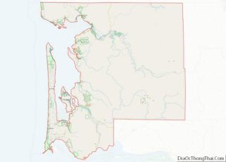
Map of Washington State and its subdivision:- Adams
- Asotin
- Benton
- Chelan
- Clallam
- Clark
- Columbia
- Cowlitz
- Douglas
- Ferry
- Franklin
- Garfield
- Grant
- Grays Harbor
- Island
- Jefferson
- King
- Kitsap
- Kittitas
- Klickitat
- Lewis
- Lincoln
- Mason
- Okanogan
- Pacific
- Pend Oreille
- Pierce
- San Juan
- Skagit
- Skamania
- Snohomish
- Spokane
- Stevens
- Thurston
- Wahkiakum
- Walla Walla
- Whatcom
- Whitman
- Yakima
- Alabama
- Alaska
- Arizona
- Arkansas
- California
- Colorado
- Connecticut
- Delaware
- District of Columbia
- Florida
- Georgia
- Hawaii
- Idaho
- Illinois
- Indiana
- Iowa
- Kansas
- Kentucky
- Louisiana
- Maine
- Maryland
- Massachusetts
- Michigan
- Minnesota
- Mississippi
- Missouri
- Montana
- Nebraska
- Nevada
- New Hampshire
- New Jersey
- New Mexico
- New York
- North Carolina
- North Dakota
- Ohio
- Oklahoma
- Oregon
- Pennsylvania
- Rhode Island
- South Carolina
- South Dakota
- Tennessee
- Texas
- Utah
- Vermont
- Virginia
- Washington
- West Virginia
- Wisconsin
- Wyoming