Monroe is a city in Snohomish County, Washington, United States. It is located at the confluence of the Skykomish, Snohomish, and Snoqualmie rivers near the Cascade foothills, about 30 miles (48 km) northeast of Seattle. Monroe’s population was 19,699 as of the 2020 census and was estimated to be 20,209 in 2021.
Monroe was originally founded in 1864 as the town of Park Place, located at the river confluence among several existing settlements in the Tualco Valley. The townsite was previously a trading post used by the indigenous Skykomish people. Park Place was renamed to Monroe in 1890 to honor U.S. President James Monroe, and was moved northeast to be near the tracks of the Great Northern Railway, which was constructed in 1892. Monroe was incorporated in 1902 and was selected as the home of a major condensed milk plant and the state reformatory.
Monroe became a suburban bedroom community in the late 20th century, serving commuters to Everett, Seattle, and the Eastside. It is home to the Monroe Correctional Complex, which absorbed the original reformatory in 1998, and the Evergreen State Fair, which runs annually in late summer. The city is located at the junction of two highways, U.S. Route 2 and State Route 522, which were expanded in the late 20th century to serve commuters.
| Name: | Monroe city |
|---|---|
| LSAD Code: | 25 |
| LSAD Description: | city (suffix) |
| State: | Washington |
| County: | Snohomish County |
| Founded: | 1864 |
| Incorporated: | December 20, 1902 |
| Elevation: | 72 ft (22 m) |
| Total Area: | 6.16 sq mi (15.95 km²) |
| Land Area: | 6.10 sq mi (15.79 km²) |
| Water Area: | 0.06 sq mi (0.16 km²) |
| Total Population: | 19,699 |
| Population Density: | 3,243.56/sq mi (1,252.39/km²) |
| ZIP code: | 98272 |
| Area code: | 360 |
| FIPS code: | 5346685 |
| GNISfeature ID: | 1523319 |
| Website: | ci.monroe.wa.us |
Online Interactive Map
Click on ![]() to view map in "full screen" mode.
to view map in "full screen" mode.
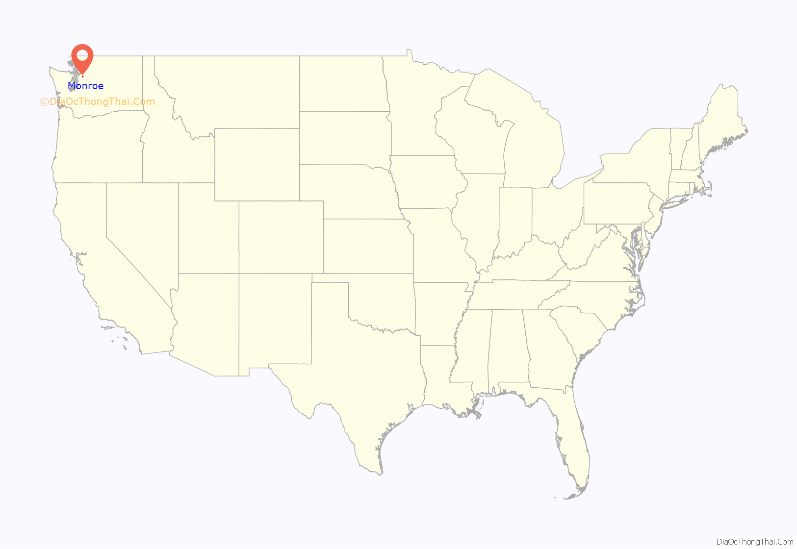
Monroe location map. Where is Monroe city?
History
Origins and establishment of Park Place
The confluence of the Skykomish and Snoqualmie rivers had originally belonged to the indigenous Skykomish tribe, who predominantly occupied the area between modern-day Monroe and Index. The confluence itself was known as Tualco (Lushootseed: squa’lxo), and a nearby Skykomish village named S’dodohobc acted as a trade post between several Coast Salish groups. A separate settlement near modern-day Monroe was used by the S’dodohobc band of the Snohomish people. The land around the confluence was cleared into a prairie and used to cultivate berries, hazelnuts, and other plants. The Skykomish were among the tribes to sign the Treaty of Point Elliott in 1855, effectively ceding their traditional territories, including the Tualco and confluence areas.
The area around modern-day Monroe was surveyed by George B. McClellan and the U.S. Army Corps of Engineers during their expedition to find a suitable pass for a railroad across the Cascade Mountains. The Treaty of Point Elliott was not fully ratified until 1859, but the first American settlers had already arrived and claimed squatters rights to homestead in the Skykomish Valley. Robert Smallman, an English immigrant, arrived in 1855 and was the first to homestead on the land around modern-day Monroe. He was followed by Henry McClurg, an appointed county commissioner, who settled in the area with his wife Martha in 1860. McClurg later founded the settlement of Park Place in 1864, on a site one mile (1.6 km) west of modern-day downtown Monroe. Two other settlers arrived in 1860: Salem Woods, who claimed a small prairie to the northeast of Tualco and was later elected county sheriff; and Charles Harriman, a territorial legislator who settled in Park Place.
Park Place and Tualco, located on opposite sides of the Skykomish River, grew with the arrival of more settlers in the 1860s and 1870s. A local school district, the second in the county, was established in 1869 by McClurg, and Park Place gained a post office in 1877 with Woods as postmaster. A ferry crossing the Skykomish River was established in 1882, several years prior to the start of regular steamship service on the river as far east as Sultan. The first roads in the area were surveyed in 1882, including an 11-mile (18 km) wagon road connecting Park Place to Snohomish in the west. During the 1880s, settlers in Park Place and Tualco received their first shipment of dairy cattle and also began planting hops, which would briefly become a cash crop until the arrival of the hop aphid and economic panic of the 1890s ruined the harvest.
Renaming and relocation
The original Park Place post office and general store were abandoned and replaced by a new building that opened in 1890. John Vanasdlen, operator of new store, petitioned for the reopening of the post office but was rejected by the U.S. Post Office Department, which only allowed a single-word name for new offices. “Monroe” was chosen by Vanasdlen, with the input of McClurg, to honor of U.S. President James Monroe. The new post office for Monroe was granted by the U.S. Post Office Department on March 19, 1890.
The Great Northern Railway chose a route over Stevens Pass in the late 1880s for its transcontinental railroad connecting Seattle to St. Paul, Minnesota, bringing new development to the Skykomish Valley. Monroe at Park Place was platted in 1890 and gained several new businesses, including a blacksmith, grocery store, a second hotel, and a butcher. The final survey for Great Northern in 1891 placed the railroad tracks one mile (1.6 km) northeast of Park Place, bypassing the settlement in favor of a straighter alignment to cross the Snohomish River south of downtown Snohomish.
The railroad built a small depot named “Wales” on the 40-acre (16 ha) homestead of Jack Stretch, who platted a settlement on the north side of the tracks that he named “Tye City” for Great Northern’s locating engineer George Tye. Great Northern completed their railroad through the Skykomish Valley in January 1893, following additional work near Snohomish to rebuild a bridge that had been destroyed in a flood. In late 1892 and early 1893, several merchants in Park Place moved their buildings to the south side of Tye City using teams of oxen, horses, and a steam thresher. After the relocation of Vanasdlen’s general store and post office, the settlement became known as Monroe.
The completion of the railroad attracted lumber operations to the Monroe area, boosted by the opening of the first shingle mill in 1894 and the first sawmill on Woods Creek in 1897. A bridge across the Skykomish River was opened in 1894 to replace the ferry and the town’s first church was established two years later. The county government chose a 40-acre (16 ha) site north of Monroe for a 20-bed poor farm at the modern-day site of the Evergreen State Fairgrounds; it later became the Valley General Hospital. A cooperative of Monroe-area farmers built the city’s first creamery in 1895, which was destroyed in a fire four years later and later rebuilt. By the end of the decade, Monroe had also gained a new school building, telephone service, a local newspaper, a full-time doctor, and paved sidewalks.
Incorporation and new industries
On the morning of September 16, 1901, a fire started at the Odd Fellows community hall and spread to nearby buildings, destroying the only complete block of businesses in Monroe. The fire caused an estimated $8,100 in damage (equivalent to $215,000 in 2021 dollars), but the businesses and buildings were rebuilt and within two years a permanent fire department was established. Monroe was incorporated as a fourth-class town on December 20, 1902, following an 88–37 vote in favor. At the time of incorporation, the area around Monroe had over 900 residents, five general stores, eight saloons, six restaurants, four sawmills, and five shingle mills. A new town hall building was completed in November 1908, costing $7,000 (equivalent to $152,000 in 2021 dollars) and paid for using a saloon license tax; the building now serves as the home of a local history museum.
The new town government granted a municipal water franchise to a private company in 1903, sparking a conflict with local water companies. A competing water company unsuccessfully sued the town for franchise rights, but later acquired the original franchised company to operate Monroe’s water. The town government proposed to acquire the system through a buyout, but their offers were rejected. A separate gravity water system was constructed by the town in 1923 that bankrupted the private system. The town government also granted franchises to private companies for electricity and a hospital in 1903. Monroe gained a new road to Snohomish in 1904, which was followed a year later by a new bridge over the Skykomish River on Lewis Street (now State Route 203).
The state government chose Monroe as the site of the state’s second reformatory in 1907, ahead of competing bids from Arlington and Sultan. The first inmate at the facility’s temporary buildings in August 1908; construction of a permanent building, now part of the Monroe Correctional Complex, began in May 1910 and was completed later that year at a cost of $1.5 million (equivalent to $32 million in 2021 dollars). The Pacific Coast Condensed Milk Company opened a milk condensery in Monroe on August 29, 1908, serving 2,000 visitors on “Condenser Day”. The plant was the largest producer of Carnation brand condensed milk and brought the city’s population to 2,500 within two years of opening. Within a year, the plant was producing 250,000 pounds (110,000 kg) of condensed milk per day; the Carnation condensery was later closed in 1928 and destroyed in a fire on March 23, 1944.
By the early 1910s, Monroe and the Cherry Valley were home to seven school districts serving rural communities in the surrounding area. A union high school was proposed to serve the students graduating from the seven districts and was opened on September 1, 1911. A new train depot was constructed by the Great Northern Railway in 1909 to serve the mainline as well as a branch line traversing the Snoqualmie Valley that was opened two years later by the Milwaukee Road. The local timber industry declined and was replaced by a larger reliance on agriculture, namely dairy, vegetable, and berry farms on the logged-off lands around Monroe. One of the largest farms in the area was a 2,000-acre (810 ha) lettuce farm and meat-packing plant owned by Charles Frye, later the benefactor of the Frye Art Museum in Seattle.
Civic projects and fairs
During the 1920s, several of the larger industrial employers in Monroe expanded their operations and attracted new businesses to the area, including an early radio station. The county government opened a new 100-bed hospital on the poor farm complex in 1925 at a cost of $92,000 (equivalent to $1.14 million in 2021 dollars) to provide services to local residents. By the end of the decade, the town had gained new churches, a new masonic hall, a larger condensery plant, and a movie theater. A greenhouse operated by the Great Northern Railway was established in 1926 to supply passengers and decorate trains with fresh flowers. The complex later expanded to include ten greenhouses, but were demolished in 1962.
At the onset of the Great Depression in 1929, several lettuce farms in the Monroe area had folded and been acquired by the Frye Company, which provided employment through the decade for 1,000 residents. The farm was foreclosed in the late 1930s by a subsidiary of Great Northern after lettuce prices had declined. Service organizations in the town ran charity assistance programs for unemployed residents and their families, raising money from large employers to fund food and clothing donations. The Works Progress Administration (WPA) began civic improvement projects around Monroe in 1933, including repairs to damage caused by a major flood in February 1932. The WPA also funded road improvements and a new middle school with a small auditorium that is now home to the Wagner Performing Arts Center.
The local granges of the Monroe area began organizing agricultural fairs and parades in the 1930s on a semi-regular basis. The county also had its own regular fair that was hosted in Snohomish and Granite Falls until the 1920s. The granges hosted the first Cavalcade of the Valleys in 1941, which was followed by the Snohomish County Fair at the poor farm grounds in 1946. The event was renamed the Evergreen State Fair in 1949 and has been hosted annually in Monroe ever since. The fairgrounds were bisected by U.S. Route 2, the successor to an earlier highway across Stevens Pass, which opened in 1949.
Following the Great Depression and World War II, Monroe’s economy became more reliant on agriculture and smaller industries. A frozen food processing facility was located in Monroe until 1958 and was later replaced with a seafood processor. By 1949, the local government had twice rejected proposals to become a third-class city because of the increased operating costs needed; it also lacked a full-time fire department. The Valley General Hospital was established in 1961 to replace the county-run general hospital on the poor farm complex. A major earthquake struck the Puget Sound region on April 29, 1965, causing severe damage to the original Monroe High School and its annex. The high school campus was demolished and replaced by a new building that opened in October 1968 and served the city until the modern campus was built in 1999. Great Northern was consolidated into the Burlington Northern Railroad in 1970, and the Monroe train depot was demolished in October of that year.
Suburban growth
State Route 522, a new state highway connecting Monroe to Bothell, was opened to traffic on February 10, 1965. The easier car access made Monroe into a bedroom community for Everett, Seattle, and the Eastside region, with new suburban subdivisions being built around the city and annexed by the end of the decade. A new state prison, the Twin Rivers Corrections Center, was opened in 1984 and brought new jobs to the area despite opposition from residents.
The former Frye lettuce farm in western Monroe was sold in the late 1980s to an Eastside-based real estate developer, which proposed the “Fryelands” residential and industrial neighborhood. The Fryelands industrial park, once proposed for a Boeing 777 parts facility, was developed adjacent to another industrial park that was opened a decade earlier. The residential component of the development sold out in 1993 and began construction that year alongside other subdivisions in western Monroe. As part of mitigation for the Fryelands project, an artificial lake named Lake Tye was created to provide wetlands and a park for residents. Between 1990 and 2000, the population of the city doubled to over 13,000.
The increased residential development in Monroe caused worsened congestion on State Route 522, which was named one of the most dangerous highways in the United States. The state government began a widening and safety improvement program in 1995 that has continued since then, gradually building four-lane sections for the highway and upgrading the remaining two-lane sections. During the 1990s and 2000s, several large strip malls and big-box stores were built along U.S. Route 2 north of downtown. The North Kelsey development in the early 2010s brought a controversial Walmart to Monroe, which was challenged by neighborhood activists for violating the city’s plans for a pedestrian-friendly retail neighborhood. Since 2000, the Downtown Revitalization and Enhancement Association of Monroe (DREAM) has sponsored revitalization projects in downtown Monroe to preserve the city’s main street. More recent development in Monroe has been concentrated in the northern hills, which were annexed into the city in the 2000s.
Monroe Road Map
Monroe city Satellite Map
Geography
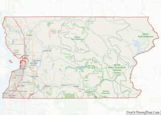
Monroe is located in south-central Snohomish County near the confluence of the Skykomish and Snoqualmie rivers, which form the Snohomish River. The area is in the western foothills of the Cascade Range and is bisected by U.S. Route 2, a major cross-state highway. According to the United States Census Bureau, the city has a total area of 6.11 square miles (15.82 km), of which, 6.05 square miles (15.67 km) is land and 0.06 square miles (0.16 km) is water. The city limits are generally defined by Lake Tye and Fryelands Boulevard to the west, the Skykomish River to the south, Woods Creek to the east, and to the north by Milwaukee Hill and other foothills. Monroe also has an urban growth area that includes 251 acres (102 ha) of unincorporated areas on the north side of the city limits. The city had annexed 1,367 acres (553 ha) of the urban growth area between 1993 and 2011.
The city lies at the eastern end of the Snohomish River floodplain, with elevations that range from 40 to 210 feet (12 to 64 m). The south and east edges of the city along the Skykomish River are within a 100-year flood hazard zone and also include habitats for migratory birds and game animals. The residential neighborhoods of Monroe lie within the watersheds of French Creek and Woods Creek, which both drain into the Skykomish River before its confluence with the Snoqualmie and Snohomish rivers. The surrounding area includes hills and plateaus that were formed from glacial till and gravel deposits from the Skykomish River. Monroe also sits on a local fault line that produced a pair of minor earthquakes on July 12, 2019, that were felt as far as Seattle and Vancouver without causing damage.
Climate
Monroe has a general climate similar to most of the Puget Sound lowlands, with dry summers and mild, rainy winters moderated by a marine influence from the Pacific Ocean. The majority of the region’s precipitation arrives during the winter and early spring, and Monroe averages 177 days of precipitation per year. Monroe’s location in the foothills of the Cascade Range brings additional precipitation compared to nearby communities, with 48 inches (1,200 mm) annually compared to 33 inches (840 mm) in Everett. Monroe rarely receives significant snowfall, with an average of 8 inches (20 cm) per year since 1929.
July is Monroe’s warmest month, with average high temperatures of 76.4 °F (24.7 °C), while January is the coolest, at an average high of 44.9 °F (7.2 °C). The highest recorded temperature, 102 °F (39 °C), occurred on July 29, 2009, and the lowest, −3 °F (−19 °C), occurred on January 18, 1950. The highest recorded snowfall, 60.4 inches (153 cm), also occurred in January 1950. According to the Köppen climate classification system, Monroe has a warm-summer Mediterranean climate (Csb).
On March 30, 2017, an EF0 tornado struck Monroe and damaged several recreational vehicles at a dealership, but did not injure any people. Tornadoes are a rare occurrence in Western Washington, but the Puget Sound Convergence Zone is able to provide the necessary conditions to create one.
See also
Map of Washington State and its subdivision:- Adams
- Asotin
- Benton
- Chelan
- Clallam
- Clark
- Columbia
- Cowlitz
- Douglas
- Ferry
- Franklin
- Garfield
- Grant
- Grays Harbor
- Island
- Jefferson
- King
- Kitsap
- Kittitas
- Klickitat
- Lewis
- Lincoln
- Mason
- Okanogan
- Pacific
- Pend Oreille
- Pierce
- San Juan
- Skagit
- Skamania
- Snohomish
- Spokane
- Stevens
- Thurston
- Wahkiakum
- Walla Walla
- Whatcom
- Whitman
- Yakima
- Alabama
- Alaska
- Arizona
- Arkansas
- California
- Colorado
- Connecticut
- Delaware
- District of Columbia
- Florida
- Georgia
- Hawaii
- Idaho
- Illinois
- Indiana
- Iowa
- Kansas
- Kentucky
- Louisiana
- Maine
- Maryland
- Massachusetts
- Michigan
- Minnesota
- Mississippi
- Missouri
- Montana
- Nebraska
- Nevada
- New Hampshire
- New Jersey
- New Mexico
- New York
- North Carolina
- North Dakota
- Ohio
- Oklahoma
- Oregon
- Pennsylvania
- Rhode Island
- South Carolina
- South Dakota
- Tennessee
- Texas
- Utah
- Vermont
- Virginia
- Washington
- West Virginia
- Wisconsin
- Wyoming
