Normandy Park is a city in King County, Washington, United States. The population was 6,771 at the 2020 census.
| Name: | Normandy Park city |
|---|---|
| LSAD Code: | 25 |
| LSAD Description: | city (suffix) |
| State: | Washington |
| County: | King County |
| Elevation: | 328 ft (100 m) |
| Total Area: | 3.32 sq mi (8.59 km²) |
| Land Area: | 2.50 sq mi (6.47 km²) |
| Water Area: | 0.82 sq mi (2.12 km²) |
| Total Population: | 6,771 |
| Population Density: | 2,643.71/sq mi (1,020.82/km²) |
| ZIP code: | 98148, 98166, 98198 |
| Area code: | 206 |
| FIPS code: | 5349415 |
| GNISfeature ID: | 1512509 |
| Website: | normandyparkwa.gov |
Online Interactive Map
Click on ![]() to view map in "full screen" mode.
to view map in "full screen" mode.
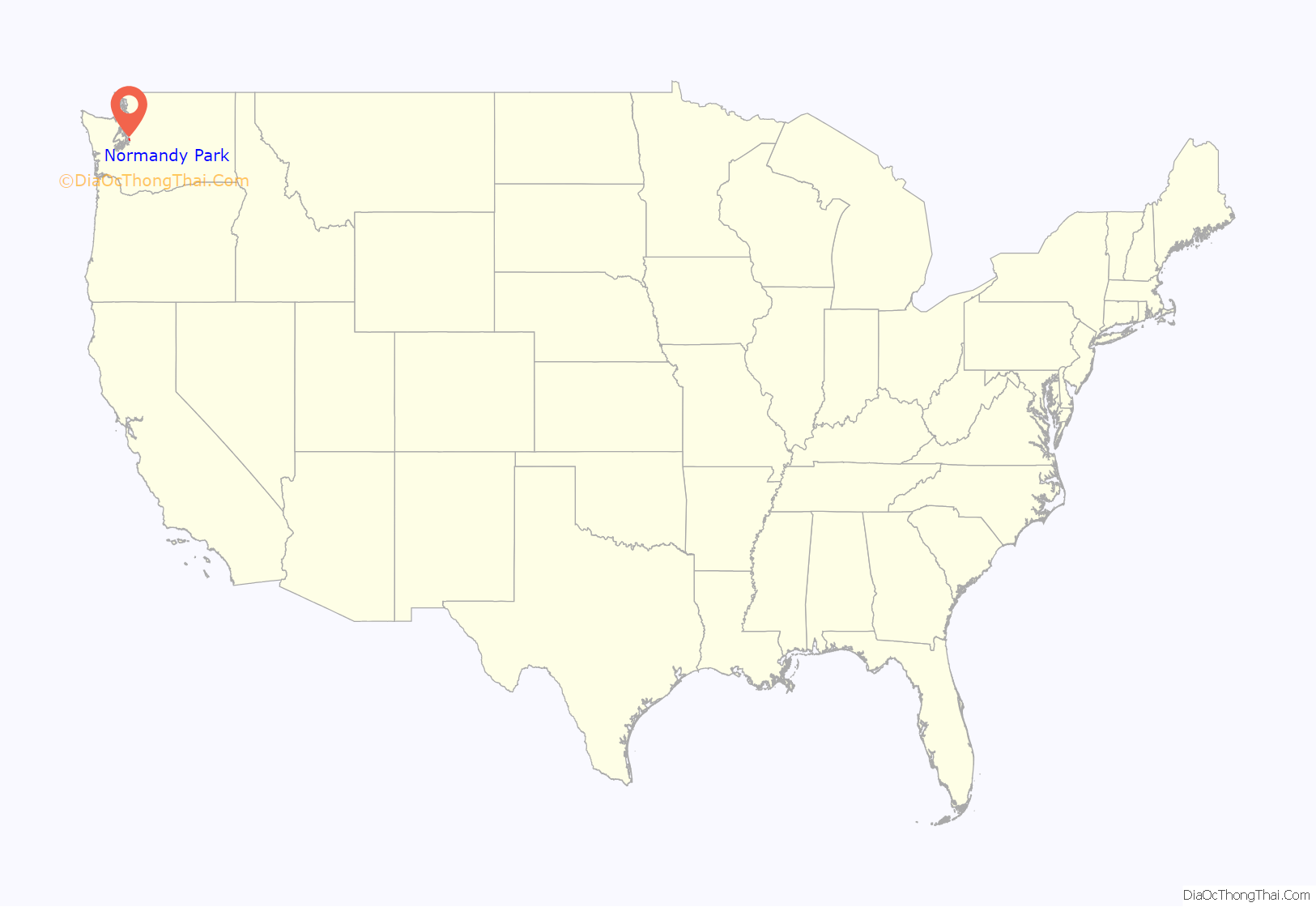
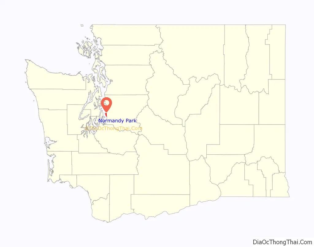
Normandy Park location map. Where is Normandy Park city?
History
Normandy Park was officially incorporated on June 8, 1953. The city is located in King County and is bordered on the north by the City of Burien and by the City of Des Moines to the south.
The Seattle-Tacoma Land Company was organized in the mid-1920s for the purpose of developing 1,200 acres (4.9 km) of land on the shores of Puget Sound between Seattle and Tacoma. The development was to be known as Normandy Park, a planned residential community with strict building codes and numerous restrictions. It was to be a community of distinctive architecture in the French Normandy style, and there was to be a yacht club, two community beaches and a golf course.
By 1929, the entire area had been platted. Good gravel roads were built and a water system installed that was fed from deep wells in the area. An elegant clubhouse was built on what is now known as “Lot A,” and promotional efforts such as free refreshments and band concerts were offered there to promote Normandy Park. Building started with a distinctive brick house on Lot 1, Block 20, built by C. S. Hughett. This house was considered to be the first built according to the plans of the developers. The house is located at 17999 Normandy Terrace SW. A few other houses in the French Normandy style were built soon after, as well as two Prudence Penny Budget houses.
The depression brought a halt to all development activities of Normandy Park and the Seattle-Tacoma Land Company abandoned the project. The clubhouse was sold to the late Ben Tipp in 1934, and much of the property passed into private hands.
In the late 1940s and early 1950s, Normandy Park was rediscovered and, within a few years, many fine homes were built. In a short time it became a vigorous community, so much so that on June 8, 1953, the residents incorporated the area into the City of Normandy Park.
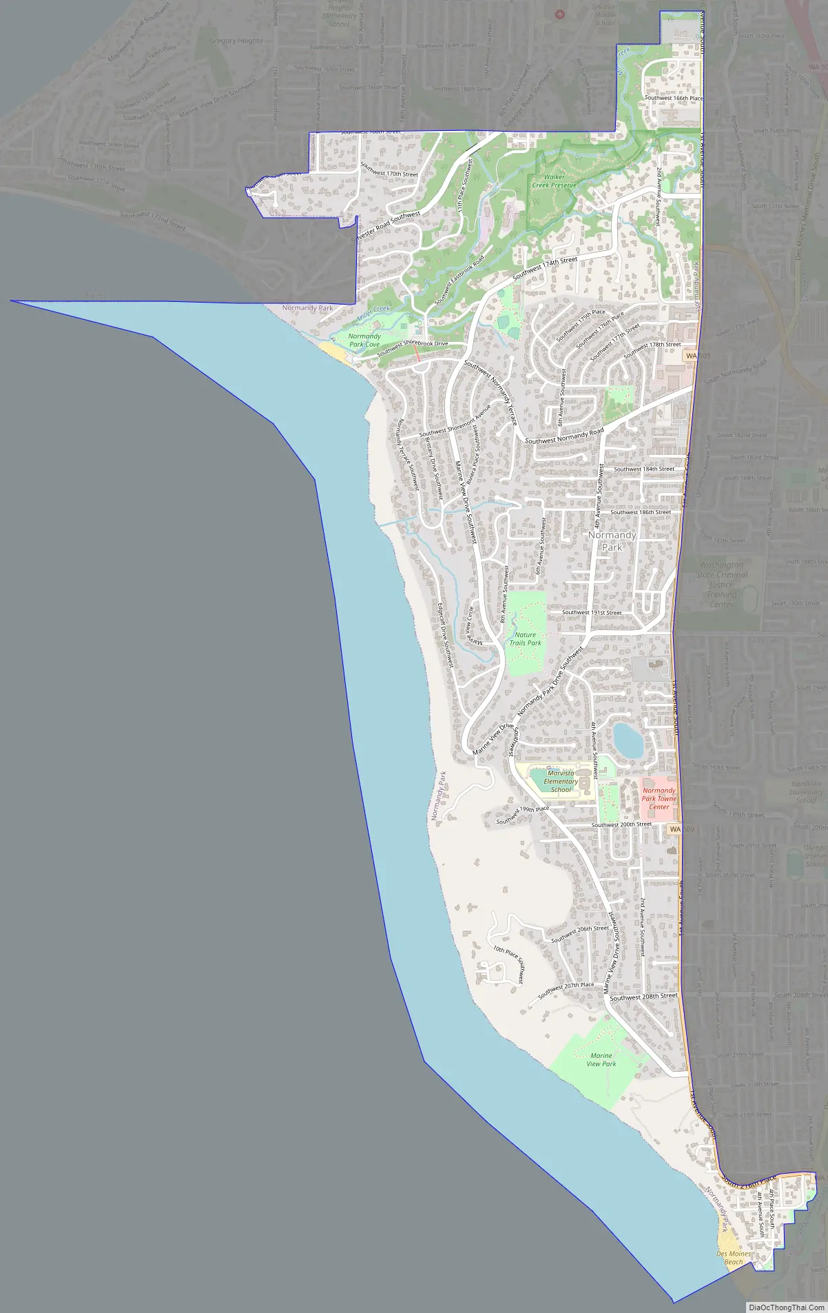
Normandy Park Road Map
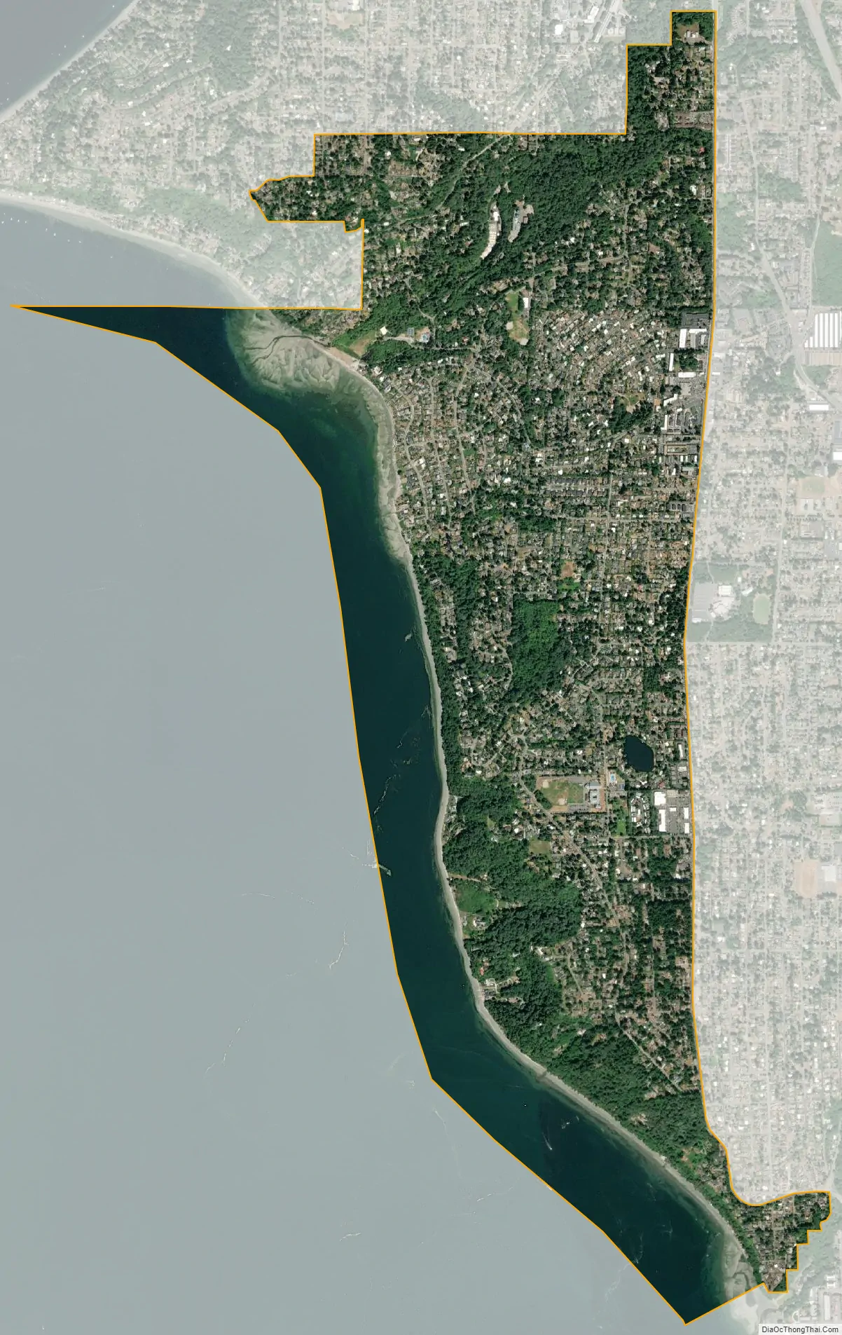
Normandy Park city Satellite Map
Geography
Normandy Park is located at 47°26′14″N 122°20′36″W / 47.43722°N 122.34333°W / 47.43722; -122.34333 (47.437341, -122.343310).
According to the United States Census Bureau, the city has a total area of 6.68 square miles (17.30 km), of which, 2.52 square miles (6.53 km) is land and 4.16 square miles (10.77 km) is water.
See also
Map of Washington State and its subdivision:- Adams
- Asotin
- Benton
- Chelan
- Clallam
- Clark
- Columbia
- Cowlitz
- Douglas
- Ferry
- Franklin
- Garfield
- Grant
- Grays Harbor
- Island
- Jefferson
- King
- Kitsap
- Kittitas
- Klickitat
- Lewis
- Lincoln
- Mason
- Okanogan
- Pacific
- Pend Oreille
- Pierce
- San Juan
- Skagit
- Skamania
- Snohomish
- Spokane
- Stevens
- Thurston
- Wahkiakum
- Walla Walla
- Whatcom
- Whitman
- Yakima
- Alabama
- Alaska
- Arizona
- Arkansas
- California
- Colorado
- Connecticut
- Delaware
- District of Columbia
- Florida
- Georgia
- Hawaii
- Idaho
- Illinois
- Indiana
- Iowa
- Kansas
- Kentucky
- Louisiana
- Maine
- Maryland
- Massachusetts
- Michigan
- Minnesota
- Mississippi
- Missouri
- Montana
- Nebraska
- Nevada
- New Hampshire
- New Jersey
- New Mexico
- New York
- North Carolina
- North Dakota
- Ohio
- Oklahoma
- Oregon
- Pennsylvania
- Rhode Island
- South Carolina
- South Dakota
- Tennessee
- Texas
- Utah
- Vermont
- Virginia
- Washington
- West Virginia
- Wisconsin
- Wyoming


