Onalaska is an unincorporated community and census-designated place (CDP) in Lewis County, Washington, United States. As of the 2020 census it had a population of 657. Onalaska is located along Washington State Route 508.
| Name: | Onalaska CDP |
|---|---|
| LSAD Code: | 57 |
| LSAD Description: | CDP (suffix) |
| State: | Washington |
| County: | Lewis County |
| Elevation: | 515 ft (157 m) |
| Total Area: | 1.60 sq mi (4.15 km²) |
| Land Area: | 1.60 sq mi (4.15 km²) |
| Water Area: | 0.0 sq mi (0.0 km²) |
| Total Population: | 657 |
| ZIP code: | 98570 |
| Area code: | 360 |
| FIPS code: | 5351410 |
| GNISfeature ID: | 2586742 |
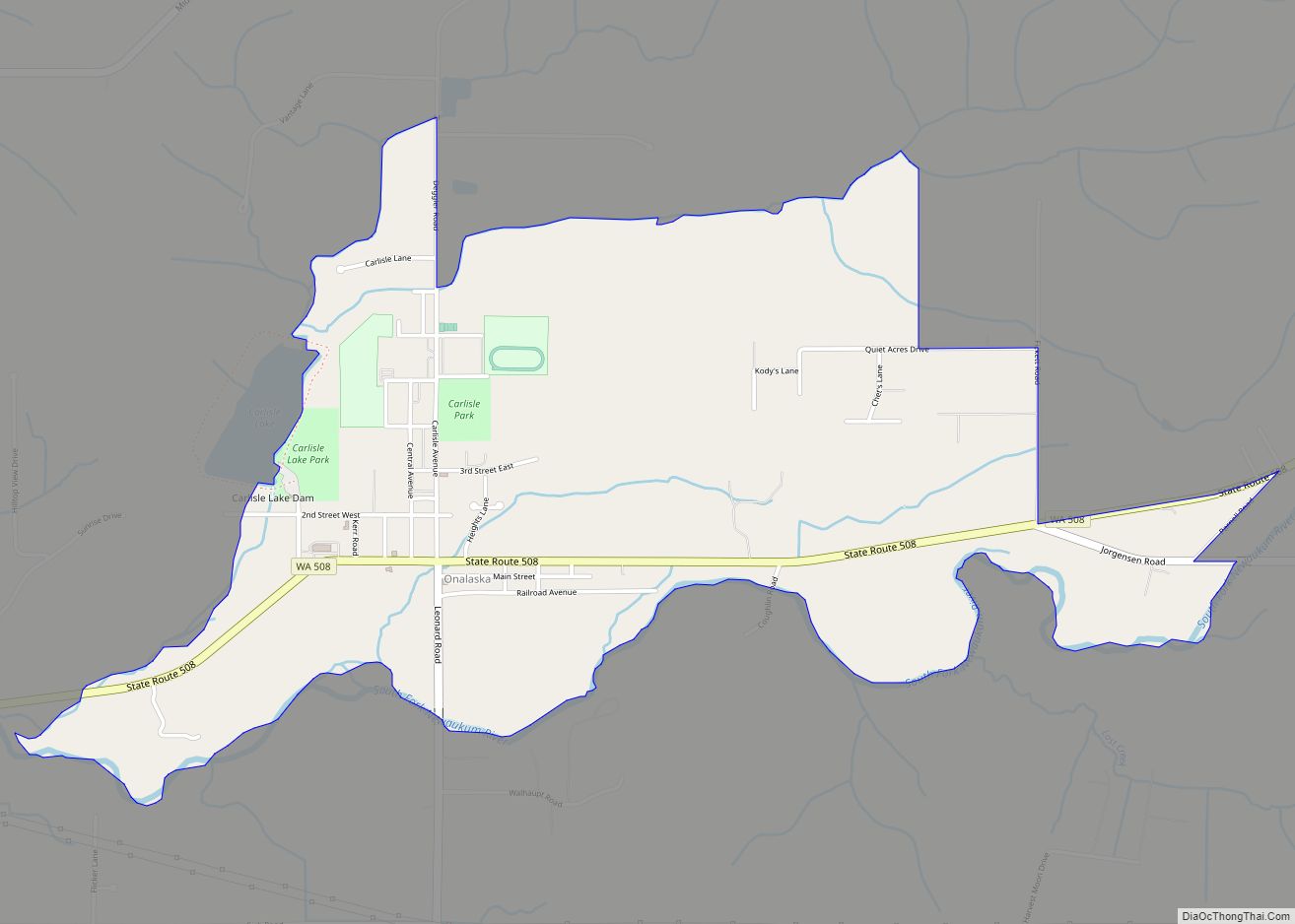
Online Interactive Map
Click on ![]() to view map in "full screen" mode.
to view map in "full screen" mode.
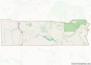
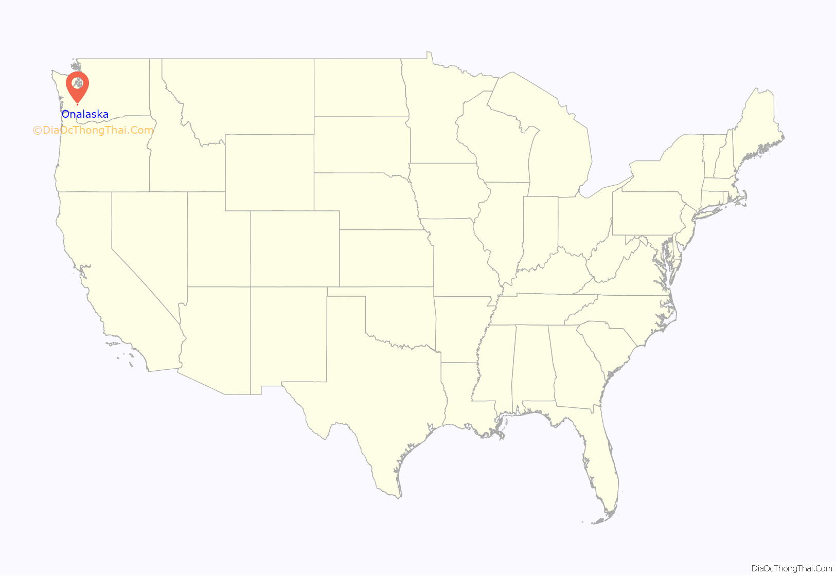
Onalaska location map. Where is Onalaska CDP?

History
Onalaska was built around the inland mill established by the Carlisle Lumber Company in 1909, with actual production commencing in 1914. At its peak in 1929, company inventory numbered over 20 million board feet of lumber — enough to stretch all the way to the Panama Canal. The company closed down the mill and the Carlisle family left the town following issues with unionization in the late 1940s, which they decided not to combat.
The company’s surviving 225-foot smokestack near Carlisle Lake was built around 1920, and is the last trace of one of the most successful mid-sized sawmills in Washington state. In May 2021, the site was listed to the Washington Heritage Register by the Washington State Advisory Council on Historic Preservation.
The mill employed a significant number of Japanese and Japanese Americans. They lived north of today’s State Route 508 and east of Carlisle Avenue. The streets, which ran parallel to Carlisle Avenue were called Oriental Avenue, Nippon Avenue and Tokyo Avenue.
According to Onalaska, a history of the Carlisle Lumber Company by Vic Kucera, the 1940 census showed 62 people of Japanese descent living in Lewis County. Because of their experience in the mill, the local Japanese Americans were forced to relocate to Camp Tulelake in California to help with its construction, Kucera writes. The Army relied on their labor to finish the camp where they were subsequently interned for the duration of WWII.
The Lewis County Museum in Chehalis has an exhibit honoring the Japanese and Japanese American internees.
In 2014, Governor Jay Inslee awarded $20,000 to Onalaska Wood Energy during his Climate Tour that year, and praised the company as “one of the leaders in biofuel technology.” By 2020, the company had left 100,000 gallons of hazardous waste and in 2021 the EPA started an emergency $0.9 million cleanup, shipping the waste by truck and railroad to Idaho and Utah.
Onalaska Road Map
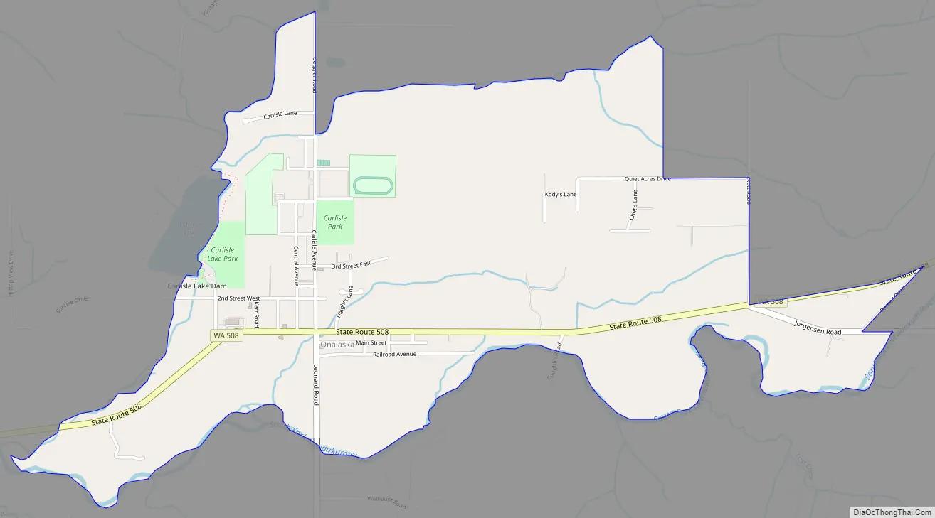
Onalaska city Satellite Map

Geography
Onalaska is in west-central Lewis County, in the valley of the South Fork of the Newaukum River. State Route 508 passes through the community, leading west 9 miles (14 km) to Napavine and east 24 miles (39 km) to Morton. Chehalis, the Lewis county seat, is 14 miles (23 km) northwest of Onalaska.
According to the U.S. Census Bureau, the Onalaska CDP has an area of 1.6 square miles (4.2 km), all of it recorded as land. The South Fork of the Newaukum forms the southern edge of the community, and Carlisle Lake is on the western edge. The Newaukum River flows west to the Chehalis River at Chehalis.
See also
Map of Washington State and its subdivision:- Adams
- Asotin
- Benton
- Chelan
- Clallam
- Clark
- Columbia
- Cowlitz
- Douglas
- Ferry
- Franklin
- Garfield
- Grant
- Grays Harbor
- Island
- Jefferson
- King
- Kitsap
- Kittitas
- Klickitat
- Lewis
- Lincoln
- Mason
- Okanogan
- Pacific
- Pend Oreille
- Pierce
- San Juan
- Skagit
- Skamania
- Snohomish
- Spokane
- Stevens
- Thurston
- Wahkiakum
- Walla Walla
- Whatcom
- Whitman
- Yakima
- Alabama
- Alaska
- Arizona
- Arkansas
- California
- Colorado
- Connecticut
- Delaware
- District of Columbia
- Florida
- Georgia
- Hawaii
- Idaho
- Illinois
- Indiana
- Iowa
- Kansas
- Kentucky
- Louisiana
- Maine
- Maryland
- Massachusetts
- Michigan
- Minnesota
- Mississippi
- Missouri
- Montana
- Nebraska
- Nevada
- New Hampshire
- New Jersey
- New Mexico
- New York
- North Carolina
- North Dakota
- Ohio
- Oklahoma
- Oregon
- Pennsylvania
- Rhode Island
- South Carolina
- South Dakota
- Tennessee
- Texas
- Utah
- Vermont
- Virginia
- Washington
- West Virginia
- Wisconsin
- Wyoming