Pateros /pəˈtærəs/ pə-TARR-əs is a city in Okanogan County, Washington, United States. The population was 643 at the 2000 census and increased 3.7% to 667 in the 2010 census.
| Name: | Pateros city |
|---|---|
| LSAD Code: | 25 |
| LSAD Description: | city (suffix) |
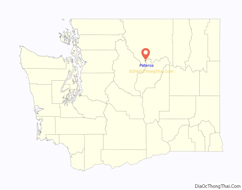
| State: | Washington |
| County: | Okanogan County |
| Founded: | c. 1886 |
| Incorporated: | May 1, 1913 |
| Elevation: | 804 ft (245 m) |
| Total Area: | 0.70 sq mi (1.82 km²) |
| Land Area: | 0.51 sq mi (1.31 km²) |
| Water Area: | 0.20 sq mi (0.51 km²) |
| Total Population: | 667 |
| Population Density: | 1,413.86/sq mi (546.23/km²) |
| ZIP code: | 98846 |
| Area code: | 509 |
| FIPS code: | 5353720 |
| GNISfeature ID: | 1524247 |
Online Interactive Map
Click on ![]() to view map in "full screen" mode.
to view map in "full screen" mode.
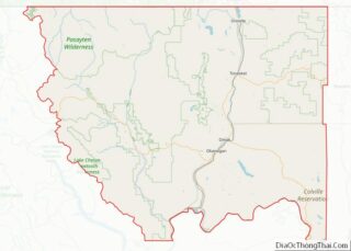
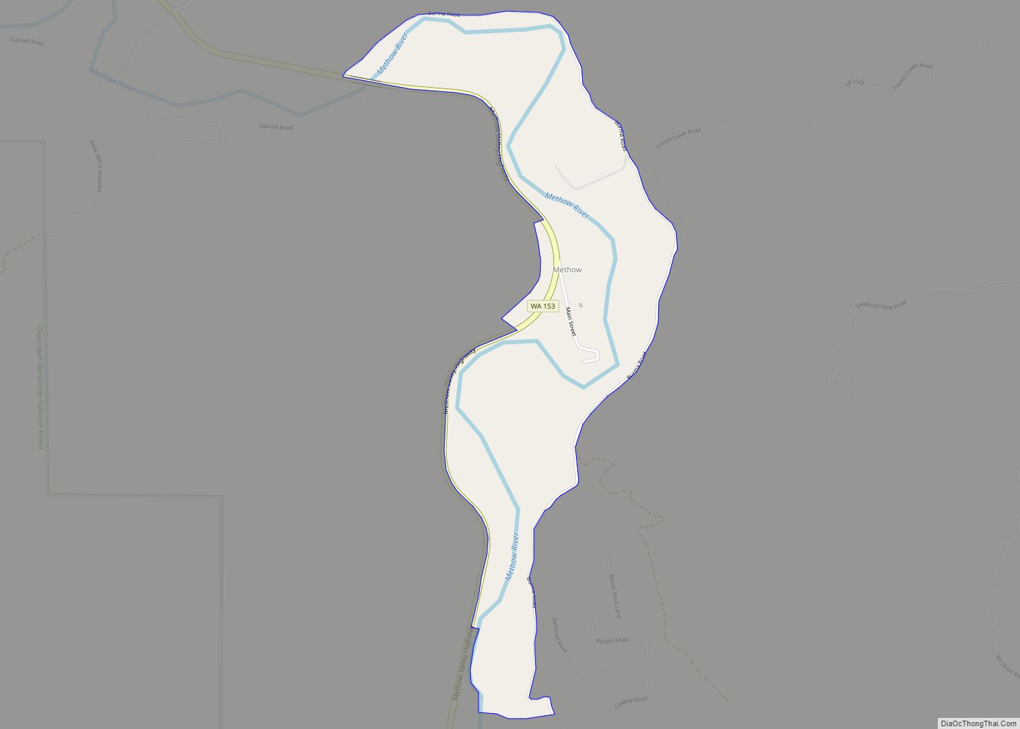
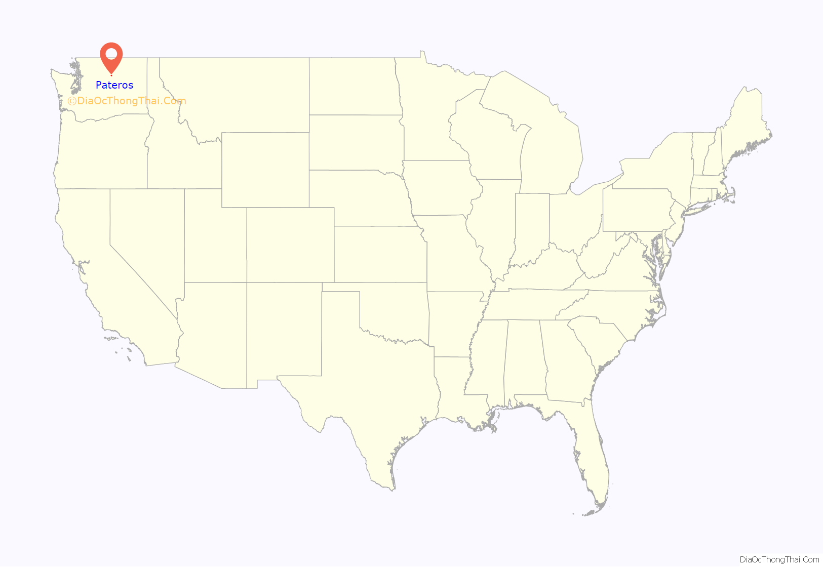
Pateros location map. Where is Pateros city?
History
Pateros was originally established as Ive’s Landing in around 1886 by Lee Ives. Ives began farming the area near the confluence of the Methow and Columbia Rivers, which was populated by a small band of Native Americans and around 20 Chinese miners. Ives also built an 18-room hotel at the town site and operated a ferry crossing. The first post office was built in 1895.
In 1900, Charles Nosler acquired most of the townsite. He renamed the town to Pateros, after a town in the Philippines he previously visited. In 1903, the city consisted of four commercial establishments and nine residences and the town was sold to J.C. Steiner. Steiner vigorously promoted the town, making Pateros the principal rail shipping point between Oroville and Wenatchee. Pateros was officially incorporated on May 1, 1913.
In 1962, the Federal Power Commission granted the Douglas County Public Utility District a 50-year license to build and operate Wells Dam about 8 miles downstream of Pateros. Construction of the dam would flood much of the original city. The Pateros City Council accepted an offer to relocate the town, and the PUD spent about US$1,000,000 on moving or demolishing buildings and improving the town’s infrastructure. Wells Dam went into operation in 1967. Despite relocation of the city, the population dropped by almost a third from 1960 to 1970.
Much of Pateros was destroyed by the Carlton Complex wildfire on July 17 and 18, 2014. No injuries or fatalities were reported, but at least 95 homes in the area were reported destroyed, along with at least one business.
Pateros Road Map
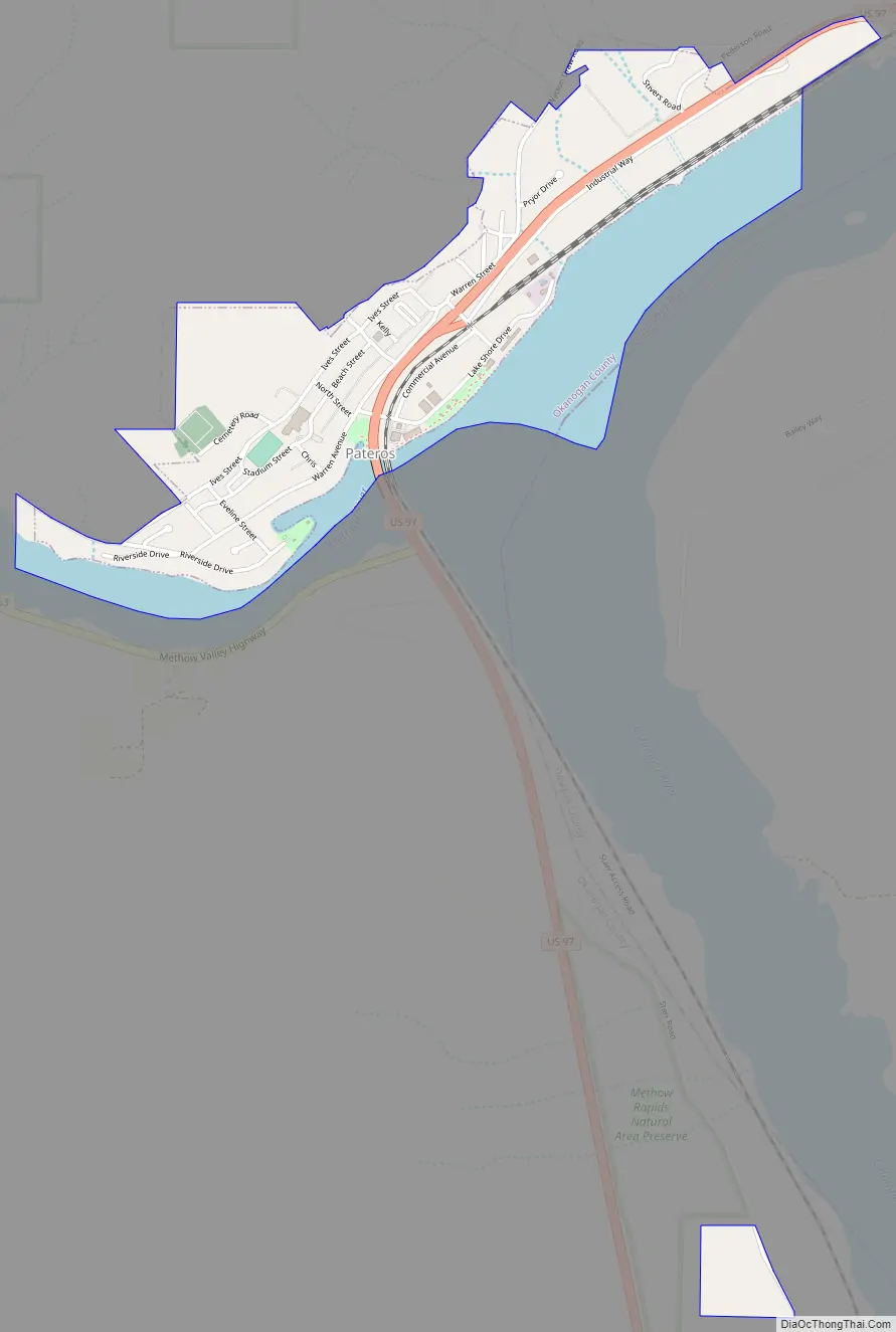
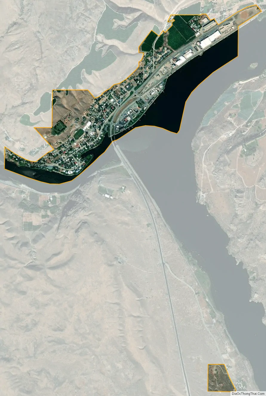
Pateros city Satellite Map
Geography
Pateros is located at 48°3′12″N 119°54′9″W / 48.05333°N 119.90250°W / 48.05333; -119.90250 (48.053457, -119.902544).
According to the United States Census Bureau, the city has a total area of 0.49 square miles (1.27 km), all of it land.
Climate
This climatic region is typified by large seasonal temperature differences, with warm to hot (and often humid) summers and cold (sometimes severely cold) winters. According to the Köppen Climate Classification system, Pateros has a humid continental climate, abbreviated “Dfb” on climate maps.
See also
Map of Washington State and its subdivision:- Adams
- Asotin
- Benton
- Chelan
- Clallam
- Clark
- Columbia
- Cowlitz
- Douglas
- Ferry
- Franklin
- Garfield
- Grant
- Grays Harbor
- Island
- Jefferson
- King
- Kitsap
- Kittitas
- Klickitat
- Lewis
- Lincoln
- Mason
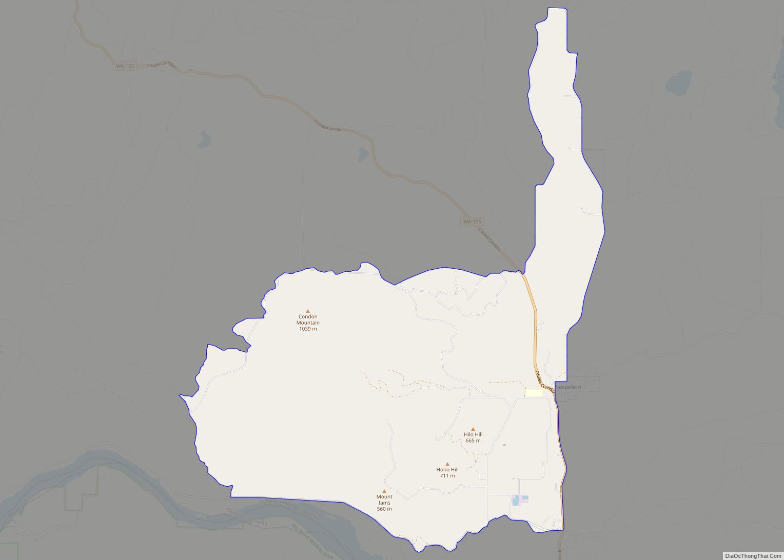
- Okanogan
- Pacific
- Pend Oreille
- Pierce
- San Juan
- Skagit
- Skamania
- Snohomish
- Spokane
- Stevens
- Thurston
- Wahkiakum
- Walla Walla
- Whatcom
- Whitman
- Yakima
- Alabama
- Alaska
- Arizona
- Arkansas
- California
- Colorado
- Connecticut
- Delaware
- District of Columbia
- Florida
- Georgia
- Hawaii
- Idaho
- Illinois
- Indiana
- Iowa
- Kansas
- Kentucky
- Louisiana
- Maine
- Maryland
- Massachusetts
- Michigan
- Minnesota
- Mississippi
- Missouri
- Montana
- Nebraska
- Nevada
- New Hampshire
- New Jersey
- New Mexico
- New York
- North Carolina
- North Dakota
- Ohio
- Oklahoma
- Oregon
- Pennsylvania
- Rhode Island
- South Carolina
- South Dakota
- Tennessee
- Texas
- Utah
- Vermont
- Virginia
- Washington
- West Virginia
- Wisconsin
- Wyoming