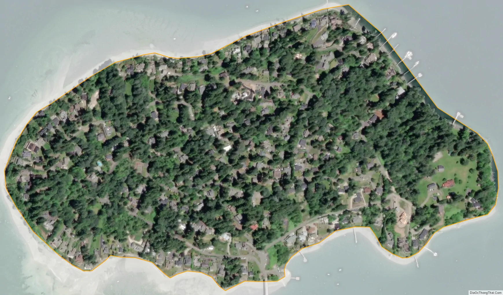
Raft Island is a private island and CDP located near the Pierce County community of Rosedale, Washington, United States. Gig Harbor, Washington is the nearest incorporated town, although unincorporated Artondale is much closer. The island features approximately 200 homes on 160 acres. All of these homes are served through the Gig Harbor post office.
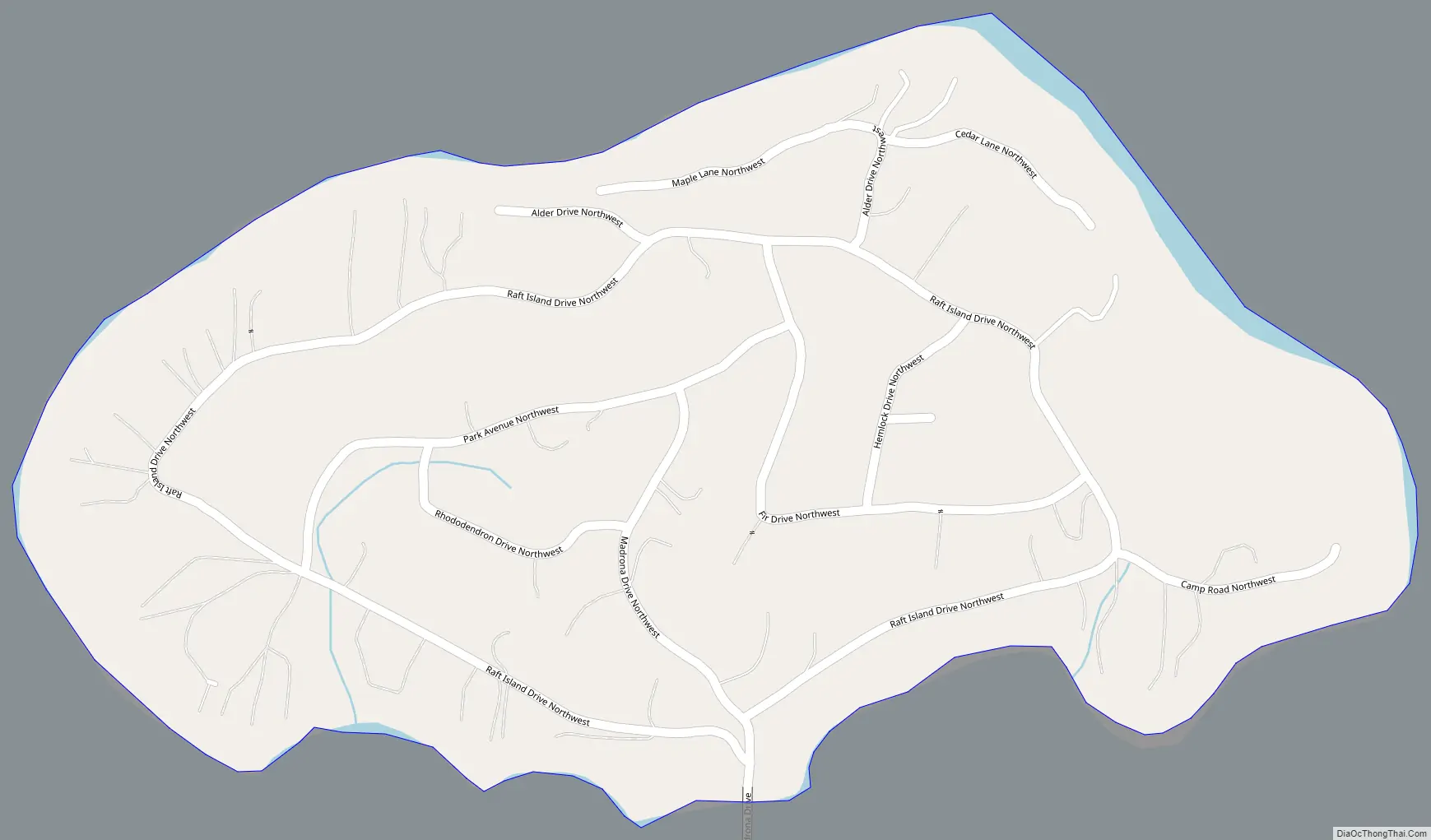
Raft Island contains parks, roads, several private beaches, a private tennis court, private boat launch, and a church camp. Because of its picturesque setting, Raft Island has been the subject of many artistic pursuits. The island is connected to the mainland by a 0.5 km (0.31 mi)-long bridge.
Raft Island is located at 47°19.700′N 122°40.000′W / 47.328333°N 122.666667°W / 47.328333; -122.666667. The size varies between 160 and 201 acres (813,910 m²) in area depending on high or low tide, and is oval in shape. It is located in Henderson Bay within Puget Sound.
According to Edmond S. Meany, Raft Island was probably named from its appearance. In 1841 Charles Wilkes of the United States Exploring Expedition gave it the name “Allshouse Island”, probably for Joseph Allshouse, a member of his crew.
| Name: | Raft Island CDP |
|---|---|
| LSAD Code: | 57 |
| LSAD Description: | CDP (suffix) |
| State: | Washington |
| County: | Pierce County |
| FIPS code: | 5357140 |
Online Interactive Map
Click on ![]() to view map in "full screen" mode.
to view map in "full screen" mode.
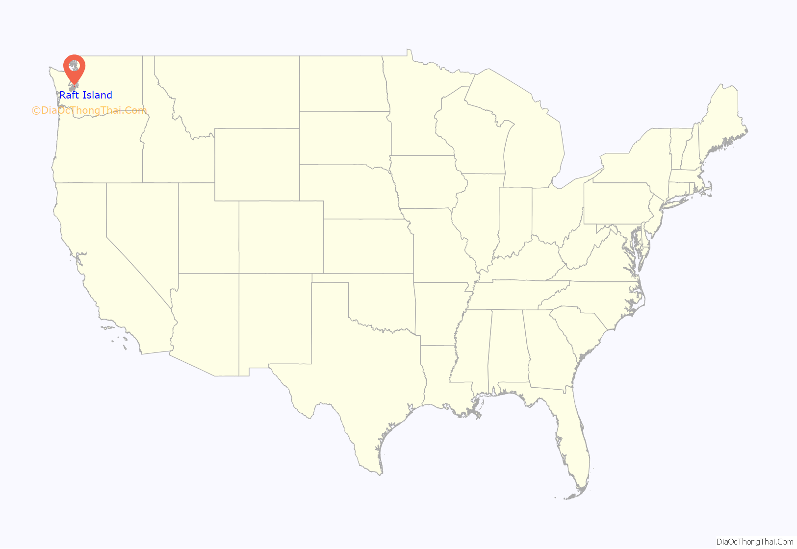
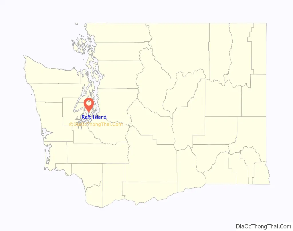
Raft Island location map. Where is Raft Island CDP?
Raft Island Road Map
Raft Island city Satellite Map
See also
Map of Washington State and its subdivision:- Adams
- Asotin
- Benton
- Chelan
- Clallam
- Clark
- Columbia
- Cowlitz
- Douglas
- Ferry
- Franklin
- Garfield
- Grant
- Grays Harbor
- Island
- Jefferson
- King
- Kitsap
- Kittitas
- Klickitat
- Lewis
- Lincoln
- Mason
- Okanogan
- Pacific
- Pend Oreille
- Pierce
- San Juan
- Skagit
- Skamania
- Snohomish
- Spokane
- Stevens
- Thurston
- Wahkiakum
- Walla Walla
- Whatcom
- Whitman
- Yakima
- Alabama
- Alaska
- Arizona
- Arkansas
- California
- Colorado
- Connecticut
- Delaware
- District of Columbia
- Florida
- Georgia
- Hawaii
- Idaho
- Illinois
- Indiana
- Iowa
- Kansas
- Kentucky
- Louisiana
- Maine
- Maryland
- Massachusetts
- Michigan
- Minnesota
- Mississippi
- Missouri
- Montana
- Nebraska
- Nevada
- New Hampshire
- New Jersey
- New Mexico
- New York
- North Carolina
- North Dakota
- Ohio
- Oklahoma
- Oregon
- Pennsylvania
- Rhode Island
- South Carolina
- South Dakota
- Tennessee
- Texas
- Utah
- Vermont
- Virginia
- Washington
- West Virginia
- Wisconsin
- Wyoming


