Renton is a city in King County, Washington, United States, and an inner-ring suburb of Seattle. Situated 11 miles (18 km) southeast of downtown Seattle, Renton straddles the southeast shore of Lake Washington, at the mouth of the Cedar River. As of the 2020 census, the population of Renton was 106,785, up from 90,927 at the 2010 census. The city is currently the sixth-largest municipality in greater Seattle and the ninth-largest in Washington state.
After a long history as an important salmon fishing area for Native Americans, Renton was first settled by people of European descent in the 1860s. Its early economy was based on coal mining, clay production, and timber export. Today, Renton is best known as the final assembly point for the Boeing 737 family of commercial airplanes, but it is also home to a growing number of well-known manufacturing, technology, and healthcare organizations, including Boeing Commercial Airplanes Division, Paccar, Kaiser Permanente, IKEA, Providence Health & Services, UW Medicine, and Wizards of the Coast.
| Name: | Renton city |
|---|---|
| LSAD Code: | 25 |
| LSAD Description: | city (suffix) |
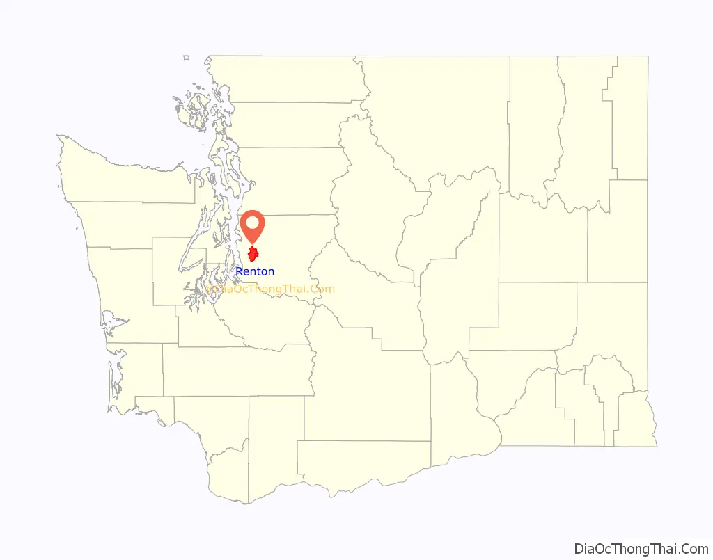
| State: | Washington |
| County: | King County |
| Elevation: | 46–410 ft (14–125 m) |
| Total Area: | 25.23 sq mi (65.36 km²) |
| Land Area: | 23.47 sq mi (60.80 km²) |
| Water Area: | 1.76 sq mi (4.56 km²) |
| Total Population: | 106,785 |
| Population Density: | 4,200/sq mi (1,600/km²) |
| ZIP code: | 98055–98059 |
| Area code: | 425 |
| FIPS code: | 5357745 |
| GNISfeature ID: | 1512599 |
| Website: | rentonwa.gov |
Online Interactive Map
Click on ![]() to view map in "full screen" mode.
to view map in "full screen" mode.
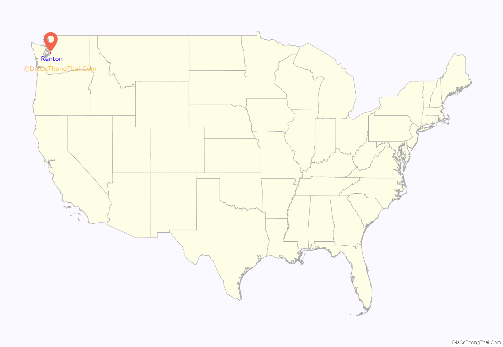
Renton location map. Where is Renton city?
History
Long a cultural center for the Duwamish, European settlers arrived in the area of present-day Renton in the 1870s. First among them were Henry Tobin and his wife Diana. The town of Renton was accessed via the Seattle and Walla Walla Railroad, the first railroad to be built to Seattle, and was in the vicinity of several coal mines that attracted entrepreneurs like Erasmus M. Smithers, who is credited with the founding and establishment of the town in 1875. Smithers named Renton in honor of Captain William Renton, a local lumber and shipping merchant who invested heavily in the coal trade. Smithers discovered coal there and brought in Charles D. Shattuck as the coal mine operator.
Renton was incorporated as a city on September 6, 1901, when coal mining and timber processing were the most important economic industries in the area. The town was prone to flooding from the Cedar River and Black River. In 1916 the completion of the Lake Washington Ship Canal lowered the surface of Lake Washington by several feet which consequently eliminated drainage of Lake Washington through the Black River (in favor of the Ship Canal). The Cedar River was then diverted to drain into Lake Washington instead of into the Black River. As a result, the Black River largely disappeared, leaving only a few remnants. The culmination of these actions reduced the threat of annual flooding.
The population sharply increased during World War II when Boeing built their Renton Factory to produce the B-29 Superfortress. Renton grew from a population of 4,488 in 1940 to 16,039 in 1950.
The game company Wizards of the Coast also is headquartered in Renton. Providence Health System has centralized its administrative offices in Renton, along with Group Health Cooperative.
Owing to its location at the confluence of three major freeways (I-5, I-405, and SR 167), Renton’s economic development team has lured a number of specialty retailers that draw consumers from around the region, including IKEA. Some retail establishments were unwanted though, and the city successfully defended zoning restrictions on pornographic theaters before the U.S. Supreme Court in Renton v. Playtime Theatres, Inc.
The Renton Public Library was built directly over the Cedar River and opened in 1966. It stretches 80 feet (24 m) across the river, next to Liberty Park, and was the main branch of the city’s independent library system until its 2010 annexation into the King County Library system.
21st-century redevelopment
The city government has encouraged redevelopment of industrial areas around Downtown Renton and near Southcenter since the 1980s. The first IKEA in the Pacific Northwest opened in Renton in 1994. The former Longacres horse-racing track was redeveloped in the 1990s to support offices for Boeing and the Federal Reserve Bank, which moved from its Seattle building. Port Quendall, a land parcel in north Renton, is home to the Virginia Mason Athletic Center (VMAC), housing the Seattle Seahawks Headquarters and training facility that opened in August 2008; before then, the Seahawks trained in Kirkland.
In the mid-1990s, Renton undertook a major redevelopment effort to revitalize its downtown core, which had declined in commercial prominence since the opening of the Southcenter Mall in Tukwila in 1968. The many car dealerships that had previously occupied the center of downtown Renton were encouraged through economic incentives to relocate to a newly created auto sales zone close to the I-405/SR-167 interchange. In place of the old dealerships downtown, a new transit center and parking garage were built in partnership with King County Metro. The transit center is surrounded by several multi-family residential buildings and a small town square named Piazza Park, which hosts a weekly farmers’ market.
Centered on former Boeing Co. property near the south shore of Lake Washington is a 68-acre (280,000 m) residential and commercial development named The Landing. To the north of the Landing, a hotel and office development on the lakefront called Southport has been developed at the site of the former Shuffleton power plant, which was demolished in 2001. A 347-room hotel operated under the Hyatt Regency brand opened in June 2017.
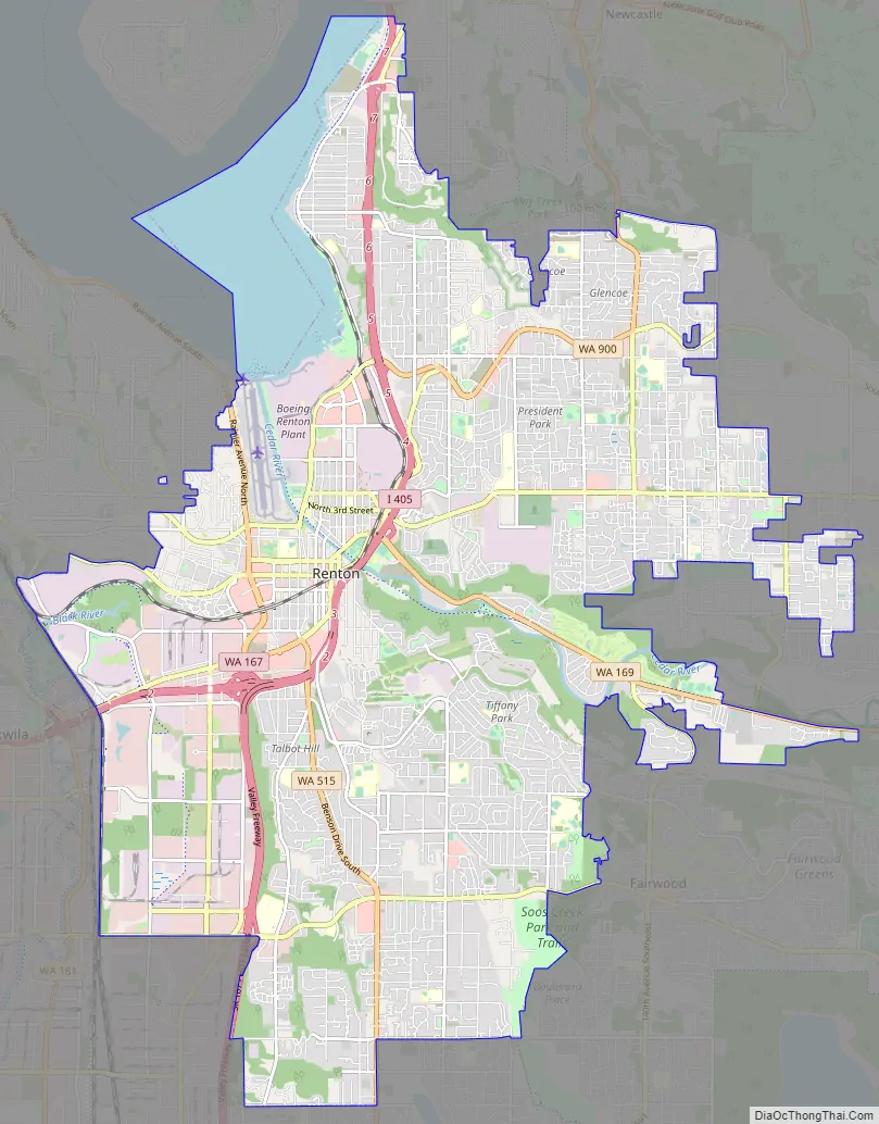
Renton Road Map
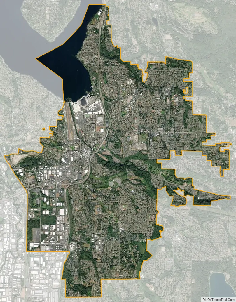
Renton city Satellite Map
Geography
Renton is located at 47°29′12″N 122°11′43″W / 47.486622°N 122.195163°W / 47.486622; -122.195163 (47.486622, −122.195163), on the southeast shore of Lake Washington.
According to the United States Census Bureau, the city has a total area of 23.54 square miles (60.97 km), of which 23.12 square miles (59.88 km) is land and 0.42 square miles (1.09 km) is water, most of which is the Cedar River.
Potential Annexation Areas (PAAs) include the communities of Fairwood southeast of Renton, the East Renton Plateau on the eastern edge of Renton, and West Hill northwest of Renton. These communities are large unincorporated urban areas that are encouraged by the King County Annexation Initiative to incorporate as cities or annex into neighboring cities. As of 2012 these three PAAs are not part of the City of Renton, and not included in its demographics or statistics.
Renton one of the cities in the Puget Sound Region with an independent street grid system. Roads names beginning with sectional divisions (N 32nd ST) generally follow a latitudinal direction, while roads names ending in a sectional direction (Duvall Ave NE) generally follow a longitudinal direction. Many of the avenues in the city are named in honor of other cities in Washington.
Renton is bordered to the north by Newcastle. Along the east side of Renton is the Urban Growth Boundary established by King County, as such there is no incorporated city directly east of Renton. The geographical characteristics of Renton’s eastern border are varied and include (from north to south) the south flank of Cougar Mountain descending southward merging with the community of May Valley. The terrain then elevates south of May Valley to the communities of the East Renton Plateau before descending to the north bank of the Cedar River. Renton is bordered to the south by the city of Kent. The western border consists of the city of Tukwila, and finally the unincorporated King County community West Hill and Lake Washington to the northwest.
Areas
Climate
Renton has a warm-summer Mediterranean climate (Köppen: Csb) with warm and dry summers mixed with cloudy, wet and cool winters, with a precipitation regime typical of the Pacific Northwest. Being located in a partial rain shadow and shielded from the coastal summers, Renton has more of a climate influenced by the interior than many other areas nearby.
See also
Map of Washington State and its subdivision:- Adams
- Asotin
- Benton
- Chelan
- Clallam
- Clark
- Columbia
- Cowlitz
- Douglas
- Ferry
- Franklin
- Garfield
- Grant
- Grays Harbor
- Island
- Jefferson
- King
- Kitsap
- Kittitas
- Klickitat
- Lewis
- Lincoln
- Mason
- Okanogan
- Pacific
- Pend Oreille
- Pierce
- San Juan
- Skagit
- Skamania
- Snohomish
- Spokane
- Stevens
- Thurston
- Wahkiakum
- Walla Walla
- Whatcom
- Whitman
- Yakima
- Alabama
- Alaska
- Arizona
- Arkansas
- California
- Colorado
- Connecticut
- Delaware
- District of Columbia
- Florida
- Georgia
- Hawaii
- Idaho
- Illinois
- Indiana
- Iowa
- Kansas
- Kentucky
- Louisiana
- Maine
- Maryland
- Massachusetts
- Michigan
- Minnesota
- Mississippi
- Missouri
- Montana
- Nebraska
- Nevada
- New Hampshire
- New Jersey
- New Mexico
- New York
- North Carolina
- North Dakota
- Ohio
- Oklahoma
- Oregon
- Pennsylvania
- Rhode Island
- South Carolina
- South Dakota
- Tennessee
- Texas
- Utah
- Vermont
- Virginia
- Washington
- West Virginia
- Wisconsin
- Wyoming


