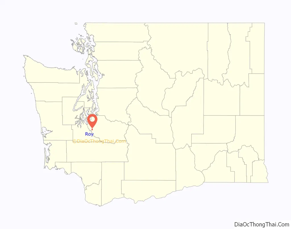
Roy is a city in Pierce County, Washington, United States. The population was 816 at the 2020 census.
| Name: | Roy city |
|---|---|
| LSAD Code: | 25 |
| LSAD Description: | city (suffix) |
| State: | Washington |
| County: | Pierce County |
| Incorporated: | January 16, 1908 |
| Elevation: | 322 ft (98 m) |
| Total Area: | 0.48 sq mi (1.25 km²) |
| Land Area: | 0.48 sq mi (1.25 km²) |
| Water Area: | 0.00 sq mi (0.00 km²) |
| Total Population: | 816 |
| Population Density: | 1,701.86/sq mi (656.88/km²) |
| ZIP code: | 98580 |
| Area code: | 253 |
| FIPS code: | 5360160 |
| GNISfeature ID: | 1512625 |
| Website: | cityofroywa.us |
Online Interactive Map
Click on ![]() to view map in "full screen" mode.
to view map in "full screen" mode.
Roy location map. Where is Roy city?

History
Roy was officially incorporated on January 16, 1908. It is a rural city outside Tacoma and primarily features ranch-style homes and farms. Roy was one of the early communities in the area, a prosperous boom-town and a major stop on the railroad line. But 3 major blows reduced this once-thriving town to its current form. A major fire in 1929 wiped out most of the downtown businesses just before the Depression started. The railroad eventually discontinued using Roy as a main stop. The Army annexed most of the surrounding land to the north and west, limiting expansion and the local tax base, and erasing the nearby community of Loveland.
Major features and/or attractions in Roy and the vicinity include the Roy Pioneer Rodeo, attracting participants and spectators from several states and Canada.
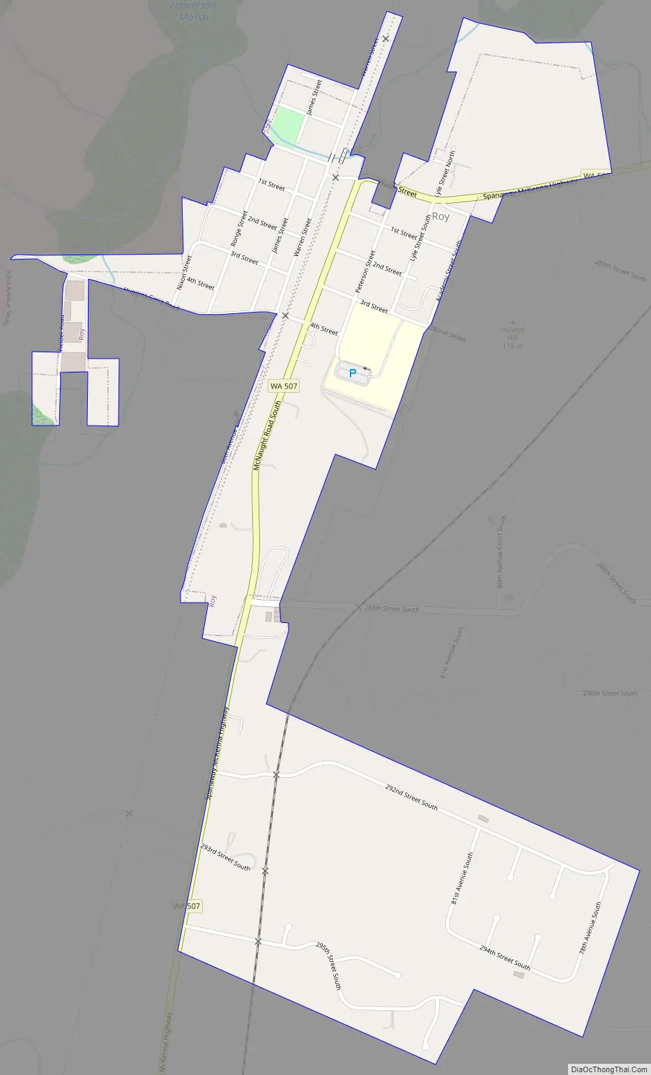
Roy Road Map
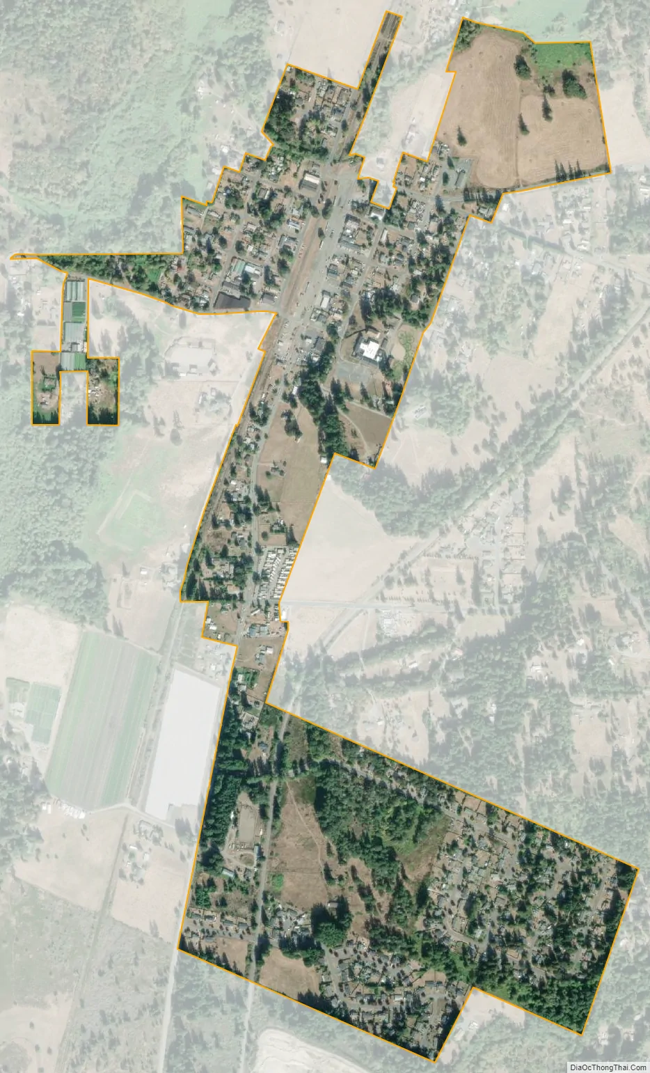
Roy city Satellite Map
Geography
Roy is located at 47°0′12″N 122°32′39″W / 47.00333°N 122.54417°W / 47.00333; -122.54417 (47.003382, -122.544171).
According to the United States Census Bureau, the city has a total area of 0.49 square miles (1.27 km), all of it land.
Although the intersection of SR 7 and SR 507 is known as the Roy “Y”, the intersection is in Spanaway, about seven miles northeast of Roy.
See also
Map of Washington State and its subdivision:- Adams
- Asotin
- Benton
- Chelan
- Clallam
- Clark
- Columbia
- Cowlitz
- Douglas
- Ferry
- Franklin
- Garfield
- Grant
- Grays Harbor
- Island
- Jefferson
- King
- Kitsap
- Kittitas
- Klickitat
- Lewis
- Lincoln
- Mason
- Okanogan
- Pacific
- Pend Oreille
- Pierce
- San Juan
- Skagit
- Skamania
- Snohomish
- Spokane
- Stevens
- Thurston
- Wahkiakum
- Walla Walla
- Whatcom
- Whitman
- Yakima
- Alabama
- Alaska
- Arizona
- Arkansas
- California
- Colorado
- Connecticut
- Delaware
- District of Columbia
- Florida
- Georgia
- Hawaii
- Idaho
- Illinois
- Indiana
- Iowa
- Kansas
- Kentucky
- Louisiana
- Maine
- Maryland
- Massachusetts
- Michigan
- Minnesota
- Mississippi
- Missouri
- Montana
- Nebraska
- Nevada
- New Hampshire
- New Jersey
- New Mexico
- New York
- North Carolina
- North Dakota
- Ohio
- Oklahoma
- Oregon
- Pennsylvania
- Rhode Island
- South Carolina
- South Dakota
- Tennessee
- Texas
- Utah
- Vermont
- Virginia
- Washington
- West Virginia
- Wisconsin
- Wyoming


