Sultan is a city in Snohomish County, Washington, United States. It is located approximately 23 miles (37 km) east of Everett at the confluence of the Skykomish River and the Sultan River, a minor tributary. The city had a population of 4,651 at the 2010 census.
The city was founded in 1880 at the site of a Skykomish village and initially settled during a small gold rush. Sultan was platted in 1889, just prior to the arrival of the Great Northern Railway, and was a hub for mining and the lumber industry. It was incorporated on June 28, 1905, with a population of 700. The city was home to a Civilian Conservation Corps camp during the Great Depression and undertook several civic improvements in the post-war years.
Sultan has since become a bedroom community for large employment centers in the Puget Sound region. The city has several public parks, a historic museum, and is located near outdoor recreation areas in the Cascade Mountains. It is connected to nearby cities by U.S. Route 2.
| Name: | Sultan city |
|---|---|
| LSAD Code: | 25 |
| LSAD Description: | city (suffix) |
| State: | Washington |
| County: | Snohomish County |
| Incorporated: | June 28, 1905 |
| Elevation: | 108 ft (33 m) |
| Total Area: | 3.27 sq mi (8.48 km²) |
| Land Area: | 3.27 sq mi (8.48 km²) |
| Water Area: | 0.00 sq mi (0.00 km²) |
| Total Population: | 4,651 |
| Population Density: | 1,645.69/sq mi (635.49/km²) |
| ZIP code: | 98294 |
| Area code: | 360 |
| FIPS code: | 5368260 |
| GNISfeature ID: | 1526700 |
| Website: | ci.sultan.wa.us |
Online Interactive Map
Click on ![]() to view map in "full screen" mode.
to view map in "full screen" mode.
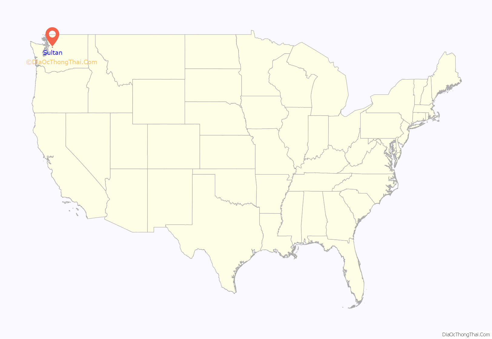
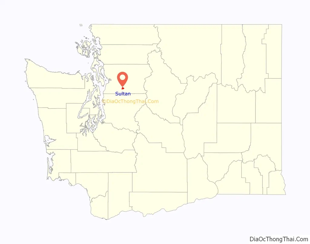
Sultan location map. Where is Sultan city?
History
The area around the Sultan and Skykomish rivers was occupied by the Skykomish, a branch of the Snohomish people, prior to the arrival of American settlers. The Skykomish had a permanent village at the confluence named tʷ’tsɬitɬd, along with a nearby fishery named stək’talidubc. Following the discovery of a rich gold vein along the Sultan River, the land around the confluence was claimed for a homestead by John Nailor and his wife in 1880. Among the first arrivals to the area were Chinese prospectors, who later settled the land but were evicted in 1885. Nailor built a small store and hotel to serve miners and loggers, eventually serving as the first postmaster after the settlement received a post office in 1885. The town and river were named “Sultan”, an anglicization of Tseul-tud (also known as Tseul-dan), then chief of the Skykomish tribe.
The Nailors sold 20 acres (8.1 ha) of their homestead to William B. Stevens in 1889, who filed the first plat for Sultan City that October. The Great Northern Railway placed a supply depot for its railroad workers in Sultan in 1891, meeting river steamboats and contributing to the town’s early growth. Sultan gained its first sawmill in 1891 and a shingle mill in 1895, as the local economy transitioned away from mining and towards logging. Sultan was officially incorporated as a city on June 28, 1905. At the time, the city had a population of 700 people and three general stores, along with a variety of small industries. By 1912, the city had a public library, electrical service, paved streets, and was considering a plan to build a hydroelectric dam that would also provide municipal water service. A bridge across the Skykomish River was built in 1908 to connect to new farms on the south bank.
An economic slowdown after World War I led to a population decrease in the Skykomish Valley, causing Sultan voters to approve a reduction in the city’s size in June 1920. The area was home to various illicit industries during the Prohibition era and experienced several major crimes, including the murder of town marshal Percy Brewster on March 2, 1927, by a serial robber who later escaped from prison before being re-captured. The area also experienced an economic downturn during the Great Depression and was home to a Civilian Conservation Corps camp that primarily dealt with firefighting and forest management. The Works Progress Administration also completed several projects in the city, including two expansions of the high school and its gymnasium in 1929 and 1939. Several major fires struck Sultan in the 1940s, including one in October 1945 that destroyed a block of buildings on Main Street and another in 1947 that decimated the Sultan Union High School.
Sultan residents participated a civic improvement program during the 1950s and 1960s that upgraded or replaced several major facilities, often with assistance from the state government. A new city hall was opened in 1954, the elementary school was expanded in 1957, and a new landing field for airplanes and helicopters opened in 1958. The city annexed 33 acres (13 ha) of rural land to the southeast in 1958 and it was subsequently developed for housing. The Skykomish River Bridge was also replaced by a new span in 1961. The Snohomish County Public Utility District (PUD) constructed the Culmback Dam on the Sultan River, creating the Spada Lake reservoir and providing electricity and drinking water for Everett and much of the county beginning in 1965.
The Sky River Rock Festival and Lighter Than Air Fair, one of the first outdoor U.S. music festivals, was hosted at a raspberry farm south of Sultan beginning August 30, 1968. The three-day festival, organized by radio station KRAB and the Helix newspaper, attracted an estimated 20,000 hippies, of whom 13,000 had paid tickets, and was considered to be a forerunner for later festivals like Woodstock. Musical acts at the festival included Santana, the Grateful Dead, Country Joe McDonald, Muddy Waters, Buffy St. Marie, and John Fahey, among others. The Sultan city government declined to allow the festival to return the following year due to the traffic and logistical issues that were experienced, including the venue running out of drinking water. The event was largely forgotten by local residents, but was revived for a one-time festival in 2017.
Sultan has since developed into a bedroom community for workers commuting to Everett, Seattle, and Bellevue. Several suburban subdivisions were built in the 1990s and early 2000s, contributing to a population boom and political strife over the area’s rural and small-town character. The Department of Veteran Affairs considered the Sultan area for a new national military cemetery, but ultimately chose a site near Kent. Sultan celebrated its centennial in 2005 with several festivals and the dedication of a new visitor’s center. Despite the population growth, the city’s traditional businesses have left Sultan and caused a decline in local employment options.
In an effort to resolve development issues and a city budget shortfall, a Monroe city councilmember unsuccessfully suggested merging the two cities during the 2007 financial crisis. The Sultan city government instead began outsourcing its policing and library services to county agencies while undergoing other reforms. The city government has endorsed schemes to lure new industries, including offering tracts of land and opening new parks and a shooting range in a bid to appeal to outdoor recreation companies.
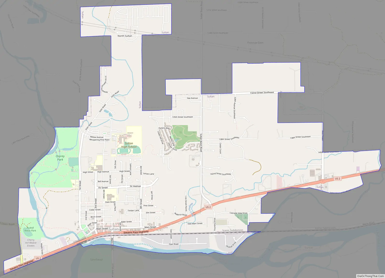
Sultan Road Map
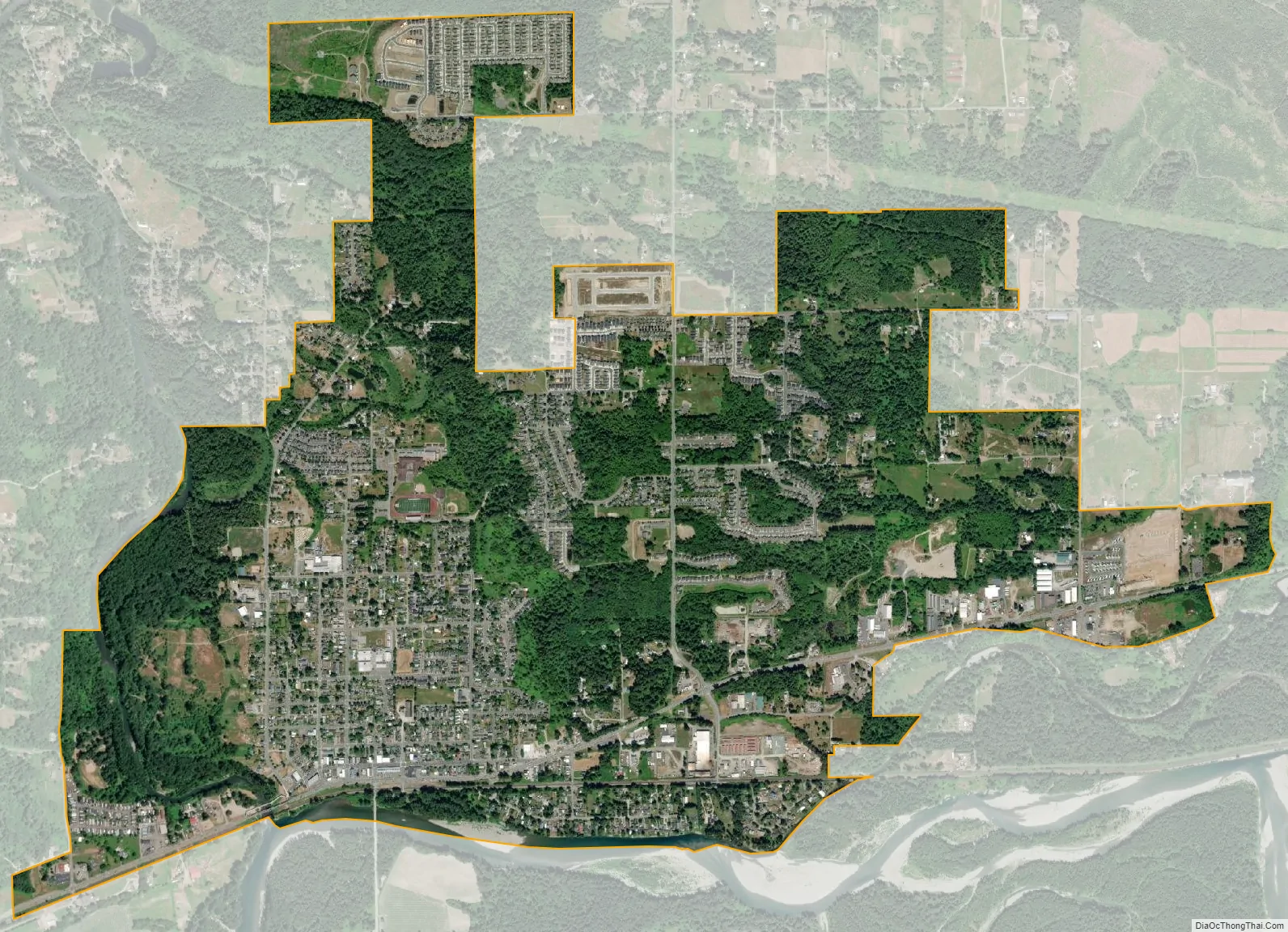
Sultan city Satellite Map
Geography
Sultan is located along the Skykomish River at its confluences with the Sultan and Wallace rivers in south-central Snohomish County, approximately 23 miles (37 km) east of Everett, the county seat. U.S. Route 2 and the BNSF Railway’s Scenic Subdivision bisect the city from west to east, connecting it to Everett, Monroe, Gold Bar, and Stevens Pass. The city limits of Sultan are generally defined by the Skykomish River to the south, the Sultan River and Old Owens Road to the west, and several county roads to the north and east. According to the United States Census Bureau, the city has a total area of 3.15 square miles (8.16 km).
The city is located within the Skykomish Valley, which is flanked to the north and south by the Cascade foothills. Several prominent peaks of the mountain range are visible on the northern and eastern horizons, including Mount Pilchuck, Mount Index, Mount Persis, and Mount Stickney. The Sultan Basin is located on the north side of the Skykomish River and is a flat plain with some rolling hills.
Downtown Sultan is one of three identified flood zones within the city, which covers 30 percent of residents, and has experienced major floods as recently as 1991 and 2009. The city government installed three emergency sirens to alert residents of an incoming flood or another disaster.
See also
Map of Washington State and its subdivision:- Adams
- Asotin
- Benton
- Chelan
- Clallam
- Clark
- Columbia
- Cowlitz
- Douglas
- Ferry
- Franklin
- Garfield
- Grant
- Grays Harbor
- Island
- Jefferson
- King
- Kitsap
- Kittitas
- Klickitat
- Lewis
- Lincoln
- Mason
- Okanogan
- Pacific
- Pend Oreille
- Pierce
- San Juan
- Skagit
- Skamania
- Snohomish
- Spokane
- Stevens
- Thurston
- Wahkiakum
- Walla Walla
- Whatcom
- Whitman
- Yakima
- Alabama
- Alaska
- Arizona
- Arkansas
- California
- Colorado
- Connecticut
- Delaware
- District of Columbia
- Florida
- Georgia
- Hawaii
- Idaho
- Illinois
- Indiana
- Iowa
- Kansas
- Kentucky
- Louisiana
- Maine
- Maryland
- Massachusetts
- Michigan
- Minnesota
- Mississippi
- Missouri
- Montana
- Nebraska
- Nevada
- New Hampshire
- New Jersey
- New Mexico
- New York
- North Carolina
- North Dakota
- Ohio
- Oklahoma
- Oregon
- Pennsylvania
- Rhode Island
- South Carolina
- South Dakota
- Tennessee
- Texas
- Utah
- Vermont
- Virginia
- Washington
- West Virginia
- Wisconsin
- Wyoming


