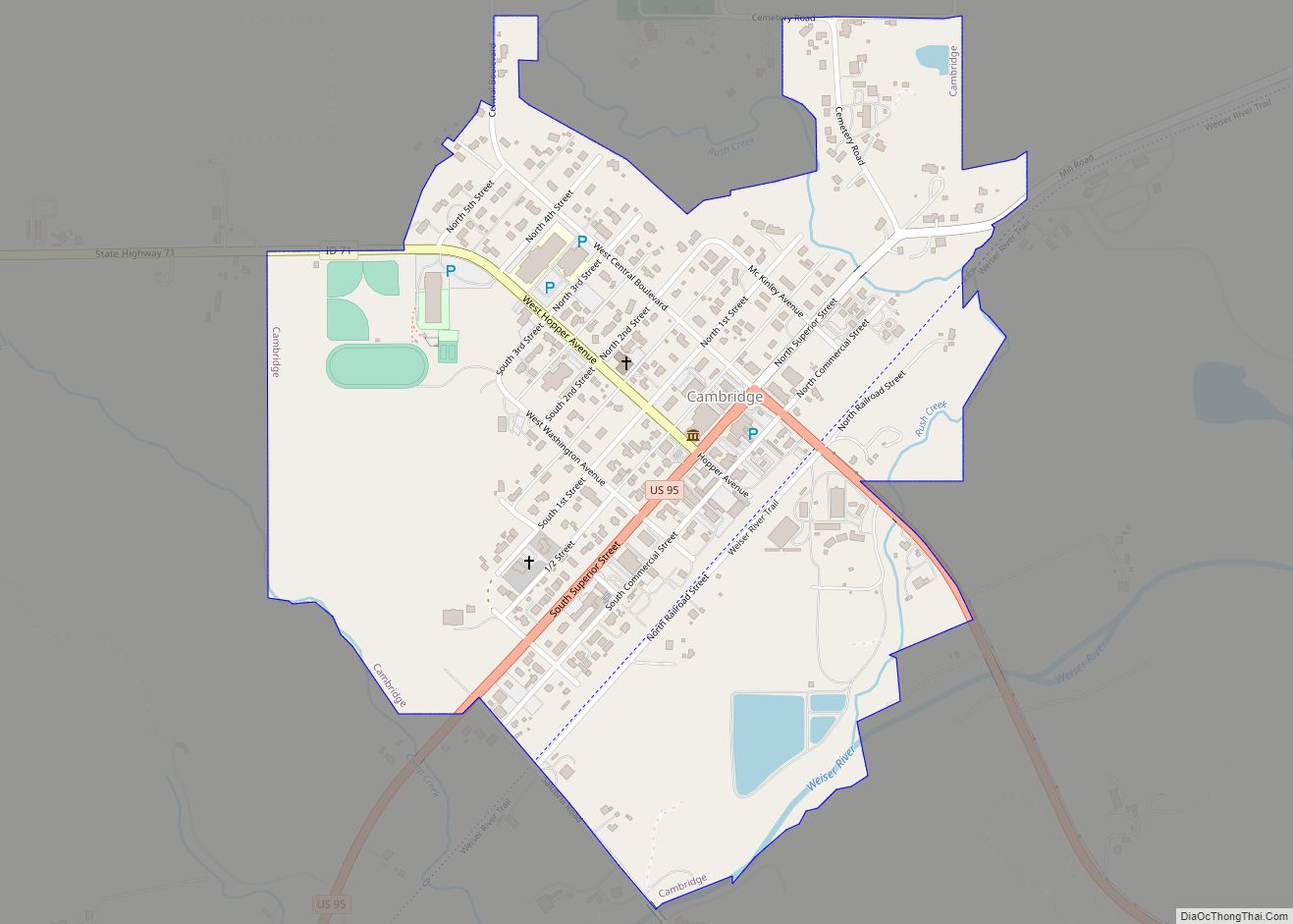
Cambridge is a city in Washington County, Idaho, United States. The population was 328 at the 2010 census, down from 360 in 2000. It is the second largest city in the county, behind the significantly larger Weiser, the county seat.
| Name: | Cambridge city |
|---|---|
| LSAD Code: | 25 |
| LSAD Description: | city (suffix) |
| State: | Idaho |
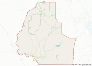
| County: | Washington County |
| Elevation: | 2,661 ft (811 m) |
| Total Area: | 0.50 sq mi (1.29 km²) |
| Land Area: | 0.48 sq mi (1.25 km²) |
| Water Area: | 0.01 sq mi (0.04 km²) |
| Total Population: | 328 |
| Population Density: | 661.16/sq mi (255.34/km²) |
| ZIP code: | 83610 |
| Area code: | 208, 986 |
| FIPS code: | 1612520 |
| GNISfeature ID: | 0400338 |
| Website: | www.cambridge.id.gov |
Online Interactive Map
Click on ![]() to view map in "full screen" mode.
to view map in "full screen" mode.
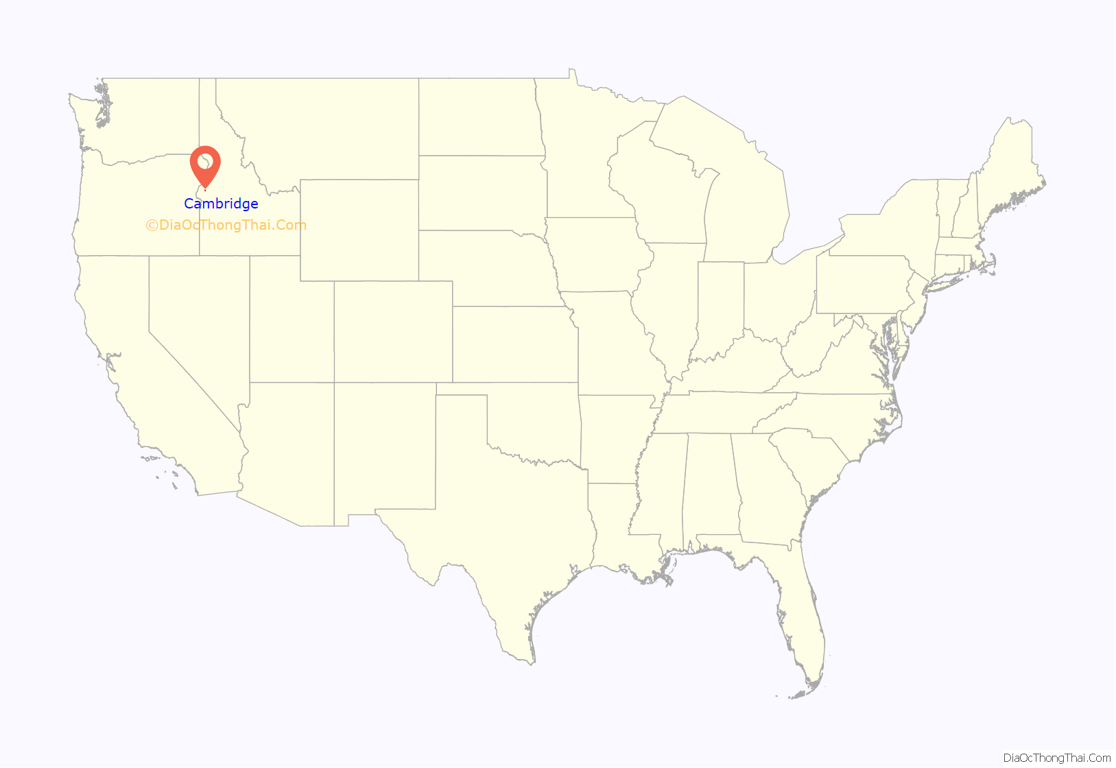
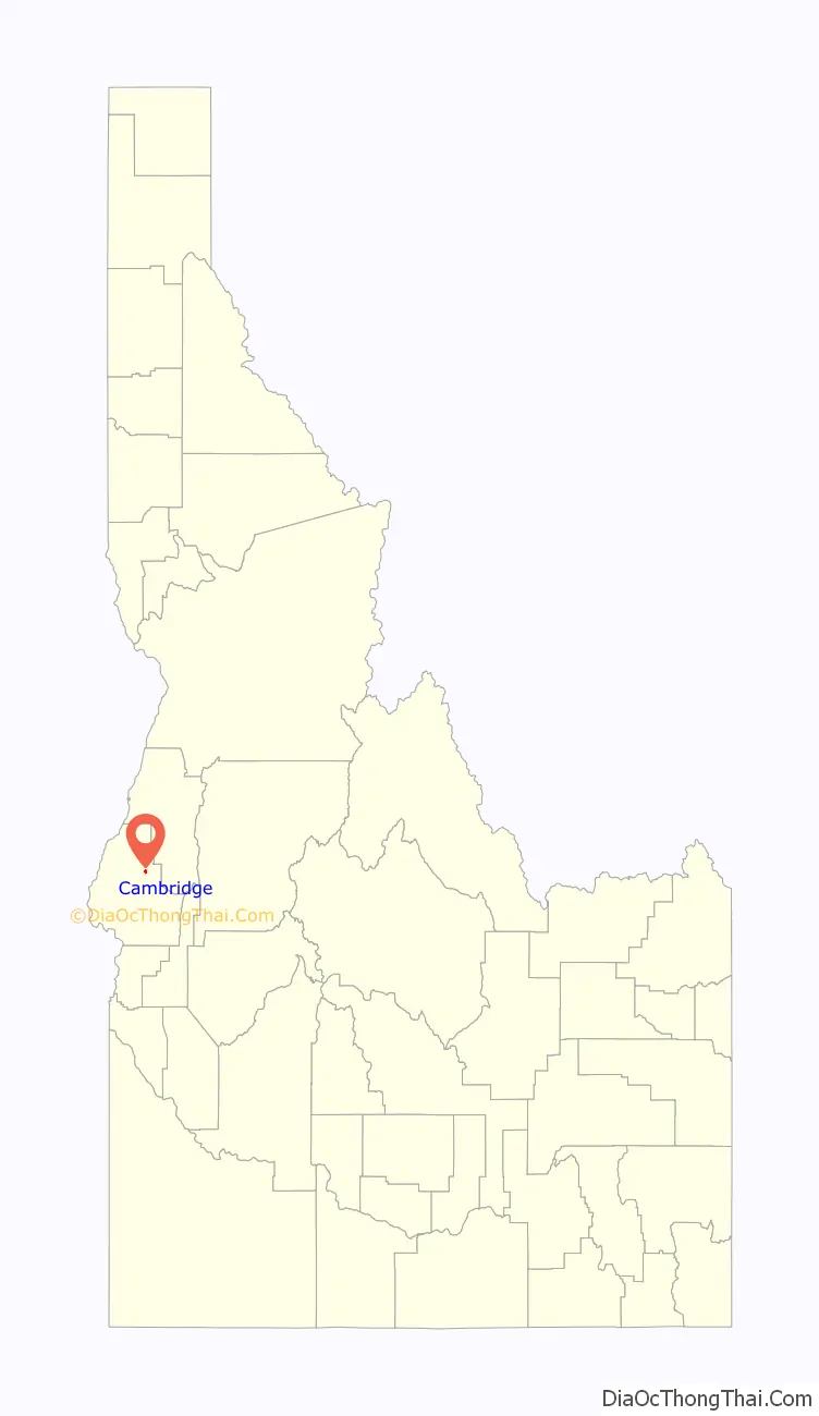
Cambridge location map. Where is Cambridge city?
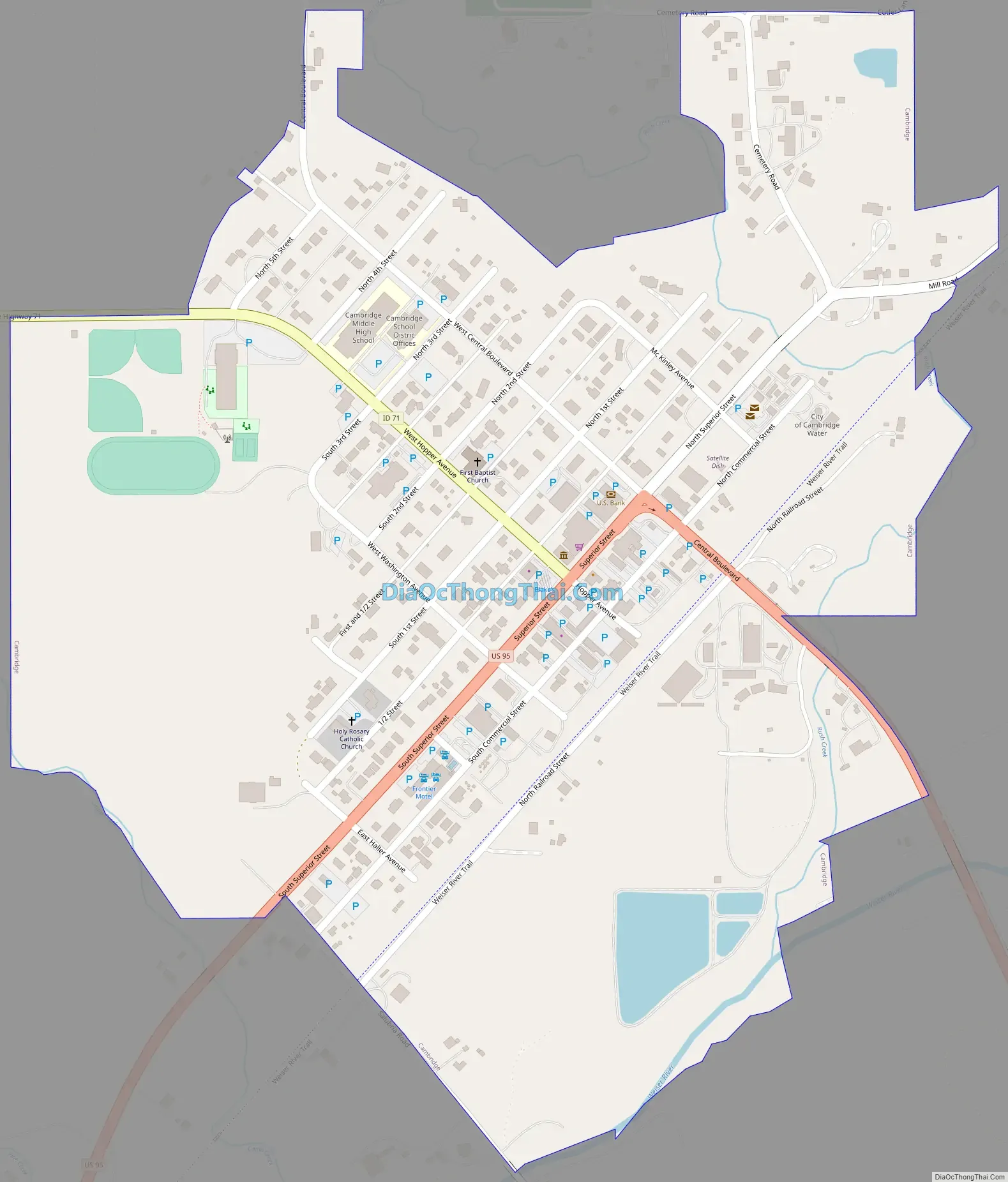
Cambridge Road Map
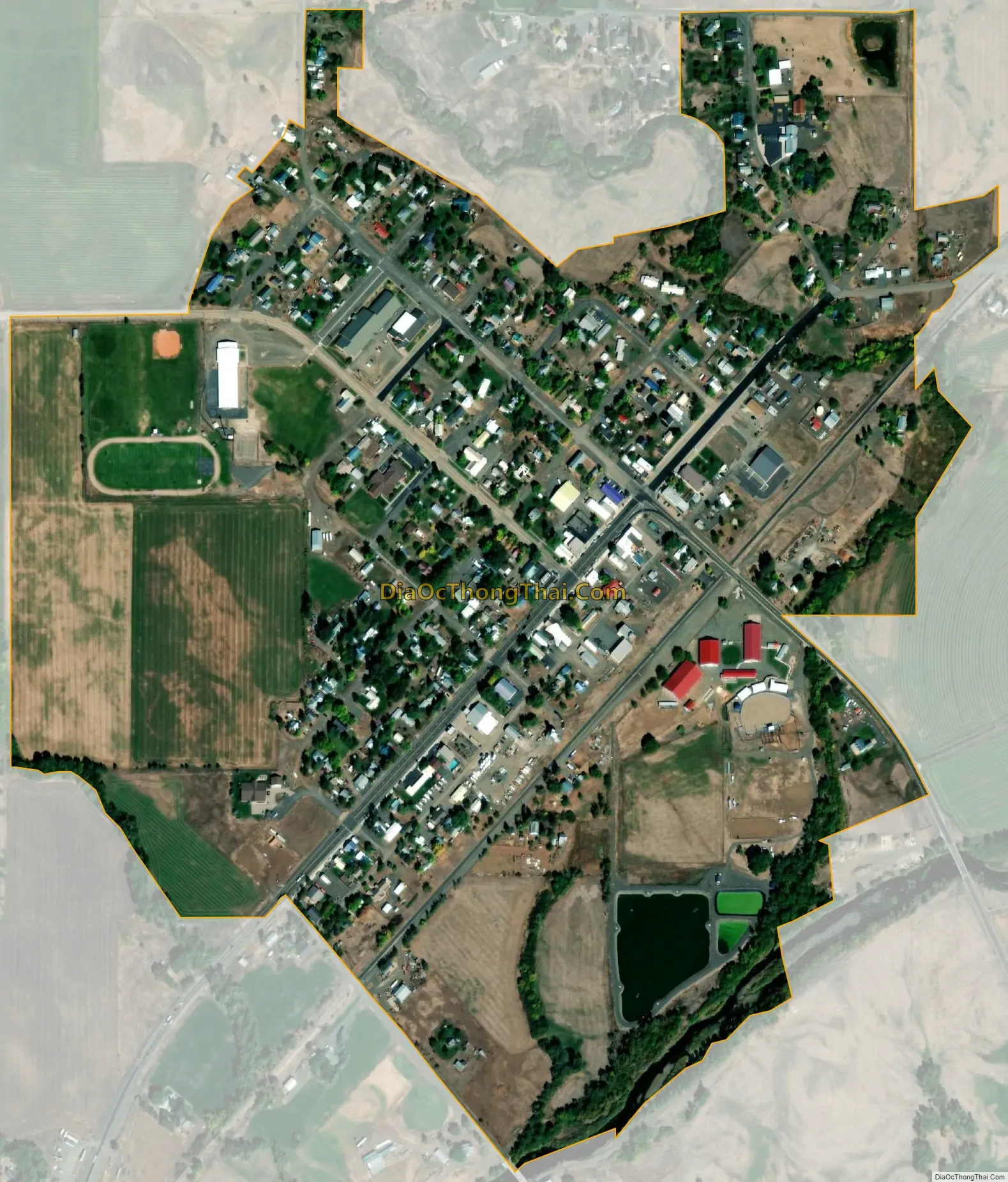
Cambridge city Satellite Map
Geography
Cambridge is located at 44°34′18″N 116°40′41″W / 44.57167°N 116.67806°W / 44.57167; -116.67806 (44.571535, −116.678013), at an elevation of 2,661 feet (811 m) above sea level. According to the United States Census Bureau, the city has a total area of 0.49 square miles (1.27 km), of which, 0.48 square miles (1.24 km) is land and 0.01 square miles (0.03 km) is water.
Climate
Cambridge has a hot-summer mediterranean continental climate (Köppen climate classification Dsa), with cold, moist winters, gradual springs, hot and dry summers, and brief autumns. July is the hottest month, with a daily average of 74.1 °F (23.4 °C); highs reach 100 °F (38 °C) on 10.7 days in a typical year and 90 °F (32 °C) on 57 days. Yet because of the aridity, summer nights typically cool to below 60 °F (16 °C). January is the coldest month, with a daily average of 23.3 °F (−4.8 °C), and lows falling to 0 °F (−18 °C) or below on 9.6 nights per year. Snowfall averages 33 inches (84 cm) per season. Precipitation is usually infrequent and light, especially so during the summer months. Extremes have ranged from −35 °F (−37 °C) on December 13, 1919 to 117 °F (47 °C), recorded July 29, 1934.
See also
Map of Idaho State and its subdivision:- Ada
- Adams
- Bannock
- Bear Lake
- Benewah
- Bingham
- Blaine
- Boise
- Bonner
- Bonneville
- Boundary
- Butte
- Camas
- Canyon
- Caribou
- Cassia
- Clark
- Clearwater
- Custer
- Elmore
- Franklin
- Fremont
- Gem
- Gooding
- Idaho
- Jefferson
- Jerome
- Kootenai
- Latah
- Lemhi
- Lewis
- Lincoln
- Madison
- Minidoka
- Nez Perce
- Oneida
- Owyhee
- Payette
- Power
- Shoshone
- Teton
- Twin Falls
- Valley
- Washington
- Alabama
- Alaska
- Arizona
- Arkansas
- California
- Colorado
- Connecticut
- Delaware
- District of Columbia
- Florida
- Georgia
- Hawaii
- Idaho
- Illinois
- Indiana
- Iowa
- Kansas
- Kentucky
- Louisiana
- Maine
- Maryland
- Massachusetts
- Michigan
- Minnesota
- Mississippi
- Missouri
- Montana
- Nebraska
- Nevada
- New Hampshire
- New Jersey
- New Mexico
- New York
- North Carolina
- North Dakota
- Ohio
- Oklahoma
- Oregon
- Pennsylvania
- Rhode Island
- South Carolina
- South Dakota
- Tennessee
- Texas
- Utah
- Vermont
- Virginia
- Washington
- West Virginia
- Wisconsin
- Wyoming