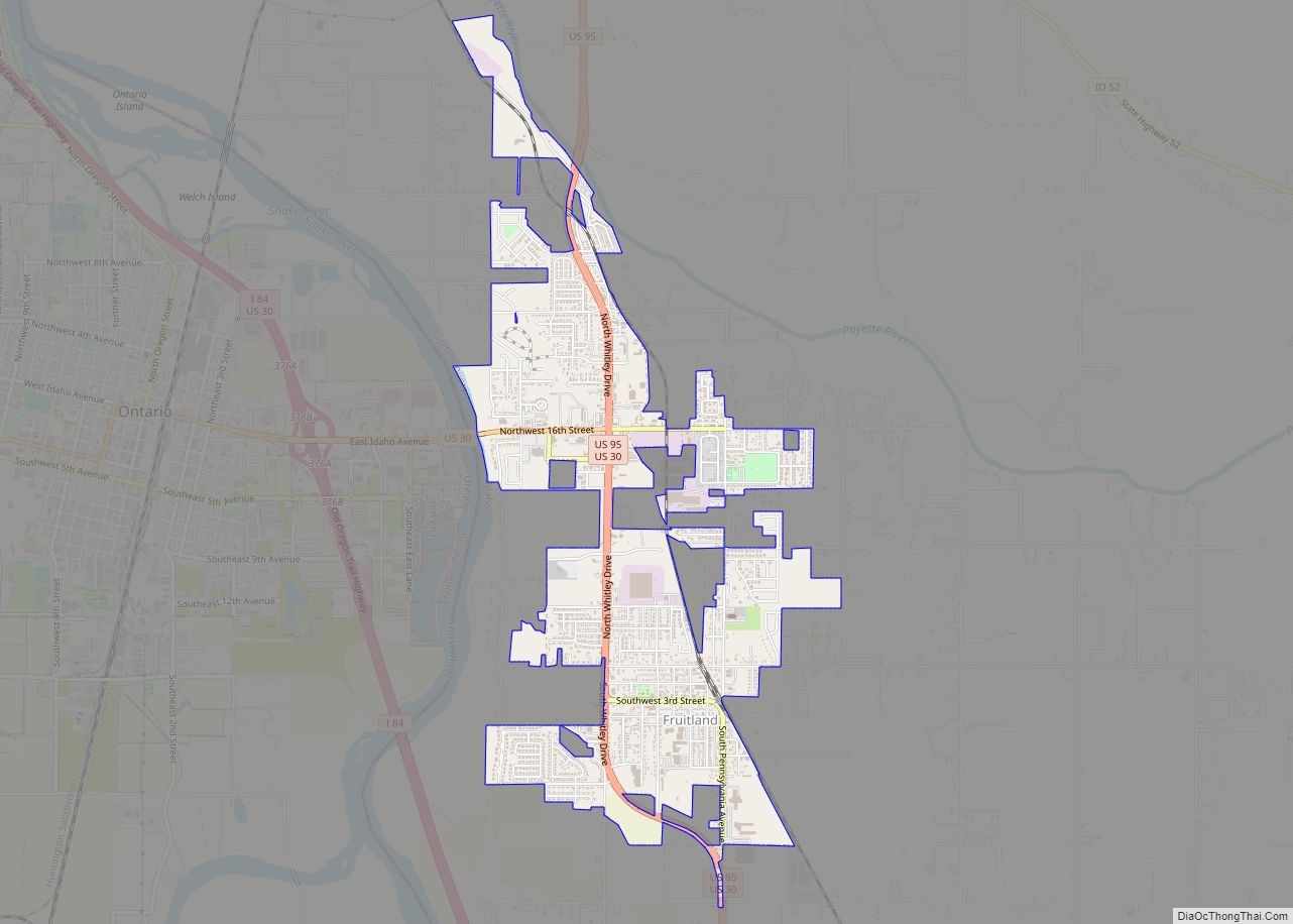
Fruitland is a city along the Snake and Payette rivers in Payette County, Idaho, United States. It lies along U.S. Route 95 in the Treasure Valley of southwest Idaho, about 50 miles (80 km) west of Boise on the border with Oregon. It is part of the Ontario Micropolitan Area. Fruitland is named after apple orchards that surround the community, and its slogan is “The Big Apple of Idaho.”
As of the 2010 census, the city had a total population of 4,684, up from 3,805 in 2000.
| Name: | Fruitland city |
|---|---|
| LSAD Code: | 25 |
| LSAD Description: | city (suffix) |
| State: | Idaho |
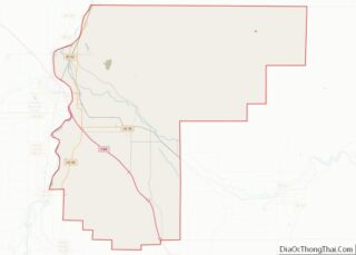
| County: | Payette County |
| Elevation: | 2,228 ft (679 m) |
| Total Area: | 2.16 sq mi (5.59 km²) |
| Land Area: | 2.15 sq mi (5.58 km²) |
| Water Area: | 0.01 sq mi (0.01 km²) |
| Total Population: | 4,684 |
| Population Density: | 2,519.03/sq mi (972.42/km²) |
| ZIP code: | 83619 |
| Area code: | 208, 986 |
| FIPS code: | 1628990 |
| GNISfeature ID: | 0396521 |
| Website: | fruitland.org |
Online Interactive Map
Click on ![]() to view map in "full screen" mode.
to view map in "full screen" mode.
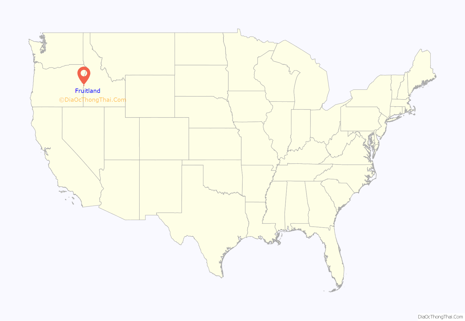
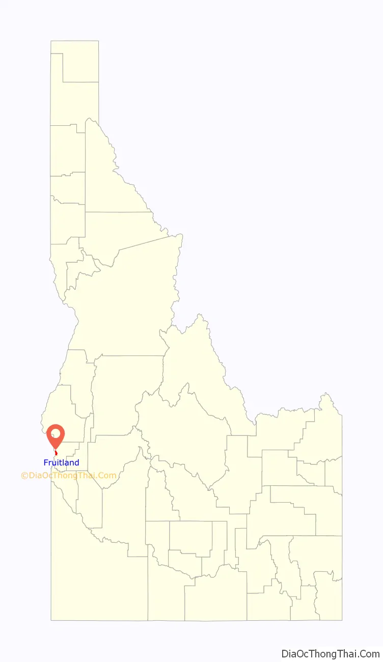
Fruitland location map. Where is Fruitland city?
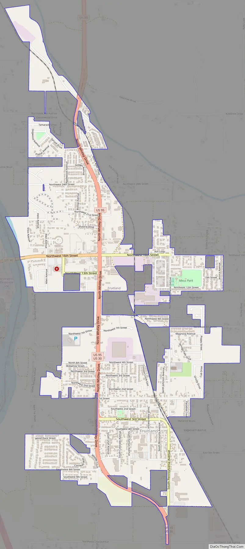
Fruitland Road Map
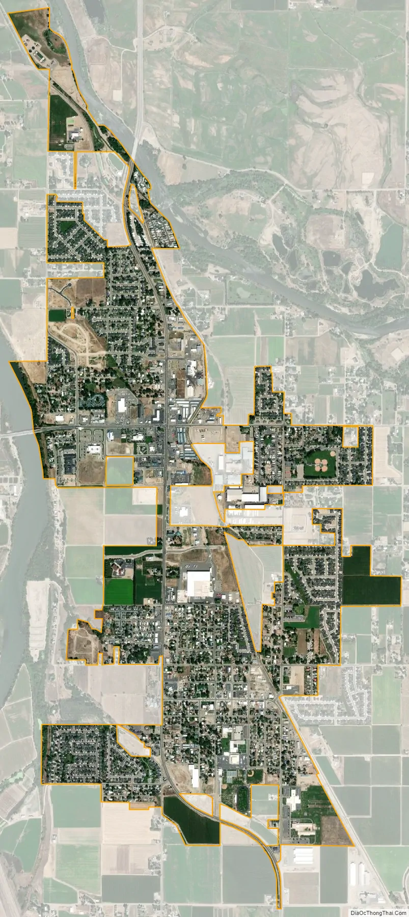
Fruitland city Satellite Map
Geography
Fruitland is located within the Snake River watershed.
According to the United States Census Bureau, the city has a total area of 2.24 square miles (5.80 km), of which, 2.23 square miles (5.78 km) is land and 0.01 square miles (0.03 km) is water.
See also
Map of Idaho State and its subdivision:- Ada
- Adams
- Bannock
- Bear Lake
- Benewah
- Bingham
- Blaine
- Boise
- Bonner
- Bonneville
- Boundary
- Butte
- Camas
- Canyon
- Caribou
- Cassia
- Clark
- Clearwater
- Custer
- Elmore
- Franklin
- Fremont
- Gem
- Gooding
- Idaho
- Jefferson
- Jerome
- Kootenai
- Latah
- Lemhi
- Lewis
- Lincoln
- Madison
- Minidoka
- Nez Perce
- Oneida
- Owyhee
- Payette
- Power
- Shoshone
- Teton
- Twin Falls
- Valley
- Washington
- Alabama
- Alaska
- Arizona
- Arkansas
- California
- Colorado
- Connecticut
- Delaware
- District of Columbia
- Florida
- Georgia
- Hawaii
- Idaho
- Illinois
- Indiana
- Iowa
- Kansas
- Kentucky
- Louisiana
- Maine
- Maryland
- Massachusetts
- Michigan
- Minnesota
- Mississippi
- Missouri
- Montana
- Nebraska
- Nevada
- New Hampshire
- New Jersey
- New Mexico
- New York
- North Carolina
- North Dakota
- Ohio
- Oklahoma
- Oregon
- Pennsylvania
- Rhode Island
- South Carolina
- South Dakota
- Tennessee
- Texas
- Utah
- Vermont
- Virginia
- Washington
- West Virginia
- Wisconsin
- Wyoming